discover.swiss ID
osm_1684063
discover.swiss Additional Type
City

Grisons Marathon

Geschlossen
Difficult
42.1 km
9:00 h
2648 mhd
401 mhd
Graubünden Marathon
Graubünden Marathon (oua_2810084_050c892_profile)

Marathon run over the classic distance from Chur via Lenzerheide to the Parpaner Rothorn.

Technique 6/6
Fitness 6/6
Highest Point  2840 m
Lowest Point  591 m
Best Season
Jan
Feb
Mär
Apr
Mai
Jun
Jul
Aug
Sep
Okt
Nov
Dez
Start
Chur
Destination
Rothorn
Coordinates
46.851745, 9.5335

Details

Description

Geheimtipp

The route from Chur to Lenzerheide is signposted and can be walked all year round. The route from Lenzerheide to the Rothorn can be walked from June.

Directions

The start is in Chur on the Quader meadow. From there you take the route through the old town and then turn to the road Chur-Arosa. At the junction “Arosa” continue straight towards Sand. At Sand, the route leaves the asphalt road on a gravel road towards Passugg. In Passugg, the route leads around the building of the drink manufacturer Passugger and leaves the road again on a dirt road. After a climb, you turn onto a wide gravel road. Follow the “Polish” path to Churwalden. You run through the village Churwalden (1’240m asl) past the post office, Coop and after the hotel Hemmi you turn left. Afterwards a longer section starts up to Büel, Foppa. In Foppa (1’753 m asl) turn into the asphalt road direction Parpan. After about 1 km down the road, turn left onto a narrow path towards Mittelberg. At Mittelberg, turn left onto the asphalt road that leads to Parpan. At the first junction in Parpan (1’493m asl), turn right into the main road just before the main road, turn left and then go up the parallel to the Hotel Alpina. After the post office, turn left. After about 15m turn right and after another 10m turn right again. You then turn directly into a narrow path that leads over roots to the Valbellnerhöhe. There you walk past a very small lake and then you run parallel to the road until you reach Canols. On your right, you can see the big lake Heidsee. Cross the main street and walk past the Canols kiosk. After a round around the right side of lake Heidsee you cross the main road at the Rothorn valley station. After the underpass turn right and then walk up the sidewalk and after about 100m cross the side of road and run straight into the forest. After about 1.5 km on a gravel road in the forest you cross a side road and cross the main road at the underpass. After going around the school you leave Lenzerheide (1’478m asl) again at the underpass and after the underpass you turn right towards village centre. After the UBS building turn left and walk up a steep asphalt road. After approximately 100m turn left onto a 1m wide gravel road. After the steep gravel road turn left onto an asphalt road after about 25m turn right. After another 100m turn left and then climb steeply again towards the waterfall. The path up to the waterfall is narrow and is very energy-sapping. When you reach the waterfall, a beautiful trail leads up to the Alp Scharmoin (1’904 m asl) to the Rothorn centre station. From the centre station, about 1km has many steep sections on the gravel road. Then there is a small flat section of about 500m. However, the final ascent starts at 2’266m asl on a route of approx. 2.5 km up to the Rothorn summit 2’861 m asl. Once you are on the summit, you can be proud of what you have done, because you have made the toughest marathon in the world!

Responsible for this content Graubünden Ferien.
This content has been translated automatically.

Pleasure tour Chur Rhine valley

Simple
38.4 km
0:00 h
223 mhd
223 mhd
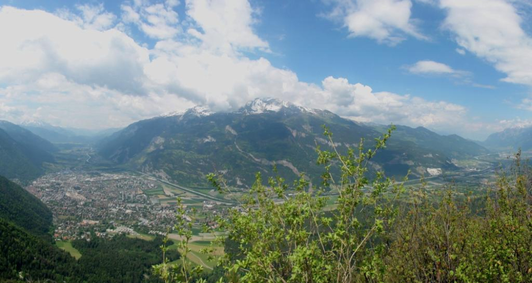
Churer Rheintal aus der Vogelperspektive
Kultur & Genussroute Churer Rheintal

Show all 11 images

Kultur & Genussroute Churer Rheintal
Pleasant tour through the Chur Rhine valley, ideal for a half day cycling or e-bike tour.
Technique 2/6
Fitness 2/6
Highest Point  674 m
Lowest Point  562 m
Best Season
Jan
Feb
Mär
Apr
Mai
Jun
Jul
Aug
Sep
Okt
Nov
Dez
Start
Chur, railway station
Destination
Chur, railway station
Coordinates
46.83469502, 9.45786212

Details

Description

From Chur, follow the course of the Rhine and cross the villages of Felsberg and Tamins to the confluence of the Rhine at Reichenau. You then reach the high plateau of the municipalities of Bonaduz and Rhäzüns. The route takes you past the historic Sogn Gieri church. Optionally, you can plan a detour to Rhäzüns to visit the church of Sogn Paul. The new Hinterrheinsteg, which connects national cycle routes no. 2 (Rhine route) and no. 6 (Graubünden route), finally takes you back to Chur via the Domat/Ems golf course. 

The new Hinterrheinsteg opens up many possibilities and is also suitable for families. 

Directions

Public Transport

The tour starts at the Chur railway station.

Responsible for this content Chur Tourism.

Outdooractive Logo

This website uses technology and content from the Outdooractive platform.

GPS Biketicket 2 RIDE black

Geschlossen
Difficult
76.2 km
6:00 h
430 mhd
5569 mhd
Älpliseetrail
Biketicket to ride schwarz

Show all 8 images

Biketicket to ride schwarz

The mother of all enduro tours! Pedal almost 700 metres uphill and 6,000 metres downhill. A special bike experience with 10 different mountain railways.

Technique 6/6
Fitness 5/6
Highest Point  2633 m
Lowest Point  588 m
Best Season
Jan
Feb
Mär
Apr
Mai
Jun
Jul
Aug
Sep
Okt
Nov
Dez
Start
Chur or Lenzerheide
Destination
Chur or Lenzerheide
Coordinates
46.73985, 9.556527

Details

Description

The round tour can be started from various starting points. This description starts in Chur. (Alternatively also in Lenzerheide and Arosa) The Brambrüesch mountain railway takes you from the capital to the first summit, to Brambrüesch. The start of the Freeride Tour is identical to the signposted Biketicket to RIDE red No. 616 to Churwalden. From Heidbüel you traverse via Alp Stätz to Heidsee. We continue on the eastern flank of Lenzerheide, on the Rothorn side. With an additional loop on the Weisshorn Speed, the fresh The Great White is taken with you before you go to Arosa via the Älplisee Trail. A real single trail highlight for experienced bikers. Once in Arosa, you can comfortably take the Hörnli cable car to the Hörnli. Now it's off on the technically very demanding single trail down to the Schwellisee. The next train, Arosa to the Weishorn, takes you back to 2,653 meters above sea level in no time. A breathtaking single trail leads from the Weisshorn summit to Ochsenalp and on to Tschiertschen. After the village tour, further trail highlights lead to Chur. After six peaks, ten mountain railways and endless single trails downhill, the tour ends again in Chur.

Geheimtipp

If you start this tour from Chur, you will earn the badge "Black Mamba" in the Bike Kingdom app

Sicherheitshinweis

Please note the respective operating times and the transport criteria at the Scalottas and Weisshorn before starting the tour. You can find more information here

Plan enough time and respect other trail users - Trail tolerance!

Directions

Lenzerheide - Piz Scalottas - Lenzerheide -  Rothorn - Inner-Arosa - Hörnli - Arosa Weisshorn - Tschiertschen - Praden - Passugg - Chur - Brambrüesch - Churwalden - Alp Stätz - Lenzerheide

Directions

Public Transport

Arriving by train to Chur, then change directly to the buses from PostbusGraubünden and get to Lenzerheide within 30 minutes.

In the village the free sports bus is available.

Anreise Information

From Basel and Zurich - Chur-Süd (exit no. 17) - Lenzerheide.

From Milano - Lugano - San Bernadino Tunnel - Thusis - Chur (exit Lenzerheide) - Lenzerheide.

Parking

Lenzerheide: Parking spaces at the entrance to Lenzerheide or the Rothornbahn valley station.

Chur: Parking valley station Bergbahn Chur - Dreibündenstein

Responsible for this content Graubünden Ferien.
This content has been translated automatically.

Ochsenberg-Mittenberg

Medium
20.1 km
4:00 h
1047 mhd
1047 mhd
Ochsenberg Trail
Höhenweg Mittenberg-Maladers

Show all 7 images

Höhenweg Mittenberg - Maladers
Singletrail highlight from Chur, which must be earned.
Technique 3/6
Fitness 4/6
Highest Point  1485 m
Lowest Point  585 m
Best Season
Jan
Feb
Mär
Apr
Mai
Jun
Jul
Aug
Sep
Okt
Nov
Dez
Start
Chur, station
Destination
Chur, station
Coordinates
46.85319, 9.530176

Details

Description

The Ochsenberg is the big brother of the Mittenberg. While the latter is well known in Chur as a popular bike mountain, only few know the Ochsenberg. It lies directly above the Mittenberg and the sensational trail descent must first be earned with a sweaty ascent. The more comfortable option is to take the post bus and bike from Chur to Maladers and thus avoid the first part of the ascent - this way, the Ochsenberg can even be mastered as an evening ride. But also the ascent from Maladers is still a bit difficult, less altitude meters, but relatively steep throughout. But more than worthwhile for this descent. A narrow single trail winds its way down to the Mittenberg, technically but continuously rideable. Once there, one can then immediately attach another fine trail descent back to Chur. 

Responsible for this content Chur Tourism.

Gravel Bike Route Vorderrhein

Medium
281.7 km
30:05 h
7856 mhd
7856 mhd
Aussicht von Ruschein
Ausblick in die Surselva

Show all 10 images

Rheinschlucht
The gravelbike tour through the Surselva to Disentis-Sedrun and the Maighelshütte promises not only an exciting journey of discovery, but also a journey through the largest Romansh-speaking area of Graubünden to the source of the Rhine.
Technique 3/6
Fitness 3/6
Highest Point  2311 m
Lowest Point  559 m
Best Season
Jan
Feb
Mär
Apr
Mai
Jun
Jul
Aug
Sep
Okt
Nov
Dez
Start
Chur
Destination
Chur
Coordinates
46.861507, 9.506525

Details

Description

Your journey starts in Chur where you be ride along the Anterior Rhine on the spectacular panoramic road through the Ruinaulta. Via the little-known Alp Brün, the ride continues to Ilanz, the first city on the Rhine.

On the other side of the valley, on the way up to the Lag da Pigniu reservoir, you can expect steep ramps and a great view of the Obersaxen plateau. The “Panix Stausee”, as it is called in German, impresses with its imposing waterfalls, before you head onto gravel roads, forest and meadows from Andiast to Brigels.

Unhurried you ride through typical villages of Surselva all the way to Trun. From here, the journey goes up into the valley with the Rhaetian Railway. From Tschamut you’ll follow the young Rhine towards its source. After a short stretch on the Oberalp pass road, you’ll get to a steep gravel road in high Alpine terrain until you reach the Maighels hut. The hut is the highest point that can be reached by bicycle in the headwaters of the Anterior Rhine. You whiz down the valley to Sedrun, where you’ll be able to fortify yourself with the smallest nut cake in the world. Over the Muota Pigniel you’ll get to the Uaul Cavorgia, which awaits you with its flora and a great panoramic view.

From Disentis you’ll reach Trun by riding over gravel banks and through cool groves along the Anterior Rhine, from where you’ll start climbing up the way to the Obersaxen plateau. The ascent over the Alp Stavonas is long but the panorama more than compensates for it. From the Alp Nova the ride continues on a long descent through the Val Lumnezia. Climb over the small chapel Sogn Carli up to the Mountain Inn Bündner Rigi. The winding descent towards Luven finally brings you to Ilanz.

Through the Flims Grosswald, the route leads past the picturesque Lake Cauma, to the viewing platform Conn, to Lake Cresta and along the Felsbachschlucht (gorge) through the Flimserwald. After a rapid descent towards Sagogn, you’ll cross the Rhine at Valendas station. A short ascent takes you back to the road high above the Ruinualta. At the end, the Rheinschlucht-Strasse awaits you before the comfortable ride back to Chur.

From this 281.70 km you drive 23.70 km with the train.

Stages

Stage 1: Chur – Ilanz

Stage 2: Ilanz – Lag Pigniu – Brigels

Stage 3: Brigels – RhB – Lai Tuma – Disentis

Stage 4: Disentis – Obersaxen

Stage 5: Obersaxen – Alp Nova – Ilanz

Stage 6: Ilanz – Flimserwald – Chur

Geheimtipp

Tip: Don’t worry about carrying your luggage on this trip multi-day trip. Book the luggage transfer from hotel to hotel - convenient and easy.

Directions

Chur - Ilanz: 49.9 kilometers - 1249 altitude

Your journey starts in Chur (593 m above sea level) and ride the bike path along the Rhine to Reichenau where the Anterior and Posterior Rhine merge. On secondary roads, you’ll ride along the cycle route no. 3 to Bonaduz. Here, you’ll reach a spectacular road, which takes you through the Ruinaulta.  Due to its 300 meter high rock walls and rock formations, the Rheinschlucht (Rhine gorge) is called “Little Swiss Canyon". A fantastic panoramic road also belongs to it. Take a little rest to enjoy one of the most varied landscapes in the Alps. Over the bridge at the end of the first short descent, you’ll reach a short ascent with splendid hairpin bends leading you to Versam (909 m above sea level). Once you get to the village entrance turn in direction of Safiental and follow the MTB route no. 157 "Calörtsch". Via Arezen, you’ll get on natural roads through forests and meadows to the Maiensässen at Calörtsch (1,401m above sea level). You’ll be able to enjoy a particularly impressive panoramic view of the Flimser Stein. Following the MTB route, you’ll reach a short forest path through the Calörtscherwald (1,580m above sea level) and get back onto a road that takes you to the idyllic village of Brün. On the fast descent from Brün onto the main road (910m above sea level), you’ll get back to cycle route 3, which you follow in the direction of Valendas. Valendas delights not only with countless well-preserved manors, but also with the largest wooden fountain in Europe. From here follow the cycle route to Ilanz (699m above sea level), the first city on the Rhine.

Ilanz - Lag Pigniu - Brigels: 31.9 kilometers - 1395 altitude

From Ilanz (699m above sea level) the journey takes you on a paved road with a crisp ascent to Ruschein (1,166m above sea level). The view from Ruschein over Ilanz to Valsertal is the first highlight of the route. In Ruschein, you’ll reach the Graubünden bike route no. 90 and traverse to Siat. Steep ascents alternate with relaxing flat sections. In Siat, some of the fountains are a welcome opportunity to fill up your bottles. The view of the Obersaxen plateau lets you forget your sore legs for a while. Until Darpagaus (1,494m above sea level), the road ascents, before you’ll reach the side valley "Val da Pigniu" on a fast descent.

The ascent towards Pigniu and up to the reservoir Lag da Pigniu (1,447m above sea level) is easy to master. The rock wall with impressive waterfalls at the very back of the lake is so impressive that the detour to the very end of the gravel road is definitely worthwhile. The route only folows the road for a short while before you turn right on the MTB route 90. On the other side of the river, you’ll first get onto a dirt road, and then followed by a short interlude through woods and meadows to Andiast. From Andiast you follow the main road to Waltensburg (1,003m above sea level) for short stretch. The church in Waltensburg has an inspiring interior with fantastic paintings and is certainly worth a stop.

 A gravel road with a panoramic view and an impressive rock tunnel will take you to Brigels (1,290m above sea level).

Brigels - RhB - Lai Tuma - Disentis: 44.1 kilometers - 1238 altitude

Today’s motto is starting comfortably! From Brigels (1,290m above sea level) you’ll ride through typical villages of Surselva to Trun (861m above sea level). Once every hour, the Rhaetian Railway rolls up into the valley. You’ll load your gravel bike into the red RhB and together you’ll get from Disentis to Tschamut (1,645m above sea level). From here, you’ll follow the young Rhine towards its source. At first, the cycle route no. 3 leads you in the direction of the Oberalp pass, in Surpalits you’ll turn onto the MTB route no. 205. A steep gravel road will take you into high Alpine terrain and every time you pedal, the air gets a little thinner. In Siara (2,174m above sea level), you’ll have the opportunity to tackle the last 900 meters and 176 altitude to the source of the Anterior Rhine on foot. A steep and difficult path leads to Lai da Tuma (2,345m above sea level).

If you prefer travelling on two wheels, follow the dirt road to Maighels Hut (2,314m). The hut is the highest point on the tributaries of the Anterior Rhine, which can be reached by bicycle. Taking a break is more than deserved at this point, you’ll first get back on the dirt road, which will be followed by the Oberalp pass road back to Tschamut (1,645m above sea level). In Selva you’ll leave the main road and follow the Graubünden bike route no. 90 to Sedrun (1,406m above sea level). Taking a short detour to the village to strengthen yourself in "La Conditoria" with a piece of the smallest nut cake in the world is definitely worth the trip. Via Surrein, taking the path through the Muota Pigniel, you’ll get to Uaul Cavorgia (1,662m above sea level), which stuns with its flora and a great panoramic view. The route will take you to Disentis (1,130m above sea level) via Mumpé Medel. From a distance, you’ll be able to see the imposing Benedictine monastery, which has made an impact on the town since the 13th century.

Disentis - Obersaxen: 29.2 kilometers - 1260 altitude

From Disentis (1,130m above sea level) you’ll already be able to see Cavardiras towering high above the Surselva. A short descent to the Rhine and a slight incline take you to the village on the other side of the valley. You’ll be on cycle route no. 3. A short, fast descent will take you to Pardomat and riding along the Anterior Rhine you’ll encounter gravel banks and riverside forests from Surrein to Trun (852m above sea level). MTB route no. 90 takes you to the Obersaxen plateau. The area was settled by the Walsers and acts a Swiss German language island in the middle of the Surselva. Above Friggahüs, you’ll reach the highest point of the day (1,481m above sea level) and accompanied by an imposing view into the Surselva, you can take it easy riding down to Meierhof (1,259m above sea level).

Obersaxen - Alp Nova - Ilanz: 38.3 kilometers - 1252 altitude

Many roads lead to Rome and many through Obersaxen. You’lll reach Meierhof (1,259m above sea level) via Miraniga to Wali. Here you’ll get on the MTB route no. 90 which continues via the Alp Stavonas to the Alp Prada (1,971m above sea level). A short descent promises some rest, but shortly after the route will ascent again with a short, steep meadow path to Alp Naul. A natural road will take you to the highest point of the day, the Alp Nova (2,077m above sea level). You’ll be way past the tree line now, and up here, wind and weather have no mercy. The route comfortably leads to Alp Sezner (1,982m above sea level). On the descent to Vignogn, you’ll be able to enjoy a breathtaking view of the Val Lumnezia - and on hot days you can cool off in the Davos Munts bathing lake.

Via Vella (1,244m asl), the journey continues through the valley to Morissen, where the route’s last ascent awaits you. Via the small chapel Sogn Carli, you’ll get to the Mountain Inn Bündner Rigi. At 1618 altitude, a magical view of the Val Lumnezia and the Rheinschlucht (Rhine gorge) will surprise you. Enjoy the winding descent towards Luven (998m above sea level), before you end the gravel bike day in Ilanz (699m above sea level), the first city on the Rhine.

Ilanz - Flimserwald - Chur: 65.7 kilometers - 1397 altitude

From Ilanz (699m above sea level), you’ll take the MTB route no. 260 "Rheinschluchttour" via Schluein and Sagogn into the Flims Grosswald. The tour takes you over Flims landslide’s scree and forest roads accompanied by views of the UNESCO World Natural Reserve Sardona past the picturesque Lake Cauma (997m above sea level) to the Conn viewing platform. Here you can enjoy a breathtaking view over the Rheinschlucht (Rhine gorge). The Conn restaurant serves local specialties where you can take a minute to spoil yourself. Strengthened; the route takes you back on natural roads on the MTB route no. 245 "Flimserwald Rundtour". An open hedgerow landscape with panoramic views will take you to Trin Digg, from where you’ll Lake Cresta (845m above sea level), you’ll ride through the Flimserwald and along the Felsbachschlucht (gorge) passing steep natural roads back to Flims (1,099m above sea level). Via Murschetg, you’ll return to Sagogn on a rapid descent and cross the Rhine at Valendas’ station (669m above sea level). A short ascent takes you up to the road above Ruinualta, which you already know from the first stage. Finally; enjoy riding on the Rheinschlucht-Strasse before you get onto the route to Bonaduz and Reichenau, where the Anterior Rhine and Posterior Rhine merge. From here, you comfortably ride back to Chur (593m above sea level).

Responsible for this content Graubünden Ferien.
This content has been translated automatically.

Stage 1 Gravel Bike Route Anterior Rhine: Chur – Ilanz

Medium
44.2 km
4:20 h
1143 mhd
1005 mhd
Rheinschlucht
Gasthaus am Brunnen in Versam

Show all 4 images

gemütliches Ausfahren
The gravel tour through the Surselva to Disentis-Sedrun and the Maighelshütte promises not only an exciting journey of discovery, but also a journey through the largest Romansh-speaking area of Graubünden to the source of the Rhine.
Technique 3/6
Fitness 3/6
Highest Point  1580 m
Lowest Point  559 m
Best Season
Jan
Feb
Mär
Apr
Mai
Jun
Jul
Aug
Sep
Okt
Nov
Dez
Start
Chur
Destination
Anonymous
Coordinates
46.861349, 9.50708

Details

Description

Your journey starts in Chur (593 m above sea level) and ride the bike path along the Rhine to Reichenau where the Anterior and Posterior Rhine merge. On secondary roads, you’ll ride along the cycle route no. 3 to Bonaduz. Here, you’ll reach a spectacular road, which takes you through the Ruinaulta.  Due to its 300 meter high rock walls and rock formations, the Rheinschlucht (Rhine gorge) is called “Little Swiss Canyon". A fantastic panoramic road also belongs to it. Take a little rest to enjoy one of the most varied landscapes in the Alps. Over the bridge at the end of the first short descent, you’ll reach a short ascent with splendid hairpin bends leading you to Versam (909 m above sea level). Once you get to the village entrance turn in direction of Safiental and follow the MTB route no. 157 "Calörtsch". Via Arezen, you’ll get on natural roads through forests and meadows to the Maiensässen at Calörtsch (1,401m above sea level). You’ll be able to enjoy a particularly impressive panoramic view of the Flimser Stein. Following the MTB route, you’ll reach a short forest path through the Calörtscherwald (1,580m above sea level) and get back onto a road that takes you to the idyllic village of Brün. On the fast descent from Brün onto the main road (910m above sea level), you’ll get back to cycle route 3, which you follow in the direction of Valendas. Valendas delights not only with countless well-preserved manors, but also with the largest wooden fountain in Europe. From here follow the cycle route to Ilanz (699m above sea level), the first city on the Rhine.

Stage

Overall route: Chur  – Chur

Stage 1: Chur – Ilanz

Stage 2: Ilanz – Lag Pigniu – Brigels

Stage 3: Brigels – RhB – Lai Tuma – Disentis

Stage 4: Disentis – Obersaxen

Stage 5: Obersaxen – Alp Nova – Ilanz

Stage 6: Ilanz – Flimserwald – Chur

Responsible for this content Graubünden Ferien.
This content has been translated automatically.

Stage 6 Gravel Bike Route Anterior Rhine: Ilanz – Flimserwald – Chur

Medium
65.7 km
5:00 h
1397 mhd
1535 mhd
Stadt Chur
Caumasee

Show all 5 images

Sonnenuntergang
The gravel tour through the Surselva to Disentis-Sedrun and the Maighelshütte promises not only an exciting journey of discovery, but also a journey through the largest Romansh-speaking area of Graubünden to the source of the Rhine.
Technique 3/6
Fitness 3/6
Highest Point  1169 m
Lowest Point  559 m
Best Season
Jan
Feb
Mär
Apr
Mai
Jun
Jul
Aug
Sep
Okt
Nov
Dez
Start
Anonymous
Destination
Chur
Coordinates
46.775182, 9.207514

Details

Description

From Ilanz (699m above sea level), you’ll take the MTB route no. 260 "Rheinschluchttour" via Schluein and Sagogn into the Flims Grosswald. The tour takes you over Flims landslide’s scree and forest roads accompanied by views of the UNESCO World Natural Reserve Sardona past the picturesque Lake Cauma (997m above sea level) to the Conn viewing platform. Here you can enjoy a breathtaking view over the Rheinschlucht (Rhine gorge). The Conn restaurant serves local specialties where you can take a minute to spoil yourself. Strengthened; the route takes you back on natural roads on the MTB route no. 245 "Flimserwald Rundtour". An open hedgerow landscape with panoramic views will take you to Trin Digg, from where you’ll Lake Cresta (845m above sea level), you’ll ride through the Flimserwald and along the Felsbachschlucht (gorge) passing steep natural roads back to Flims (1,099m above sea level). Via Murschetg, you’ll return to Sagogn on a rapid descent and cross the Rhine at Valendas’ station (669m above sea level). A short ascent takes you up to the road above Ruinualta, which you already know from the first stage. Finally; enjoy riding on the Rheinschlucht-Strasse before you get onto the route to Bonaduz and Reichenau, where the Anterior Rhine and Posterior Rhine merge. From here, you comfortably ride back to Chur (593m above sea level).

Stages

Overall route: Chur  – Chur

Stage 1: Chur – Ilanz

Stage 2: Ilanz – Lag Pigniu – Brigels

Stage 3: Brigels – RhB – Lai Tuma – Disentis

Stage 4: Disentis – Obersaxen

Stage 5: Obersaxen – Alp Nova – Ilanz

Stage 6: Ilanz – Flimserwald – Chur

Responsible for this content Graubünden Ferien.
This content has been translated automatically.

Mittenberg St. Luzi Trail

Medium
12.2 km
1:50 h
520 mhd
520 mhd
Trail mit St. Luzikapelle
Technischer Trail im oberen Bereich

Show all 8 images

Kurz vor der St. Luzikapelle
Varied tour to the Mittenberg with top single trail downhill on the south side.
Technique 3/6
Fitness 3/6
Highest Point  1105 m
Lowest Point  585 m
Best Season
Jan
Feb
Mär
Apr
Mai
Jun
Jul
Aug
Sep
Okt
Nov
Dez
Start
Chur, station
Destination
Chur, station
Coordinates
46.85319, 9.530176

Details

Description

The bike tour to the Mittenberg is a classic in Chur. This downhill variant is one of the best that the Chur Bikeberg has to offer for lovers of single trails. On the sunny south side the trail leads very varied down to the St. Luzi chapel and in another panoramic loop back to the town. The descent is partly technical, partly exposed, with hairpin bends and again and again also fluid passages. Mountain bikers with single trail experience will love this ride. 

Responsible for this content Chur Tourism.

Helsana Trail Chur: Short Trail

Simple
4.1 km
0:40 h
77 mhd
77 mhd
Helsana Trail Chur: Kleiner Trail
Helsana Trail Chur: Kleiner Trail (oua_25240865_c249a90_profile)
The short trail is signposted blue and with a length of 4 km a shorter and easier run.
Technique /6
Fitness 2/6
Highest Point  739 m
Lowest Point  663 m
Best Season
Jan
Feb
Mär
Apr
Mai
Jun
Jul
Aug
Sep
Okt
Nov
Dez
Start
Waldhausstall Fürstenwald, Chur
Destination
Waldhausstall Fürstenwald, Chur
Coordinates
46.870241, 9.544089

Details

Description

In the Fürstenwald near Chur there are three signposted jogging / nordic walking trails available:

  • Short Trail (blue route)
  • Medium Trail (green route)
  • Long Trail (yellow route)

The Fürstenwald is a recreational area near Chur. It offers a diverse and popular route network for joggers and nordic walkers.

Responsible for this content Chur Tourism.
This content has been translated automatically.

Road cycling Route Source Region Rhine

Medium
304.5 km
17:25 h
4827 mhd
4935 mhd
Gravel&Road Graubünden

Show all 8 images

Gravel&Road Graubünden
270 kilometers, two magnificent alpine passes, deep gorges, spectacular landscapes and a ride through all three language regions of Graubünden await you.
Technique 3/6
Fitness 3/6
Highest Point  2066 m
Lowest Point  237 m
Best Season
Jan
Feb
Mär
Apr
Mai
Jun
Jul
Aug
Sep
Okt
Nov
Dez
Start
Chur
Destination
Chur
Coordinates
46.797537, 9.398778

Details

Description

Your journey starts in Chur, passing side streets you’ll discover the rolling hills of the Domleschg fruit and castle country. The route leads through the Viamala-Schlucht (gorge) natural monument and from here, the route climbs steadily through the valley of the Posterior Rhine. At the Roffla-Schlucht (gorge), the valley narrows, before finally reaching Splügen, the oldest pass village in Graubünden. Shortly after, the San Bernardino Pass, an Alp transit history classic attracts your attention. The pass’ numerous hairpin turns accelerate every racing bike enthusiast’s heart. Once at the top, a little rest is more than deserved. Soon after, the fast descent to the south is waiting for you to get down into the Misox. During the 44-kilometer descent, the landscape will surprise and astound you - high Alpine one minute, Mediterranean the next. Shortly after Roveredo, you’ll cross the Cantonal border from Graubünden to Ticino. Until Biasca, the terrain continues to rise gently. The Lukmanier Pass is a real treat which deserves to be at the top of the racing bike Olympus. The ascent leads through the Valle di Blenio to Olivone, where you’ll turn off into the Valle Santa Maria. At the Ospizio del Lucomagno you’ll not only find the passport sign, but it’ll also take you back to the canton of Graubünden. The descent will take you through Val Medel to Disentis. The journey continues along the Anterior Rhine through the Bündner Oberland, the Surselva. A detour over the Obersaxen plateau, which stuns with its countless hidden streets, will take you to Ilanz, the first city on the Rhine. From here, a spectacular road leads through the Ruinaulta: the Rheinschlucht (Rhine gorge), with its 300-meter high rock walls and rock formations also called "Little Swiss Canyon". Following the road will bring you back to Chur.

Stages

Stage 1: Chur – Splügen

Stage  2: Splügen – Biasca

Stage  3: Biasca – Disentis

Stage  4: Disentis – Ilanz

Stage  5: Ilanz – Chur

Geheimtipp

Tip for tired legs: If you prefer to keep the cycling day short, but just as spectacular, skip the descent over Riein and Dutjen. Instead, follow the road from Ilanz directly through the Rheinschlucht (Rhine gorge). That will shorten the daily route to 34.3 kilometers and 249 altitude.

Tip: Don’t worry about carrying your luggage on this trip multi-day trip. Book the luggage transfer from hotel to hotel - convenient and easy.

Directions

Chur - Splügen: 56.2 kilometers - 1216 altitude

Your journey starts in Chur (593m above sea level) and following the Rhine along the bike path, you’ll get to Reichenau. This is where the Posterior and Anterior Rhine come together, the two rivers that that we’re most interested in on this tour. On side roads, you’ll follow the road through the rolling hills of the Domleschg fruit and castle country. At Rothenbrunnen you’ll see the imposing Porta Raetica fortification whilst still on your bike. In Paspels, you’ll be able to admire the works of art by the well-known artist Robert Indermaur and the Schauenstein castle in Fürstenau will tempt you to take a first break. After passing through the historic trading town of Thusis (680m above sea level), the road ascends steadily. The Viamala-Schlucht (gorge) natural monument will have you in awe and you’ll soon forget all about the tough journey. The road runs spectacularly through the Viamala and a look into the gorge is certainly worthwhile. The route continues through the valley of the Posterior Rhine, passing the villages of Schamserberg until the valley narrows towards the Rofflaschlucht (gorge). The Roffla promises great insights into a wild ravine. The path ascends steadily but not steeply. Through the valley floor of the Rheinwald, you’ll reach Splügen (1,475m above sea level), the oldest pass village of

Graubünden.

Splügen - Biasca: 94.1 kilometers - 894 altitude

The Walser settlement Posterior Rhine (1,624m above sea level) at the foot of the Rheinwaldhorn is the starting point of the San Bernardino Pass, an Alp transit history classic. The pass’ numerous hairpin turns at 2066 altitude will accelerate every racing bike enthusiast’s heart. The ascent is steady, but doesn’t have any extremely steep ramps, so you can still enjoy the scenery. Once you arrive at the pass, taking a short break is well deserved. The Ospizio and the small lake invite you to relax. Soon, however, the anticipation of the rapid descent south to the Misox will have you jumping back into the saddle.

Let yourself be staggered by the diverse scenery during the 44-kilometer descent. The numerous hairpin turns will put a smile on your face. Surrounded by chestnut trees and grapevines, chill grotti along the roadside will startle you with their southern flair. Shortly after Roveredo, you’ll cross the canton border into Ticino and the last 20 kilometers will lead you to Biasca (301m above sea level) without having to put too much effort. The perfect starting point to tackle the Lukmanier Pass on the following day.

Biasca - Disentis: 60 kilometers - 1787 altitude

The beginning of the crowning stage takes off leisurely. Although the route ascends steadily from Biasca (301m above sea level), it’s enjoyable despite tired legs. The Lukmanier Pass is a real treat that deserves to be at the top of the racing bike Olympus. A 42-kilometer-long ascent with 1680 altitude can be hard on tired legs. The ascent continues through the Valle di Blenio to Olivone (902m above sea level) where you’ll turn into Valle Santa Maria. The ascent is constant but has quite a few crisp ramps. The actual pass is next to the Lai da Santa Maria mountain lake at 1972 altitude, the passport sign is located at the Ospizio del Lucomagno at 1914 altitude, where you’ll also get back to Graubünden. The descent leads through the Val Medel to Disentis (1,130m above sea level). A last short, crisp climb will bring you back into the village. From a distance, you’ll be able to see the imposing Benedictine monastery, which has had an impact on the town since the 13th century.

Disentis - Ilanz: 61.4 kilometers - 1570 altitude

From Disentis (1,130m above sea level) the journey continues along the Anterior Rhine through the Surselva, the largest Romansh-speaking area of Graubünden. In Trun (852m above sea level) you’ll turn off the main road and explore picturesque villages on the northern side of the valley at six kilometers and 300 meters above sea level. After swapping valley sides, you’ll be on the ascent in the direction of the Obersaxen plateau. The area was settled by the Walsers and acts a Swiss German language island in the middle of the Surselva. With its countless hidden streets, Obersaxen enthuses the most adventurous racing cyclists. Until you reach Meierhof (1,259m above sea level) you stay on the main road and then turn right in the center of the village. You’ll climb up a little higher and with turn of the paedals and the view into the Surselva gets more and more impressive. You’ll pass the villages of Miraniga, Misanenga and Surcuolm before tackling the last ascent of the day. At 1535 altitude, a magical view over the Val Lumnezia and the Rheinschlucht (Rhine gorge) will thrill you. Enjoy the winding descent in direction of Luven (998m above sea level), before you end the racing bike day in Ilanz (699m above sea level), the first city on the Rhine.

Ilanz - Chur: 47.5 kilometers - 1143 altitude

Shortly after Ilanz (699m above sea level), you’ll turn onto a small road to Sevgein and finally reach Riein (1,270m above sea level). The low-traffic and perfectly paved road ascends steeply at the beginning and soon you’ll leave the village of Sevgein behind you. From here, the street lights up its true magic. The road steadily ascends and the view of Valsertal is unique. Since Riein is a dead end for motorised vehicles, only a few cars can be found here.

After Riein, you’ll pass the ban on motorised vehicles and a narrow asphalt road leads you to Cuolm (1,550m above sea level) and Ober Dutjen. The idyllic landscape makes you forget all the hardships and the fast descent to Valendas (810m above sea level) with excellent views of the Rhine Valley is a pure reward. From Versam, a spectacular road leads through the Ruinaulta. The Rheinschucht (Rhine gorge), with its 300-meter high rock walls and rock formations also called "Little Swiss Canyon" ascends to Versam, before you are treated to a fast descent with fantastic hairpin bends. Over the bridge at the end of the descent, you’ll reach a short incline. You can anticipate rocky tunnels and a fantastic panoramic road. Take a little rest to enjoy the view of the gorge. The route will lead you to Bonaduz (662m above sea level) and Reichenau, where the Anterior and Posterior Rhine flow together and further back to Chur (593m above sea level).

Responsible for this content Graubünden Ferien.
This content has been translated automatically.