discover.swiss ID
ds_chur
discover.swiss Additional Type
TourismArea

Town Square Chur

Arcas square

Arcas
Arcas Platz mit St. Martinskirche

Show all 5 images

Arcas Platz, Chur
The Arcas, surrounded by historic rows of houses and lined with several cafés and restaurants, is probably the most beautiful square in Chur.

Description

Picturesque and medieval - that is how the Arcas looks today. Before 1971, however, it was quite a different story, for until then warehouses obscured the square. Architect Theodor Hartmann had these demolished and integrated an underground garage into his new design concept. Nevertheless, the Arcas has still retained its medieval character, for the row of houses extending towards the Plessur river are built onto the old city walls. And these - as can be seen at Arcas 25 - are thought to date from the 13th century. Nowadays, the medieval houses, with the modern open spaces in between, give the square a picturesque touch.

The Arcas is arguably the most beautiful city square in Chur. With its historical town houses and cafes surrounding the open space, it exudes an almost Mediterranean ambiance. During events, the Arcas becomes a picturesque stage in the heart of the Old Town. Of course, there is also a well where you can refresh yourself. The well on Arcas square is made of Gneis rock from the village of Andeer. It is based on the myth about the spirits on Scalära.

Contact

Responsible for this content Chur Tourism.

Forest Chur

Fürstenwald forest

Fürstenwald mit Blick zum Calanda
Fürstenwald oberhalb Chur
Forest Fürstenwald

Description

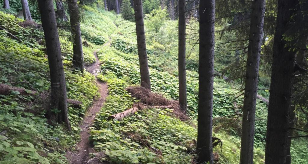
The Fürstenwald forest extends along the North East of the urban area; it is a popular recreational area with beautiful views of the city and the Calanda. Many paths lead through the mixed forest, making it an inviting place to go walking, hiking, jogging, or biking. A true paradise for anyone who wants to relax far from the bustle of the city or to get active!
The fastest way to Fürstenwald: by public bus no. 2 «Fürstenwald» from Bahnhofplatz in Chur or by car to the Fürstenwald cemetery car park.

Map

Fürstenwald forest

Responsible for this content Chur Tourism.

Playground Chur

Playground Haldenstein

Kinderspielplatz Haldenstein
Spacious playground between Chur and Haldenstein with barbecue area.

Description

The Haldenstein playground lies just along the walking and cycling route Chur-Haldenstein (Rhine cycle route no. 2), along the river Rhine. Its location and the integrated barbecue make it the perfect destination for a family outing. There is a lot of shade thanks to the many trees. 

Contact

Playground Haldenstein

Haldensteinerstrasse, 7000 Chur

Responsible for this content Chur Tourism.

Castle Tamins

Reichenau Castle

Weinbau von Tscharner · Schloss Reichenau
The location of Reichenau Castle at the confluence of the Vorder and Hinterrhein rivers is unique.

Description

Reichenau castle lies at the birthplace of the Alpine Rhine, where the two arms of the Rhine join together. Built in the 16th century by the clergy family Schauenstein, the castle looks back on a long and eventful history. At one time it even housed the last King of France.

Today, the historic building serves as a winery for the Tscharner family. Visit and meet wine producer Gian Battista von Tscharner and his smooth, honest wines during a castle tour with wine tasting.

Contact

Responsible for this content Chur Tourism.

City Bonaduz

Bonaduz

Bonaduz
Bonaduz

Show all 5 images

Sogn Mang
Bonaduz lies on a sunny terrace between the Vorder and HInter Rhine. The village has very high quality of life, attractive leisure offers and a wonderful landscape.

Description

Bonaduz' leisure offerings are varied and appeal to big and small, families, locals and visitors alike. Well maintained hiking and cycling trails take you into the charming surroundings - whether that's up on the mountains or down into the fascinating Rhine gorge, from Bonaduz the spellbinding nature of Graubünden is only a stone's throw away.

In Bonaduz proper, there are several fun things to do, like a minigolf course, football pitches, tennis courts, cross-country ski trails and woodchip running trails. The golf course Domat/Ems and the fashionable ski resort Laax are close by, too.

History

Archaeological finds from the late La Tène era (5th - 1st century BCE) and an early medieval burial site with more than 700 graves in Valbeuna are evidence for the fact that this has been settled for a long time. The Wackenau castle ruin lies high above the Rhine, not far from the village. It was probably constructed to secure a nearby river crossing. Bonaduz was part of the Rhäzüns dominion and came into possession of Maximilian I of Austria and Habsburg  in 1497. During the reformation, Bonaduz remained Catholic and formed a clerical, political and economic entity with neighbouring Rhäzüns in 1529.  The church was not separated until 1667.

In the middle of the 16th century, Bonaduz purchased Alp Ramuz on the far side of the Kunkels pass. Livestock and grain farming were the cornerstones of the community for most of its existence. Today, many inhabitants of Bonaduz are employed at Ems-Chemie in Domat/Ems, others  commute to Chur.

Bonaduz was originally part of the Romansh language area. In 1860, nearly 70% of the population were still Romansh-speaking. But during the years of reconstruction following a great fire in 1908, more and more German speakers moved into the area, and they made up 80% of the population in 1990 while Romansh speakers had dwindled to only 6%.

Church S. Gieri/St. George

Church S. Gieri/St. George between Bonaduz and Rhäzüns used to be the main church of the Rhäzüns dominion and has exceptional cultural value today. According to excavations the first church at this site dates back to the 6th or 7th century. Around the middle of the 14th century a new choir was built and soon after the interior was lavishly decorated with magnificent paintings. Patrons were the barons of Rhäzüns. The frescoes in the choir from the early 14th century, the choir wall (showing the legend og St. George),  the impressive dragon fight and a donor portrait along the northern wall are by the famous "Master of Waltensburg". The scenes from the Old and New Testaments as well as the hagiographies in the rest of the nave were added in the second half of the 14th century by the "Master of Rhäzüns" in fresco secco style.

Rhine gorge

Close to Bonaduz lies the fascinating Rhine gorge Ruinaulta. It is one of the greatest and most diverse landscapes of the Alps. A wild gorge with a raging river, white cliffs and vast forests. Quiet lakes are filled as if by magic and rare birds breed in the forests along the river. You can even find orchids in the little garden of Eden.

You can explore Ruinalta perfectly well on your own. In the forests and along the Rhine you will find a dense network of hiking trails, various cycling routes and beautiful rest areas. There are three train stations of the Rhaetian Railway (Trin, Versam-Safien and Valendas-Sagogn) at either end and in the middle of the gorge.

If you want to get to know the Rhine gorge from up close, you can even take to the water. Ruinalta is one of Europe's most exciting waterbodies for canoeing, kayaking and river rafting.

Nature reserve Weihermühle

Its own little oasis, the mill of Weihermühle is powered by spring water. The abundance of water and constant care have created a true gem of nature all around the mill. The shallow moor of Weihermühle is classified as being of national importance. It is home to a number of rare species like the dormouse, numerous orchids and sundew, a local carnivorous plant. It's thanks to the efforts of Natura Graubünden and the former Natural Protection Society Graubünden that Weihermühle has been listed as a natural reserve since 1967. The first plots of land were purchased by the Natural Protection Society even in 1961. Today, the plot is in possession of Pro Natura, having grown to a size of nearly 9 acres.

Contact

Responsible for this content Chur Tourism.

Catholic Church Rhäzüns

Church Sogn Gieri Rhäzüns

Kirche Sogn Gieri Rhäzüns
The church Sogn Gieri (Rhaeto-Romanic in the idiom Sursilvan for St. George) is a small church outside the village of Rhäzüns.

Description

The Church of S. Gieri / St. Georg between Bonaduz and Rhazuns was probably the old parish church of both places and is a very special treasure. The oldest building is according to archaeological finds from the 6/7 Century date. In the second Quarter of the 14th Century brought a new choir, and then the interior was equipped with magnificent paintings. Clients were probably the Barons of Rhazuns. A first unknown artist took over the decoration of the chancel, the east wall (it shows the legend of St. George), and a dragon fight and a donor picture on the long north side. From a second, also not particularly well-known artist, the remaining north wall were the West and south walls provided with scenes from the Old and New Testaments, as well as with painted saints stories. For more information about these historic buildings can be found on the website of the parish Rhazuns.

Opening hours

Daily from 8am-7pm (door closes automatically)

Contact

Responsible for this content Chur Tourism.

Catholic Church Rhäzüns

Church Sogn Paul Rhäzüns

Kirche Sogn Paul Rhäzüns
The church Sogn Paul stands slightly elevated at the edge of the village of Rhäzüns.

Description

The former parish and current cemetery church Sogn Paul is slightly increased, at the southwestern edge of the village, at the foot of the spur of the Heinz mountain. The striking building with einschiffigem nave and a rectangular choir is covered by a single pitched roof.

 The authentic medieval interior is the stage for works of art from four centuries to enter into a dialogue with each other.

Sogn Paul was a medieval parish church that was expanded by a baroque nave and the cemetery for the Barons of Rhäzüns Inside there are remnants of frecoes by the Master of Waltensburg and by a workshop of the "Gotico Internazionale". The alter is decorated by post-Gothic papier-maché copies of the alter wings of Sogn Gieri.

Opening hours

Daily from 8am-7pm (door closes automatically)

Contact

Responsible for this content Chur Tourism.

Chapel Bonaduz

Chapel Sogn Mang

Sogn Mang
The Sogn Mang Chapel is dedicated to St. Magnus.

Description

The little field chapel Sogn Mang was built on a hill near Bonaduz and restored in 1993. It is dedicated to Saint Magnus (Sogn Mang in Romansh). Its unique location on a wide-open field under two mighty poplar trees gives it a wonderful aura of peace and strength.

ttp://www.bonaduz.ch/index.php?idcatside=96

Contact

Responsible for this content Chur Tourism.

City Tamins

Tamins

Reichenau-Tamins
Zusammenfluss des Rheins

Show all 5 images

Schloss Reichenau
Tamins and Reichenau are two villages that for most people have merged into one over time, located an the juncture of Vorder and Hinter Rhine. The Rhaetian Railway station where the lines to Surselva valley and to central Graubünden separate isn't called Reichenau-Tamins for nothing. Kunkels Pass is a well-known location for mountain bikers from near and far. The peak of Ringelspitze is the top of Tamins at 3,247 metres above sea level. Tamins shares its peak with the neighbouring village of Trin and with the canton of St. Gallen across the pass.

Description

The uniquely sunny location makes Reichenau and Tamins a fantastic place to live. Inhabitants profit from a well-developed infrastructure and modern school facilities. Locals and tourists alike find excellent public transport links. Tamins is located along the main north-to-south traffic axis, the A13 motorway.

The natural landscape around Tamins is one of a kind, with many hiking trails through forests and meadows and a diverse flora and fauna. The diversity of nature's beauty knows no bounds in this wonderful area. The unique oak forest, the adjacent rough pastures and the dry landscapes are of national importance. The natural reserve Rattena is characterised by its species-rich hedges, old deciduous trees, dry walls and reptile habitats, ponds and the Valtonis creek. The adjacent forests also have an impressive biodiversity. More than 20 different species of deciduous trees can be found here, amongst them some "exotic" species like the downy oak and the chestnut tree. The entire area is integrated into the Eichwald forest reserve. An exciting nature learning trail introduces visitors to the beauty and the inner workings of this unique landscape.

Where earth meets the skies, atop the Kunkels Pass at 1,357 metres above sea level, the municipality of Tamins owns the mountain restaurant "überuf. Here, hikers and cyclists can refill their batteries, for example with locally produced cheese from the alp at "überuf". For mountaineers wanting to climb up to Ringelspitze, the Ringelspitz cabin offers shelter and an ideal starting point for the expedition.

History

Excavations at burial sites suggest that the area has been inhabited since the Iron Age (around 500 BCE). The Romans were here, too, witnessed by a number of graves and Roman coins that were found top the Kunkels Pass. The grave of an Alemannic warrior suggests that the area remained settled after the fall of the Roman empire. The first written sources mentioning Tamins date back to 1399. In 1540, the parish adopted the Reformation. The village was repeatedly devastated by fires, for instance in the years 1616 and 1631. In 1799, it was set ablaze during the French invasion. The last great fire occurred in 1905.

Reichenau

The name Reichenau goes back to the monastery of the same name at Lake Constance which purchased property in this area during the early Middle Ages. Reichenau Castle was probably built when the seat of the house of Schauenstein was moved to Reichenau in the early 17th century. Around 1755, the residential buildings and workshops in the castle were extended under supervision of Johann Anton Buol.

In 1793 Johann Baptista von Tscharner's educational institution called "Philanthropinum" moved to Reichenau Castle. Teachers like Johann Peter Nesemann and Johann Heinrich Zschokke made the school a renowned institution until its end in 1798. Even Louis-Philippe I, later king of France, thought at Reichenau Castle for some time, adopting the pseudonym "Monsieur Chabos". In 1820 the castle came into possession of the Planta family who gave it its current appearance. Especially noteworthy are the dining room and a small hall in the garden wing.

Kunkels Pass

A particular challenge for bikers is the Kunkels Pass leading to Tamina valley, itself part of the canton of St. Gallen. In old times the route was often used by smugglers trying to avoid tolls around Chur and elsewhere, but it was also an alternate route whenever the Rhine flooded or bridges spanning it had collapsed. 

Rhine gorge

Tamins is the gate to the fascinating world of the Rhine gorge at Ruinaulta. (For water sports, it's the destination!) It is one of the greatest and most diverse landscapes of the Alps. A wild gorge with a raging river, white cliffs and vast forests. Quiet lakes are filled as if by magic and rare birds breed in the forests along the river. Even orchids can be found in this little Paradise. The Ruinaulta is also easy to discover and explore on your own. In the forests and along the Rhine you will find a dense network of hiking trails, various cycling routes and beautiful rest areas. Three stations of the Rhaetian railway (Trin, Versam-Safien and Valendas-Sagogn) are located at either entrance and even in the middle of the Rhine gorge. Those wanting to get to know the Rhine gorge intimately can do so riding on the waves of the river. Ruinaulta offers one of Europe's most exciting routes for canoeing, kayaking and river rafting!

Contact

Responsible for this content Chur Tourism.

Natural Monument Domat/Ems

Tumas

Tumas, Domat/ems
The small hills in Domat/Ems are called Tumas in romanish language

Description

Domat/Ems lies at the beginning of the wide Chur Rhine valley, surrounded by wooded hills and high mountain ranges - a landscape in grand style. The location of Domat/Ems between small round hills, known as the «Tumas», is also distinctive. The «Tumas» are relics of past landslides that have shaped the lowlands around Domat/Ems. They were originally formed from harder debris that was not washed away by erosion. The distinctive talus slopes lean against the southern foot of the mountain; they jut out in the shape of a fan and roll in gentle slopes down to the plain. The «Tumas» are under conservation.

Contact

Tumas

7013 Domat/Ems

Responsible for this content Chur Tourism.