discover.swiss ID
ds_chur
discover.swiss Additional Type
TourismArea

Rhine-Route No. 2: Section 3 Chur - Buchs (SG)

Medium
47.5 km
3:15 h
107 mhd
248 mhd
Heidihaus Grand Tour
Maienfeld

Show all 4 images

Rheindamm
The Rhine route accompanies the Alpine river from its source in the mountains to the large Rhine ports of Basel. On varied paths, the journey leads through many landscapes that this powerful river has created over the course of time.
Technique 2/6
Fitness 4/6
Highest Point  630 m
Lowest Point  445 m
Best Season
Jan
Feb
Mär
Apr
Mai
Jun
Jul
Aug
Sep
Okt
Nov
Dez
Start
Chur, railway station
Destination
European box
Coordinates
46.854078, 9.528082

Details

Description

The Bündner Herrschaft, Graubunden's fertile garden and winery lies on a mound of slate detritus. Also the home of Heidi, Peter and Alpöhi (Heidi's grandfather).

Note(s)
Beware: in good weather, a strong wind blows up the Rhine Valley in the afternoon however down valley if the Föhn wind is blowing.

See also
Ostschweiz Tourismus
Fürstenlandstrasse 53
9000 St.Gallen
Tel:+41 (0)71 274 99 00
Fax: +41 (0)71 274 99 01
Email: info@ostschweiz.ch
Internet: www.ostschweiz.ch

Ausrüstung

Normal cycling equipment. Functional clothing is an advantage, as ascents and descents alternate

Directions

Chur - Igis Landquart - Jenins - Sargans - Buchs

Directions

Public Transport

By train to Chur.

Anreise Information

Take the motorway exit Chur Nord and follow the signs to the train station.

Parking

Public parking available at the train station in Chur (for a fee).

Responsible for this content Graubünden Ferien.
This content has been translated automatically.

Trimmis - Malans

Medium
12.7 km
3:45 h
216 mhd
272 mhd
Das ehemalige Wasserschloss Marschlins liegt in der Ebene circa einen Kilometer nordöstlich von Igis.
Willkommen im Winzerdörfchen Malans

Show all 7 images

Breiter Kiesweg von Trimmis in Richtung Malans
The hike leads through forests and vineyards of the Five Villages and the Bündner Herrschaft.
Technique 2/6
Fitness 3/6
Highest Point  783 m
Lowest Point  536 m
Best Season
Jan
Feb
Mär
Apr
Mai
Jun
Jul
Aug
Sep
Okt
Nov
Dez
Start
Trimmis, Gargällis bus stop
Destination
Malans, Railway Station
Coordinates
46.902138, 9.562343

Details

Description

The hike through the vineyards and forests of the Five Villages into the Bündner Herrschaft begins at the northern end of the village at the "Gargällis" bus stop. Cross the access road to the village in a northerly direction and follow the sign for Molinära. After the Molinera, the path climbs slightly along the edge of the forest.

After another ascent to Dunkel Töbeli and over the Chessirüfi, you are already in the municipality of Landquart. At Birchholz there is a beautiful view of the village of Igis and the Rhine valley. It is worth stopping over the former moated castle of Marschlin. In slight ups and downs, the route continues to the Ganda, where it crosses under the Prättigauerstrasse.

After the passage at the tennis court, cross the river Landquart and walk along the right bank. After about 1 kilometre, leave the dam and head over the hay divider towards Malans station.


Geheimtipp

Refreshments in the Ganda at the tennis court (non-players are also welcome), broom pickling in the Heuteiler just before malans train station.

Sicherheitshinweis

Sections through the forest areas can be slippery in places after rainfall.

Ausrüstung

Normal hiking equipment. Depending on the weather, good footwear (hiking boots) is recommended, otherwise light trekking shoes are sufficient for the tour.

Directions

Trimmis - Molinära - Scheidrüfi - Dunkel Töbeli - Schlundrüfi - Birchholz - Marschlins - Ganda - Heuteiler - Malans

Directions

Public Transport

By train to Landquart or Chur, then by bus to the stop Trimmis Gargällis.

Anreise Information

Motorway exit Zizers, then on the main road to Trimmis. In the village, the path to the Älplibahn is signposted.

Parking

Public parking "Montalinstrass and Cholplatzweg" available (chargeable).

Responsible for this content Graubünden Ferien.
This content has been translated automatically.

Untervaz

Medium
15.8 km
5:30 h
966 mhd
966 mhd
Blick zwischen den Tannen hindurch
Blick auf Berge

Show all 8 images

Häuschen bei der Weide
A little off the A13, shortly after Chur, on the left bank of the Rhine we find the village Untervaz, which belongs to the Five Villages area. At the foot of Calanda there is the Holcim mining area (Untervaz cement works).
Technique 2/6
Fitness 4/6
Highest Point  1527 m
Lowest Point  561 m
Best Season
Jan
Feb
Mär
Apr
Mai
Jun
Jul
Aug
Sep
Okt
Nov
Dez
Start
Untervaz, Restaurant Linde
Destination
Untervaz, Restaurant Linde
Coordinates
46.927703, 9.535581

Details

Description

Untervaz has a public transport connection with Chur every half hour and can be easily reached by car. The hike starts in the middle of the village (stop Untervaz Dorf) and leads via Vordergasse to the turn-off to the various Alps. We follow the signpost to the left in the direction of Fallboden and Hinteralp. At the Fallboden, turn left again through the forest to the Bärenhag. On the way we pass two short tunnels carved into the rock.

The alpine road from Bärenhag to the former Walser settlement of Batänja is a bit steep, but easy to walk. On Batänja (belonging to the municipality of Haldenstein) it is worth taking a break and taking in the view of the opposite mountains of the Rhine Valley. Unfortunately, there is no place to stop for refreshments.

The path now winds its way through the small settlement and on through forest and across meadows to the highest point of the hike on the Gürgütschboden. Now it goes downhill on the alpine path. Again and again there are wonderful views of the valley and the rock formations of the Rätikon. The last section from Fallboden back to the village is identical to the ascent route. Right next to the village square you will find the Linde restaurant, where you can wait comfortably for the next post bus.

Ausrüstung

Normal hiking equipment, sturdy mountain boots.

Directions

Untervaz - Fallboden - Adler - Bärenhag - Batänja - Gürgütschboden - Zanoppis - Fallboden - Untervaz

Responsible for this content Graubünden Ferien.
This content has been translated automatically.

Culinary tour "Bündner Rheintal" (E-Bike)

Simple
51.4 km
3:40 h
269 mhd
269 mhd
E-Bike Tour Bündner Rheintal
E-Bike Station Bad Ragaz

Show all 9 images

Fahrt durch die Reben
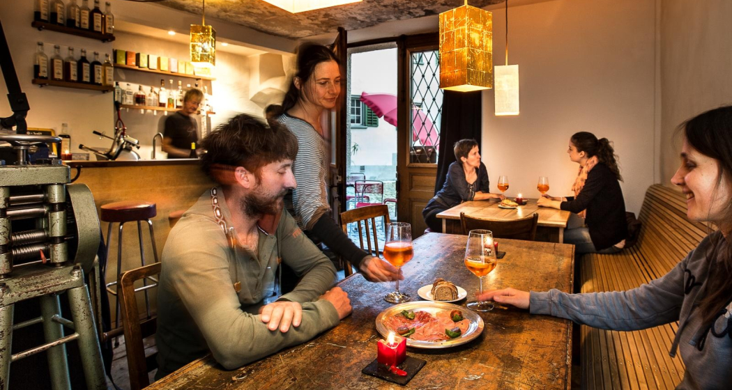
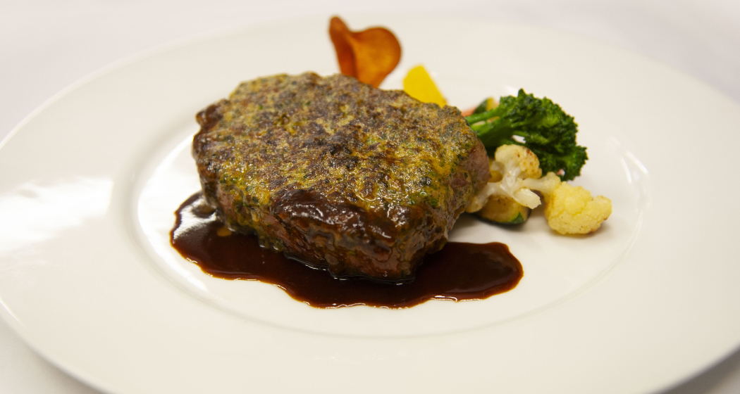
Combine a leisurely e-bike tour, from Bad Ragaz to the old town of Chur, with culinary stops at three different restaurants for starter, main course and dessert.
Technique 2/6
Fitness 2/6
Highest Point  655 m
Lowest Point  503 m
Best Season
Jan
Feb
Mär
Apr
Mai
Jun
Jul
Aug
Sep
Okt
Nov
Dez
Start
Bad Ragaz
Destination
Bad Ragaz
Coordinates
46.999248, 9.504763

Details

Description

Combine a leisurely e-bike tour, from Bad Ragaz through the "Graubünden Rhine Valley" region to the historic old town of Chur, with culinary stops in three different restaurants for starters, main courses and desserts.

Geheimtipp

After the tour, relax in the thermal water of the Tamina Therme and benefit from the relaxation bonus: pay 2 hours, relax for 4 hours.

Ausrüstung

Normal cycling equipment. Functional clothing is an advantage, as ascents and descents alternate

Directions

The tour starts at the e-bike station in Bad Ragaz. The first few metres run along the main road until you reach the historic town of Maienfeld. From there you cycle past vineyards to Jenins and Malans. After the idyllic village of Malans, you cross the Landquart River and continue to Igis, Zizers and Trimmis until you finally arrive in the oldest city in Switzerland - Chur. The way back to Bad Ragaz runs along the Rhine.

Directions

Public Transport

By train to Bad Ragaz, then by bus to Bad Ragaz, Post.

Anreise Information

Motorway exit Bad Ragaz, then on the main road to the village center of Bad Ragaz.

Parking

Public parking available at the multi-storey car park Zentrum, Tamina Therme or at the train station (for a fee).

Responsible for this content Graubünden Ferien.
This content has been translated automatically.

Via Son Giachen: Tschiertschen - Chur

Medium
11.6 km
3:30 h
109 mhd
857 mhd
Blick von Tschiertschen übers Schanfigg
reformierte Kirche von Inner Praden

Show all 11 images

Blick ob Usser Praden auf Maladers
The pilgrimage route Via Son Giachen leads from South Tyrol through the Val Müstair in the canton of Graubünden towards Central Switzerland or Valais. The partly alpine pilgrimage route is only accessible continuously in warm seasons.
Technique 2/6
Fitness 4/6
Highest Point  1343 m
Lowest Point  597 m
Best Season
Jan
Feb
Mär
Apr
Mai
Jun
Jul
Aug
Sep
Okt
Nov
Dez
Start
Tschiertschen, Church
Destination
Chur at Martinsplatz
Coordinates
46.817885, 9.606672

Details

Description

This stage takes us from Tschiertschen on the left bank of the Plessur via Praden and Passugg to Martinsplatz in Chur's old town. The Cathedral of Santa Maria in Chur is part of the bishopric there. Built on the foundations of a Roman fort, this is the oldest bishop's seat north of the Alps.
Our way leads us past Passugg with the former  Kurhaus there. The 5 healing springs bubbling up here with different chemical compositions were first mentioned in 1562. The spa was closed in 1979. Today, the building is used by the Swiss School of Tourism and Hospitality, the international Graubünden hotel management and tourism school, but also for local school operations.
Chur is the seat of the diocese of the same name and probably dates back to the 4th century, a bishop of the Diocese of Chur was first mentioned in a document in 451.

Geheimtipp

Chur is the capital of the canton of Graubünden and is a lively city for young and old.

Sicherheitshinweis

Detour Felsberg: The route will be diverted until further notice due to landslide. Redirection takes you 30 minutes more.

Directions

Be careful when crossing the Steinbachtobel: if the trail is poorly visible when crossing the (sometimes dry) stream bed, do NOT follow the stream bed in the fall line, but immediately look for the continuation of the trail on the other side ABOVE the stream bed. where the trail then initially follows the Steinbach parallel.

Responsible for this content Graubünden Ferien.
This content has been translated automatically.

Via Son Giachen: Chur - Trin-Digg

Medium
17.3 km
4:55 h
499 mhd
284 mhd
Kirche Tamins mal von der Bergseite
Kathedrale Chur

Show all 12 images

Blick am Morgen über Chur vom Fuss des Pizoggel
The pilgrimage route Via Son Giachen leads from South Tyrol through the Val Müstair in the canton of Graubünden towards Central Switzerland or Valais.  The partly alpine pilgrimage route is only accessible continuously in warm seasons.
Technique 2/6
Fitness 4/6
Highest Point  818 m
Lowest Point  571 m
Best Season
Jan
Feb
Mär
Apr
Mai
Jun
Jul
Aug
Sep
Okt
Nov
Dez
Start
Chur, Martinsplatz
Destination
District *Digg" of the place Trin/Digg
Coordinates
46.848316, 9.5327

Details

Description

This stage takes us from Chur towards the Graubünden Oberland, also called Surselva by the locals. From Chur, we initially hike along the southern edge of the wide Rhine valley and cross a few side valleys here. From Kalkofen, the path leads us to Domat/Ems, mostly across fields at the bottom of the valley. At Domat/Ems we first cross the tracks of the Rhaetian Railway at the station, then walk between the two hills "Tuma Tschelli" and "Tuma Casti" and then circle the second to the north. This brings us to the Rhine power plant, where we cross the weir to reach the island of Barnaus, which we leave a little upstream towards the north bank.
Here we reach the «Senda Sursilvana», the hiking trail through the Surselva, which will be part of our route again and again for the next few days. If the way to Trin-Digg is too long for you, you can already look for a suitable place to stay in Domat/Ems or Tamins.

Responsible for this content Graubünden Ferien.
This content has been translated automatically.

T 08 Via Francisca: Bonaduz - Ilanz

Difficult
22.9 km
6:35 h
527 mhd
479 mhd
Beweis unserer Wegführung
T 08 Via Francisca: Bonaduz - Ilanz

Show all 4 images

Pilgerweg in Imboden: Via Francisca: Bonaduz - Ilanz
The "Via Francisca" is also known as the "Road of the Emperors". It leads from Constance over the Lukmanier to Pavia, where it meets the Via Francigena.
Technique 1/6
Fitness 5/6
Highest Point  936 m
Lowest Point  658 m
Best Season
Jan
Feb
Mär
Apr
Mai
Jun
Jul
Aug
Sep
Okt
Nov
Dez
Start
Bonaduz, Railway Station
Destination
Ilanz. Railway station
Coordinates
46.810677, 9.397203

Details

Description

Today's stage is impressive, it takes us on the southern flank through the Rhine Gorge, the Swiss version of the "Grand Canyon", popular especially with water sports enthusiasts such as canoeists or rafters. The gorge has very steep flanks on both sides, so that the embarkation usually takes place in Ilanz and the disembarkation at the confluence of the Vorderrhein and Hinterrhein near Reichenau. However, there is still a transport option, because the Rhaetian Railway (narrow gauge) runs on the Chur - Ilanz route through the gorge, with some bridges and tunnels. This route is also used in winter. So whatever the weather has in store for capers, we will definitely come to Ilanz.
Of course, we hope for sunny weather, because then this stage with its breathtaking views is an unforgettable treat. We will ascend at the beginning and enjoy the gorge from above, then we will descend to the Rhine, where we will then meet the Rhaetian Railway and follow it and the Rhine to Ilanz.

Geheimtipp

The stages in this documentation are suggestions that each pilgrim can adapt to his wishes. however, the technical data always concern the assumption that these stages are completed in one day.

Sicherheitshinweis

.

Ausrüstung

Normal hiking/trekking equipment: backpack with rain cover, well-worn footwear, durable clothing appropriate to the season, rain and sun protection, hiking stick or trekking poles, pilgrim's passport.

Directions

Bonaduz - Caumas - Tschavir - Zault - Puz da Mattauns - Versam - Hübschera - Carnifels - Alatobel - Carrera - Carreratobel - Valendas - Station Valendas - Castrisch - Glenner - Ilanz

Directions

Public Transport

RhB (Rhaetian Railway)

Responsible for this content Graubünden Ferien.
This content has been translated automatically.

T 06 Via Francisca: Maienfeld - Chur

Medium
24.9 km
6:45 h
479 mhd
373 mhd
T 06 Via Francisca: Maienfeld - Chur
Pilgerweg in Graubünden: Via Francisca: Maienfeld - Chur

Show all 3 images

T 06 Via Francisca: Maienfeld - Chur (oua_24511570_6eddf74_profile)
The "Via Francisca" is also known as the "Road of the Emperors". It leads from Constance over the Lukmanier to Pavia, where it meets the Via Francigena.
Technique /6
Fitness 4/6
Highest Point  753 m
Lowest Point  514 m
Best Season
Jan
Feb
Mär
Apr
Mai
Jun
Jul
Aug
Sep
Okt
Nov
Dez
Start
Maienfeld, railway station
Destination
Chur, Cathedral of the Assumption of the Virgin Mary
Coordinates
47.006933, 9.531564

Details

Description

After leaving Maienfeld, we walk through the vineyards of Jenins and Malans. After the village of Malans, we leave the "Graubünden dominion", as this wine-growing region is called.
Afterwards we cross the Landquart, which has left the Prättigau shortly before through a very narrow rock cut. In the upper part of this valley are the well-known ski resorts of Klosters and Davos.
We stay on the eastern side of the Rhine in the relatively wide valley to Trimmis, passing through other, smaller vine-growing areas. The Rhine Valley is now gradually changing direction to the west.
Leaving Trimmis, we then go up again to the valley flank, which brings us shade in the forest and also gives us the opportunity to look at the Rhine Valley from the heights. In doing so, we also bypass the extensive outskirts of Chur, which lie at the bottom of the valley. This takes us through a lot of nature directly to the cathedral of Chur, the capital of the canton of  Graubünden. 

Geheimtipp

The stages in this documentation are suggestions that each pilgrim can adapt to his wishes. however, the technical data always concern the assumption that these stages are completed in one day.

Sicherheitshinweis

.

Ausrüstung

Normal hiking/trekking equipment: backpack with rain cover, well-worn footwear, durable clothing appropriate to the season, rain and sun protection, hiking stick or trekking poles, pilgrim's passport.

Directions

Maienfeld - Eichholz - Erlenböden - Buochwald - Malans - River Landquart - Marschlins Castle - Igis - Zizers - Molinära - Trimmis - Bach Maschänser Rüfi - Fürstenwald - Waldhaus - Eulengut - Chur Cathedral

Directions

Public Transport

SBB

Anreise Information

A13 / E43

Responsible for this content Graubünden Ferien.
This content has been translated automatically.

Kunkelspass in the World Heritage Site Sardona

Medium
14.6 km
4:15 h
423 mhd
763 mhd
Bergrestaurant Überuf auf dem Kunkelspass
UNESCO-Infotafeln auf dem Kunkelspass

Show all 4 images

Felstunnel auf dem Abstieg vom Kunkelspass
The Kunkelspass is more than just a crossing, it is a popular destination as well. Walkers and leisure hikers will find the mountain restaurants Eggwald in Oberkunkels and Überuf on the pass summit. From here, hikers approach the UNESCO World Heritage Tectonic Arena Sardona to the SAC-Ringelspitzhütte.
Technique 3/6
Fitness 4/6
Highest Point  1358 m
Lowest Point  595 m
Best Season
Jan
Feb
Mär
Apr
Mai
Jun
Jul
Aug
Sep
Okt
Nov
Dez
Start
Vättis/SG
Destination
Reichenau/Tamins train station
Coordinates
46.909101, 9.440192

Details

Description

The Kunkelspass (1357 m a.s.l.) connects Vättis with Tamins. The lovely plateau presents itself like an arena, surrounded by the mountains of the Calanda (2805 m above sea level), the Crap Mats (2947 m above sea level) and the Ringelspitz (3247 m above sea level), the highest mountain in St.Gallen, located in the Tectonic Arena Sardona.

From Vättis (943 m a.s.l.) an easy hike leads to the Kunkel Pass. Along the bubbling Görbsbach, the path leads gently uphill through meadows and forest sections to Unter Kunkels (1073 m above sea level). What a feast for the eyes, especially in early summer, when the alpine flora comes to life! Above the left side of the valley are the Haldensteiner and the Felsberger Calanda with their rugged limestone formations. When the path becomes a little steeper, you approach the Eggwald mountain restaurant in Ober Kunkels (1148 m a.s.l.). In the case of pleasure hikers, the 'autopilot' takes over in view of the neat restaurant, and you steer straight into the garden restaurant. But it is also not far to the Kunkelspasshöhe (1357 m.a.s.l.).

Kunkelspass as a goal or intermediate destination

In the mountain inn Überuf you can linger with pleasure on the garden terrace or in the wood-fired warmed dining room. Next door is a seminar room with information about the UNESCO World Heritage Site Tectonic Arena Sardona. They are proud to be able to offer the eastern entrance to the geological wonderland with Kunkels. A telescope offers the opportunity to take a close look at the Ringelspitz and the Glarus main thrust or the demolition niche of the Tamins landslide. Sometimes on the seabed, sometimes under 800 metres of glacial ice - the history of the earth also offers a lot of variety for Kunkels.

The shortest route into the valley is via a small road built during the First World War to Tamins (660 m above sea level). The view from the tunnel blasted into the rock is spectacular. If you want to continue uphill, climb via Grossalp to the SAC-Ringelspitzhütte (1998 m.a.s.l.). The hospitable hut can be enjoyed as a panoramic east-facing balcony of the Tectonic Arena Sardona.

Geheimtipp

Visit the earthquake exhibition in Vättis and learn, among other things, how earthquakes are related to the formation of mountains.

Sicherheitshinweis

Take appropriate equipment with you to the tour and stay on the marked trails.

Ausrüstung

Normal hiking equipment. Depending on the weather, good footwear (hiking boots) is recommended, otherwise light trekking shoes are sufficient for the tour.

Directions

Vättis – Unter Kunkels – Ober Kunkels – Kunkelspass - Reichenau

Directions

Public Transport

Postbus from Bad Ragaz station to Vättis, at x.35 a.m., return journey: with the RhB from Reichenau/Tamins station

Responsible for this content Graubünden Ferien.
This content has been translated automatically.