Viewpoint Domat/Ems
Juchs

Description
On the opposite side of the Dreibündenstein to the west of Malixer Alp is the mountain pasture clearing Juchs, high above the Chur Rhine Valley. The Juchs Alp (1,378 m) is accessible via hiking trails from Chur and Brambrüesch. It is also a popular outing destination for mountain bikers. The Alp is a part of the Domat/Ems municipality and is only catered during the height of summer, when the cows are on the alp (June to September). It is a former Walser settlement. However, no traces of the former dwellings remain visible today except overgrown, crumbling masonry.
Map
Juchs
Responsible for this content Brambrüesch.
Viewpoint Domat/Ems
Lady Patricia

Description
This site marks the spot where an American bomber named «Lady Patricia» crashed in 1944. There has been a memorial stone with a metal plaque there since 2004. Situated below the Dreibündenstein, the site is accessible via a footpath with a magnificent panoramic view and is a worthwhile excursion destination for both hikers and mountain bikers. From the commemorative stone you have a great view of the Calanda massif opposite and the Rhine Valley near Chur, which lies approximately 1,400 meters of altitude below at the bottom of the valley.
Map
Lady Patricia
Responsible for this content Brambrüesch.
Mountain Summit Domat/Ems
Dreibündenstein 2160m


Description
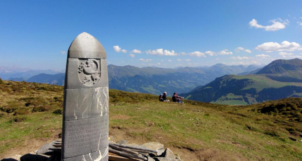
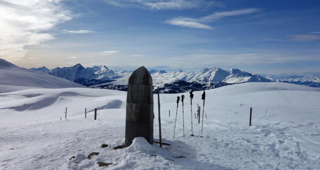
The Dreibündenstein, «Term bel» in Romansh, located in the alpine area of the present municipalities of Domat/Ems, Scheid, and Malix, is a peak, plateau, and historical border point all in one. In the heart of the Chur, Lenzerheide, and Viamala regions, it connects the three summer and winter sports areas Brambrüesch, Pradaschier, and Feldis. At an altitude of 2,160 m, a stone monument marks the shared border point of three former Rhaetian states and commemorates the freedom fighters of Graubünden. The place offers a magnificent panoramic view of the mountain ranges of the UNESCO World Heritage Tectonic Arena Sardona, the Graubünden mountains, and far beyond.
Map
Dreibündenstein 2160m
Responsible for this content Brambrüesch.
Playground Domat/Ems
Playground Domat/Ems


Description
Spacious playground with fireplace, table and benches.
Directions:
City bus line 1 to Domat/Ems, get off at stop Plarenga. Walk back to the roundabout and turn south towards the forest (5 minutes).
Directions by bicycle: From Chur via Rossboden - cross Rhine bridge towards Felsberg - back across the Rhine and the motorway, turn right straight after the bridge. Follow the dirt road to Domat/Ems. Turn left as you get to the village.
Directions by car: On the main road from Chur to Domat/Ems - turn left at the first roundabout in the village. Parking available.
Contact
Playground Domat/Ems
7013 Domat/Ems
Responsible for this content Chur Tourism.
Sports Facility Domat/Ems
Plarenga Riding School & Stable

Description
Riding lessons and horse riding on request
Opening hours
Contact
Plarenga Riding School & Stable
Plarenga, 7013 Domat/Ems
Responsible for this content Chur Tourism.
City Domat/Ems
Domat/Ems


Show all 4 images

Description
Domat/Ems lies at the beginning of the wide Rhine valley, framed by wooded hills and high mountain ranges. It is a landscape of unmistakable grandeur. Characteristic for Domat/Ems is its location amidst small, round hills call "Tumas" by locals. The village is bustling with life. Cultural, sports and leisure events and facilities like a very attractive golf course, Switzerland's longest pump track, the beautiful landscape, practical shopping opportunities and the modern infrastructure linking the village to Chur, the Surselva valley and southern Graubünden.
History
Excavated settlements date the first humans living in the area to the late bronze age, around the 11th century BCE. Throughout the Middle Ages, the monasteries of Pfäfers and Disentis as well as several noble families owned land in and around Domat/Ems. The castle that was built on the "Tuma" or hill fittingly called "Casté" became derelict in the second half of the 15th century. Its mighty tower collapsed in 1700. Together with the neighbouring villages of Rhäzüns, Bonaduz and Felsberg, Domat/Ems was part of the Rhäzüns dominion. In 1497, it came into possession of King Maximilian I of the Habsburg dynasty.
The Carolingian church S. Pieter (St. Peter) was built around 800 on the eastern side of the same hill as the castle. On the "Tuma" Turera stands the parish church S. Gion Baptista (St. John the Baptist) from the 12th century. Its great defensive tower was probably part of the original design. The late Gothic winged altar with its precious wood carvings dates back to the early 16th century. The more recent parish church Nossa Dunna d'Avuost (Our Lady of the Assumption) was consecrated in 1739. Its main altar was gifted by Emperor Charles VI. Unlike its neighbour parishes of Chur and Felsberg, Domat/Ems remained Catholic during the Reformation and has retained a rich religious tradition.
On 3 May 1799, local militia troops were dealt a bloody defeat at the hand of French troops. Between 1815 and 1819, the Rhäzüns dominion and with it Domat/Ems became part of the canton Graubünden. Until late in the 20th century the village was heavily reliant on agriculture. The alpine pastures Alp Urtgicla on the mountain Dreibündenstein and Alp Ranasca in the Surselva valley have been linked to Domat/Ems since 1469. But many villagers were forced to leave. First many became mercenaries, more recently they found work in the hospitality industry. Many children and young adults left for southern Germany.
In 1936, Werner Oswald founded the company Holzverzuckerungs-AG, which would later become the Ems Group and spearhead Ems' transition from a farming village to an industrial area. The large population influx caused by this development led to significant changes in the cultural and linguistic makeup of Domat/Ems. While in 1920 83% of villagers spoke Romansh, by 2000 that figure had dwindled to a mere 12%. In the same period, the proportion of Catholics dropped from 96% to just under two-thirds.
Bilingual community
Despite the significant decline of the Romansh language, Domat/Ems has remained officially bilingual to this day (both its names, "Domat" and "Ems" go back to Romansh "Amedes"). But Romansh leads an insular existence here, since it has almost entirely disappeared from neighbouring communities. All the more reason for Domat/Ems to conserve its second language. The dialect of Romansh that is spoken in Domat/Ems is unique, as it is unlike the dialects spoken in other Romansh communities. In the German-speaking population of Graubünden, the village is sometimes called "Welschen-Ems" because of its bilingualism - "Welsch" is a German term for a Romance language speaker.
Tumas
Domat/Ems lies at the beginning of the Rhine valley, framed by wooded hills and high mountain ranges - a landscape of unmistakable grandeur. Characteristic for Domat/Ems is its location amidst small, round hills call "Tumas" by locals. "Tumas" are relicts of past landslides which now dominate the landscape around Domat/Ems. They are made up of hard debris that wasn't washed away by erosion over time. The prominent cones of detritus lie at the southern foot of the mountains and fan out into the valley floor, where they gently ebb away into the plain. The "Tumas" are under natural conservation.
Contact
Domat/Ems
7013 Domat/Ems
Responsible for this content Chur Tourism.