31.05.2025: The indoor pool will close at 11.30am today. Reason: outdoor pool weather.

Infos outdoor pool.
discover.swiss ID
osm_1684191
discover.swiss Additional Type
City

City Trimmis

Trimmis

Trimmis
Trimmis

Description

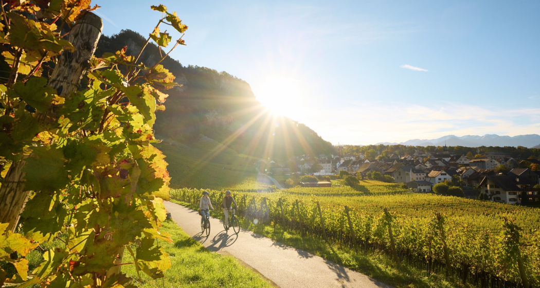
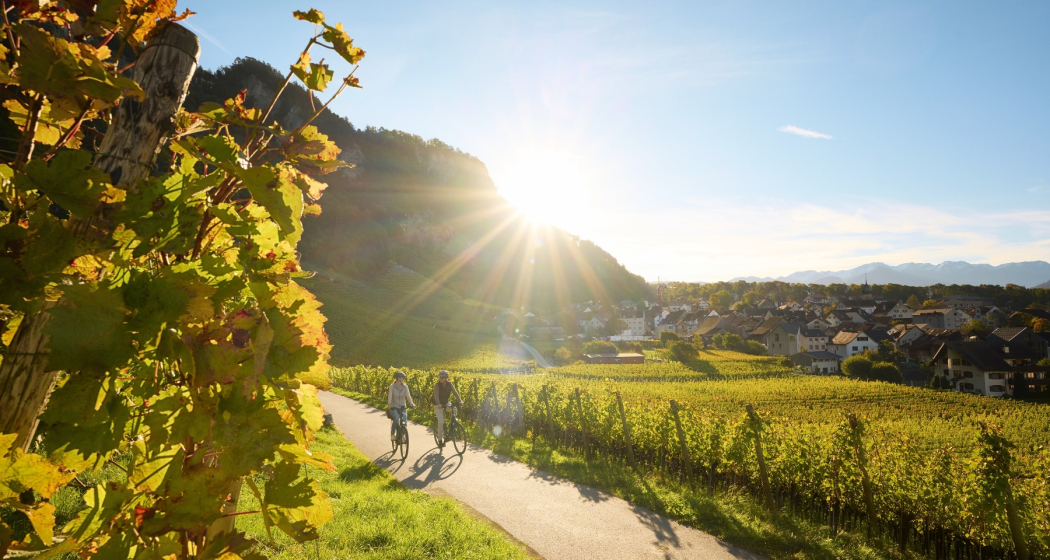
The municipality of Trimmis has exceptional local recreation areas in the area of leisure activities. Hiking, jogging, biking and much more are possible from the valley to the highest mountains. The so-called Witenen against Chur have a special appeal. Their dry stone walls, pastures, hedgerows and forests are of great importance as a local recreation area. The magnificent view of the Calanda, the Falknis, the Vial and the Caral, the local mountain of Trimmis, high above Stams, as well as the sunny location invite you to dream.

Map

Responsible for this content Heidiland Tourism Ltd..
This content has been translated automatically.

Outdooractive Logo

This website uses technology and content from the Outdooractive platform.

Catholic Church Trimmis

St. Leonhard's Evangelical Church

Evangelische Kirche
Evangelische Kirche

Show all 5 images

Evangelische Kirche
12th c.; choir from 1350; reconstruction in 1764; tower from 1687/1764

Description

The church is nestled against the castle hill, finding shelter for itself and its visitors. This impression is supported by the almost completely closed facades facing north and west. The sacral, Gothic choir room stands in dialogue with the nave, which is dominated by wooden fixtures. The galleries on the northern and western walls were built due to the lack of expansion possibilities.

Contact

St. Leonhard's Evangelical Church

Obergass, 7203 Trimmis

Responsible for this content Heidiland Tourism Ltd..

Outdooractive Logo

This website uses technology and content from the Outdooractive platform.

Historical Site Trimmis

Molinära Estate

Gut Molinära
Gut Molinära

Show all 9 images

Gut Molinära
Mentioned as „Gut Molinära“ in 1275

Description

The ruins of Alt-Aspermont Castle, situated to the south and 180 metres higher than the Molinära estate, are the former ancestral seat of the von Aspermont family (in the service of the Diocese of Chur). The Molinära farmstead, among other things, belonged to the castle until the move to Jenins in the middle of the 13th century. In 1275, Bishop Conrad III of Belmont gave Old Aspermont to Baron Walter IV of Vaz, together with the farms Molinära, Trimmis and Tomils. It was returned to the Roman Catholic Diocese of Chur in 1299.

Contact

Molinära Estate

Molinära, 7203 Trimmis

Responsible for this content Heidiland Tourism Ltd..

Outdooractive Logo

This website uses technology and content from the Outdooractive platform.

Catholic Church Trimmis

St. Carpophorus’ Catholic Church

Katholische Kirche St. Carpophorus

Show all 7 images

Katholische Kirche St. Carpophorus
8th c.; 14th c.; 1764; renovated in: 1967, 2004

Description

Once a chapel on the southern edge of the village, the church now stands its ground as a harmonious building with an onion tower almost in the middle. It is a simple church with wide, round arches on all sides under a large cross vault and a Gothic choir. Large windows featuring symbolised features of Jesus emphasise the light, sacred character of the church.

Contact

St. Carpophorus’ Catholic Church

Churweg, 7203 Trimmis

Responsible for this content Heidiland Tourism Ltd..

Outdooractive Logo

This website uses technology and content from the Outdooractive platform.

Tennis Facility Zizers

Tennis, Badminton, Squash, Sauna in Zizers

Hotel Sportcenter Fünf Dörfer AG

Show all 5 images

Hotel Sportcenter Fünf Dörfer AG
We are a sports center with tennis, squash, sauna and badmintin in summer. This includes a 3-star hotel and a dining restaurant.

Description

For sports enthusiasts – You can indulge in “ball sports” in our tennis hall all year round on four tennis courts. During the summer semester you shoot shuttles through the air on two badminton playing fields. Lovers who love it a little faster can let off steam in the four squash boxes. Tennis lessons, tennis tournaments, affordable rental prices and a selected range of sports equipment complete the offer at the Sportcenter Fünf-Dörfer.

Contact

Tennis, Badminton, Squash, Sauna in Zizers

Oberauweg 186D, 7205 Zizers

Responsible for this content Heidiland Tourism Ltd..

Outdooractive Logo

This website uses technology and content from the Outdooractive platform.

Geological E-Bike tour: over the Kunkelspass around Calanda

Medium
60.5 km
4:30 h
1063 mhd
1064 mhd
Gemeinsam um den Calanda
Auf dem Weg zum Kunkelspass

Show all 5 images

Gemeinsam über den Kunkelspass
This round trip is a classic for E-Bikers. Especially those interested in geology will enjoy the Calanda Circuit.
Technique 3/6
Fitness 4/6
Highest Point  1358 m
Lowest Point  500 m
Best Season
Jan
Feb
Mär
Apr
Mai
Jun
Jul
Aug
Sep
Okt
Nov
Dez
Start
Bad Ragaz train station
Destination
Bad Ragaz train station
Coordinates
47.010059, 9.504616

Details

Description

The start of this geologically highly interesting round trip is in Bad Ragaz. After the village centre, you turn onto the old, picturesque road towards Valens, where you have to climb 300 metres in altitude for the first 4.5 kilometres. A panoramic stop on the Tamina Bridge, which opened in 2017, is a must. With a span of 260 metres, it is the largest arch bridge in Switzerland. From Pfäfers, follow the gently ascending main road into the Tamina Valley. The next stop is worth a stop at the Windegg viewpoint in front of Vadura. Here you can enjoy a wonderful view of the Glarus main thrust and the Wildseehörner. World Heritage information boards, viewing judges and cool loungers invite you to linger... but you probably want to go further.

At kilometre 16 you reach Vättis, where the exhibition 'BergeQuake!' shows the connection between earthquakes and mountain building in the Sardona tectonic arena... very impressive thanks to the live transmission of seismic recordings! Over the next few kilometres at the bottom of the bubbling Görbsbach, you can enjoy the view of the rugged limestone formations of the Haldensteiner (2,805 m) and Felsberger Calanda (2,697 m). The Eggwald mountain restaurant in Ober Kunkels (1148 m a.s.l.) invites you to stop for a bite to eat. A last short ascent, you have reached Graubünden soil and soon also the Kunkelspasshöhe (1,357 m a.s.l.). The garden terrace of the mountain inn Überuf is irresistible. The lovely pass plateau presents itself like an arena, surrounded by the Calanda (2805 m above sea level), the Crap Mats (2947 m above sea level) and the Ringelspitz (3247 m above sea level), the highest mountain in St.Gallen, located in the Tectonic Arena. Inside the inn, an educational information room is  dedicated to the UNESCO World Heritage Site of the Sardona Tectonic Arena.

The descent to Tamins (660 m a.s.l.) leads over a steep and bumpy natural road built during the First World War. The view from the tunnel blasted into the rock is spectacular. You can overlook the Domleschg and even see the Bernina massif in the distance. From Tamins, follow the national Veloland route no. 2 to Felsberg, where you continue along the right bank of the Rhine to Chur. Once again, you can educate yourself in geology: In the Chur Natural History Museum, a comprehensive geology exhibition focuses on the topic of Alpine formation. Then you can easily roll down the Rhine to Landquart and Bad Ragaz... or you can swing to the train station, look up again to the Calanda... and end the round on the railway.

Geheimtipp

Rent an e-bike at the e-bike station Bad Ragaz. This is located right next to the Tamina Therme, where you can treat yourself to a soothing bath after the tour.

Sicherheitshinweis

Take appropriate equipment with you to the tour and stay on the marked trails.

Ausrüstung

Normal bike equipment. Functional clothing is an advantage, as ascents and descents alternate.

Directions

Bad Ragaz – Pfäfers – Vättis – Kunkelspass – Tamins – Chur – Landquart – Bad Ragaz

Directions

Public Transport

By train to Bad Ragaz station

Anreise Information

Via motorway A13 exit Bad Ragaz

Parking

Parking directly at Bad Ragaz train station (chargeable)

Responsible for this content Graubünden Ferien.
This content has been translated automatically.

RheinWelten on the Rhine Route

Medium
438.5 km
30:00 h
1838 mhd
2913 mhd
RheinWelten
RheinWelten

Show all 8 images

RheinWelten führt dich zum Rheinfall
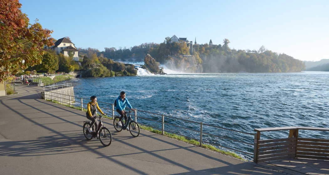
The "RheinWelten" e-bike route now connects Switzerland's existing cycling destination "Rhine Route 2" with regional, cultural and culinary highlights in 15 worlds of experience.
Technique 1/6
Fitness 3/6
Highest Point  2044 m
Lowest Point  258 m
Best Season
Jan
Feb
Mär
Apr
Mai
Jun
Jul
Aug
Sep
Okt
Nov
Dez
Start
Andermatt
Destination
Basel
Coordinates
46.634663, 8.596397

Details

Description

"RheinWelten" is a unique two-wheeler offer from the source of the Rhine to Basel for enjoyable explorers. 45 local tours in 15 adventure worlds can be discovered in Switzerland and Liechtenstein on an e-bike.  The tours combine visits to producers and farm shops, visits to museums or wineries, as well as local restaurants and overnight accommodations with the most beautiful cycling routes or hikes in the regions. The adventure worlds can be visited individually as a day trip or as a multi-day bike tour. 

Selected information on the new digital platform www.rheinwelten.com encourage people to discover new things. RheinWelten takes you through 12 tourist destinations in six cantons as well as the Principality of Liechtenstein. Experience unique cultural landscapes and the culinary diversity along the Rhine by e-bike.

Geheimtipp

Not the way is the goal, but the worlds of experience of the RheinWelten.

Ausrüstung

Roadworthy (e-)trekking bike, bicycle helmet, saddlebags or trekking backpack (approx. 35 litres) with rain cover, comfortable sports shoes, possibly cycling shoes, weather-adapted and durable clothing in the multi-layer principle, if necessary cycling jersey, change of clothes, cycling gloves, air pump, bicycle tools, sun and rain protection, provisions and drinking water, drinking bottle and suitable holder, first aid kit, pocket knife, mobile phone, if necessary mobile phone holder for the handlebar, headlamp and Reflectors, maps, travel documents, toiletry bags and towels, hand detergent and clothesline.

Directions

Rhine Route 2: Andermatt - Oberalppass - Disentis - Trun - Ilanz - Versam - Reichenau - Chur - Landquart - Jenins - Maienfeld - Sargans - Buchs - Oberriet - Altstätten - St.Margrethen - Fussach (D) - Gaissau (D) - Rohrschach - Arbon - Romanshorn - Kreuzlingen - Steckborn - Stein am Rhein - Gailingen (D) - Schaffhausen - Dachsen - Ellikon - Eglisau - Zurzach - Felsenau - Laufenburg - Stein - Rheinfelden - Pratteln - Muttenz - Basel

Directions

Public Transport

Arrival by train to Andermatt possible

Anreise Information

Motorway exit Göschnen direction Andermatt

Parking

Paid parking available

Responsible for this content Graubünden Ferien.
This content has been translated automatically.

Heidiland Bike Tour

168.5 km
18:35 h
5370 mhd
5264 mhd
Heidiland Bike Tour (oua_24515991_0c70eab_profile)
Heidiland Bike Tour
Technique 0/6
Fitness 0/6
Highest Point  1428 m
Lowest Point  421 m
Best Season
Jan
Feb
Mär
Apr
Mai
Jun
Jul
Aug
Sep
Okt
Nov
Dez
Coordinates
47.13502, 9.09802

Details

Responsible for this content Graubünden Ferien.

D01 - T22 Via Francisca des Lukmaniers

Medium
476.1 km
125:15 h
6852 mhd
7191 mhd
T01 - T22 Via Francisca des Lukmaniers
T22 Via Francisca des Lukmaniers (oua_24516016_0e20ae1_profile)
The "Via Francisca des Lukmaniers" is also known as the "Street of the Emperors". It leads from Constance over the Lukmanier Pass to Pavia, where it meets the Via Francigena. Here is the official route in 15 Swiss stages, plus 7 stages in Italy.
Technique 1/6
Fitness 4/6
Highest Point  1978 m
Lowest Point  55 m
Best Season
Jan
Feb
Mär
Apr
Mai
Jun
Jul
Aug
Sep
Okt
Nov
Dez
Start
Konstanz ( Münster )
Destination
Pavia Church, San Pietro in Ciel d'oro. ( - Rome)
Coordinates
47.663249, 9.175472

Details

Description

www.viafrancisca.ch/wegbeschreibung/

Geheimtipp

For more explanations on the trail, visit us on www.viafrancisca.ch

Sicherheitshinweis

November - April possibly snow stages 10 and 11, Disentis-Lukmanierpass-Olivone. Use public transport.

Ausrüstung

Backpack with rain cover, well-worn footwear, durable clothing appropriate to the season, rain and sun protection, hiking stick or trekking poles, pilgrim's passport.

Directions

www.viafrancisca.ch/wegbeschreibung

Directions

Public Transport

Public transport to Konstanz and from Pavia. All stage towns can be reached by public transport.

Anreise Information

-

Parking

-

Responsible for this content Graubünden Ferien.
This content has been translated automatically.

Trimmis - Malans

Medium
12.7 km
3:45 h
216 mhd
272 mhd
Das ehemalige Wasserschloss Marschlins liegt in der Ebene circa einen Kilometer nordöstlich von Igis.
Willkommen im Winzerdörfchen Malans

Show all 7 images

Breiter Kiesweg von Trimmis in Richtung Malans
The hike leads through forests and vineyards of the Five Villages and the Bündner Herrschaft.
Technique 2/6
Fitness 3/6
Highest Point  783 m
Lowest Point  536 m
Best Season
Jan
Feb
Mär
Apr
Mai
Jun
Jul
Aug
Sep
Okt
Nov
Dez
Start
Trimmis, Gargällis bus stop
Destination
Malans, Railway Station
Coordinates
46.902138, 9.562343

Details

Description

The hike through the vineyards and forests of the Five Villages into the Bündner Herrschaft begins at the northern end of the village at the "Gargällis" bus stop. Cross the access road to the village in a northerly direction and follow the sign for Molinära. After the Molinera, the path climbs slightly along the edge of the forest.

After another ascent to Dunkel Töbeli and over the Chessirüfi, you are already in the municipality of Landquart. At Birchholz there is a beautiful view of the village of Igis and the Rhine valley. It is worth stopping over the former moated castle of Marschlin. In slight ups and downs, the route continues to the Ganda, where it crosses under the Prättigauerstrasse.

After the passage at the tennis court, cross the river Landquart and walk along the right bank. After about 1 kilometre, leave the dam and head over the hay divider towards Malans station.


Geheimtipp

Refreshments in the Ganda at the tennis court (non-players are also welcome), broom pickling in the Heuteiler just before malans train station.

Sicherheitshinweis

Sections through the forest areas can be slippery in places after rainfall.

Ausrüstung

Normal hiking equipment. Depending on the weather, good footwear (hiking boots) is recommended, otherwise light trekking shoes are sufficient for the tour.

Directions

Trimmis - Molinära - Scheidrüfi - Dunkel Töbeli - Schlundrüfi - Birchholz - Marschlins - Ganda - Heuteiler - Malans

Directions

Public Transport

By train to Landquart or Chur, then by bus to the stop Trimmis Gargällis.

Anreise Information

Motorway exit Zizers, then on the main road to Trimmis. In the village, the path to the Älplibahn is signposted.

Parking

Public parking "Montalinstrass and Cholplatzweg" available (chargeable).

Responsible for this content Graubünden Ferien.
This content has been translated automatically.