discover.swiss ID
osm_1684191
discover.swiss Additional Type
City

Hiking Trail Obersays

Medium
11.9 km
4:30 h
801 mhd
801 mhd
Aussicht aus dem Wald
Blick auf Berg und Tal

Show all 8 images

Reihenhäuschen
On a green meadow terrace lies the small mountain village Obersays at 1100 meters above sea level. Already here the view to the opposite Calanda massif is magnificent. The higher we climb, the more impressive Chur's local mountain presents itself.
Technique 2/6
Fitness 4/6
Highest Point  1896 m
Lowest Point  1095 m
Best Season
Jan
Feb
Mär
Apr
Mai
Jun
Jul
Aug
Sep
Okt
Nov
Dez
Start
Obersays, Alte Sennerei
Destination
Upper Essays
Coordinates
46.906941, 9.5825

Details

Description

Obersays can be easily reached by public transport, with four daily Postbus journeys making this possible. However, the trip must be booked by phone at least 1 hour before departure. The well-developed road also allows you to travel by private car. Right next to the post bus stop is an overview map of the area around the former Walser settlement of Stams. On the forest and alpine path we leave Obersays. At the Zazaschgrank car park we take the path in the direction of Spundätscha. At the end of the forest, the now narrow road leads to the left and quite steeply up across meadows to the Maiensäss Spundätscha.

The route continues between the houses and on the open pasture land in the direction of Zanutscher Boden. On the ascent, it's worth taking a look back from time to time. The view towards the Graubünden Oberland is becoming more and more fantastic. At the highest point of the hike at the Zanutscher Boden you can see the Dolomites of the Rätikon with the well-known peaks Falknis, Schesaplana, Drusenfluh and Sulzfluh.

This is followed by the descent over pastures and through the alder forest down to the former Walser village of Stams. The small mountain restaurant (open every day from the beginning of May to the end of October) invites you to linger and enjoy. At the Artimi viewpoint there is a special wooden monument in memory of the Poles interned here (1942 - 1944). Always following the alpine road, you will soon reach the starting point in Obersays.


Ausrüstung

Normal hiking equipment, sturdy mountain boots.

Directions

Obersays - Zarzasch - Zanutscher Tobel - Spundätscha - Zanutscher Boden - Stams - Artimi - Tarnags - Obersays

Responsible for this content Graubünden Ferien.
This content has been translated automatically.

T 06 Via Francisca: Maienfeld - Chur

Medium
24.9 km
6:45 h
479 mhd
373 mhd
T 06 Via Francisca: Maienfeld - Chur
Pilgerweg in Graubünden: Via Francisca: Maienfeld - Chur

Show all 3 images

T 06 Via Francisca: Maienfeld - Chur (oua_24511570_c7ae88e_profile)
The "Via Francisca" is also known as the "Road of the Emperors". It leads from Constance over the Lukmanier to Pavia, where it meets the Via Francigena.
Technique /6
Fitness 4/6
Highest Point  753 m
Lowest Point  514 m
Best Season
Jan
Feb
Mär
Apr
Mai
Jun
Jul
Aug
Sep
Okt
Nov
Dez
Start
Maienfeld, railway station
Destination
Chur, Cathedral of the Assumption of the Virgin Mary
Coordinates
47.006933, 9.531564

Details

Description

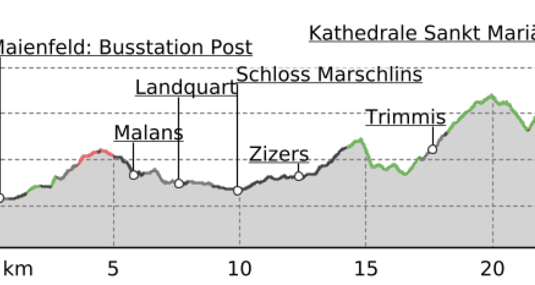
After leaving Maienfeld, we walk through the vineyards of Jenins and Malans. After the village of Malans, we leave the "Graubünden dominion", as this wine-growing region is called.
Afterwards we cross the Landquart, which has left the Prättigau shortly before through a very narrow rock cut. In the upper part of this valley are the well-known ski resorts of Klosters and Davos.
We stay on the eastern side of the Rhine in the relatively wide valley to Trimmis, passing through other, smaller vine-growing areas. The Rhine Valley is now gradually changing direction to the west.
Leaving Trimmis, we then go up again to the valley flank, which brings us shade in the forest and also gives us the opportunity to look at the Rhine Valley from the heights. In doing so, we also bypass the extensive outskirts of Chur, which lie at the bottom of the valley. This takes us through a lot of nature directly to the cathedral of Chur, the capital of the canton of  Graubünden. 

Geheimtipp

The stages in this documentation are suggestions that each pilgrim can adapt to his wishes. however, the technical data always concern the assumption that these stages are completed in one day.

Sicherheitshinweis

.

Ausrüstung

Normal hiking/trekking equipment: backpack with rain cover, well-worn footwear, durable clothing appropriate to the season, rain and sun protection, hiking stick or trekking poles, pilgrim's passport.

Directions

Maienfeld - Eichholz - Erlenböden - Buochwald - Malans - River Landquart - Marschlins Castle - Igis - Zizers - Molinära - Trimmis - Bach Maschänser Rüfi - Fürstenwald - Waldhaus - Eulengut - Chur Cathedral

Directions

Public Transport

SBB

Anreise Information

A13 / E43

Responsible for this content Graubünden Ferien.
This content has been translated automatically.

Stams

Difficult
42.2 km
5:40 h
1349 mhd
1349 mhd
Valzeina
Stams

Show all 8 images

Picknickwiese hinter Stams
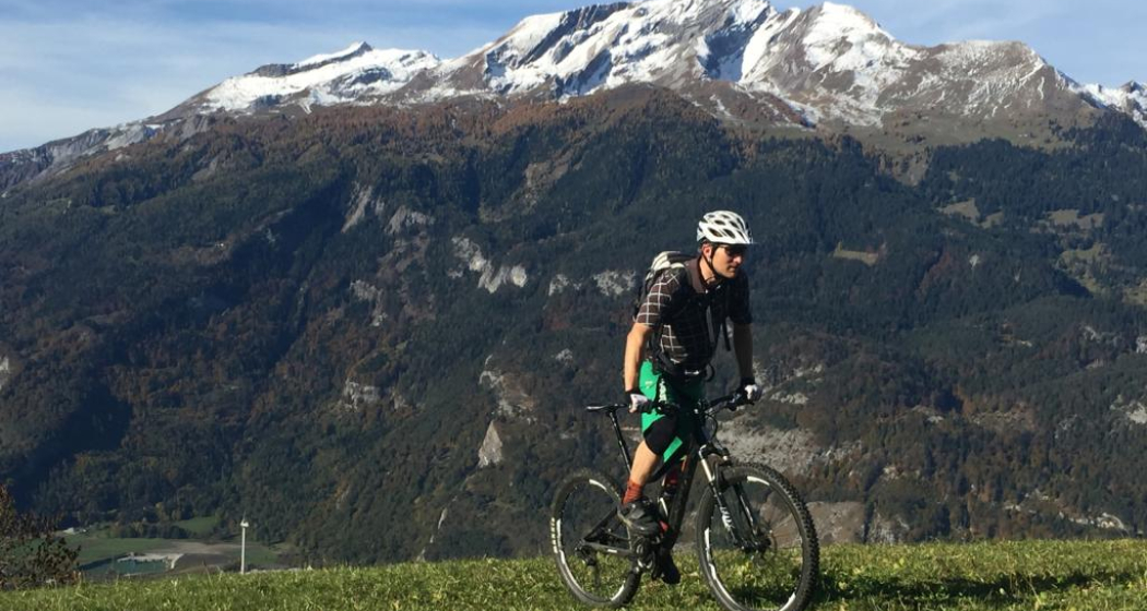
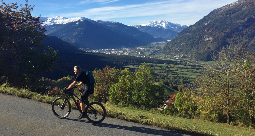
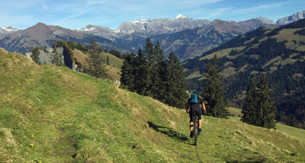
Beautiful mountain bike tour through a breathtaking landscape.
Technique 4/6
Fitness 5/6
Highest Point  1693 m
Lowest Point  518 m
Best Season
Jan
Feb
Mär
Apr
Mai
Jun
Jul
Aug
Sep
Okt
Nov
Dez
Start
Landquart, train station
Destination
Landquart, train station
Coordinates
46.967639, 9.554892

Details

Description

Varied bike tour with a beautiful descent through the magnificent and wild Valzeina Valley. The variant is particularly recommended here, because it offers further scenic as well as sporting highlights.


Sicherheitshinweis

Shooting range at Igis, evt. Bypass Marschlins Castle.

Ausrüstung

Normal bike equipment. Functional clothing is an advantage, as ascents and descents alternate

Directions

Landquart - Zizers - Trimmis - Says - Stams - Valzeina Valley - Landquart

Directions

Public Transport

By train to Landquart. The round trip starts from Landquart train station.

Anreise Information

Motorway exit Landquart, then follow the signalling on the main road towards Landquart station.

Parking

Public parking available at Landquart train station (chargeable)

Responsible for this content Graubünden Ferien.
This content has been translated automatically.
Wine Hiking Trail in Graubünden's Rhine Valley

Medium
27.1 km
7:00 h
423 mhd
479 mhd
Blick auf die Weinbauregion Bündner Herrschaft
Rebberge Bündner Herrschaft

Show all 6 images

Blick von oben auf die Weinregion
The wine hiking trail Bündner Rheintal connects the city of Chur with the wine villages in the Bündner Rheintal and Bündner Herrschaft.
Technique 1/6
Fitness 3/6
Highest Point  740 m
Lowest Point  525 m
Best Season
Jan
Feb
Mär
Apr
Mai
Jun
Jul
Aug
Sep
Okt
Nov
Dez
Start
Chur, Fläsch or along the route
Destination
Chur, Fläsch or along the route
Coordinates
46.853432, 9.529714

Details

Description

The scenic Rhine Valley near Chur, as well as Graubünden's north, known as Bündner Herrschaft, are regions that are predestined for wonderful walks and beautiful hiking tours. The wine villages and hiking trails are aligned like pearls along the Rhine River. Hike on a breezy autumn day when the "Föhn" blows across the Alps, when the wine harvest is drawing close and when one of the wine villages is preparing for a colorful fall festival - these are truly unforgettable experiences!

There are 3 circular tours through the vineyards along the way, Trimmis/Zizers (appr. 4 km), Malans/Jenins (appr. 10 km), Maienfeld/Fläsch (appr. 10 km). Together with the main trail from Chur to Fläsch (30 km), there are more than 40 km of signposted hiking tours available. A special map of the wine hiking trail is available at the tourist information at the railway station in Chur, as well as along the the way in the wine villages.

Due to its sunny location in the valley, the wine hiking trails are a good option almost all year round.

Responsible for this content Graubünden Ferien.

Chur - Herrentobel - Chur

Simple
20.4 km
2:45 h
620 mhd
640 mhd
Ausblick vom Herrentobel auf Chur
Chur - Herrentobel - Chur

Show all 5 images

Ausblick von der Burg Lichtenstein auf Haldenstein
Easy and short, but appealing round tour, that leads past some castles and ruins in the area.
Technique 1/6
Fitness 2/6
Highest Point  1143 m
Lowest Point  534 m
Best Season
Jan
Feb
Mär
Apr
Mai
Jun
Jul
Aug
Sep
Okt
Nov
Dez
Start
Chur, train station
Destination
Chur, train station
Coordinates
46.854276, 9.528356

Details

Description

This round tour starts at the Chur train station. Follow the official cycling route no. 2 to Haldenstein - Untervaz. At the sports centre Fünf Dörfer in Untervaz branch off to the right, cross the Rhine river and cycle into the village of Untervaz. The ruins of the two castles Neuenburg and Rappenstein in Untervaz can be visited.

In the upper part of Untervaz go left in direction of the Vazer Alp. Follow this partly very steep path until you reach Zalt at 930 m. Here, take the left road and enjoy the panoramic and smooth ride through the forests of the Herrentobel. On the opposite site you can see the impressive Montalin mountain and the lower situated Fürhörnli, which is the highest point of Chur.

On a forest road you continue to Oldiswald. At Bild (point 805) leave the road and continue straight ahead, pass by the ruin of Lichtenstein and descent into the village of Haldenstein with the remarkable caste of Haldenstein.

Responsible for this content Chur Tourism.

Stams - Mittagsplatte

Difficult
39.9 km
5:30 h
1600 mhd
1600 mhd
Calanda im Hintergrund
Im Aufstieg nach Says

Show all 7 images

Abfahrt von Stams Richtung Valzeina
Extended day tour with beautful viewing points and single tracks on the descent.
Technique 4/6
Fitness 5/6
Highest Point  1727 m
Lowest Point  546 m
Best Season
Jan
Feb
Mär
Apr
Mai
Jun
Jul
Aug
Sep
Okt
Nov
Dez
Start
Chur, train station
Destination
Chur, train station
Coordinates
46.85346, 9.529688

Details

Description

The start of this tour is at the train station Chur. Cycle out of the city in eastern direction, through the Fürstenwald (forest) to the village of Trimmis. When you have crossed the stream in Trimmis, the ascent begins on the right side up to Says and further up to Stams, where you will have a splendid panorama view. During the summer months, the restaurant in Stams is feasted and you can refresh yourself with some drinks and snacks.

From Stams follow the trail uphill across the meadow. And then the first downill begins on a challenging but ridable single track into direction of Clavadatsch. Back on the street you continue to Valzeina, where the second (but short) ascent begins and leads you up to the Mittagsplatte, where a 120 m high transmitting mast is positioned. Shortly before, you branch off to the left and follow a trail through the meadow to a fence. Here, the second part of the descent begins. At first quite steep and demanding, but soon getting easier and smoother, through the "Schlund" back into the valley. Leave the village of Zizers to your right and continue along Molinära back to Trimmis. After crossing the village, follow the trail to the Rhine river. From there, follow the official cycling path Rhine route No. 2 back to Chur.

Responsible for this content Chur Tourism.

Chur - Trimmis - Zizers - Haldenstein - Chur

Simple
26.4 km
2:15 h
139 mhd
139 mhd
Trimmiser Mittelweg
Trimmiser Mittelweg

Show all 6 images

Churer Rheinroute 501, Pardislabrücke Haldenstein-Chur
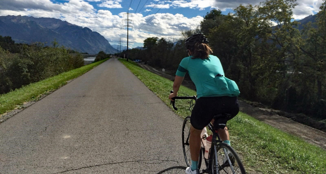
Beautiful round tour from Chur, connecting the two new cycle paths Chur-Trimmis and Haldenstein-Chur with the Rhine route.
Technique 1/6
Fitness 2/6
Highest Point  655 m
Lowest Point  539 m
Best Season
Jan
Feb
Mär
Apr
Mai
Jun
Jul
Aug
Sep
Okt
Nov
Dez
Start
Chur railway station
Destination
Chur railway station
Coordinates
46.85354, 9.529757

Details

Description

The Chur-Trimmis cycle path over the Trimmiser Mittelweg was opened on 27 November 2019. It leads from the end of the Cadonaustrasse in Chur to the Blutmarchweg in the Fürstenwald and over a new bridge at the Maschänserrüfe and the Trimmiser Mittelweg to Trimmis. The Haldenstein-Chur cycle path was opened on 14 December 2018. It leads from Haldenstein along the Rhine to the Pardisla bridge, which was newly built and crosses the Rhine in the direction of Chur.

The two new cycle paths can be combined in a round tour from Chur via Zizers to a beautiful round tour. Provided there is no snow all the way down to the valley, this route can be used practically all year round and is also suitable in winter as a round route for cyclists, cross-country bikers, e-bikers or gravel bikers. Between Trimmis and Zizers, the tour leads through the vineyard landscape and on to Molinära Hof over a piece of unpaved ground (hiking trail). If you prefer to do the whole round on a paved surface, you can go in Trimmis directly down to the Deutsche Strasse and along it to Zizers - so the round is even suitable for racing cyclists (a short section through the Fürstenwald on the new cycle path Chur-Trimmis runs on a not asphalted but paved forest path).

Responsible for this content Chur Tourism.

Round trip Graubünden Rhine Valley - Bündner Herrschaft

Medium
56.1 km
4:00 h
256 mhd
256 mhd
Unterwegs in der Weinregion Bündner Herrschaft
Weinreben oberhalb Chur

Show all 6 images

Rundtour Bündner Rheintal - Bündner Herrschaft
Wonderful round trip through the wine region of the Bündner Rheintal and Bündner Herrschaft.
Technique 1/6
Fitness 4/6
Highest Point  683 m
Lowest Point  494 m
Best Season
Jan
Feb
Mär
Apr
Mai
Jun
Jul
Aug
Sep
Okt
Nov
Dez
Start
Chur, train station
Destination
Chur, train station
Coordinates
46.853616, 9.53027

Details

Description

This tour takes you from Chur through the wine regions of the Rhine valley and the Bündner Herrschaft. Enjoy the beautiful scenery and villages in this region. The journey back to Chur is along the well known bicycling route along the Rhine river.

Responsible for this content Chur Tourism.

Chur - Bündner Herrschaft - Luzisteig - Rheindamm - Chur

61.6 km
3:15 h
420 mhd
420 mhd
Chur - Bündner Herrschaft - Luzisteig - Rheindamm - Chur
Technique 0/6
Fitness 0/6
Highest Point  716 m
Lowest Point  472 m
Best Season
Jan
Feb
Mär
Apr
Mai
Jun
Jul
Aug
Sep
Okt
Nov
Dez
Coordinates
46.850822, 9.531945

Details

Description

This route takes you through the hills of the Bündner Herrschaft, past huge vineyards and picturesque Torkeln, up to the St. Luzisteig. At 713 metres above sea level, the top of the pass is reached.  A rapid descent leads further down into Liechtenstein. From there it goes back on the Rhine dam in the direction of Chur. Flat and without car traffic, the Rhine dam invites you to really push your pedals. The Rhine dam ends at Bad Ragaz and the route leads along country roads via Bad Ragaz back to Landquart. From there, take  the same route back to Chur as you came. 

Responsible for this content Chur Tourism.
This content has been translated automatically.