discover.swiss ID
osm_1684212
discover.swiss Additional Type
City

E-bike round trip wine region Graubünden Rhine Valley

Medium
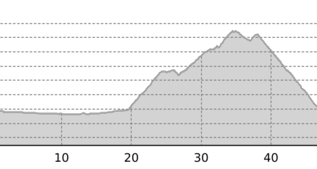
55.1 km
3:50 h
259 mhd
259 mhd
Weinregion Bündner Rheintal von oben
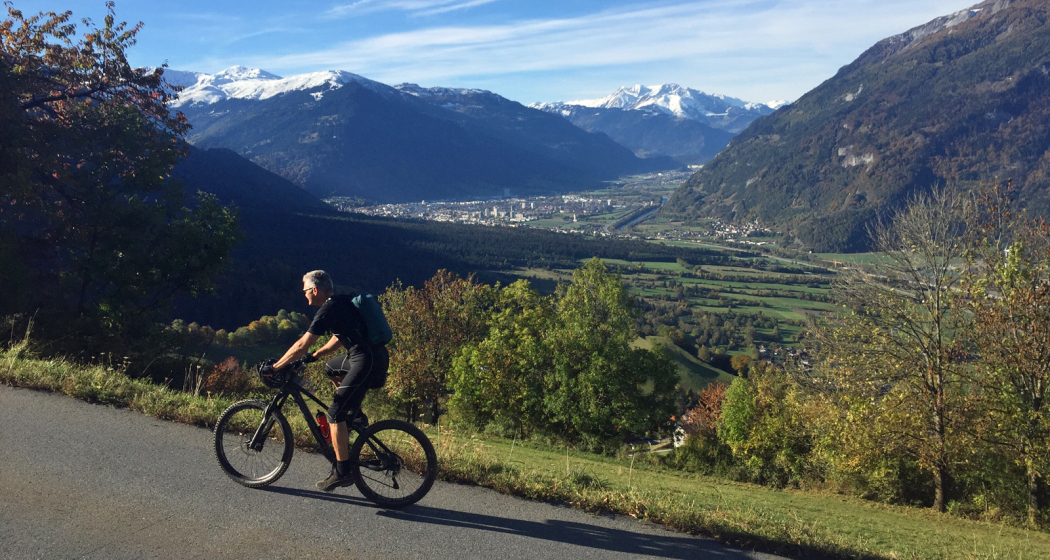
Unterwegs auf der Churer Rheinroute 501

Show all 7 images

Überquerung des Rheins zwischen Haldenstein und Chur (Pardislabrücke)
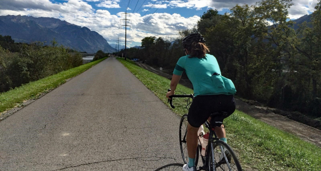
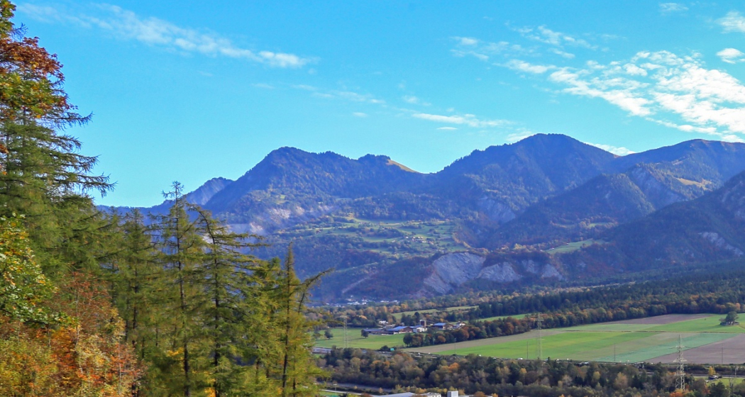
This extended circular tour is all about wine and water. It crosses the wine region of the Graubünden Rhine Valley between Chur and Fläsch and leads along the popular Rhine route back to Chur.
Technique 1/6
Fitness 3/6
Highest Point  655 m
Lowest Point  494 m
Best Season
Jan
Feb
Mär
Apr
Mai
Jun
Jul
Aug
Sep
Okt
Nov
Dez
Start
Station Chur
Destination
Station Chur
Coordinates
46.853441, 9.52974

Details

Description

Directly from the city of Chur, this circular tour leads through the wine-growing villages in the Graubünden Rhine valley and later the "Bündner Herrschaft". Part of the route runs along the Graubünden wine hiking trail, where various panels provide interesting information about regional viticulture. From the outermost Graubünden village of Fläsch, the return journey then takes place along the Alpine Rhine and, at the end, with a detour through the old town of Chur, which is well worth seeing, to the starting point at the train station.

Directions

Chur train station - Chur Rhine Route 501 to Ganda. From there on the Rhine Route 2 through the wine-growing villages of the Bündner Herrschaft to Fläsch and the Rhine. After crossing the Fläsch bridge over the Rhine on the Prättigau Route 21 to Landquart and along the Chur Rhine Route 501 back to Chur.

Directions

Public Transport

Chur train station is easily accessible by SBB (Swiss Federal Railways), Rhaetian Railways, Postbus or Chur Bus.

Anreise Information

Motorway exit Chur Nord or Chur Süd and then drive to the city centre.

Parking

At Chur railway station two multi-storey car parks are available (Otto & Alex / SBB Park & Rail).

Responsible for this content Graubünden Ferien.
Stams - Mittagsplatte

Difficult
39.9 km
5:30 h
1600 mhd
1600 mhd
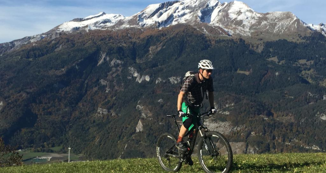
Calanda im Hintergrund
Im Aufstieg nach Says

Show all 8 images

Abfahrt von Stams Richtung Valzeina
Extended day tour with beautful viewing points and single tracks on the descent.
Technique 4/6
Fitness 5/6
Highest Point  1727 m
Lowest Point  546 m
Best Season
Jan
Feb
Mär
Apr
Mai
Jun
Jul
Aug
Sep
Okt
Nov
Dez
Start
Chur, train station
Destination
Chur, train station
Coordinates
46.85346, 9.529688

Details

Description

The start of this tour is at the train station Chur. Cycle out of the city in eastern direction, through the Fürstenwald (forest) to the village of Trimmis. When you have crossed the stream in Trimmis, the ascent begins on the right side up to Says and further up to Stams, where you will have a splendid panorama view. During the summer months, the restaurant in Stams is feasted and you can refresh yourself with some drinks and snacks.

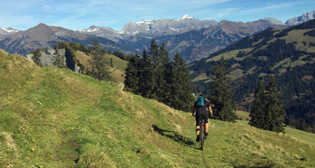
From Stams follow the trail uphill across the meadow. And then the first downill begins on a challenging but ridable single track into direction of Clavadatsch. Back on the street you continue to Valzeina, where the second (but short) ascent begins and leads you up to the Mittagsplatte, where a 120 m high transmitting mast is positioned. Shortly before, you branch off to the left and follow a trail through the meadow to a fence. Here, the second part of the descent begins. At first quite steep and demanding, but soon getting easier and smoother, through the "Schlund" back into the valley. Leave the village of Zizers to your right and continue along Molinära back to Trimmis. After crossing the village, follow the trail to the Rhine river. From there, follow the official cycling path Rhine route No. 2 back to Chur.

Responsible for this content Chur Tourism.

Round trip Graubünden Rhine Valley - Bündner Herrschaft

Medium
56.1 km
4:00 h
256 mhd
256 mhd
Unterwegs in der Weinregion Bündner Herrschaft
Weinreben oberhalb Chur

Show all 7 images

Rundtour Bündner Rheintal - Bündner Herrschaft
Wonderful round trip through the wine region of the Bündner Rheintal and Bündner Herrschaft.
Technique 1/6
Fitness 4/6
Highest Point  683 m
Lowest Point  494 m
Best Season
Jan
Feb
Mär
Apr
Mai
Jun
Jul
Aug
Sep
Okt
Nov
Dez
Start
Chur, train station
Destination
Chur, train station
Coordinates
46.853616, 9.53027

Details

Description

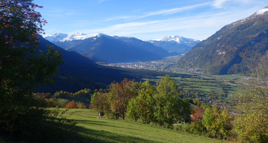
This tour takes you from Chur through the wine regions of the Rhine valley and the Bündner Herrschaft. Enjoy the beautiful scenery and villages in this region. The journey back to Chur is along the well known bicycling route along the Rhine river.

Responsible for this content Chur Tourism.

Chur - Bündner Herrschaft - Luzisteig - Rheindamm - Chur

61.6 km
3:15 h
420 mhd
420 mhd
Chur - Bündner Herrschaft - Luzisteig - Rheindamm - Chur
Chur - Bündner Herrschaft - Luzisteig - Rheindamm - Chur (oua_45483875_0d6f74c_profile)
Chur - Bündner Herrschaft - Luzisteig - Rheindamm - Chur
Technique 0/6
Fitness 0/6
Highest Point  716 m
Lowest Point  472 m
Best Season
Jan
Feb
Mär
Apr
Mai
Jun
Jul
Aug
Sep
Okt
Nov
Dez
Coordinates
46.850822, 9.531945

Details

Description

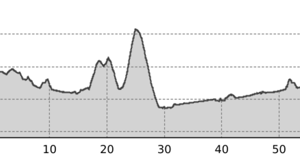
This route takes you through the hills of the Bündner Herrschaft, past huge vineyards and picturesque Torkeln, up to the St. Luzisteig. At 713 metres above sea level, the top of the pass is reached.  A rapid descent leads further down into Liechtenstein. From there it goes back on the Rhine dam in the direction of Chur. Flat and without car traffic, the Rhine dam invites you to really push your pedals. The Rhine dam ends at Bad Ragaz and the route leads along country roads via Bad Ragaz back to Landquart. From there, take  the same route back to Chur as you came. 

Responsible for this content Chur Tourism.
This content has been translated automatically.

E-bike round tour Walser settlement Stams

Medium
53.5 km
5:15 h
1358 mhd
1358 mhd
Blick von Says ins Churer Rheintal
Blick auf Says und oben Stams

Show all 3 images

E-Bike Rundtour Walsersiedlung Stams (oua_66798104_865041c_profile)
A very varied circular tour with ascent via Valzeina and the wild valley behind it to the Walser settlement of Stams, where a magnificent view and a rustic mountain inn beckon.
Technique 2/6
Fitness 3/6
Highest Point  1692 m
Lowest Point  523 m
Best Season
Jan
Feb
Mär
Apr
Mai
Jun
Jul
Aug
Sep
Okt
Nov
Dez
Start
Station Chur
Destination
Station Chur
Coordinates
46.853247, 9.529973

Details

Description

After a leisurely roll through the Graubünden Rhine Valley into the Prättigau region, the climb on the mountain road towards Valzeina begins shortly before Grüsch. The small mountain village is a typical Walser scattered settlement with numerous farms, which are far apart. After leaving the asphalt road, the climb continues through the long, wild and magnificent Valzeina valley up to Stams, the highest point of the tour. The beautifully situated Walser settlement is today only used as a maiensäss. In addition to the great view far into the Chur Rhine Valley, there is also a rustic mountain restaurant where you can fortify yourself with drinks and Graubünden specialties.

Now follows a long descent via Says - also a Walser settlement - down to the village of Trimmis. Finally, it's back to the Alpine City of Chur on a beautiful bike path through the Fürstenwald forest.

Directions

From Chur on the Rhine Route 2 to Landquart, there along the Prättigau Route 21 to the fork in the mountain road to Valzeina. Follow this to the village of Valzeina and from there on bikeroute 330 (Panorama Ride) to the "Laubenzug" junction. Here continue on the bikeroute Graubünden 90 to Stams. The descent is also along the Graubünden 90 bikeroute to Trimmis on the mountain road. From Trimmis on the Churer Rheinroute 501 back to Chur.

The ride is also possible in the opposite direction.

Directions

Public Transport

Chur train station is easily accessible by SBB (Swiss Federal Railways), Rhaetian Railways, Postbus or Chur Bus.

Anreise Information

Motorway exit Chur Nord or Chur Süd and then drive to the city centre.

Parking

At Chur railway station two multi-storey car parks are available (Otto & Alex / SBB Park & Rail).

Responsible for this content Graubünden Ferien.
Event Zizers

Divine service for the Autumn Festival with Communion

Festgottesdienst zu Pfingsten mit Abendmahl (gdl_583151656_image)
Rev. Heinz-Ulrich Richwinn

Description

Ort
Ev.-ref. Kirche Zizers

Collection: oeku Churches and Environment

Veranstaltungsort

Ev.-ref. Kirche Zizers

Obergasse, 7205 Zizers

Responsible for this content Evangelisch-reformierte Kirchgemeinde Zizers.
This content has been translated automatically.

Guidle Logo

This website uses content from Guidle.

Event Zizers

service

Festgottesdienst zur Konfirmation (gdl_583085651_image)
Rev. Heinz-Ulrich Richwinn and Anita Zysset, employee of the parish office with a focus on youth work
Introduction service with the young people of the confirmation course "Loben" Confirmation 2023.

Description

Ort
Ev.-ref. Kirche Zizers

All parents are cordially invited.
Regional Church Collection: Mission 21

Veranstaltungsort

Ev.-ref. Kirche Zizers

Obergasse, 7205 Zizers

Responsible for this content Evangelisch-reformierte Kirchgemeinde Zizers.
This content has been translated automatically.

Guidle Logo

This website uses content from Guidle.

Event Zizers

Five Villages Gourmet Breakfast Buffet

img_wt1_fgbbgbjeb
img_wt1_fgbbgbjec

Show all 3 images

img_wt1_fgbbgcajh
We offer our Five Villages gourmet breakfast buffet every Sunday.
The breakfast buffet is arranged very nicely according to the style of the house, because the eye eats with you!

Description

Date
04.04.2021 to 01.01.2023 from 08:00 to 11:00 o'clock
on Sunday
Price
CHF 28.00 per adult
Children up to 12 years pay one "Fränkli" per year of life
Ort
Hotel Sportcenter Fünf-Dörfer

We offer a rich breakfast buffet with many "gluschtigen" dishes. There is a smoked salmon plate, a Graubünden meat platter, various fine cheeses. Fried and scrambled eggs can be ordered directly from the service. Fitness-conscious people will also get their money's worth with a Bircher muesli with fresh fruits or tomatoes and cucumbers. If you feel like a glass of Prosecco or fruit juices, you can also get it. At the buffet coffee machine there is a favorite hot drink for everyone. The breakfast buffet is arranged very nicely according to the style of the house, because the eye eats with you! Breakfast is for all connoisseurs who like a fine and cozy breakfast.

Veranstaltungsort

Hotel Sportcenter Fünf-Dörfer

Oberauweg 186D, 7205 Zizers

Responsible for this content Heidiland Tourismus AG - IBR.
This content has been translated automatically.

Guidle Logo

This website uses content from Guidle.

Zizers

Mo
Thunderstorms
10.7°
Today
Rain
11.1° 6.3°
We
Showers
12.5° 6.7°
Th
Showers
13.6° 6.6°
Fr
Showers
12.9° 6.1°

Playground Zizers

Playground Untervaz

Spielplatz Untervaz
Peter Pan playground is a popular adventure playground.

Description

The playground Peter Pan lies just by the restaurant Fünf-Dörfer, which is part of the Sport Hotel Fünf Dörfer. On this exceptional playground, children can give full rein to their energy until they run out of steam. On the Lokal playground there are two impressive, three-story wooden towers with long slides that guarantee an adventurous day for kids of all ages. For younger visitors there is also a smaller climbing frame with a slide, swings, several seesaws and a play house. \r\n 

Contact

Playground Untervaz

Oberauweg 186D, 7205 Zizers

Responsible for this content Chur Tourism.