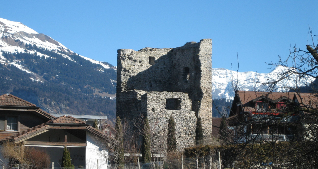
Please note: from 10. until and including 27. June, the facilities in the indoor pool building will be closed for the annual maintenance works. Sauna and gym will reopen on 21. June.

Additional infos.
Name plural
Theme SUI
Original Name
Theme SUI
discover.swiss ID
sui_root

Hotel Chur

Mercure Chur City West
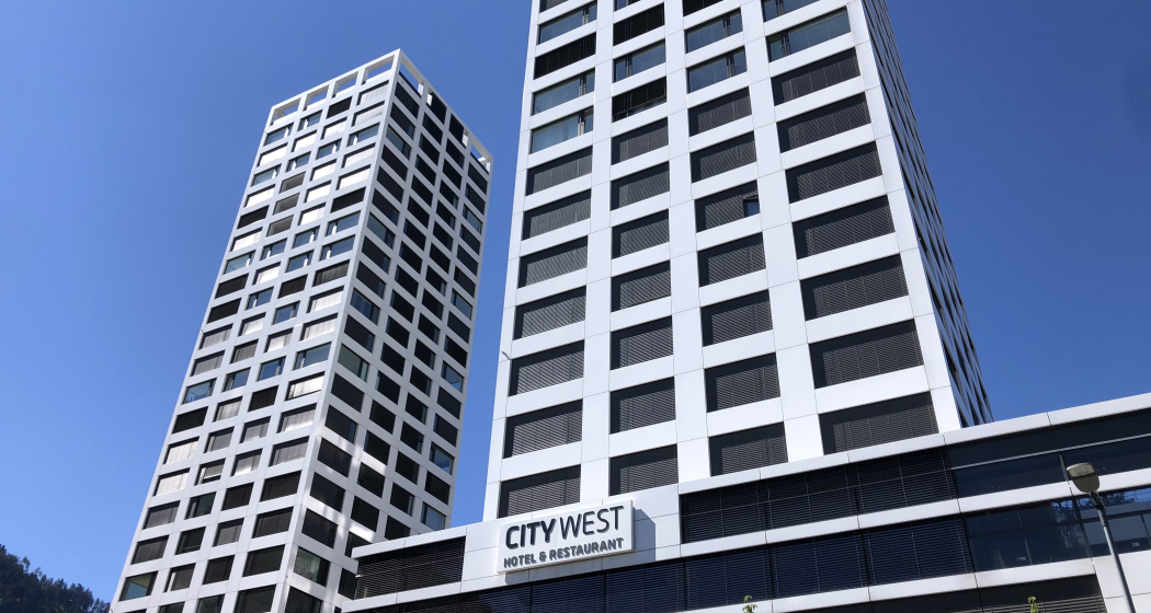
Mercure Chur City West (tom_tds00020012899441419_image)
Zimmer

Show all 49 images

Eckzimmer
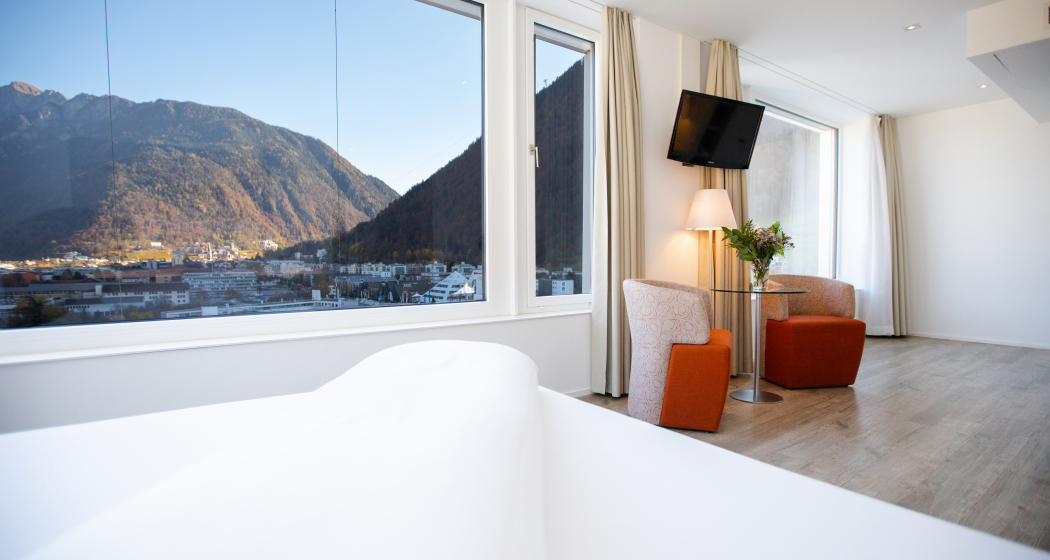
Find a sense of wellbeing in modern surroundings, with spacious bedrooms and conference rooms and culinary delicacies in the restaurant, with a dreamlike view.

Description

The modern 4* Mercure Chur City West hotel is located in the business district of Switzerland's oldest city. It is the best place for your business or leisure trip. The 49 air-conditioned rooms on the 3rd to 9th floors offer breathtaking views of the nearby mountains. The hotel also has a restaurant and bar, a smoking lounge, terrace, garage, gym and meeting rooms for 150 people.

Prices

Prices excl. taxes and incl. Wi-Fi and minibar. Underground parking for hotel guests: CHF 15.00 per day. Pets allowed: 20.00 CHF per day (without food). Check-in from 15:00 to 22:00 / Check-out from 06:30 to 11:00.

Contact

Mercure Chur City West

Comercialstrasse 32, 7000 Chur

Responsible for this content Chur Tourism.
This content has been translated automatically.

Hut hike high above the Chur Rhine Valley (stage 3)

Medium
8.8 km
1:50 h
0 mhd
1320 mhd
Stage 3: Ringelspitzhütte SAC - Tamins
Technique /6
Fitness 4/6
Highest Point  1992 m
Lowest Point  665 m
Best Season
Jan
Feb
Mär
Apr
Mai
Jun
Jul
Aug
Sep
Okt
Nov
Dez
Start

Ringelspitzhütte SAC

Destination

Tamins

Coordinates
46.8539, 9.53159

Details

Description

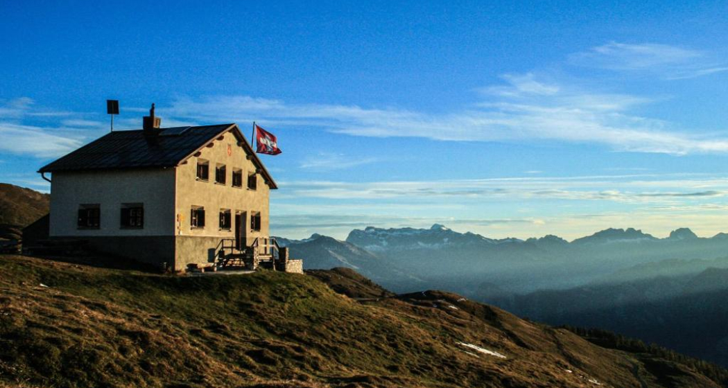
After a second overnight stay at the Ringelspitzhütte, the path leads down through the Lavoitobel, which is characterized by its alpine rocky landscapes and the Lavoibach. The descent continues down through forests, back into the Chur Rhine Valley. Finally, you will reach the charming village of Tamins, which marks the end point of this unforgettable hike.

For the return journey, you can take the bus directly to Chur in Tamins. On the way back, enjoy the beauty of the landscape once again and review the experiences of this hike.

Responsible for this content Chur Tourism.
This content has been translated automatically.
Hut hike high above the Chur Rhine Valley (stage 2)

Medium
12.4 km
4:00 h
751 mhd
835 mhd
Ringelspitzhütte
Berggasthaus Überruf am Kunkelspass

Show all 4 images

Ringelspitz von der Ringelspitzhütte aus
Stage 2: Calandahütte SAC - Ringelspitzhütte SAC
Technique /6
Fitness 4/6
Highest Point  2082 m
Lowest Point  1339 m
Best Season
Jan
Feb
Mär
Apr
Mai
Jun
Jul
Aug
Sep
Okt
Nov
Dez
Start

Calandahütte SAC

Destination

Ringelspitzhütte SAC

Coordinates
46.8539, 9.53159

Details

Description

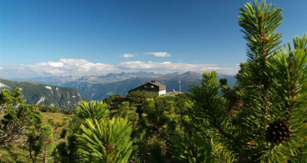
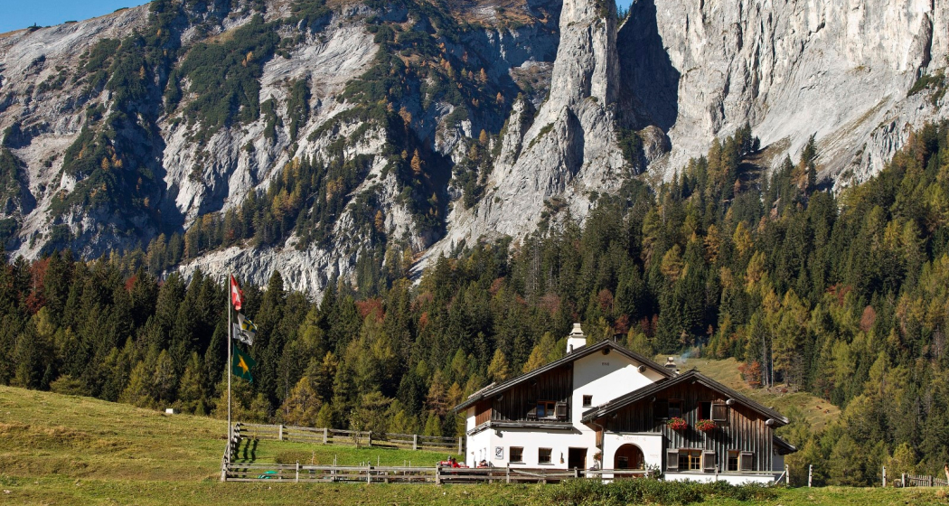
The next day, your path leads you over the Felsberger and Taminser Älpli to the historic Kunkelspass. On the way, the Überruf mountain inn invites you to fortify yourself with delicacies and enjoy the impressive surroundings. You are now officially within the perimeter of the UNESCO World Heritage Site Sardona.

In the informative room of the mountain inn, you will have the opportunity to learn in detail about the special features of the UNESCO World Heritage Site and to gain an insight into the rich history of this unique region. Strengthened and inspired, you continue your ascent to the Ringelspitzhütte. From this place you can get a great view of the UNESCO World Heritage Site and the clearly visible Glarus main thrust on the Ringelspitz summit.

Responsible for this content Chur Tourism.
This content has been translated automatically.
Hut hike high above the Chur Rhine Valley (stage 1)

Medium
8.9 km
5:20 h
1519 mhd
0 mhd
Blick auf die Alpenstadt Chur vom Calanda aus
Calandahütte SAC
Stage 1: Haldenstein - Calandahütte SAC
Technique /6
Fitness 4/6
Highest Point  2076 m
Lowest Point  550 m
Best Season
Jan
Feb
Mär
Apr
Mai
Jun
Jul
Aug
Sep
Okt
Nov
Dez
Start

Haldenstein

Destination

Calandahütte SAC

Coordinates
46.8539, 9.53159

Details

Description

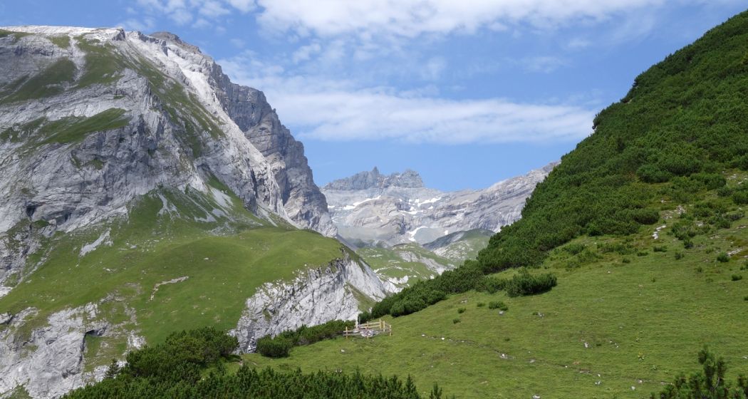
The fascinating hut hike begins in Haldenstein. Against the backdrop of the imposing Calanda massif, which rises majestically in front of Chur, an adventure full of breathtaking views and unforgettable experiences begins. With every step uphill, you dive deeper into the beauty of nature, and the panoramas become more beautiful with every meter of altitude gained.

An ascent of around 1,500 metres in altitude leads to the Calanda hut. But for those who are still looking for enough energy and even more adventure, there is the opportunity to climb to the summit of the Haldensteiner Calanda.  Another ascent of about 800 meters in altitude is pending. This is rewarded with an all-round view that makes you forget even the most strenuous steps.

Responsible for this content Chur Tourism.
This content has been translated automatically.
Castle Untervaz

Rappenstein Castle Ruins

Burg Rappenstein
Burg Rappenstein

Show all 12 images

Burg Rappenstein
Built around 1250

Description

Cave castle. Strong wall with window slits and high entrance. Remains of wooden beams mark the position of the arbours and external stairs leading to the high entrance. Remains of beams on the top of the wall hint at a roof construction or a wooden upper section. The interior of the cave is largely filled with rock debris. A narrow gap at the foot of the outer wall makes it possible to climb inside the cave.

Contact

Rappenstein Castle Ruins

Bachtobel, 7204 Untervaz

Responsible for this content Heidiland Tourism Ltd..

Outdooractive Logo

This website uses technology and content from the Outdooractive platform.

Castle Zizers

Zizers Castle

Schloss Zizers
Unteres Schloss Zizers

Show all 9 images

Schloss Zizers
Old small castle around 1620; castle 1670-87, until 20th c.

Description

You have stepped through the archway of Villa Maria and are standing in the former forecourt of the Salis-Zizers family. The three-storey Baroque castle is surrounded by arcades with massive columns on three sides and a park on the valley side. The octagonal tower, covered by a dome, is the landmark of the Zizers region and marks the centre of the castle.

Audio Guide

Unteres Schloss Zizers

Contact

Zizers Castle

Vialstrasse 16 / 18, 7205 Zizers

Responsible for this content Heidiland Tourism Ltd..

Outdooractive Logo

This website uses technology and content from the Outdooractive platform.

Castle Untervaz

Neuenburg Ruins

Neuenburg
Neuenburg

Show all 10 images

Neuenburg
From around 1300; burnt out in the 16th c.

Description

Monumental overall structure of uniform design, almost palatial building. Ground plan and facades in loose symmetry. Finely worked light-coloured limestone for window and door surrounds and building edges. Construction elements made of tuff stone or thick natural stone with raw worked face (bossage); some wall surfaces with Rasa-Pietra masonry.

Contact

Neuenburg Ruins

Schlossboda, 7204 Untervaz

Responsible for this content Heidiland Tourism Ltd..

Outdooractive Logo

This website uses technology and content from the Outdooractive platform.

Castle Zizers

Burg Friedau und Haus zur Glocke

Burg Friedau und Haus zur Glocke
Burg Friedau und Haus zur Glocke (oua_604495056_image)
Burg Friedau und Haus zur Glocke

Description

The complex was built by the Bishop of Chur Volkhart (1237-1251). The once mighty fortification was the centre of the episcopal jurisdiction. Later, the delinquents from the Five Villages district were imprisoned in the castle. The village fire of 1897 severely damaged the complex. Today, the castle is owned by the Five Villages District. In 2001, structural safety measures were taken. One of the oldest buildings still inhabited in Zizers is the House of the Bell. Once it was an inn, to which probably also Susten (warehouses with horse positions) were attached. Later, the Haus zur Glocke served as the town hall of the Five Villages district. It housed the district administration, the district office, the district notary's office, the debt collection and bankruptcy office, and the guardianship authority. Today, the beautifully spruced up Haus zur Glocke is used purely as a residential building.

Contact

Burg Friedau und Haus zur Glocke

Rathaus, 7205 Zizers

Responsible for this content Heidiland Tourism Ltd..
This content has been translated automatically.

Outdooractive Logo

This website uses technology and content from the Outdooractive platform.

City Zizers

Zizers

Zizers
Zizers

Description

The municipality of Zizers is located in the north of the canton of Graubünden, in the middle of the Chur Rhine Valley.  In addition to nature, which is easily accessible around Zizers by public transport such as bus or train, the surrounding area has many interesting neighboring towns and communities to offer that are worth a visit. In Zizers, no one needs to go hungry due to the number of restaurants. The spectrum ranges from Italian restaurants, Chinese restaurants to restaurants with German cuisine. For sports enthusiasts, there is the pump track in Zizers. The pump track Zizers, built in 2016, nestled in a beautiful landscape with lots of forest and open space, is located on the outskirts of the village of Zizers.   With a length of 240 metres, the asphalt circuit with 10 banked curves and 42 bumps is one of the longest in the canton of Graubünden. Some benches at the edge of the forest and a beautiful lark fountain with drinking water also invite parents and grandparents to linger together with the young people and children. Right next to the facility is the children's playground "Föhrenwäldli" with an open fireplace for grilling, wooden tables with benches, play equipment for the little ones and a toilet facility. Parking is also available. The facilities can be used free of charge by locals and tourists from near and far during the snow-free period.

Map

Responsible for this content Heidiland Tourism Ltd..
This content has been translated automatically.

Outdooractive Logo

This website uses technology and content from the Outdooractive platform.

City Untervaz

Untervaz

Untervaz
Untervaz (oua_604535452_image)
Untervaz

Description

The residential community of Untervaz is located on the left side of the Graubünden Rhine Valley and nestles harmoniously in the corner of the Val Cosenz, at the foot of the Calanda. The Haldensteiner Calanda (2806 m above sea level) forms the highest point of the municipality. Three castle ruins belong to Untervaz, all of which were left to decay by their last owners: 2 km southeast of the village lies the ruins of Neuburg on a rocky head above the Rhine. To the west of the village, in a narrow and damp crevice in the Valcosenz lies the ruins of Rappenstein Castle from the 13th century. Today, only remnants of the third Friewis Castle and the bath that operated there can be seen. The water of two springs had healing properties.

Map

Responsible for this content Heidiland Tourism Ltd..
This content has been translated automatically.
Outdooractive Logo

This website uses technology and content from the Outdooractive platform.