Please note: the indoor pool and wellness pool will remain closed until and including 27. June due to the annual maintenance works. All other facilities are open.

Additional infos.
Name plural
Activities
Original Name
Activities
discover.swiss ID
sui_01

Spundis Trail

3 km
1:30 h
160 mhd
160 mhd
Muddy winter weather and snowfall? Not to worry! Since you are almost always in the woods on this easy tour over the Brambrüesch plateau, it can also be completed without problems even if the weather is less than perfect.
Technique /6
Fitness 2/6
Highest Point   m
Lowest Point   m
Best Season
Jan
Feb
Mär
Apr
Mai
Jun
Jul
Aug
Sep
Okt
Nov
Dez
Start
Chur, Brambrüesch
Destination
Chur, Brambrüesch
Coordinates
46.828795460085, 9.5159724733297

Details

Responsible for this content SwitzerlandMobility.

5 km
1:40 h
150 mhd
150 mhd
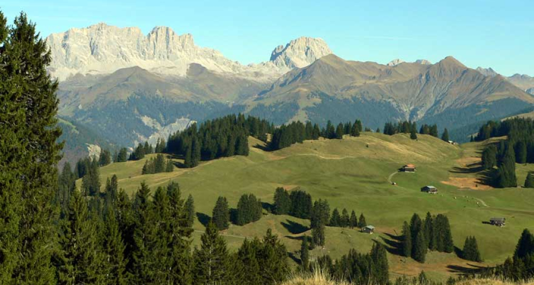
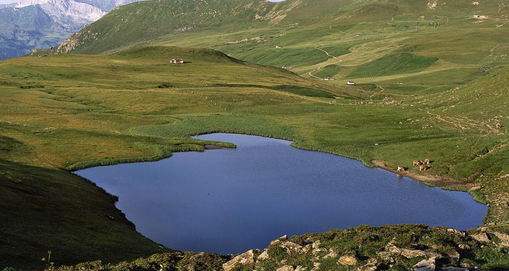
This panoramic trail has earned its name. From the Feldis highlands, the view of the majestic Piz Beverin, Tödi and Calanda group is simply divine. The gently undulating route goes past a small lake and a natural ice field and around the Tgom Aulta.
Technique /6
Fitness 4/6
Highest Point   m
Lowest Point   m
Best Season
Jan
Feb
Mär
Apr
Mai
Jun
Jul
Aug
Sep
Okt
Nov
Dez
Start
Feldis, Mutta
Destination
Feldis, Mutta
Coordinates
46.796609676146, 9.4561349013648

Details

Responsible for this content SwitzerlandMobility.

Difficult
48 km
5:25 h
1450 mhd
1450 mhd
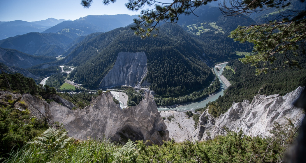
Blick in die Rheinschlucht | Route 260
Mountainbike-tour in Ruinaulta: Rheinschluchttour (260)

Show all 11 images

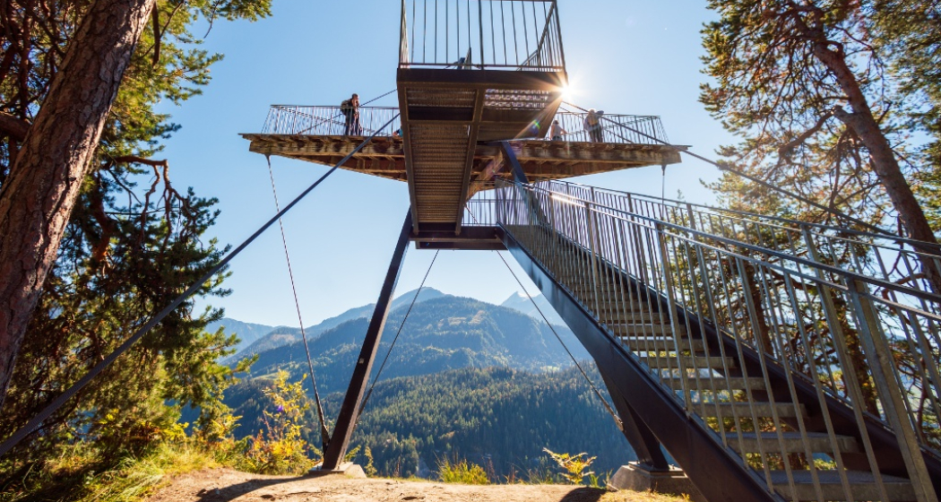
Aussichtsplattform il Spir
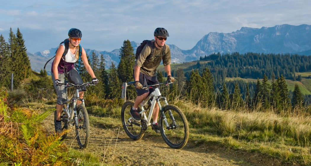
The Rhine Gorge in Graubünden is one of the most majestic and diverse landscapes in the Alps. The wild gorge combines roaring rapids with steep white cliffs and expansive woodlands. This circular route around the Rhine Gorge guides you along forested roads and single trails through the diverse landscape of the Vorderrheintal valley.
Technique /6
Fitness 6/6
Highest Point   m
Lowest Point   m
Best Season
Jan
Feb
Mär
Apr
Mai
Jun
Jul
Aug
Sep
Okt
Nov
Dez
Start
Laax, Staderas
Destination
Laax, Staderas
Coordinates
46.821879629577, 9.2706259297764

Details

Description

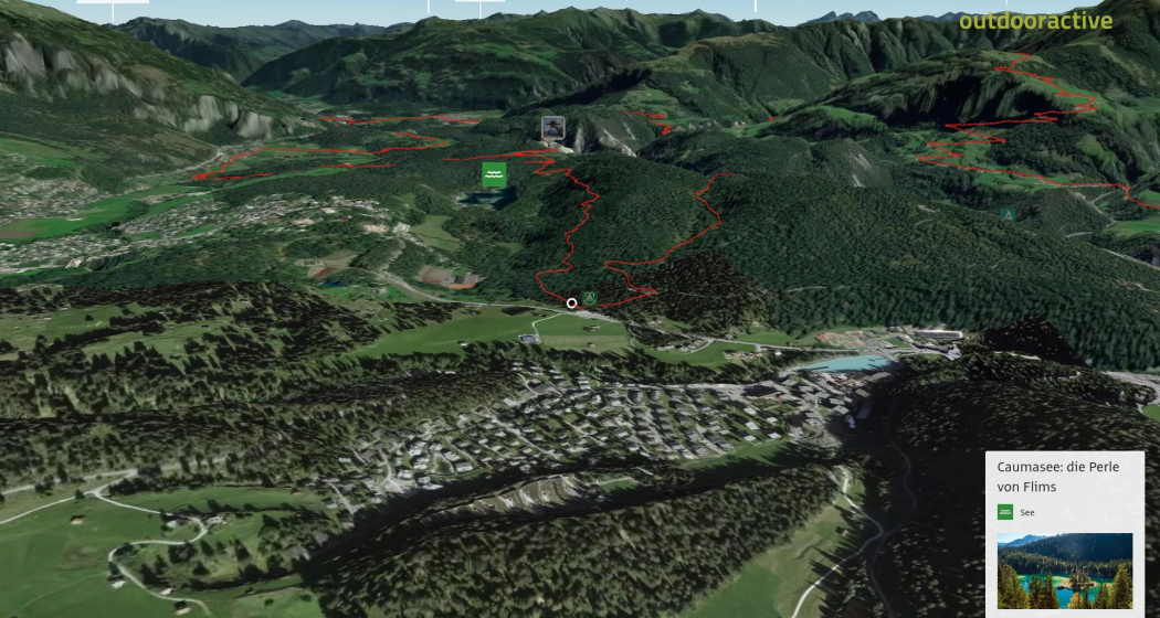
Whoever can complete the round tour in a single day from Ilanz, over Sagogn, Flims, Trin to Tamins and back to Ilanz via Bonaduz, Versam and Valendas, can count him or herself a biking-ace. However, for those who enjoy the scenery, it is recommended to do this tour in daily stages. The first pleasure is a choice of three bathing lakes: Laaxersee, Caumasee and the Crestasee. Further on are three different viewing-platforms over the unique landscape of Sardona - which is also a UNESCO world heritage site. A worthwhile detour from Versam into the Safiental is rewarded with a glimpse of delightful old Walser hamlets. There are many places to stay along the biking-route, from camping to five-star resorts.

Geheimtipp

For those who enjoy the scenery, it is recommended to do this tour in daily stages.

Sicherheitshinweis

Watch out for hikers. In the canton of Graubünden we share the paths.

Ausrüstung

A repair kit and first aid kit belong in the rucksack.

Directions

Laax - Flims - Trin- Tamins - Bonaduz - Versam - Valendas - Ilanz - Sagogn - Laax

Directions

Public Transport

Stop: Laax GR, Staderas
By post bus from Chur or the public Flims Laax Falera Shuttle.

Timetable
www.sbb.ch

Anreise Information

By car on the A13 motorway from Zurich to Chur, exit 18 Flims

Parking

Parking spaces at Staderas

Responsible for this content Flims Laax Falera Management Ltd..

Outdooractive Logo

This website uses technology and content from the Outdooractive platform.

Tennis Facility Zizers

Tennisplätze Zizers

Tennisplätze Zizers (ctd_5f53692e-d66b-4c02-9b04-6ce4e1e1a190_image)
Tennisplätze Zizers (ctd_5f53692e-d66b-4c02-9b04-6ce4e1e1a190_img01)

Show all 7 images

Tennisplätze Zizers (ctd_5f53692e-d66b-4c02-9b04-6ce4e1e1a190_img02)
With 300 members, the Zizers Tennis Club is an important sports club for our region. A club that stands for healthy, active leisure activities and for the promotion of tennis. But also a club that connects generations: More than 70 years lie between our youngest and our oldest member. Our club strives to meet the different needs of our motley group of members with a varied and interesting annual programme. Competition and fun, sport and social activities should alternate appropriately.

Description

The courts and clubhouse of the Zizers Tennis Club are located in one of the most beautiful spots in the Chur Rhine Valley: the "Stöckli" is on the upper edge of the village of Zizers. It's worth a visit, even if you don't want to play tennis. Just sit there, pause for a moment, enjoy the peace and the beautiful view, it's good for you. One way or another!

Opening hours

Monday to Sunday 07:00 - 22.00 hrs.

Courts always playable, except in snow!

Contact

Tennisplätze Zizers

Im Stöckli, 7205 Zizers

Responsible for this content Heidiland Tourism Ltd..

Difficult
55.5 km
6:00 h
1800 mhd
1800 mhd
Biker ob Furna
325 Furna - Trimmiser Alp (oua_2015772_image)

Show all 6 images

Kirche in Furna
This wonderful circuit boasting stunning vistas takes us from the Prättigau valley over the Furnerberg along single trails and pleasant tracks past the Trimmiser Alp down into the Rhine valley around Chur and then gently back to the valley of Prättigau.
Technique /6
Fitness 5/6
Highest Point  1806 m
Lowest Point  523 m
Best Season
Jan
Feb
Mär
Apr
Mai
Jun
Jul
Aug
Sep
Okt
Nov
Dez
Start
Grüsch
Destination
Grüsch
Coordinates
46.973788, 9.644439

Details

Description

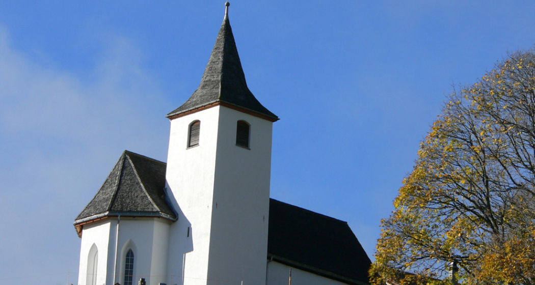
After setting off in Grüsch at the valley station of the Grüsch-Danusa mountain railways we follow the route along riverside paths and pleasantly undulating single trails we track the course of the Landquart river. From Schiers we continue along flat and pleasant sections to Pragg Jenaz. This is where the steep, asphalted ascent to the picturesque mountain village of Furna begins. It is well worth stopping at the pretty little church to take in the stunning panorama of the Rätikon range. From Furna we continue upwards along the mountain road, through the skiing area of Grüsch-Danusa, to the Alp Rona. This is the start of the wonderful single trail that takes us through the hilly terrain on a fast-flowing route. At the pretty hamlet of Scära the trail leads on to the mountain pasture and from here it plunges very steeply downhill to the alpine track in the direction of Stams. We then continue on a pleasant track through Stams, the picturesque cluster of pasture huts, then down a steeper asphalted road through the villages of Says and Trimmis to the beautiful Rhine river. The route briefly takes us along the banks of the Rhine to Zizers and then on to Igis and the fine sight of Schloss Marschlins. At Ganda the valley steadily closes in as it takes us through the narrow Chlus along flat and pleasant tracks back to Grüsch in the Prättigau valley

Directions

Grüsch - Pragg-Jenaz - Furna - Furner Berg - Scära - Stams - Says - Trimmis - Igis - Ganda - Chlus - Grüsch

Directions

Public Transport

Take the <a href="http://www.rhb.ch" target="_blank">Rhaetian Railway to Grüsch (Timetable field 910 or 941).

Anreise Information

Via the A13 and the B28 to Grüsch.

Parking

Free parking is available between the Sportis restaurant and the ice rink.

Responsible for this content SwitzerlandMobility.
This content has been translated automatically.

26 km
0:00 h
340 mhd
260 mhd
Leave the charms of Chur – the Rhaetian capital – behind, and set out on the Polish Trail. Enjoy breathtaking views of the Hinterrhein, and then enter the blossoming garden of Graubünden. The Domleschg: guarded by mighty castles and the Piz Beverin.
Technique /6
Fitness 2/6
Highest Point   m
Lowest Point   m
Best Season
Jan
Feb
Mär
Apr
Mai
Jun
Jul
Aug
Sep
Okt
Nov
Dez
Start
Chur
Destination
Thusis
Coordinates
46.854472231092, 9.5285856715227

Details

Responsible for this content SwitzerlandMobility.

155 km
0:00 h
3600 mhd
3200 mhd
The Graubünden Route leads along breathtaking stretches through glorious Alpine landscapes, from Chur over the Albulapass to Engadine and on a second branch of the route, along the Hinterrhein over the Bernhardinpass down to Bellinzona.
Technique /6
Fitness 6/6
Highest Point   m
Lowest Point   m
Best Season
Jan
Feb
Mär
Apr
Mai
Jun
Jul
Aug
Sep
Okt
Nov
Dez
Start
Chur
Destination
Martina / Bellinzona
Coordinates
46.854472231092, 9.5285856715227

Details

Description

Beseelte Bündner Alpenlandschaft mit allen Sinnen erfahren: Dem lässigen Charme der rätischen Kapitale entwischen, sich auf den Polenweg machen und sensationelle Ausblicke auf den Hinterrhein geniessen. Dann das Domleschg, blühender Garten Graubündens, bewacht von Burgen und dem Piz Beverin. Wild und gefährlich durch die Schijnschlucht, später den steilen Kehren der Rhätischen Bahn folgen, stetig aufwärts zum Albulapass, einer steinigen und windverblasenen Schönheit. Weit und licht, mit frischer Sicht auf die schneebedeckten Gipfel, liegt das Engadin in einer grandiosen Alpenlandschaft. Und ruhig wie der Flug eines Adlers erscheint die Natur des Engiadina bassa.

Der Preis für den Eintritt ins Rheinwald: ein 300 m tiefer Schlund, Via Mala, die fürchterlichste Schlucht in Rätien. Der Lohn: freundliche, sonnenwarme Holzhäuser in Splügen. Der Aufstieg zur alpinen Moorlandschaft des Bernhardinpasses, vorbei an Gletscherschliff und Alpwirtschaften, zehrt an den Kalorien. Im Abfahrtsrausch – 2000 Höhenmeter ohne Pedalschlag in die Tiefe – locken die Schätze des Valle Mesolcina vergeblich. Die Milde des Südens beschwingt, der Asphalt kocht, die Felgen glühen. Das Ziel ist in Sicht: die Türme Bellinzonas, trutzige Bewacher einstiger Handelsrouten.

Responsible for this content SwitzerlandMobility.

Difficult
47 km
7:55 h
2200 mhd
2000 mhd
90.03 Graubünden Bike Etappe 3 Untervaz - Küblis (oua_9299272_image)
90.03 Graubünden Bike Etappe 3 Untervaz - Küblis (oua_9299276_image)

Show all 3 images

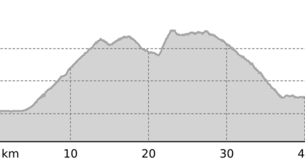
90.03 Graubünden Bike Etappe 3 Untervaz - Küblis (oua_7727750_2d8f924_profile)
Sensational long-distance views over the Bündner Rheintal, your reward for the perspiration-soaked ascent to Stams. Over gentle Alpine meadows and rugged valley flanks to the lonely Furnerberg moorland with impressive panoramic views into Prättigau.
Technique /6
Fitness 6/6
Highest Point   m
Lowest Point   m
Best Season
Jan
Feb
Mär
Apr
Mai
Jun
Jul
Aug
Sep
Okt
Nov
Dez
Start
Untervaz
Destination
Küblis
Coordinates
46.927546001645, 9.5351321862774

Details

Description

Sensational views of the Graubünden Rhine Valley are the reward for the strenuous ascent to Stams. Over gentle alpine meadows and steep mountain slopes, you reach the lonely moorland of the Furnerberg with a magnificent view all around to the Prättigau.

Directions

Untervaz - Trimmis - Says - Stams - Scära - Furner Berg - Furna - Pragg-Jenaz - Jenaz - Fideris - Strahlegg - Küblis

Responsible for this content SwitzerlandMobility.
This content has been translated automatically.

430 km
0:00 h
3400 mhd
4600 mhd
The Rhine Route follows the Alpine river from mountain source to the large Rhine port at Basel. A vastly varied trip through diverse landscapes hewn by the mighty river over the ages.
Technique /6
Fitness 4/6
Highest Point   m
Lowest Point   m
Best Season
Jan
Feb
Mär
Apr
Mai
Jun
Jul
Aug
Sep
Okt
Nov
Dez
Start
Andermatt
Destination
Basel(–Rotterdam)
Coordinates
46.63712862396, 8.5948598028698

Details

Description

Die Rhein-Route umspannt den Osten der Schweiz in einem grossen Bogen. Sie beginnt mit einer zünftigen Passfahrt über den Oberalp, dem Quellgebiet des Rheins, führt durch die romanischsprachige Surselva, gewährt eindrucksvolle Blicke in die wilde Schlucht Ruinaulta und besucht die rätische Kapitale Chur. Mit dem Traubenkocher-Wind durch die Bündner Herrschaft und auf dem Rheindamm eilig zum weiten Bodensee, wo Obstgärten, Schlösser und fröhliches Touristengeschnatter die Gestade des grün und silbern schimmernden «schwäbischen Meeres» zieren. Es folgt ein ruhiger waldreicher Abschnitt, dann eine bevölkerte Schaffhauser Altstadt, bevor mit Getöse die Wasser des Rheinfalls in die Tiefe donnern.

Der kraftvolle Fluss – zwischen Schaffhausen und Basel Hochrhein genannt – wird durch elf Kraftwerke gebändigt. Wie ein Puzzle fügen sich die Eindrücke entlang des Weges zusammen: romantische Uferweglein, schnurgerade Spargelfelder, putzige Riegelhäuser, endlose Strommasten, stoische Fischersleute, sonnenverbrannte Salztürme, ungleich-gleiche deutsch-schweizerische Brückenstädte und aufsehenerregende römische Ruinen. Schliesslich geht’s durch emsiges Agglomerationsgewusel, vorbei an riesigen Produktionshallen der chemischen Industrie und an Frachtschiffen in das Dreiländereck um Basel.

Velofahren weit über die Schweizer Grenzen hinaus? Die Rhein-Route ist erst der Anfang. Eingebettet in die EuroVelo 15, Rheinradweg und die beliebte EuroVelo 6 - Atlantik-Schwarzes Meer führt die Reise von Basel weiter durch die schönsten Ecken Europas.

Responsible for this content SwitzerlandMobility.

mein Ranger

0 km
0:00 h
0 mhd
0 mhd
egger-16-9
Discover mystical landscapes and be amazed – recharge your batteries in nature
Technique 0/6
Fitness 0/6
Highest Point  0 m
Lowest Point  0 m
Best Season
Jan
Feb
Mär
Apr
Mai
Jun
Jul
Aug
Sep
Okt
Nov
Dez
Coordinates
46.86192, 9.53713

Details

Description

Discover new areas and landscapes in guided small groups – leave familiar paths and gain new insights – lie in the sun and reflect on life – hiking guide Andi Egger, ranger and landscape architect, Graubünden high hunter and splitboard tourer takes you into nature.

Responsible for this content Chur Tourism.
This content has been translated automatically.