Name plural
Activities
Original Name
Activities
discover.swiss ID
sui_01

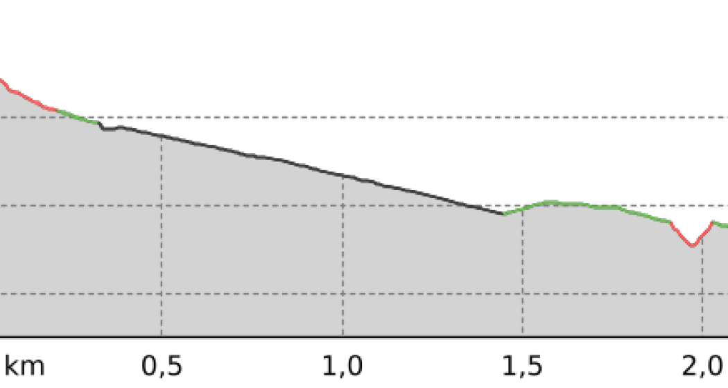
707 Chur Flow: Section 3

Simple
1.6 km
0:05 h
0 mhd
219 mhd
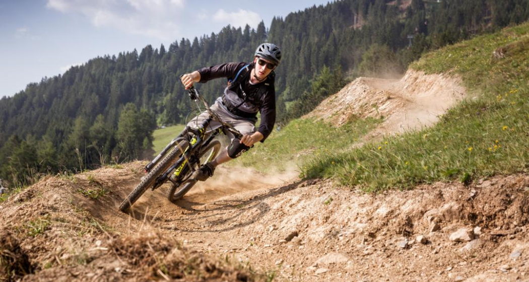
Chur Flow Trail im Alpenbikepark Chur
707 Chur Flow: Sektion 3 (oua_59381293_6e39ee0_profile)
707 Chur Flow: Section 3
Technique /6
Fitness /6
Highest Point  851 m
Lowest Point  632 m
Best Season
Jan
Feb
Mär
Apr
Mai
Jun
Jul
Aug
Sep
Okt
Nov
Dez
Coordinates
46.841115, 9.532592

Details

Responsible for this content Graubünden Ferien.

708 Vertigo: Section 3

Difficult
1 km
0:05 h
0 mhd
227 mhd
708 Vertigo: Sektion 3
708 Vertigo: Sektion 3 (oua_59381264_ef46109_profile)
708 Vertigo: Section 3
Technique /6
Fitness /6
Highest Point  852 m
Lowest Point  625 m
Best Season
Jan
Feb
Mär
Apr
Mai
Jun
Jul
Aug
Sep
Okt
Nov
Dez
Coordinates
46.841227, 9.532347

Details

Responsible for this content Graubünden Ferien.

708 Vertigo: Section 2

Difficult
0.8 km
0:05 h
0 mhd
160 mhd
708 Vertigo: Sektion 3
708 Vertigo: Sektion 2 (oua_59381259_f28ae81_profile)
708 Vertigo: Section 2
Technique /6
Fitness /6
Highest Point  1012 m
Lowest Point  852 m
Best Season
Jan
Feb
Mär
Apr
Mai
Jun
Jul
Aug
Sep
Okt
Nov
Dez
Coordinates
46.837786, 9.53203

Details

Responsible for this content Graubünden Ferien.

Heidiland Bike Tour

168.5 km
18:35 h
5370 mhd
5264 mhd
Heidiland Bike Tour (oua_24515991_0c70eab_profile)
Heidiland Bike Tour
Technique 0/6
Fitness 0/6
Highest Point  1428 m
Lowest Point  421 m
Best Season
Jan
Feb
Mär
Apr
Mai
Jun
Jul
Aug
Sep
Okt
Nov
Dez
Coordinates
47.13502, 9.09802

Details

Responsible for this content Graubünden Ferien.

D01 - T22 Via Francisca des Lukmaniers

Medium
476.1 km
125:15 h
6852 mhd
7191 mhd
T01 - T22 Via Francisca des Lukmaniers
T01 - T22 Via Francisca des Lukmaniers (oua_24516016_0e20ae1_profile)
The "Via Francisca des Lukmaniers" is also known as the "Street of the Emperors". It leads from Constance over the Lukmanier Pass to Pavia, where it meets the Via Francigena. Here is the official route in 15 Swiss stages, plus 7 stages in Italy.
Technique 1/6
Fitness 4/6
Highest Point  1978 m
Lowest Point  55 m
Best Season
Jan
Feb
Mär
Apr
Mai
Jun
Jul
Aug
Sep
Okt
Nov
Dez
Start
Konstanz ( Münster )
Destination
Pavia Church, San Pietro in Ciel d'oro. ( - Rome)
Coordinates
47.663249, 9.175472

Details

Description

www.viafrancisca.ch/wegbeschreibung/

Geheimtipp

For more explanations on the trail, visit us on www.viafrancisca.ch

Sicherheitshinweis

November - April possibly snow stages 10 and 11, Disentis-Lukmanierpass-Olivone. Use public transport.

Ausrüstung

Backpack with rain cover, well-worn footwear, durable clothing appropriate to the season, rain and sun protection, hiking stick or trekking poles, pilgrim's passport.

Directions

www.viafrancisca.ch/wegbeschreibung

Directions

Public Transport

Public transport to Konstanz and from Pavia. All stage towns can be reached by public transport.

Anreise Information

-

Parking

-

Responsible for this content Graubünden Ferien.
This content has been translated automatically.

303.1 km
89:45 h
9688 mhd
10093 mhd
Sumvitg mit seiner von weither sichtbaren Kirche
Müstair: Kloster San Gian

Show all 10 images

S-charl: Kapelle
The pilgrimage route Via Son Giachen leads from South Tyrol through the Val Müstair in the canton of Graubünden towards Central Switzerland or Valais.  The partly alpine pilgrimage route is only accessible continuously in warm seasons.
Technique 0/6
Fitness 0/6
Highest Point  2605 m
Lowest Point  435 m
Best Season
Jan
Feb
Mär
Apr
Mai
Jun
Jul
Aug
Sep
Okt
Nov
Dez
Coordinates
46.629432, 10.449222

Details

Responsible for this content Pilgerwege Schweiz.
This content has been translated automatically.

Outdooractive Logo

This website uses technology and content from the Outdooractive platform.

Haldensteiner Calanda

Difficult
16.2 km
8:05 h
2344 mhd
2344 mhd
Blick von Vättis hoch zum Calanda
Dorf Vättis mit dem Calanda im Hintergrund

Show all 3 images

Haldensteiner Calanda (oua_33755936_2a8308a_profile)
On Vättis' proud local mountain.
Technique 5/6
Fitness 6/6
Highest Point  2804 m
Lowest Point  943 m
Best Season
Jan
Feb
Mär
Apr
Mai
Jun
Jul
Aug
Sep
Okt
Nov
Dez
Start
Vättis
Destination
Vättis
Coordinates
46.910159, 9.440518

Details

Description

The mountain tour to Vättis' local mountain is challenging and only recommended for experienced mountaineers. The very steeply ascending mountain path leads from Vättis through dense fir forest over rock steps to the Gonschrolaboden. Between imposing rock faces you reach the Tüfelschilchli. In an airy, easy ridge walk you reach the summit after 1862 meters of altitude with a fantastic panoramic view. Calanda is home to a large ibex colony, almost certainly, you can observe the proud Graubünden heraldic animals with their majestic antlers on every tour.

Sicherheitshinweis

Some parts of the route can be slippery depending on the weather.

Ausrüstung

Normal hiking equipment, very stable mountain boots.

Directions

Vättis – Gonscherolaboden – Haldensteiner Schaftäli – Tüfelschilchli – Haldensteiner Calanda – Tüfelschilchli – Haldensteiner Schaftäli –Gonscherolaboden - Vättis

Descent variants: Via Calanda SAC hut and to the Vazer Alp (time 3h)

Directions

Public Transport

Arrival by train to Bad Ragaz and Postbus to Vättis

Daily to Bad Ragaz, continue by bus 451 direction Vättis, village to stop Vättis, Dorf.

Anreise Information

Motorway exit Bad Ragaz, take the mountain road in the direction of Pfäfers/Valens to Vättis.

Responsible for this content Graubünden Ferien.
This content has been translated automatically.
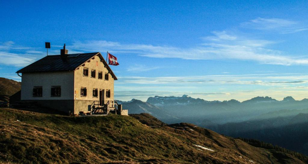
Antennatrail

Difficult
4.3 km
0:20 h
2 mhd
596 mhd
Antennatrail (oua_94756988_image)
Antennatrail Brambrüesch

Show all 6 images

Antennatrail Brambrüesch
Hidden trail highlight away from the well-known freeride routes of the Alpenbikepark.
Technique /6
Fitness /6
Highest Point  1761 m
Lowest Point  1165 m
Best Season
Jan
Feb
Mär
Apr
Mai
Jun
Jul
Aug
Sep
Okt
Nov
Dez
Coordinates
46.816554, 9.509091

Details

Description

This narrow trail has it all: It leads amazingly flat and flowing through a remote and steep terrain. Every now and then it goes up and down easily, only rarely do you have to apply the brakes properly. You'll get a real flow when you ride through this magical forest - but don't be tempted too hard and lose concentration, because there are some exposed parts. Roots and also stones make the trail technically interesting - much more difficult to ride in wet conditions than in dry ones.

Responsible for this content Arosa Lenzerheide.

Outdooractive Logo

This website uses technology and content from the Outdooractive platform.