Name plural
Activities
Original Name
Activities
discover.swiss ID
sui_01

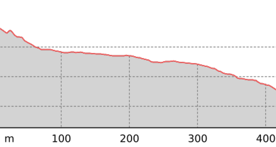
Dreibündenstein Trail

Medium
17.3 km
2:05 h
364 mhd
1500 mhd
Dreibündenstein Trail
Spundis

Show all 6 images

Dreibündenstein Trail
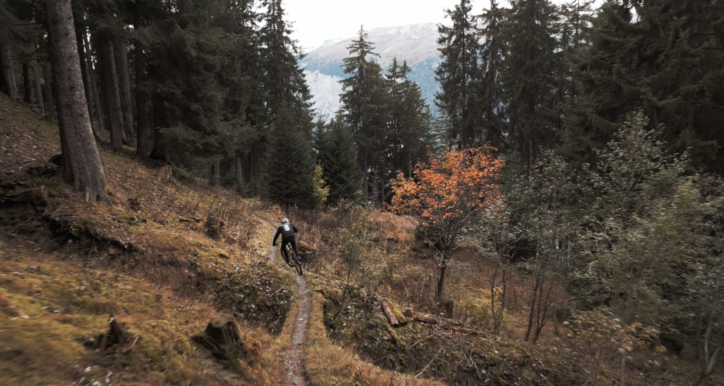
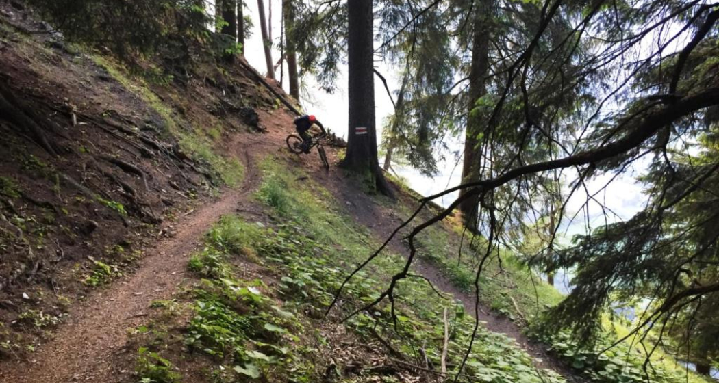
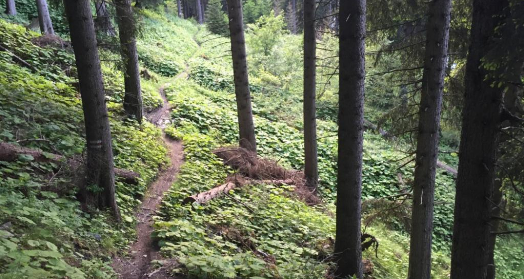
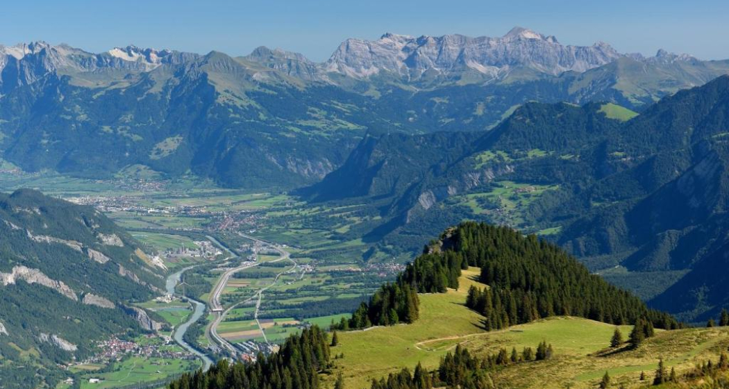
This varied and panoramic trail connects the local mountain Brambrüesch in Chur with the Domleschg.
Technique /6
Fitness /6
Highest Point  2039 m
Lowest Point  682 m
Best Season
Jan
Feb
Mär
Apr
Mai
Jun
Jul
Aug
Sep
Okt
Nov
Dez
Coordinates
46.817884, 9.503647

Details

Description

The Dreibündenstein is a summit that is both a plateau and a place steeped in history. But the ascent to it must be earned. Not only the view is worthwhile, but also the long downhill run that leads to Domleschg. 

Responsible for this content Arosa Lenzerheide.

Outdooractive Logo

This website uses technology and content from the Outdooractive platform.

Piz Scalottas - Brambrüesch

Medium
16.6 km
7:25 h
880 mhd
1611 mhd
Piz Scalottas.
Scalottas Terrasse Sommer

Show all 11 images

June Hütte Sommer
A ridge walk from Piz Scalottas to Brambrüesch. Endless , beautiful panorama included.
Technique /6
Fitness 4/6
Highest Point  2573 m
Lowest Point  1588 m
Best Season
Jan
Feb
Mär
Apr
Mai
Jun
Jul
Aug
Sep
Okt
Nov
Dez
Start
Piz Scalottas
Destination
Brambrüesch
Coordinates
46.721798, 9.510781

Details

Description

A long ascent to reach the ridge is not necessary on this tour. The two chairlifts Tgantieni and Scalottas go from Lenzerheide directly to Piz Scalottas. The time saved is needed for the full tour.

The hike leads from Piz Scalottas to Piz Danis and via Stätzerhorn and Fulhorn to Dreibündenstein. At Fulbergegg it descends towards Hühnerköpfe, Alp Malix and finally Brambrüesch, where the hike ends. From there you can take the cable car down to Chur.

The trail is exposed in places and requires surefootedness, but rewards you with a breathtaking panorama of Piz after Piz.

Geheimtipp

Those who do not want to do the whole tour can follow the hiking trail from Piz Danis towards Alp Stätz. There the cable car Heidbüel is waiting for you, with which you can comfortably ride down to Churwalden.

Ausrüstung

hiking boots

clothes suitable for the weather

Sufficient drinks and snacks for the tour

Directions

Piz Scalottas - Piz Danis - Stätzerhorn - Fulaberg - Fulhorn - Fulbergegg - Furggabüel - Hühnerköpfe - Alp Malix - Brambrüesch

Directions

Public Transport

With the sports bus from Lenzerheide to Val Sporz. The Tgantieni chairlift runs directly there. From Chur you can return to Lenzerheide by post bus.

Anreise Information

From Lenzerheide to the Val Sporz car park. As this is a route tour, however, we recommend travelling by public transport.

Parking

Val Sporz

Responsible for this content Graubünden Ferien.

Culinary tour "Bündner Rheintal" (E-Bike)

Simple
51.4 km
3:40 h
269 mhd
269 mhd
E-Bike Tour Bündner Rheintal
E-Bike Station Bad Ragaz

Show all 9 images

Fahrt durch die Reben
Combine a leisurely e-bike tour, from Bad Ragaz to the old town of Chur, with culinary stops at three different restaurants for starter, main course and dessert.
Technique 2/6
Fitness 2/6
Highest Point  655 m
Lowest Point  503 m
Best Season
Jan
Feb
Mär
Apr
Mai
Jun
Jul
Aug
Sep
Okt
Nov
Dez
Start
Bad Ragaz
Destination
Bad Ragaz
Coordinates
46.999248, 9.504763

Details

Description

Combine a leisurely e-bike tour, from Bad Ragaz through the "Graubünden Rhine Valley" region to the historic old town of Chur, with culinary stops in three different restaurants for starters, main courses and desserts.

Geheimtipp

After the tour, relax in the thermal water of the Tamina Therme and benefit from the relaxation bonus: pay 2 hours, relax for 4 hours.

Ausrüstung

Normal cycling equipment. Functional clothing is an advantage, as ascents and descents alternate

Directions

The tour starts at the e-bike station in Bad Ragaz. The first few metres run along the main road until you reach the historic town of Maienfeld. From there you cycle past vineyards to Jenins and Malans. After the idyllic village of Malans, you cross the Landquart River and continue to Igis, Zizers and Trimmis until you finally arrive in the oldest city in Switzerland - Chur. The way back to Bad Ragaz runs along the Rhine.

Directions

Public Transport

By train to Bad Ragaz, then by bus to Bad Ragaz, Post.

Anreise Information

Motorway exit Bad Ragaz, then on the main road to the village center of Bad Ragaz.

Parking

Public parking available at the multi-storey car park Zentrum, Tamina Therme or at the train station (for a fee).

Responsible for this content Graubünden Ferien.
This content has been translated automatically.

Untervaz

Medium
15.8 km
5:30 h
966 mhd
966 mhd
Blick zwischen den Tannen hindurch
Blick auf Berge

Show all 8 images

Häuschen bei der Weide
A little off the A13, shortly after Chur, on the left bank of the Rhine we find the village Untervaz, which belongs to the Five Villages area. At the foot of Calanda there is the Holcim mining area (Untervaz cement works).
Technique 2/6
Fitness 4/6
Highest Point  1527 m
Lowest Point  561 m
Best Season
Jan
Feb
Mär
Apr
Mai
Jun
Jul
Aug
Sep
Okt
Nov
Dez
Start
Untervaz, Restaurant Linde
Destination
Untervaz, Restaurant Linde
Coordinates
46.927703, 9.535581

Details

Description

Untervaz has a public transport connection with Chur every half hour and can be easily reached by car. The hike starts in the middle of the village (stop Untervaz Dorf) and leads via Vordergasse to the turn-off to the various Alps. We follow the signpost to the left in the direction of Fallboden and Hinteralp. At the Fallboden, turn left again through the forest to the Bärenhag. On the way we pass two short tunnels carved into the rock.

The alpine road from Bärenhag to the former Walser settlement of Batänja is a bit steep, but easy to walk. On Batänja (belonging to the municipality of Haldenstein) it is worth taking a break and taking in the view of the opposite mountains of the Rhine Valley. Unfortunately, there is no place to stop for refreshments.

The path now winds its way through the small settlement and on through forest and across meadows to the highest point of the hike on the Gürgütschboden. Now it goes downhill on the alpine path. Again and again there are wonderful views of the valley and the rock formations of the Rätikon. The last section from Fallboden back to the village is identical to the ascent route. Right next to the village square you will find the Linde restaurant, where you can wait comfortably for the next post bus.

Ausrüstung

Normal hiking equipment, sturdy mountain boots.

Directions

Untervaz - Fallboden - Adler - Bärenhag - Batänja - Gürgütschboden - Zanoppis - Fallboden - Untervaz

Responsible for this content Graubünden Ferien.
This content has been translated automatically.

Trimmis - Malans

Medium
12.7 km
3:45 h
216 mhd
272 mhd
Das ehemalige Wasserschloss Marschlins liegt in der Ebene circa einen Kilometer nordöstlich von Igis.
Willkommen im Winzerdörfchen Malans

Show all 7 images

Breiter Kiesweg von Trimmis in Richtung Malans
The hike leads through forests and vineyards of the Five Villages and the Bündner Herrschaft.
Technique 2/6
Fitness 3/6
Highest Point  783 m
Lowest Point  536 m
Best Season
Jan
Feb
Mär
Apr
Mai
Jun
Jul
Aug
Sep
Okt
Nov
Dez
Start
Trimmis, Gargällis bus stop
Destination
Malans, Railway Station
Coordinates
46.902138, 9.562343

Details

Description

The hike through the vineyards and forests of the Five Villages into the Bündner Herrschaft begins at the northern end of the village at the "Gargällis" bus stop. Cross the access road to the village in a northerly direction and follow the sign for Molinära. After the Molinera, the path climbs slightly along the edge of the forest.

After another ascent to Dunkel Töbeli and over the Chessirüfi, you are already in the municipality of Landquart. At Birchholz there is a beautiful view of the village of Igis and the Rhine valley. It is worth stopping over the former moated castle of Marschlin. In slight ups and downs, the route continues to the Ganda, where it crosses under the Prättigauerstrasse.

After the passage at the tennis court, cross the river Landquart and walk along the right bank. After about 1 kilometre, leave the dam and head over the hay divider towards Malans station.


Geheimtipp

Refreshments in the Ganda at the tennis court (non-players are also welcome), broom pickling in the Heuteiler just before malans train station.

Sicherheitshinweis

Sections through the forest areas can be slippery in places after rainfall.

Ausrüstung

Normal hiking equipment. Depending on the weather, good footwear (hiking boots) is recommended, otherwise light trekking shoes are sufficient for the tour.

Directions

Trimmis - Molinära - Scheidrüfi - Dunkel Töbeli - Schlundrüfi - Birchholz - Marschlins - Ganda - Heuteiler - Malans

Directions

Public Transport

By train to Landquart or Chur, then by bus to the stop Trimmis Gargällis.

Anreise Information

Motorway exit Zizers, then on the main road to Trimmis. In the village, the path to the Älplibahn is signposted.

Parking

Public parking "Montalinstrass and Cholplatzweg" available (chargeable).

Responsible for this content Graubünden Ferien.
This content has been translated automatically.

Rhine-Route No. 2: Section 3 Chur - Buchs (SG)

Medium
47.5 km
3:15 h
107 mhd
248 mhd
Heidihaus Grand Tour
Maienfeld

Show all 4 images

Rheindamm
The Rhine route accompanies the Alpine river from its source in the mountains to the large Rhine ports of Basel. On varied paths, the journey leads through many landscapes that this powerful river has created over the course of time.
Technique 2/6
Fitness 4/6
Highest Point  630 m
Lowest Point  445 m
Best Season
Jan
Feb
Mär
Apr
Mai
Jun
Jul
Aug
Sep
Okt
Nov
Dez
Start
Chur, railway station
Destination
European box
Coordinates
46.854078, 9.528082

Details

Description

The Bündner Herrschaft, Graubunden's fertile garden and winery lies on a mound of slate detritus. Also the home of Heidi, Peter and Alpöhi (Heidi's grandfather).

Note(s)
Beware: in good weather, a strong wind blows up the Rhine Valley in the afternoon however down valley if the Föhn wind is blowing.

See also
Ostschweiz Tourismus
Fürstenlandstrasse 53
9000 St.Gallen
Tel:+41 (0)71 274 99 00
Fax: +41 (0)71 274 99 01
Email: info@ostschweiz.ch
Internet: www.ostschweiz.ch

Ausrüstung

Normal cycling equipment. Functional clothing is an advantage, as ascents and descents alternate

Directions

Chur - Igis Landquart - Jenins - Sargans - Buchs

Directions

Public Transport

By train to Chur.

Anreise Information

Take the motorway exit Chur Nord and follow the signs to the train station.

Parking

Public parking available at the train station in Chur (for a fee).

Responsible for this content Graubünden Ferien.
This content has been translated automatically.