Please note: the indoor pool and wellness pool will remain closed until and including 27. June due to the annual maintenance works. All other facilities are open.

Additional infos.

Stage 1 Gravel Bike Route Hinterrhein: Chur - Thusis

Geschlossen
Medium
29.8 km
2:35 h
404 mhd
257 mhd
Kunstwerke des bekannten Künstlers Robert Indermaur
Etappe 1 Gravelbike-Route Hinterrhein: Chur – Thusis

Show all 5 images

Sonnenuntergang
Deep ravines, impressive panoramic views and witnesses to the history of Graubünden’s transport routes await discovery at the Posterior Rhine.
Technique 3/6
Fitness 3/6
Highest Point  805 m
Lowest Point  559 m
Best Season
Jan
Feb
Mär
Apr
Mai
Jun
Jul
Aug
Sep
Okt
Nov
Dez
Start
Chur
Destination
Thusis
Coordinates
46.861438, 9.506374

Details

Description

 You start the journey in Chur (593 m above sea level) and get on bike path no. 6 on the Polenweg to the imposing fortification Porta Rhaetica. From Rothenbrunnen the route makes its way over the gentle hills of the Domleschg fruit and castle country. In Paspels (757 m above sea level), you can marvel at the art works by the well-known artist Robert Indermaur. Lake Canova invites you to take a break, especially to cool down during summer. From here, it’s not far to Thusis, the historical trading place (680 m above sea level).

Stages

Overall route: Chur  – Chur

Stage 1: Chur – Thusis

Stage 2: Thusis – Glaspass – Thusis

Stage 3: Thusis – Andeer

Stage 4 Andeer – Lai da Vons – Splügen

Stage 5. Splügen – Splügen

Stage 6. Splügen – Chur

Geheimtipp

Tip: Gravel bikers with lots of leg power will manage stages 1 and 2 in one day.

Responsible for this content Graubünden Ferien.
This content has been translated automatically.

Trans Grischun: Castrisch–Scuol (Stage 3)

Geschlossen
Difficult
134.7 km
0:00 h
6402 mhd
5820 mhd
Abfahrt ins Safiental
Aufstieg nach Guarda im Unterengadin

Show all 13 images

Biketransport mit dem Zug oder Postauto ist in Graubünden ein Kinderspiel
Today is a long day ahead – including a transfer with the Rhaetian Railway. So it's always worth getting up early. The highlights? A small Maiensässbeizli with a great view, a spectacular road through the Rhine Gorge and typical Lower Engadine villages.
Technique 5/6
Fitness 4/6
Highest Point  2946 m
Lowest Point  517 m
Best Season
Jan
Feb
Mär
Apr
Mai
Jun
Jul
Aug
Sep
Okt
Nov
Dez
Start
Castrisch or Ilanz
Destination
Chur / Scuol
Coordinates
46.84462199, 9.72071553

Details

Description

The stage starts in the tranquil village of Castrisch. You first follow the official Rhine Veloroute No. 3, which is only slightly uphill - perfect for taking it easy on your legs. In Valendas, you can fill your water bottle with fresh mountain spring water from the largest wooden fountain in Europe. Shortly after Carrera, turn off onto the road to Brün and continue up to Imschlacht. The road and views are fantastic. Tip: you can fortify yourself with a portion of mountain cheese, salsiz or a nut tart at the Maiensässbeizli. Continue down into the Safiental valley. Then comes another highlight: the spectacular panoramic road along the Rhine Gorge. The rock faces of the “Swiss Grand Canyon” tower 300 meters high. From Bonaduz, you cycle along side roads to Chur. The section between the capital of Graubünden and Lavin in the Lower Engadine is covered comfortably on the Rhaetian Railway.

From the Lower Engadin village of Lavin, your muscle power is needed once again. The route to the stage finish takes you along a fine gravel path via Guarda to Scuol. Below you, the bright turquoise Inn River flows. The landscape in the Lower Engadin presents a completely different picture. The sunburnt stables of the Surselva have given way to houses adorned with colorful paintings. The art of Sgraffito, the traditional stucco technique of the region, is now mastered by only a few in the valley. And in Scuol, not only does mountain spring water flow from the fountains, but even mineral water. Simply gschpunna.

Total distance and elevation gain (excluding public transport sections): 66 km, 1,400 meters of ascent, 1,900 meters of descent.

Geheimtipp

The Trans Grischun passes through inhabited areas at regular intervals, so that you can always find places to stay overnight and adapt the stages to your needs.

Sicherheitshinweis

The tour should not be undertaken in uncertain weather conditions. Weather changes are frequent in the mountains. If a rain front or similar is approaching during the hike, you should turn back in good time.

144 Emergency call, first aid

1414 Mountain rescue REGA

112 International emergency call

Ausrüstung

Helmet, gloves, cycling shoes, glasses, rain and sun protection, drinks, repair kit, first aid kit

Directions

Castrisch - Valendas - Brün - Imschlacht - Arezen - Versam - Versamer Tobel - Bonaduz - Reichenau - Tamins - Felsberg - Chur - public transport - Lavin - Guarda - Ftan - Ardez - Scuol

Directions

Public Transport

Stage tour

Anreise Information

Stage tour

Parking

Stage tour

Responsible for this content Surselva Tourism.
This content has been translated automatically.

Outdooractive Logo

This website uses technology and content from the Outdooractive platform.

Tennis Facility Zizers

Tennis, Badminton, Squash, Sauna in Zizers

Hotel Sportcenter Fünf Dörfer AG

Show all 5 images

Hotel Sportcenter Fünf Dörfer AG
We are a sports center with tennis, squash, sauna and badmintin in summer. This includes a 3-star hotel and a dining restaurant.

Description

For sports enthusiasts – You can indulge in “ball sports” in our tennis hall all year round on four tennis courts. During the summer semester you shoot shuttles through the air on two badminton playing fields. Lovers who love it a little faster can let off steam in the four squash boxes. Tennis lessons, tennis tournaments, affordable rental prices and a selected range of sports equipment complete the offer at the Sportcenter Fünf-Dörfer.

Contact

Tennis, Badminton, Squash, Sauna in Zizers

Oberauweg 186D, 7205 Zizers

Responsible for this content Heidiland Tourism Ltd..

Outdooractive Logo

This website uses technology and content from the Outdooractive platform.

707 Chur Flow: Section 3

Simple
1.6 km
0:05 h
0 mhd
219 mhd
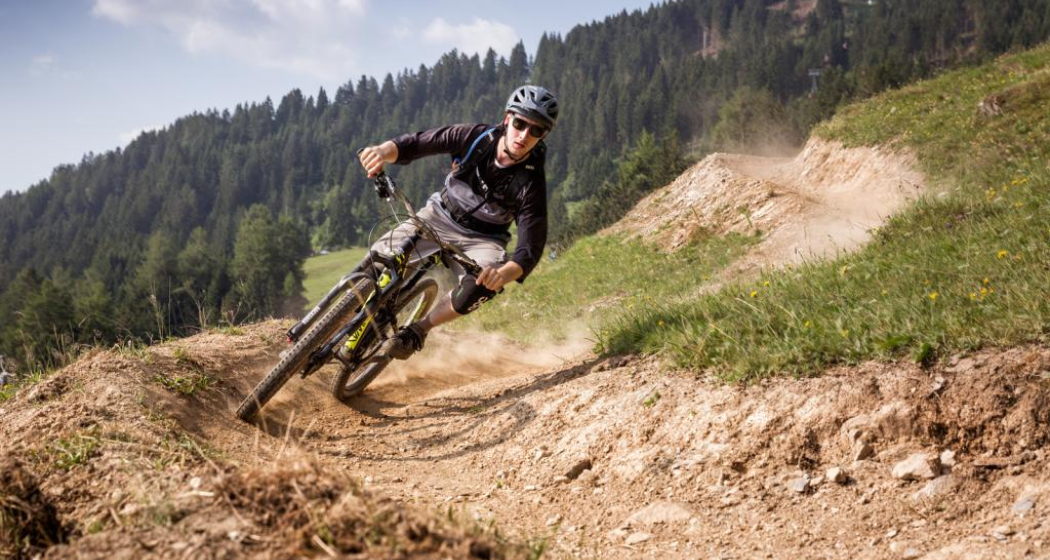
Chur Flow Trail im Alpenbikepark Chur
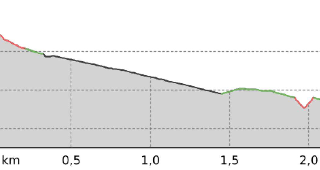
707 Chur Flow: Sektion 3 (oua_59381293_6e39ee0_profile)
707 Chur Flow: Section 3
Technique /6
Fitness /6
Highest Point  851 m
Lowest Point  632 m
Best Season
Jan
Feb
Mär
Apr
Mai
Jun
Jul
Aug
Sep
Okt
Nov
Dez
Coordinates
46.841115, 9.532592

Details

Responsible for this content Graubünden Ferien.

708 Vertigo: Section 3

Difficult
1 km
0:05 h
0 mhd
227 mhd
708 Vertigo: Sektion 3
708 Vertigo: Sektion 3 (oua_59381264_ef46109_profile)
708 Vertigo: Section 3
Technique /6
Fitness /6
Highest Point  852 m
Lowest Point  625 m
Best Season
Jan
Feb
Mär
Apr
Mai
Jun
Jul
Aug
Sep
Okt
Nov
Dez
Coordinates
46.841227, 9.532347

Details

Responsible for this content Graubünden Ferien.

708 Vertigo: Section 2

Difficult
0.8 km
0:05 h
0 mhd
160 mhd
708 Vertigo: Sektion 3
708 Vertigo: Sektion 2 (oua_59381259_f28ae81_profile)
708 Vertigo: Section 2
Technique /6
Fitness /6
Highest Point  1012 m
Lowest Point  852 m
Best Season
Jan
Feb
Mär
Apr
Mai
Jun
Jul
Aug
Sep
Okt
Nov
Dez
Coordinates
46.837786, 9.53203

Details

Responsible for this content Graubünden Ferien.