Sunday opening hours apply on Whit Monday, 9 June. Please note: from Tuesday, 10 June, the facilities in the indoor pool building will be closed for the annual maintenance works.

Additional infos.
Medium
110 km
36:55 h
4500 mhd
4800 mhd
64 Via Sett Gesamttour (6 Etappen)

Show all 10 images

Museumskaffee Chur
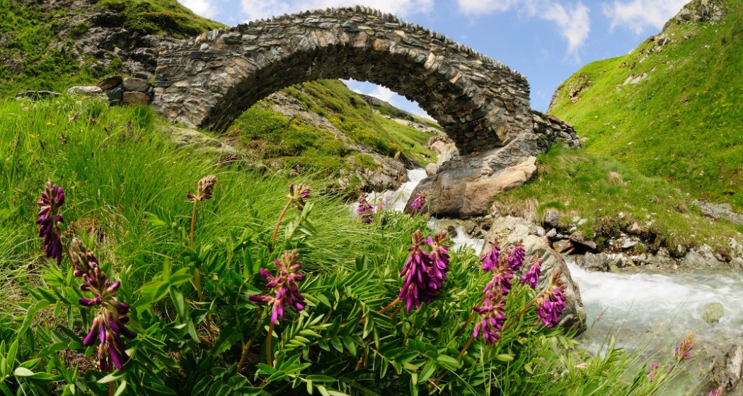
Cross the Septimer on foot, from one Alpine town to another: the route runs from Chur through the Churwalden Valley, Lenzerheide, Surses in Parc Ela and Bregaglia to Chiavenna (Italy). Explore three linguistic and cultural regions and a diverse cultural landscape – from pastures to chestnut groves.
Technique /6
Fitness 6/6
Highest Point   m
Lowest Point   m
Best Season
Jan
Feb
Mär
Apr
Mai
Jun
Jul
Aug
Sep
Okt
Nov
Dez
Start
Chur
Destination
Chiavenna (I)
Coordinates
46.853222455222, 9.5300062165975

Details

Description

Traders, armies, kings and emperors all crossed the Alps via the Septimer route. Its advantages were the convenient location with a direct north-south link and ideal topographical conditions. Finds of lead slingshot on the Septimer bear witness to the fact that the Roman army made early use of the pass. Above all in the High Middle Ages, the Septimerpass was one of the most important trading routes and brought wealth to the Bishop of Chur. Today, one of Switzerland's most diverse cultural and long-distance hiking routes travels over what was once an arduous Alpine crossing. From Chur to Chiavenna in Italy, it gradually traces a chequered history and leads through three different cultural regions. The natural setting is just as varied. There is plenty to discover, the open space of the high plateau in the Surses, the rocky landscape at the head of the Septimerpass and the Mediterranean mountain valleys of Bergell and Valchiavenna.

Geheimtipp

The Via Sett is accessible from mid-June to mid-October, depending on weather conditions. The 93 km long long-distance hike from Chur (CH) to Chiavenna (IT) can be hiked in 6 or 7 daily stages. The average walking time per day is 4 - 7 hours. The stages can be simplified by public transport.

Book Via Sett now at:

Tour Explorer

+41 81 356 22 44

info@tour-explorer.ch 

www.tour-explorer.ch

Sicherheitshinweis

attention:

Due to the instability of the rocks in the Boca Naira area above Casaccia, the path to Alp Maroz Dora and the Septimer Pass is closed until further notice.

A detour for hikers/mountain bikers is signposted. However, mountain bikers have to get off the bike for this section.

For horses, the diversion is not suitable and impassable.

Ausrüstung

Crossing the border between Switzerland and ItalyA valid identity card or passport is required to cross the border.

Directions

Directions

Public Transport

All stage destinations Via Sett are accessible by public transport (train or bus). Partial Reservations are required. The return from Chiavenna can be done via Splügenpass or Maloja to St. Moritz.

Anreise Information

From Chur on the motorway to Thusis. Savognin via Tiefencastel to Thusis.

Parking

Parking is available at the train station in Thusis. There are a number of parking spaces.

Responsible for this content Graubünden Ferien.
This content has been translated automatically.

Geschlossen
Medium
11 km
3:15 h
240 mhd
1000 mhd
Kathedrale St. Mariä Himmelfahrt
43.11 Tschiertschen - Chur, Jakobsweg Graubünden

Show all 3 images

43.11 Tschiertschen - Chur, Jakobsweg Graubünden (oua_9702261_38bc304_profile)
The descent leads along the northern slope of the Gürgaletsch through the wild Schanfigg valley and follows the Plessur River to the 5,000-year-old town of Chur. Light lark forests, the traditional Passugg Hotel Management School and tanned Walser houses catch the eye along the way.
Technique /6
Fitness 6/6
Highest Point   m
Lowest Point   m
Best Season
Jan
Feb
Mär
Apr
Mai
Jun
Jul
Aug
Sep
Okt
Nov
Dez
Start
Tschiertschen
Destination
Chur
Coordinates
46.817787465823, 9.606690444464

Details

Description

Along the mountain road through Praden; Bärenschlucht canyon crossing and on down to Grida-Passugg. Natural pathway from the resort to the Plessurbrücke (bridge). Chur cathedral with two significant Jakob exhibitions and Martinskirchplatz town centre.

Responsible for this content SwitzerlandMobility.

Geschlossen
Simple
31 km
4:20 h
1200 mhd
1200 mhd
Churer Altstadt mit Hausberg Brambrüesch im Hintergrund
Willkommen in der Bike-Stadt Chur

Show all 7 images

Aufstieg auf dem Polenweg
From the heart of Chur's Old Town and into the nearby mountain scenery - this Alpine town is the gateway to Graubünden.
Technique /6
Fitness 6/6
Highest Point   m
Lowest Point   m
Best Season
Jan
Feb
Mär
Apr
Mai
Jun
Jul
Aug
Sep
Okt
Nov
Dez
Start
Chur
Destination
Chur
Coordinates
46.854472231092, 9.5285856715227

Details

Description

This biking tour starts in Chur, a city surrounded by 937 Grisons mountain peaks. There are plenty of things to do and see here in Switzerland's oldest town. Wanting mountain magic or vibrant city life? Chur in the Alps has both. This is a round trip amid magnificent scenery and with gentle climbs and beautiful descents. Leave the pulsating city behind you as you continue along the Plessur towards Meiersboden. This pleasant route goes up to Passugg, where the famous Passugg mineral water has been bubbling out of the Theophil Spring for over 400 years. From Passugg follow the street upwards for a moment. Then turn right and follow the Polenweg to Churwalden. Turn left at the monastery and ride through the Chlosterwald to the Oberhus and then on to Spina. High above the municipality of Malix, the route continues steadily upwards until you get to the Brambrüesch plateau, the location of the mountain station for the Chur mountain railway. Here, several guesthouses offer you the opportunity to recharge your batteries while enjoying outstanding views of the many mountain peaks. The descent takes you through meadows and pastures to the Känzeli, Rosenhügel, Obertor and finally ends in the traffic free Oldtown (or if you prefer a proper trail descent, just follow one of the official freeride trails in the Alpenbikepark Chur). Perfect to finish the tour in one of the many terraces. In early summer this tour is magnificent due to its Alpine flora and fauna.

Directions

Public Transport

The tour begins directly at the train station of Chur.

Responsible for this content SwitzerlandMobility.

Simple
13 km
2:10 h
360 mhd
360 mhd
Rundtour Bonaduzer Wald 256
256 Bonaduzer Wald

Show all 16 images

256 Bonaduzer Wald
This tour opens up to magnificent views of the imposing Rhine Gorge. From Bonaduz the route passes through beautiful forest paths into the Rhine Gorge and back again.
Technique /6
Fitness 2/6
Highest Point   m
Lowest Point   m
Best Season
Jan
Feb
Mär
Apr
Mai
Jun
Jul
Aug
Sep
Okt
Nov
Dez
Start
Bonaduz
Destination
Bonaduz
Coordinates
46.810512104199, 9.3977179167695

Details

Description

The starting point of this mountain bike tour is the village of Bonaduz, which together with Rhäzüns forms an actual high plateau. Bonaduz is also the gateway to the Rhine Gorge Natural Monument.

After crossing the idyllic forest landscape near Bonaduz on well-maintained forest paths, an ascent follows on a road with little traffic, which leads to Sigl'Ault with great views. This is soon followed by a single trail that leads smoothly down to the panoramic road above the Rhine Gorge. The "Ruinaulta", as the gorge is called in Romansh, is one of the most magnificent and diverse landscapes in the Alps, which was formed by a landslide 10,000 years ago. You follow this road with a magnificent view down below, past the "Zault" viewing platform (photo stop recommended), before finally diving back into the forests and driving back to Bonaduz on extensive forest paths.

Geheimtipp

This route is usually drivable early in the year until late in autumn.

Sicherheitshinweis

Watch out for hikers. In the canton of Graubünden we share the paths.

Ausrüstung

Repair and first aid kit belong in the rucksack

Directions

This route is only signposted in one direction: Bonaduz – Sigl Ault – Zault.

Directions

Public Transport

Stop: Flims Dorf, mountain railways
By post bus from Chur or the public Flims Laax Falera Shuttle.

Timetable
www.sbb.ch

Anreise Information

By car on the A13 motorway from Zurich to Chur, exit 18 Reichenau

Parking

You will find parking spaces in Bonaduz at the railway station.

Responsible for this content Flims Laax Falera Management Ltd..
This content has been translated automatically.

Outdooractive Logo

This website uses technology and content from the Outdooractive platform.

Medium
46 km
5:00 h
620 mhd
3700 mhd
pinkbike Trail Shooting

Show all 4 images

pinkbike Trail Shooting
This is a tour made for single trail fans: about 400 altitude meters up, six lift rides and more than 3,300 altitude meters down. In addition to all the single trails, the views of Heidsee Lake, the Albula Valley and the Domleschg region are breathtaking. Never a dull moment.
Technique /6
Fitness 4/6
Highest Point   m
Lowest Point   m
Best Season
Jan
Feb
Mär
Apr
Mai
Jun
Jul
Aug
Sep
Okt
Nov
Dez
Start
Lenzerheide
Destination
Lenzerheide
Coordinates
46.72715139073, 9.5578329519424

Details

Description

Attention:

- The chairlift Tgantieni, Scalottas and Weisshorn 2nd does not transport downhill bikes (double crown fork)!

- Transport of bikes with a maximum weight of 25 kg: Gondola lifts Chur-Brambrüesch 2nd section.

No less than five cable cars make the ascents on this round tour easier for you. You start with the two chairlifts from Lenzerheide via Tgantieni to Piz Scalottas. Once there, a good 4 km long, partly steep descent to Churwalden awaits you. On the beautiful single trail along the elevation curve you pass the Junehütte - take a moment and enjoy the wide view over the whole valley. After Parpan you pass lush alpine meadows to the Maiensäss settlement Mittelberg - Büel.

The final ride leads to Runcalier, over a short stretch on the Tschiertschen main road and a flowing trail in the Steinbach forest to Chur. Here the mountain railroad takes you via Känzeli up to Brambrüesch. From Brambrüesch you continue to Churwalden. From Churwalden the panoramic cable car Heidbüel brings you back up to 1930 m.a.s.l. After a short transfer on the gravel road a last trail highlight awaits you from the mountain restaurant Spoina to the Heidsee between Lenzerheide and Valbella.

Whole tour: 42 km (5 km chair and gondola ride)

Sicherheitshinweis

Attention:

- The chairlifts Tgantieni, Scalottas and Weisshorn 2 do not transport downhill bikes (double crown fork)!

- Transport of bikes with maximum weight 25 Kg: Gondola lifts Chur-Brambrüesch 2nd section.

Please note the respective operating times as well as the transport criteria before you start the tour. You can find more info on www.bikekingdom.ch

Directions

Lenzerheide – Piz Scalottas – Parpan – Mittelberg – Fanülla – Chur – Brambrüesch – Churwalden – Alp Stätz – Spoina – Lenzerheide

Directions

Public Transport

By train to Chur and continue by post bus to Lenzerheide/Lai.

Anreise Information

On the A13 and B3 to Lenzerheide.

Responsible for this content SwitzerlandMobility.

Geschlossen
Simple
45 km
4:30 h
460 mhd
2900 mhd
615 Biketicket to ride blau

Show all 7 images

615 Biketicket to ride blau
For a leisurely ride and for families this round tour through idyllic countryside offers a lot of fun! With pleasant and gentle declines and slight ascents, this route is suitable even for bikes without extra suspension.
Technique /6
Fitness 4/6
Highest Point   m
Lowest Point   m
Best Season
Jan
Feb
Mär
Apr
Mai
Jun
Jul
Aug
Sep
Okt
Nov
Dez
Start
Lenzerheide
Destination
Lenzerheide
Coordinates
46.72715139073, 9.5578329519424

Details

Description

Taking the Tgantieni chairlift, the first step of the tour is comfortably begun. Above lies the alpine path, going to the Tgantieni Mountain Hotel and then further onto the Bergbeizli (small mountain pub) Spoina. The first part runs over well-prepared forest roads with occasional glimpses of Lenzerheide and Heid lake. The gentle descent passes the Valbella hostel and goes through Parpan village back to Churwalden.

A further nature trail brings you to Passugg, which is the source of a famous mineral water. The roaring creek Rabiosa, in Romansch «The Raging», cuts its way through the Passugg gorge. In 1863 this spring was rediscovered, which is known today throughout Switzerland as the mineral springs of Passugg. Next you drop down to Chur and take the gondola back up to Brambrüesch. From here descend again on a tarmac surface to Churwalden, where you take the chairlift Heidbüel.

Sicherheitshinweis

Attention:

- The Tgantieni and Scalottas chairlifts do not transport downhill bikes (double bridge fork)!

- Please note the respective operating times as well as the transport criteria before you start the tour. You can find more information here.

Ausrüstung

Protector jackets and full-face helmets are also prohibited. Normal helmets, knee and elbow protectors are permitted.

Directions

This route is only signposted in one direction: Lenzerheide-Tgantieni-Churwalden-Brambrüesch-Chruwalden-Alp Stätz-Lenzerheide

Directions

Public Transport

Travel by train to Chur, then transfer directly to the Postauto Graubünden buses to reach Lenzerheide within 30 minutes.

Anreise Information

Von Basel und Zürich - Chur-Süd (Ausfahrt Nr. 17) - Lenzerheide.

Von Milano - Lugano - San-Bernadino-Tunnel - Thusis - Chur (Ausfahrt Lenzerheide) - Lenzerheide.

Parking

Parking: Julier Parkplatz, Parkplatz Rothorn oder Parkplatz Tgantieni

Responsible for this content Graubünden Ferien.

Event Chur

6th JazzChurFestival 2025

6. JazzChurFestival 2025 (gdl_859680723_image)
Music from jazz to...

Description

Date
03.09.2025 to 07.09.2025
daily
Ort
Postremise
Organizer
JazzChur

The JazzChur Summer Festival becomes the JazzChur Festival.

The organizer is still the JazzChur association.

Details to follow!

Veranstaltungsort

Responsible for this content Guidle.
This content has been translated automatically.

Guidle Logo

This website uses content from Guidle.

Event Chur

Theater MiMe: Anniversary Production - "Igloo Water"

Theater MiMe: Jubiläumsproduktion - "Iglu Wasser" (gdl_869812924_image)
Theater MiMe: Jubiläumsproduktion - "Iglu Wasser" (gdl_869812925_image)
The MiMe Theatre celebrates its anniversary - a magical journey beyond the everyday

Description

Date
12.06.2025 to 14.06.2025 from 20:00 to 21:15 o'clock
daily
15.06.2025 from 17:00 to 18:15 o'clock
Price
25.-
20.- (AHV/IV/Students/Apprentices/Kultur-Legi)
Zeit
Duration: approx. 70 minutes
Ort
Postremise
Organizer
Theater MiMe

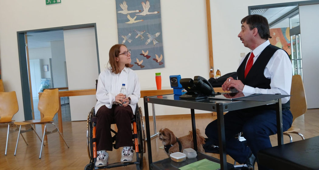
With great anticipation and a touch of magic, the MiMe Theatre – a service offered by Pro Infirmis Graubünden – presents its 20th production: the in-house production "Igloo Wasser".
Since its founding in 2004, Theater MiMe has inspired and inspired many people, relying on creativity, improvisation and the special spark that lies dormant in each of us. An innovative and inclusive world of experience.

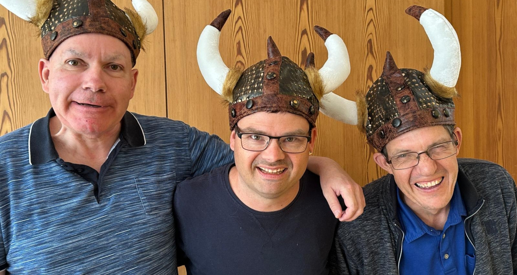
"Igloo Water" breaks the boundaries of the usual and invites its audience on a fascinating journey of discovery into the world of fantasy. The production - created from the collective improvisational power of all actors involved - gives each performance an unmistakable touch. The focus is not only on exciting stories and surprising twists, but also on the commitment and creativity of people with disabilities, who can fully develop their talents and individuality here.

The plot of the new production takes the audience into a world in which reality merges with the magical-unreal:
Who still believes in goblins when we live in the 21st century?
What's the deal with an igloo that has been standing in an Irish pub for ages?
And how long, one wonders almost with a smile, does it take for an igloo to melt?
Why do the Vikings leave two magical goblins behind in Ireland?
These and other questions form the magical core of "Igloo Water", a production that makes you smile and think and captivates the audience.

On the occasion of the anniversary, every performance will be a unique experience: In addition to the exciting stage performance, the audience can expect an exclusive concert by the inclusive band SchallwellA, which once again underlines the emotions and magic of the production.
In addition, the performance will be made accessible on Saturday, June 15, 2025, through a sign language translation to involve all viewers in this special moment.

The MiMe Theatre cordially invites you: Let yourself be enchanted, inspired and carried away, because the real magic begins exactly where we think outside the box together.

Veranstaltungsort

Responsible for this content Guidle.
This content has been translated automatically.

Guidle Logo

This website uses content from Guidle.

Event Chur

desdëa – Two voices, two violins... with Andrina Däppen and Zoë Gordon

desdëa – Zwei Stimmen, zwei Violinen... mit Andrina Däppen und Zoë Gordon (gdl_869667678_image)
A project close to the heart of the two classically trained violinists Andrina Däppen and Zoë Gordon.

Description

Date
21.06.2025 from 20:00 to 21:30 o'clock
Price
Fr. 30.-/pupils/students/Kulturlegi 15.-/studio members/children up to 16 free of charge
Ort
Postremise
Organizer
konzert studio chur

"Two voices, two violins... Sometimes a bit of baritone ukulele.
From classical music to folk and pop – that's desdëa. A project close to the heart of the two classically trained violinists Andrina Däppen and Zoë Gordon, who have decided to take a slightly different path. With roots in southeastern Switzerland and French-speaking Switzerland, it carries the two young musicians into the wide world and their imagination and joy of experimentation know no bounds. Spanish, English, Romansh, Swiss German, Italian and French songs alternate with purely instrumental music from a wide variety of origins and epochs. In an intimate setting, a vibrating polyphony is created that gets under your skin."

Veranstaltungsort

Responsible for this content Guidle.
This content has been translated automatically.

Guidle Logo

This website uses content from Guidle.

Trans Grischun: Scuol–Sta. Maria (Stage 4)

Difficult
39.4 km
3:30 h
1089 mhd
1001 mhd
Spektakuläre Brücke über den Inn bei Scuol
Das wilde Val S-charl mit dem Fluss Clemgia

Show all 12 images

Trinkflasche füllen im Bergdorf S-charl
On the last stage of the Trans Grischun it gets wild, rough and technical. The highlight is the route through Val S-charl and up to the Pass da Costainas, the transition from the Lower Engadine to Val Müstair.
Technique 1/6
Fitness 6/6
Highest Point  2250 m
Lowest Point  1206 m
Best Season
Jan
Feb
Mär
Apr
Mai
Jun
Jul
Aug
Sep
Okt
Nov
Dez
Start
Scuol
Destination
Sta. Maria Val Müstair
Coordinates
46.8539, 9.53159

Details

Description

After the start in Scuol, follow mountain bike route no. 1. The ascent to the mountain village of S-charl starts in the forest with a few steep ramps. Here the surface is still asphalted and the metres in altitude quickly melt away. Shortly afterwards, the forest thins out at Sasstaglia, tarmac is replaced by gravel and the view opens up into the valley. The Clemgia river flows down the bumpy gorge on the right. Nature becomes wilder. Not surprising, as you are close to the Swiss National Park. Nestled between high mountain peaks, the route climbs leisurely, with short, steep ramps in between, up to S-charl at 1808 metres above sea level. Here we recommend you take a short breather: fill your water bottle and recharge your batteries in the restaurant if necessary. Then the final ascent to the roof of the Trans Grischun begins - to the Pass da Costainas at 2250 metres above sea level. Shortly after S-charl, you will see the God da Tamangur on the left side of the valley. This is the highest contiguous Swiss stone pine forest in Europe. Nature and gravel bike experience at its best.

Geheimtipp

The Trans Grischun leads through inhabited areas at regular intervals, so that you can always find places to stay overnight and adapt the stages to your needs.

Sicherheitshinweis

On high sections, snow fields are possible well into the summer months.

The tour was assessed in favourable weather conditions, the current weather conditions and weather forecasts must be taken into account before starting the tour. This tour does not require any special riding safety or technical skills.

Emergency call:

144 Emergency call, first aid

1414 Mountain rescue REGA

112 International emergency call

Be considerate when crossing and overtaking hikers. Most of the mountain bike routes in Graubünden are on single trails that are also signposted as hiking trails. Hikers always have right of way.

Ausrüstung

Helmet, gloves, good shoes, goggles, rain and sun protection, water bottle, repair kit, first aid kit

Directions

Scuol – S-charl – Alp Astras – Costainas – Alp da Munt – Lü – Tschierv – Fuldera – Valchava – Sta. Maria Val Müstair

Directions

Public Transport

  • With the Rhaetian Railway (from Chur, Landquart/Prättigau or from the Upper Engadine) hourly to Scuol-Tarasp
  • By PostBus (from Martina, Sent, Ftan or Tarasp) hourly to Scuol-Tarasp railway station

Anreise Information

  • From the north: via Landquart - Klosters by car transport through the Vereina Tunnel (Selfranga - Sagliains) or via the Flüela Pass to the Lower Engadine on H27
  • From the east: via Landeck / Austria in the direction of St. Moritz on H27
  • From the south: via Reschenpass (Nauders-Martina) or Ofenpass (Val Müstair-Zernez) on H27

Scuol is located directly on the Engadine road H27 (20 minutes journey time from Vereina south portal)

Parking

  • Paid parking at the railway station and at the Bergnahnen in Scuol.
  • Free car parks in Porta and Punt (Scuol Sot).

Responsible for this content Tourism Engadin Scuol Samnaun Val Müstair AG.
This content has been translated automatically.

Outdooractive Logo

This website uses technology and content from the Outdooractive platform.