discover.swiss ID
osm_1684047
discover.swiss Additional Type
City
Geschlossen
Medium
18 km
1:15 h
300 mhd
300 mhd
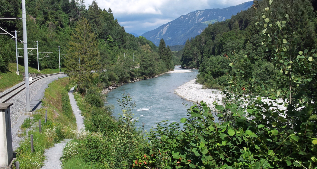
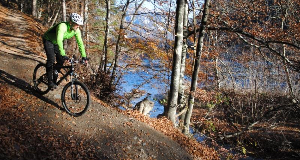
Rheinauen Ufer
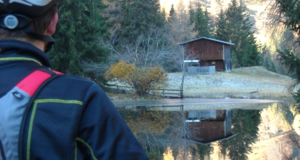
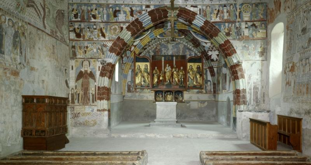
Kirche Sogn Gieri Chor

Show all 4 images

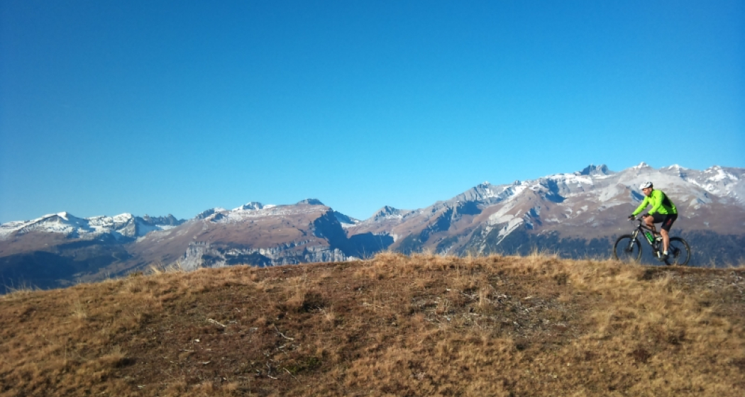
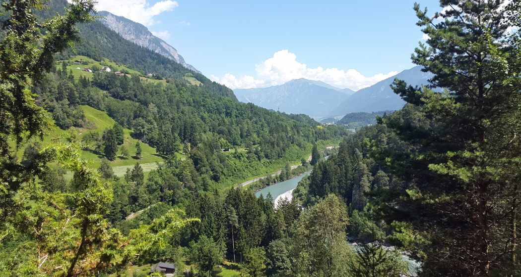
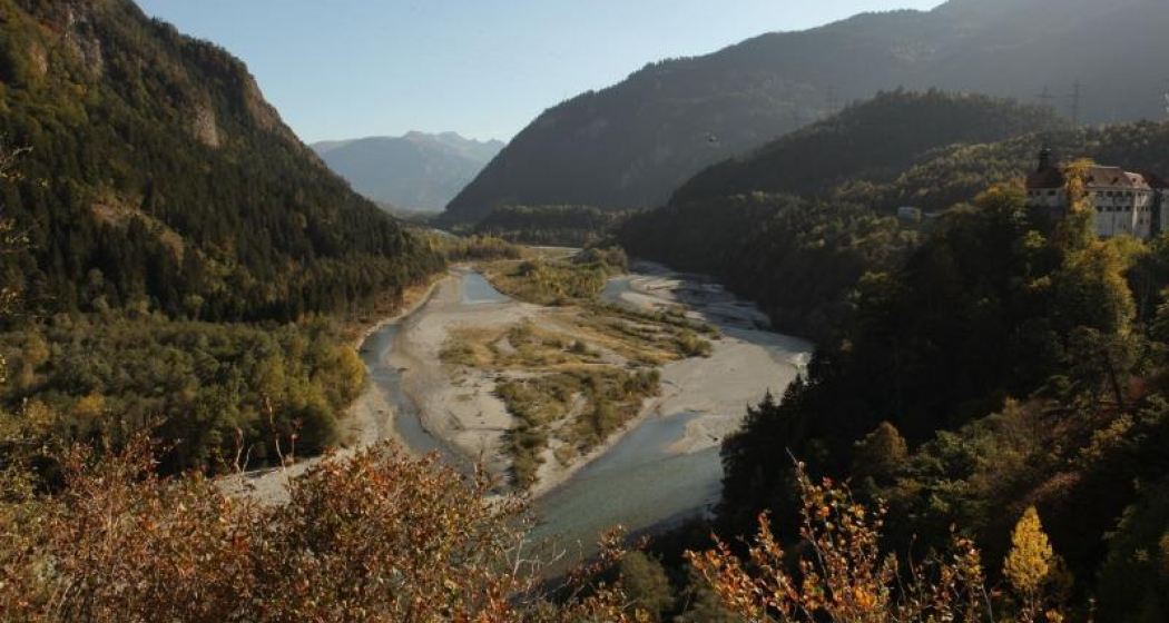
Panorama Rheinauen
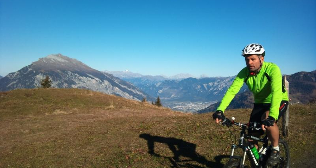
This pleasant mountain bike tour takes you along the Rhäzünser Rheinauen and features unique views of these wetlands of national importance. It also takes in a visit of the church at Sogn Gieri, famous for its murals, considered unrivalled by art historians.
Technique /6
Fitness 2/6
Highest Point   m
Lowest Point   m
Best Season
Jan
Feb
Mär
Apr
Mai
Jun
Jul
Aug
Sep
Okt
Nov
Dez
Start
Rhäzüns
Destination
Rhäzüns
Coordinates
46.799042540309, 9.3991089621148

Details

Description

From the railway station at Rhäzüns we soon reach the water's edge, our nostrils filling with the fresh air from the wetlands. The Rhäzünser Rheinauen are among the most best preserved wetland areas in Switzerland and are considered of national importance. We continue along the single trail as it rises and falls until we reach the flatter section along the Rhine dam after Rothenbrunnen. Along the Polenweg to Reichenau the sparse forest lets us glimpse wonderful views of these unique Rheinauen wetlands. Along this section of the route the Hinterrhein meanders from one side of the valley to the other. In Reichenau, the confluence of the Hinterrhein and Vorderrhein, we once again switch to the other side of the river and roll on towards Bonaduz. After a short, steep ascent up to the high plateau of Rhäzüns and Bonaduz the route continues past Sogn Gieri (St. Georg), which is well worth a stop. The Romanesque church, more than 1,000 years old, is famous beyond Switzerland's borders for its astonishing and beautifully preserved murals. After the rewarding visit of Sogn Gieri we happily cycle back to Rhäzüns.

Directions

Rhäzüns - Saulzas - Undrau - Rothenbrunnen - Polenweg - Schafweide - Stn. Reichenau-Tamins - Nulez - Plazzas - Sogn Gieri - Rhäzüns

Directions

Public Transport

By train to Rhäzüns.

Anreise Information

Take the A13/E432 in the direction of and to Rhäzüns.

Responsible for this content SwitzerlandMobility.
This content has been translated automatically.

64 km
4:30 h
760 mhd
1350 mhd
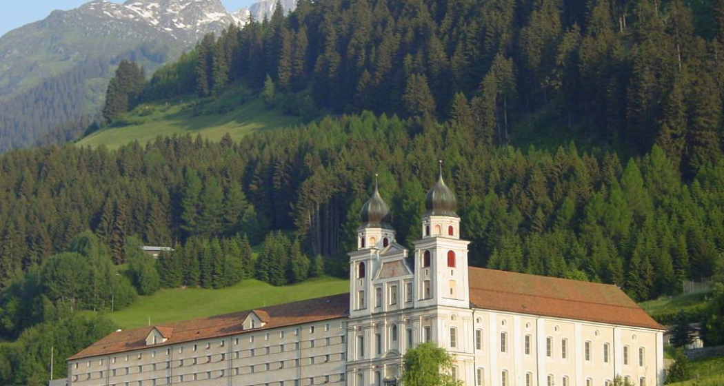
Benediktiner Kloster
02.02 Rhein-Route Etappe 2 Disentis - Chur (oua_8580502_6403454_profile)
The Surselva is the largest Romansch-speaking area in the Grisons region. Up and down we go, following the burbling Rhine through pretty little hamlets. The amazing wild gorge of the Anterior Rhine is known as the Grand Canyon of Switzerland. The day ends in Chur, the oldest Swiss town north of the Alps.
Technique /6
Fitness 6/6
Highest Point   m
Lowest Point   m
Best Season
Jan
Feb
Mär
Apr
Mai
Jun
Jul
Aug
Sep
Okt
Nov
Dez
Start
Disentis
Destination
Chur
Coordinates
46.705270682288, 8.8554213182519

Details

Description

Surselva - «above the forest» - Graubunden’s largest Romansch-speaking region. The wild gorge of the Vorderrhein is awe-inspiring - Switzerland’s Grand Canyon. Chur, the oldest town north of the Alps boasts the highest density of restaurants.

Directions

Disentis - Trun - Ilanz - Rheinschlucht - Tamins - Chur

Responsible for this content SwitzerlandMobility.
This content has been translated automatically.
Simple
13 km
2:10 h
360 mhd
360 mhd
Rundtour Bonaduzer Wald 256
256 Bonaduzer Wald

Show all 17 images

256 Bonaduzer Wald
This tour opens up to magnificent views of the imposing Rhine Gorge. From Bonaduz the route passes through beautiful forest paths into the Rhine Gorge and back again.
Technique /6
Fitness 2/6
Highest Point   m
Lowest Point   m
Best Season
Jan
Feb
Mär
Apr
Mai
Jun
Jul
Aug
Sep
Okt
Nov
Dez
Start
Bonaduz
Destination
Bonaduz
Coordinates
46.810512104199, 9.3977179167695

Details

Description

The starting point of this mountain bike tour is the village of Bonaduz, which together with Rhäzüns forms an actual high plateau. Bonaduz is also the gateway to the Rhine Gorge Natural Monument.

After crossing the idyllic forest landscape near Bonaduz on well-maintained forest paths, an ascent follows on a road with little traffic, which leads to Sigl'Ault with great views. This is soon followed by a single trail that leads smoothly down to the panoramic road above the Rhine Gorge. The "Ruinaulta", as the gorge is called in Romansh, is one of the most magnificent and diverse landscapes in the Alps, which was formed by a landslide 10,000 years ago. You follow this road with a magnificent view down below, past the "Zault" viewing platform (photo stop recommended), before finally diving back into the forests and driving back to Bonaduz on extensive forest paths.

Geheimtipp

This route is usually drivable early in the year until late in autumn.

Sicherheitshinweis

Watch out for hikers. In the canton of Graubünden we share the paths.

Ausrüstung

Repair and first aid kit belong in the rucksack

Directions

This route is only signposted in one direction: Bonaduz – Sigl Ault – Zault.

Directions

Public Transport

Stop: Flims Dorf, mountain railways
By post bus from Chur or the public Flims Laax Falera Shuttle.

Timetable
www.sbb.ch

Anreise Information

By car on the A13 motorway from Zurich to Chur, exit 18 Reichenau

Parking

You will find parking spaces in Bonaduz at the railway station.

Responsible for this content Flims Laax Falera Management Ltd..
This content has been translated automatically.
Outdooractive Logo

This website uses technology and content from the Outdooractive platform.

Playground Bonaduz

Playground Bonaduz

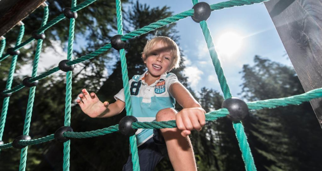
Spielplatz Symbolbild
Small playground with a lot of fun.

Description

 Beautiful playground with fireplace, located in a small forest.

Contact

Playground Bonaduz

7402 Bonaduz

Responsible for this content Chur Tourism.

Ruin Bonaduz

Castle ruin Wackenau

Ruine Wackenau
Castle ruins with a viewing platform, which offers a view of the Rhine Gorge.

Description

The sparse ruins of Wackenau castle lie about 3 kilometres north-west of the village on a promontory above the Rhine. The ruin lies within 20 minutes walking distance from a car park west of Bonaduz. Just above the caste hill you can get a great view of Ruinaulta canyon from the panorama platform named after the castle. 

Contact

Castle ruin Wackenau

7402 Bonaduz

Responsible for this content Chur Tourism.

City Bonaduz

Bonaduz

Bonaduz
Bonaduz

Show all 5 images

Sogn Mang
Bonaduz lies on a sunny terrace between the Vorder and HInter Rhine. The village has very high quality of life, attractive leisure offers and a wonderful landscape.

Description

Bonaduz' leisure offerings are varied and appeal to big and small, families, locals and visitors alike. Well maintained hiking and cycling trails take you into the charming surroundings - whether that's up on the mountains or down into the fascinating Rhine gorge, from Bonaduz the spellbinding nature of Graubünden is only a stone's throw away.

In Bonaduz proper, there are several fun things to do, like a minigolf course, football pitches, tennis courts, cross-country ski trails and woodchip running trails. The golf course Domat/Ems and the fashionable ski resort Laax are close by, too.

History

Archaeological finds from the late La Tène era (5th - 1st century BCE) and an early medieval burial site with more than 700 graves in Valbeuna are evidence for the fact that this has been settled for a long time. The Wackenau castle ruin lies high above the Rhine, not far from the village. It was probably constructed to secure a nearby river crossing. Bonaduz was part of the Rhäzüns dominion and came into possession of Maximilian I of Austria and Habsburg  in 1497. During the reformation, Bonaduz remained Catholic and formed a clerical, political and economic entity with neighbouring Rhäzüns in 1529.  The church was not separated until 1667.

In the middle of the 16th century, Bonaduz purchased Alp Ramuz on the far side of the Kunkels pass. Livestock and grain farming were the cornerstones of the community for most of its existence. Today, many inhabitants of Bonaduz are employed at Ems-Chemie in Domat/Ems, others  commute to Chur.

Bonaduz was originally part of the Romansh language area. In 1860, nearly 70% of the population were still Romansh-speaking. But during the years of reconstruction following a great fire in 1908, more and more German speakers moved into the area, and they made up 80% of the population in 1990 while Romansh speakers had dwindled to only 6%.

Church S. Gieri/St. George

Church S. Gieri/St. George between Bonaduz and Rhäzüns used to be the main church of the Rhäzüns dominion and has exceptional cultural value today. According to excavations the first church at this site dates back to the 6th or 7th century. Around the middle of the 14th century a new choir was built and soon after the interior was lavishly decorated with magnificent paintings. Patrons were the barons of Rhäzüns. The frescoes in the choir from the early 14th century, the choir wall (showing the legend og St. George),  the impressive dragon fight and a donor portrait along the northern wall are by the famous "Master of Waltensburg". The scenes from the Old and New Testaments as well as the hagiographies in the rest of the nave were added in the second half of the 14th century by the "Master of Rhäzüns" in fresco secco style.

Rhine gorge

Close to Bonaduz lies the fascinating Rhine gorge Ruinaulta. It is one of the greatest and most diverse landscapes of the Alps. A wild gorge with a raging river, white cliffs and vast forests. Quiet lakes are filled as if by magic and rare birds breed in the forests along the river. You can even find orchids in the little garden of Eden.

You can explore Ruinalta perfectly well on your own. In the forests and along the Rhine you will find a dense network of hiking trails, various cycling routes and beautiful rest areas. There are three train stations of the Rhaetian Railway (Trin, Versam-Safien and Valendas-Sagogn) at either end and in the middle of the gorge.

If you want to get to know the Rhine gorge from up close, you can even take to the water. Ruinalta is one of Europe's most exciting waterbodies for canoeing, kayaking and river rafting.

Nature reserve Weihermühle

Its own little oasis, the mill of Weihermühle is powered by spring water. The abundance of water and constant care have created a true gem of nature all around the mill. The shallow moor of Weihermühle is classified as being of national importance. It is home to a number of rare species like the dormouse, numerous orchids and sundew, a local carnivorous plant. It's thanks to the efforts of Natura Graubünden and the former Natural Protection Society Graubünden that Weihermühle has been listed as a natural reserve since 1967. The first plots of land were purchased by the Natural Protection Society even in 1961. Today, the plot is in possession of Pro Natura, having grown to a size of nearly 9 acres.

Contact

Responsible for this content Chur Tourism.

Chapel Bonaduz

Chapel Sogn Mang

Sogn Mang
The Sogn Mang Chapel is dedicated to St. Magnus.

Description

The little field chapel Sogn Mang was built on a hill near Bonaduz and restored in 1993. It is dedicated to Saint Magnus (Sogn Mang in Romansh). Its unique location on a wide-open field under two mighty poplar trees gives it a wonderful aura of peace and strength.

ttp://www.bonaduz.ch/index.php?idcatside=96

Contact

Responsible for this content Chur Tourism.

Rhine Gorge Railway Hike: Reichenau - Trin Station

Geschlossen
Simple
4.9 km
1:15 h
17 mhd
13 mhd
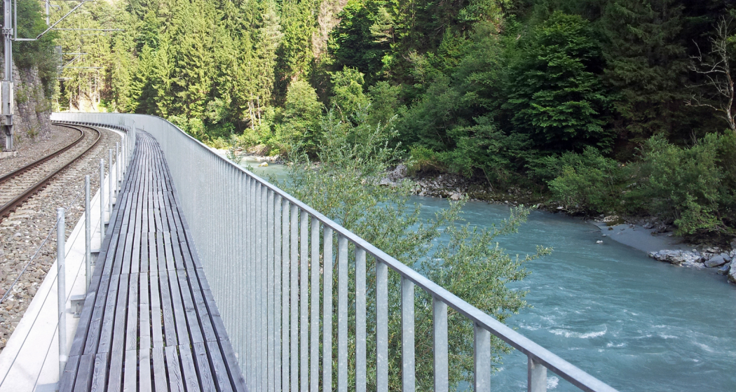
Wandersteg am Rhein
Blick auf Reichenau-Tamins und das Churer Rheintal

Show all 7 images

Ausblick auf den Rhein und den Wanderweg
A rewarding, easy hike along the Rhine Gorge from Reichenau to Trin Station.
Technique /6
Fitness 1/6
Highest Point  608 m
Lowest Point  591 m
Best Season
Jan
Feb
Mär
Apr
Mai
Jun
Jul
Aug
Sep
Okt
Nov
Dez
Start
Reichenau railway station
Destination
Trin railway station
Coordinates
46.823889, 9.412874

Details

Description

The hike starts at Reichenau railway station, where you first cross the confluence of the Vorderrhein and Hinterrhein rivers and then walk along the Vorderrhein to Trin Station. After an initial stretch through the village, a beautiful hiking trail follows, always along the Rhine. In between there are always beautiful vantage points and good opportunities for breaks or barbecues. The hike is also ideal for families with small children, who can already hike on their own or are otherwise carried in a carry backpack (but not recommended for prams). At Trin Station you can optionally cross the Rhine on the suspension bridge.

Responsible for this content Chur Tourism.

Rhine Gorge Suspension Bridge - Wackenau Ruin (656.4)

Geschlossen
Medium
12.3 km
3:25 h
160 mhd
157 mhd
Wanderung zwischen Bahngleis und Rheinfluss
Ausblick auf den Rhein und den Wanderweg

Show all 7 images

Wandersteg am Rhein
Great round trip through the Rhine Gorge with crossing the bridge Punt Ruinaulta near Trin and the ruins and viewing platform Wackenau as another highlight.
Technique 2/6
Fitness 3/6
Highest Point  749 m
Lowest Point  591 m
Best Season
Jan
Feb
Mär
Apr
Mai
Jun
Jul
Aug
Sep
Okt
Nov
Dez
Start
Reichenau station
Destination
Reichenau station
Coordinates
46.824711, 9.408565

Details

Description

This circuit leads from Reichenau, the confluence of the Vorderrhein and Hinterrhein, along the Vorderrhein to Trin Station. Here you cross the Rhine over a 100 meter long suspension bridge (Punt Ruinaulta). A short, steep ascent follows. On the further way it is worth visiting the ruins of Wackenau and the viewing platform, which is slightly below the ruins and accessible from May to October. Through the Bonaduz forest you then return to Reichenau.

Responsible for this content Chur Tourism.
This content has been translated automatically.

E-bike Domleschg castle tour

Geschlossen
Medium
61.3 km
4:25 h
618 mhd
618 mhd
Burg Castelberg
Schloss Ortenstein bei Tomils

Show all 8 images

Paspels mit Schloss Sins
An impressive circular tour through the Domleschg valley south of Chur, which is characterised by rolling hills, orchards and numerous castles.
Technique 2/6
Fitness 3/6
Highest Point  805 m
Lowest Point  564 m
Best Season
Jan
Feb
Mär
Apr
Mai
Jun
Jul
Aug
Sep
Okt
Nov
Dez
Start
Station Chur
Destination
Station Chur
Coordinates
46.853236, 9.529987

Details

Description

Along the right bank of the Rhine via Felsberg and Tamins, this tour first leads to Reichenau, where the confluence of the Vorderrhein and Hinterrhein is located, which can be seen impressively from the bridge. The tour continues picturesquely over the plateau of Bonaduz and Rhäzüns until you finally reach the Domleschg at Rothenbrunnen. Now follows a magnificent round tour through the southern-looking valley, which is characterized by rolling hills, orchards and numerous castles. A landscape that invites you to explore it on an e-bike. Again and again, the view sweeps over impressive castles, palaces and castle ruins - from Juvalt Castle near Rothenbrunnen to Hohen Rätien Castle near Sils, they characterize the Domleschg landscape. Lake Canova near Paspels invites you to take a refreshing dip in the water (bathing season from May to mid-October). The trail continues along the Polenweg with a view of the Rhäzünser Rheinauen, which are among the most intact floodplain landscapes in Switzerland and are of national importance. Behind the golf course of Domat/Ems with a view of the "Tumas" (the striking hills that originate from landslides and are under nature protection) then follows the last stretch back to the Alpine City of Chur. 

Directions

From Chur on the Rhine route 2 to Bonaduz. There ride across the plateau to Rhäzüns and along the road to Rothenbrunnen. Now follow the Graubünden Route 6 to Thusis and on to Sils. The return journey then follows through the hilly landscape along the castles and via Canova Lake back to Rothenbrunnen. From there on the Graubünden Route 6 back to Chur.

Directions

Public Transport

Chur train station is easily accessible by SBB (Swiss Federal Railways), Rhaetian Railways, Postbus or Chur Bus.

Anreise Information

Motorway exit Chur Nord or Chur Süd and then drive to the city centre.

Parking

At Chur railway station two multi-storey car parks are available (Otto & Alex / SBB Park & Rail).

Responsible for this content Graubünden Ferien.