discover.swiss ID
osm_1684047
discover.swiss Additional Type
City

Trans Grischun: Castrisch–Scuol (Stage 3)

Difficult
134.7 km
0:00 h
6402 mhd
5820 mhd
Abfahrt ins Safiental
Aufstieg nach Guarda im Unterengadin

Show all 13 images

Biketransport mit dem Zug oder Postauto ist in Graubünden ein Kinderspiel
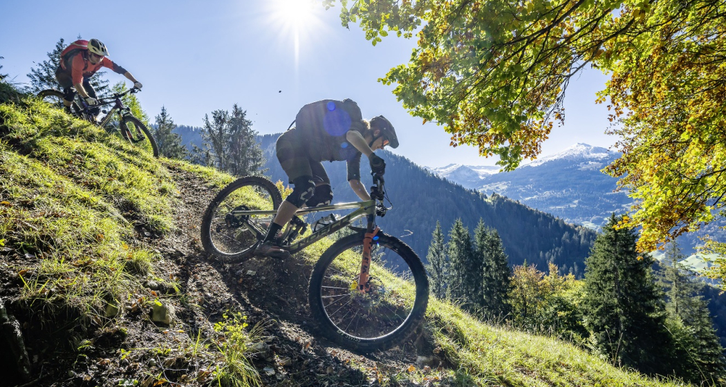
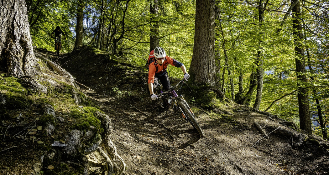
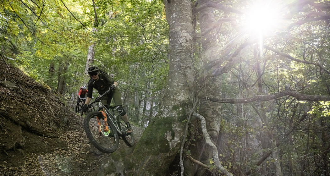
Today is a long day ahead – including a transfer with the Rhaetian Railway. So it's always worth getting up early. The highlights? A small Maiensässbeizli with a great view, a spectacular road through the Rhine Gorge and typical Lower Engadine villages.
Technique 5/6
Fitness 4/6
Highest Point  2946 m
Lowest Point  517 m
Best Season
Jan
Feb
Mär
Apr
Mai
Jun
Jul
Aug
Sep
Okt
Nov
Dez
Start
Castrisch or Ilanz
Destination
Chur / Scuol
Coordinates
46.84462199, 9.72071553

Details

Description

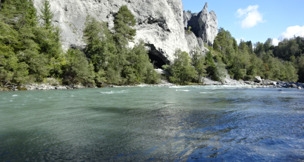
The stage starts in the tranquil village of Castrisch. You first follow the official Rhine Veloroute No. 3, which is only slightly uphill - perfect for taking it easy on your legs. In Valendas, you can fill your water bottle with fresh mountain spring water from the largest wooden fountain in Europe. Shortly after Carrera, turn off onto the road to Brün and continue up to Imschlacht. The road and views are fantastic. Tip: you can fortify yourself with a portion of mountain cheese, salsiz or a nut tart at the Maiensässbeizli. Continue down into the Safiental valley. Then comes another highlight: the spectacular panoramic road along the Rhine Gorge. The rock faces of the “Swiss Grand Canyon” tower 300 meters high. From Bonaduz, you cycle along side roads to Chur. The section between the capital of Graubünden and Lavin in the Lower Engadine is covered comfortably on the Rhaetian Railway.

From the Lower Engadin village of Lavin, your muscle power is needed once again. The route to the stage finish takes you along a fine gravel path via Guarda to Scuol. Below you, the bright turquoise Inn River flows. The landscape in the Lower Engadin presents a completely different picture. The sunburnt stables of the Surselva have given way to houses adorned with colorful paintings. The art of Sgraffito, the traditional stucco technique of the region, is now mastered by only a few in the valley. And in Scuol, not only does mountain spring water flow from the fountains, but even mineral water. Simply gschpunna.

Total distance and elevation gain (excluding public transport sections): 66 km, 1,400 meters of ascent, 1,900 meters of descent.

Geheimtipp

The Trans Grischun passes through inhabited areas at regular intervals, so that you can always find places to stay overnight and adapt the stages to your needs.

Sicherheitshinweis

The tour should not be undertaken in uncertain weather conditions. Weather changes are frequent in the mountains. If a rain front or similar is approaching during the hike, you should turn back in good time.

144 Emergency call, first aid

1414 Mountain rescue REGA

112 International emergency call

Ausrüstung

Helmet, gloves, cycling shoes, glasses, rain and sun protection, drinks, repair kit, first aid kit

Directions

Castrisch - Valendas - Brün - Imschlacht - Arezen - Versam - Versamer Tobel - Bonaduz - Reichenau - Tamins - Felsberg - Chur - public transport - Lavin - Guarda - Ftan - Ardez - Scuol

Directions

Public Transport

Stage tour

Anreise Information

Stage tour

Parking

Stage tour

Responsible for this content Surselva Tourism.
This content has been translated automatically.

Outdooractive Logo

This website uses technology and content from the Outdooractive platform.
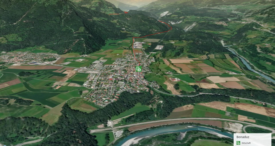
Place Bonaduz

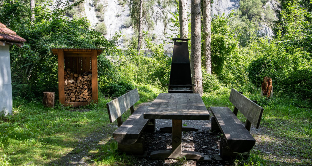
Fireplace Isla Davon

FLFRuinaulta_AMMANN_20210829-33 (1)
The Isla Davon fireplace on the banks of the Rhine near Trin railway station is a place of diversity and contrasts. Here, nature and technology, tranquillity and movement come together with the Rhine, the bridge and the Rhaetian Railway, creating a unique atmosphere that enchants every visitor.

Description

Location 

The fireplace is located on the Bonaduz side of the Rhine before crossing the bridge to Trin railway station. Firewood and seating are available. 

Accessibility 

The fireplace can be reached on foot within 10 minutes from the Trin staziun bus stop. From Bonaduz, the fireplace can be reached via Sper Tschavir and the Isla Davon path.

Contact

Fireplace Isla Davon

7402 Bonaduz

Responsible for this content Chur Tourism.

Hotel Bonaduz

Hotel Alte Post

Hotel Alte Post (tom_tds00020011249713241_image)
Aussenaufnahme Nacht

Show all 19 images

Lobby
The Hotel Alte Post, completely rebuilt in 2016, welcomes you in the center of Bonaduz at the entrance of the famous Rhine Gorge.

Description

Completely rebuilt in 2016, Hotel Alte Post is located in the centre of Bonaduz, at the entrance to the famous Rhine Gorge. Family-run for 4 generations since 1893, this hotel/restaurant offers Swiss cuisine and free Wi-Fi. Free parking is available and there is a lockable garage for bicycles and motorbikes. All rooms at the Hotel Alte Post are equipped with stylish designer furniture and an LCD HD TV. The restaurant is open daily and serves Swiss and Graubünden dishes prepared for you from regional products. Seasonal specialties such as asparagus, mushroom and game dishes are also offered. The city of Chur is 10 km away and the Flims/Laax/Falera Ski Area is 12 km away. Viamala Gorge is 18 km away. This property also has one of the top-rated locations in Bonaduz! Guests like the location better than other properties in the area. This property is also rated for the best value in the whole of Chur Rhine Valley! Compared to other accommodations, guests get more for their money here. Parking spaces and garages are available.

Prices

Prices incl. VAT & visitor's tax | Garage available for CHF 10.-/day with high-voltage sockets | Garage for motorbikes and bicycles free of charge | Pet-free hotel.

Contact

Hotel Alte Post

Versamerstrasse 1, 7402 Bonaduz

Responsible for this content Chur Tourism.
This content has been translated automatically.

Farm Shop Bonaduz

Sculmserhof

Sculmserhof 2
Sculmserhof 1
Thanks to a lot of heart and soul, passion and love for the cause and, of course, with the help of Mother Nature, the finest organic fresh meat and other natural and delicious products thrive at the Sculmserhof.

Description

The Sculmserhof is located in mountain zone 3, in a hamlet in the municipality of Safiental and is managed according to the Bio Suisse guidelines. We keep suckler cows, ewes, goats, laying chickens, livestock guard dogs and border collies. All our animals are slaughtered in the Safiental butcher's cooperative. We will drive you to the butcher's shop and accompany you to the end. This results in fine delicacies:

  • Bratwurst (beef, sheep, goat)
  • Homemade sausages (beef)
  • Käsekrainer
  • Cervelas (beef)
  • Wienerli (beef)
  • Meatloaf
  • Salsiz (beef, sheep, goat)
  • Mostbröckli (beef, sheep, goat)

From the young cattle of the Sculmserhof (between 8 and 10 months old) mixed packages with fresh meat can be ordered, which include minced meat, sliced meat, starter, entercote, fillet, saddle steak, roast, rump, boiled meat, biscuits, juice biscuits and knuckles. 

The lambs of the Sculmserhof are about 8 months old and can be ordered as half or whole lamb (portioned and vacuumed). Gitzi, which are about 12 months old, can also be ordered from the Sculmserhof. In order to use as much as possible, the skins of the sheep, lambs, goats and Gitzi are tanned. The size and color vary.
The chickens give the Sculmserhof fresh eggs every day, which are sold in the farm shop and in the Volg shops (Bonaduz, Tamins, Trin, Trin Mulin and Flims). It is possible to take out an egg subscription, which is very well received by customers (egg delivery service to the milk crate). The previous eggs are used to make pretzels and pasta.
The livestock guard dogs ensure the protection of the animals. The Sculmserhof itself trains livestock guard dogs for the farm and for the Swiss Livestock Protection Association. The dogs come to the Sculmserhof at 12 weeks and at about 15 months they pass the operational readiness test (EBÜ) and can be used as official livestock guard dogs.


Opening hours

24/7

Contact

Responsible for this content graubündenVIVA.
This content has been translated automatically.

RheinWelten on the Rhine Route

Medium
438.5 km
30:00 h
1838 mhd
2913 mhd
RheinWelten
RheinWelten

Show all 8 images

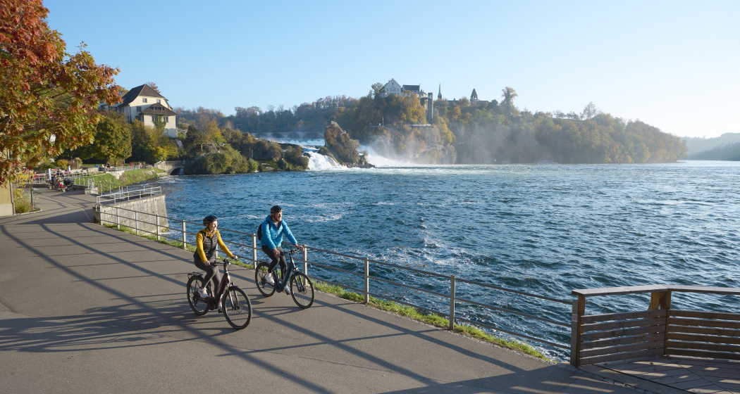
RheinWelten führt dich zum Rheinfall
The "RheinWelten" e-bike route now connects Switzerland's existing cycling destination "Rhine Route 2" with regional, cultural and culinary highlights in 15 worlds of experience.
Technique 1/6
Fitness 3/6
Highest Point  2044 m
Lowest Point  258 m
Best Season
Jan
Feb
Mär
Apr
Mai
Jun
Jul
Aug
Sep
Okt
Nov
Dez
Start
Andermatt
Destination
Basel
Coordinates
46.634663, 8.596397

Details

Description

"RheinWelten" is a unique two-wheeler offer from the source of the Rhine to Basel for enjoyable explorers. 45 local tours in 15 adventure worlds can be discovered in Switzerland and Liechtenstein on an e-bike.  The tours combine visits to producers and farm shops, visits to museums or wineries, as well as local restaurants and overnight accommodations with the most beautiful cycling routes or hikes in the regions. The adventure worlds can be visited individually as a day trip or as a multi-day bike tour. 

Selected information on the new digital platform www.rheinwelten.com encourage people to discover new things. RheinWelten takes you through 12 tourist destinations in six cantons as well as the Principality of Liechtenstein. Experience unique cultural landscapes and the culinary diversity along the Rhine by e-bike.

Geheimtipp

Not the way is the goal, but the worlds of experience of the RheinWelten.

Ausrüstung

Roadworthy (e-)trekking bike, bicycle helmet, saddlebags or trekking backpack (approx. 35 litres) with rain cover, comfortable sports shoes, possibly cycling shoes, weather-adapted and durable clothing in the multi-layer principle, if necessary cycling jersey, change of clothes, cycling gloves, air pump, bicycle tools, sun and rain protection, provisions and drinking water, drinking bottle and suitable holder, first aid kit, pocket knife, mobile phone, if necessary mobile phone holder for the handlebar, headlamp and Reflectors, maps, travel documents, toiletry bags and towels, hand detergent and clothesline.

Directions

Rhine Route 2: Andermatt - Oberalppass - Disentis - Trun - Ilanz - Versam - Reichenau - Chur - Landquart - Jenins - Maienfeld - Sargans - Buchs - Oberriet - Altstätten - St.Margrethen - Fussach (D) - Gaissau (D) - Rohrschach - Arbon - Romanshorn - Kreuzlingen - Steckborn - Stein am Rhein - Gailingen (D) - Schaffhausen - Dachsen - Ellikon - Eglisau - Zurzach - Felsenau - Laufenburg - Stein - Rheinfelden - Pratteln - Muttenz - Basel

Directions

Public Transport

Arrival by train to Andermatt possible

Anreise Information

Motorway exit Göschnen direction Andermatt

Parking

Paid parking available

Responsible for this content Graubünden Ferien.
This content has been translated automatically.

D01 - T22 Via Francisca des Lukmaniers

Medium
476.1 km
125:15 h
6852 mhd
7191 mhd
T01 - T22 Via Francisca des Lukmaniers
T01 - T22 Via Francisca des Lukmaniers (oua_24516016_0e20ae1_profile)
The "Via Francisca des Lukmaniers" is also known as the "Street of the Emperors". It leads from Constance over the Lukmanier Pass to Pavia, where it meets the Via Francigena. Here is the official route in 15 Swiss stages, plus 7 stages in Italy.
Technique 1/6
Fitness 4/6
Highest Point  1978 m
Lowest Point  55 m
Best Season
Jan
Feb
Mär
Apr
Mai
Jun
Jul
Aug
Sep
Okt
Nov
Dez
Start
Konstanz ( Münster )
Destination
Pavia Church, San Pietro in Ciel d'oro. ( - Rome)
Coordinates
47.663249, 9.175472

Details

Description

www.viafrancisca.ch/wegbeschreibung/

Geheimtipp

For more explanations on the trail, visit us on www.viafrancisca.ch

Sicherheitshinweis

November - April possibly snow stages 10 and 11, Disentis-Lukmanierpass-Olivone. Use public transport.

Ausrüstung

Backpack with rain cover, well-worn footwear, durable clothing appropriate to the season, rain and sun protection, hiking stick or trekking poles, pilgrim's passport.

Directions

www.viafrancisca.ch/wegbeschreibung

Directions

Public Transport

Public transport to Konstanz and from Pavia. All stage towns can be reached by public transport.

Anreise Information

-

Parking

-

Responsible for this content Graubünden Ferien.
This content has been translated automatically.

T 07 Via Francisca: Chur - Bonaduz

Geschlossen
Simple
16 km
4:25 h
286 mhd
245 mhd
RhB vor Domat Ems
Pilgerweg in Plessur: Via Francisca: Chur - Bonaduz

Show all 3 images

T 07 Via Francisca: Chur - Bonaduz (oua_24511571_00f683b_profile)
The "Via Francisca" is also known as the "Road of the Emperors". It leads from Constance over the Lukmanier to Pavia, where it meets the Via Francigena.
Technique /6
Fitness 2/6
Highest Point  725 m
Lowest Point  575 m
Best Season
Jan
Feb
Mär
Apr
Mai
Jun
Jul
Aug
Sep
Okt
Nov
Dez
Start
Chur, Cathedral of the Assumption of the Virgin Mary
Destination
Bonaduz, Railway Station
Coordinates
46.847633, 9.53524

Details

Description

There are now two pilgrimage routes between Chur and Disentis, with the Via Francisca running mainly on the southern side of the Rhine, while the Way of St. James Graubünden, called Via SonGiachen, runs on the northern side. However, the two paths are almost identical up to Tamins. So it may happen that the two hikers in front are also pilgrims, but on their way from South Tyrol to Central Switzerland.
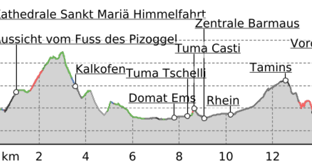
Both paths lead from Chur towards the Graubünden Oberland, called Surselva. Initially, we hike along the southern edge of the wide Rhine valley. At Domat/Ems we first cross the tracks of the Rhaetian Railway at the station, then walk between the two hills "Tuma Tschelli" and "Tuma Casti" and then circle the second to the north. This brings us first to the Rhine power plant, and after crossing the Rhine over the weir, the paths then separate to meet again briefly on the main square of Tamins. But only as far as crossing the village square, where we separate again. Now it's down to cross the Vorderrhein on the railway bridge. And so we arrive at Bonaduz.


Geheimtipp

The stages in this documentation are suggestions that each pilgrim can adapt to his wishes. however, the technical data always concern the assumption that these stages are completed in one day.

Sicherheitshinweis

.

Ausrüstung

Normal hiking/trekking equipment: backpack with rain cover, well-worn footwear, durable clothing appropriate to the season, rain and sun protection, hiking stick or trekking poles, pilgrim's passport.

Directions

Chur - River Plessur - Rose Hill - Lime kiln - Paleu sura - Domat/Ems - Tuma Casté - Power plant - Rhine weir - Tamins - Anterior Rhine - Campagna - Bonaduz

Directions

Public Transport

SBB, RhB

Anreise Information

A 13

Responsible for this content Graubünden Ferien.
This content has been translated automatically.

T 08 Via Francisca: Bonaduz - Ilanz

Difficult
22.9 km
6:35 h
527 mhd
479 mhd
Beweis unserer Wegführung
T 08 Via Francisca: Bonaduz - Ilanz

Show all 4 images

Pilgerweg in Imboden: Via Francisca: Bonaduz - Ilanz
The "Via Francisca" is also known as the "Road of the Emperors". It leads from Constance over the Lukmanier to Pavia, where it meets the Via Francigena.
Technique 1/6
Fitness 5/6
Highest Point  936 m
Lowest Point  658 m
Best Season
Jan
Feb
Mär
Apr
Mai
Jun
Jul
Aug
Sep
Okt
Nov
Dez
Start
Bonaduz, Railway Station
Destination
Ilanz. Railway station
Coordinates
46.810677, 9.397203

Details

Description

Today's stage is impressive, it takes us on the southern flank through the Rhine Gorge, the Swiss version of the "Grand Canyon", popular especially with water sports enthusiasts such as canoeists or rafters. The gorge has very steep flanks on both sides, so that the embarkation usually takes place in Ilanz and the disembarkation at the confluence of the Vorderrhein and Hinterrhein near Reichenau. However, there is still a transport option, because the Rhaetian Railway (narrow gauge) runs on the Chur - Ilanz route through the gorge, with some bridges and tunnels. This route is also used in winter. So whatever the weather has in store for capers, we will definitely come to Ilanz.
Of course, we hope for sunny weather, because then this stage with its breathtaking views is an unforgettable treat. We will ascend at the beginning and enjoy the gorge from above, then we will descend to the Rhine, where we will then meet the Rhaetian Railway and follow it and the Rhine to Ilanz.

Geheimtipp

The stages in this documentation are suggestions that each pilgrim can adapt to his wishes. however, the technical data always concern the assumption that these stages are completed in one day.

Sicherheitshinweis

.

Ausrüstung

Normal hiking/trekking equipment: backpack with rain cover, well-worn footwear, durable clothing appropriate to the season, rain and sun protection, hiking stick or trekking poles, pilgrim's passport.

Directions

Bonaduz - Caumas - Tschavir - Zault - Puz da Mattauns - Versam - Hübschera - Carnifels - Alatobel - Carrera - Carreratobel - Valendas - Station Valendas - Castrisch - Glenner - Ilanz

Directions

Public Transport

RhB (Rhaetian Railway)

Responsible for this content Graubünden Ferien.
This content has been translated automatically.

Hut tour Surselva Vrin - Tamins (stage 3)

Geschlossen
Medium
75.1 km
8:50 h
1891 mhd
2760 mhd
Hüttentour Surselva Vrin - Tamins (Etappe 3)

Show all 4 images

Casa Leon Vrin
The third stage is the Pièce de Résistance of the Surselva hut tour. But the key data are more frightening than the stage actually is – especially since the route can also be significantly shortened at the end.
Technique 3/6
Fitness 3/6
Highest Point  2410 m
Lowest Point  591 m
Best Season
Jan
Feb
Mär
Apr
Mai
Jun
Jul
Aug
Sep
Okt
Nov
Dez
Start
Vrin
Destination
Tamins
Coordinates
46.655254, 9.098761

Details

Description

Initially, you roll from Vrin down to Surin and follow the signposted mountain bike route via Surcasti to Uors. Here it is worthwhile to take the post bus for the ascent to Vals. This saves "only" 320 meters in altitude, but still! Because on the third stage of the Surselva hut tour, it is important to save energy for the upcoming ascent up to the Tomül Pass. To do this, you follow the signposted mountain bike route (Alpine Bike), first on asphalt, then on gravel and after the ridge on an easily rideable single trail. On the last section after Alp Tomül, there is always a pushing section to do, unless you have strength in your calves like Nino Schurter - or an e-bike. But the pushing is not in vain, because the upcoming section through the Safiental is one of the longest mountain bike descents in the Alps with almost 40 kilometres. The first part leads along the historic mule route down to Safien Thalkirch. Now you change to the road with little traffic and later pass the village of Safien Platz. Leave the road at the Rainmatte, follow the Rabiusa stream, pass the reservoir and then climb a few metres on the right side of the valley to finally reach the old Safierstrasse. Today, only one single trail remains of the road, so for mountain bikers it is a fantastic section through enormously steep terrain. The route here is interspersed with small tunnels. Later, the path widens again and you roll out of the valley on a small road to Sigl Ault.

At Sigl Ault, the wheat is separated from the chaff on the final stage of the Surselva hut tour: If you don't have any strength left, you roll down to Bonaduz and get on the train here for the return journey to Chur. But the original route still has a few highlights to offer. The section after the Sigl Ault is an unparalleled trail treat and leads high above the Rhine Gorge to the Versamerstrasse. Here is the next opportunity to end the stage with the flat ride to Bonaduz. But here, too, there is still something to experience on the original route, because the upcoming single trail section past the ruins of Wackenau is no less attractive than the previous trail over the Rhine Gorge. This way you get to Reichenau and get on the train back to Chur. So much for the recommended version for the third stage of the Surselva hut tour.

Geheimtipp

If you still haven't had enough in Reichenau, follow the cycle path from Tamins in the direction of Chur and then change to the trail near the left bank of the Rhine before Felsberg. This trail leads to the Rossboden army site, from where you roll along the cycle routes to Chur train station.

Responsible for this content Graubünden Ferien.
This content has been translated automatically.

Hüttentour Surselva (3 Etappen)

Medium
161 km
21:30 h
5158 mhd
5642 mhd
Hüttentour Surselva
Hüttentour Surselva

Show all 8 images

Hüttentour Surselva
The Surselva, i.e. the Bündner Oberland, has a lot to offer in terms of mountainbiking, especially in the lowest region around Laax and Ilanz. On the three-day Hüttentour through the alpine mountain world of the Surselva, two of the most extraordinary mountain huts are approached: the Ustria Staila in Siat and the Péz Terri in Vrin. But the route also has class when it comes to trails. With the Flimserwald, the singletrail descent from Siat, the Val Lumnez and the Tomül Pass, some of the really big but little-known trail highlights of Graubünden are on the schedule.
Technique 3/6
Fitness 3/6
Highest Point  2412 m
Lowest Point  585 m
Best Season
Jan
Feb
Mär
Apr
Mai
Jun
Jul
Aug
Sep
Okt
Nov
Dez
Start
Flims
Destination
Tamins
Coordinates
46.836478, 9.284353

Details

Description

The Hüttentour Surselva is a three-day mountainbike tour in the region between Chur, Flims and Vals. The ascents are primarily mastered under one‘s own power and lead over well rideable paths. The up hill to Vals is covered by post bus. The descents are mainly on singletrails that can be ridden smoothly, but experience in alpine mountainbiking is an advantage. On the Hüttentour, all luggage for three days is in the backpack, no luggage transport is possible. However, the selected huts have hotel standard.

Starting place: The Hüttentour Surselva starts in Flims. Ideally, you travel by car or public transport to Chur and get from there by post bus to Flims. Mountainbikes can be taken along without any problems, each post bus has a rear rack for up to five bikes.

E-Mountainbike: The Hüttentour Surselva is also easily doable with the e -mountainbike. However, experience in battery management is necessary to reach the stage destination with one charge. In the huts are sockets available to charge the battery. However, it is important to bring your own charger.

Responsible for this content Graubünden Ferien.
This content has been translated automatically.