Please note: from 10. until and including 27. June, the facilities in the indoor pool building will be closed for the annual maintenance works. Sauna and gym will reopen on 21. June.

Additional infos.
discover.swiss ID
osm_1684071
discover.swiss Additional Type
City

Art Gallery Domat/Ems

Art gallery Fravi Domat/Ems
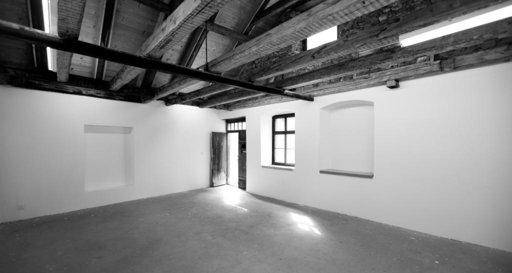
Galaria Fravi
Here contemporary art finds the present.

Description

 Galaria Fravi exhibits contemporary art with a real connection to the present, enabling and encouraging fresh dialogues and discourse right on site. Currently, Galaria Fravi is showing artworks by regional, national and international artists. Galaria Fravi does not blindly follow trends and tendencies in the art market but exhibits art in its true sense - as something essential, a possibility to expand one's own existence. The gallery constantly aims to capture: To capture dialogue, positions and experiences.

Opening hours

Friday - Saturday 6pm-8pm
Sunday 4pm - 6 pm
Other dates by prior agreement.

Contact

Responsible for this content Chur Tourism.

Playground Domat/Ems

Playground Domat/Ems

Spielplatz Domat/Ems mit Feuerstelle
Spielplatz Domat/Ems
Playground with fireplace invites you to linger.

Description

 Spacious playground with fireplace, table and benches. 

Directions:

City bus line 1 to Domat/Ems, get off at stop Plarenga. Walk back to the roundabout and turn south towards the forest (5 minutes).

Directions by bicycle: From Chur via Rossboden - cross Rhine bridge towards Felsberg - back across the Rhine and the motorway, turn right straight after the bridge. Follow the dirt road to Domat/Ems. Turn left as you get to the village.

Directions by car: On the main road from Chur to Domat/Ems - turn left at the first roundabout in the village. Parking available.

Contact

Playground Domat/Ems

7013 Domat/Ems

Responsible for this content Chur Tourism.

Natural Monument Domat/Ems

Tumas

Tumas, Domat/ems
The small hills in Domat/Ems are called Tumas in romanish language

Description

Domat/Ems lies at the beginning of the wide Chur Rhine valley, surrounded by wooded hills and high mountain ranges - a landscape in grand style. The location of Domat/Ems between small round hills, known as the «Tumas», is also distinctive. The «Tumas» are relics of past landslides that have shaped the lowlands around Domat/Ems. They were originally formed from harder debris that was not washed away by erosion. The distinctive talus slopes lean against the southern foot of the mountain; they jut out in the shape of a fan and roll in gentle slopes down to the plain. The «Tumas» are under conservation.

Contact

Tumas

7013 Domat/Ems

Responsible for this content Chur Tourism.

Viewpoint Domat/Ems

Lady Patricia

Lady Patricia
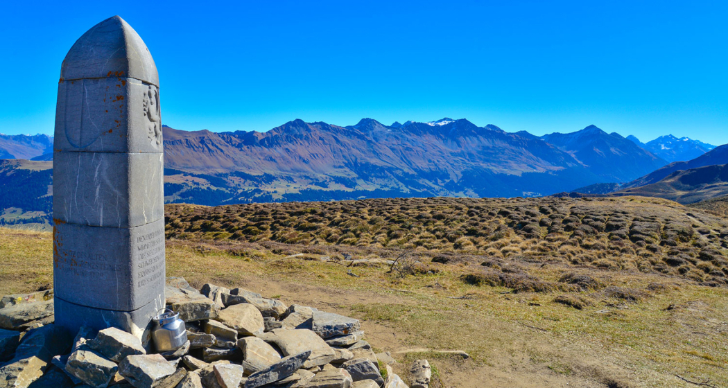
Memorial stone with panoramic view

Description

This site marks the spot where an American bomber named «Lady Patricia» crashed in 1944. There has been a memorial stone with a metal plaque there since 2004. Situated below the Dreibündenstein, the site is accessible via a footpath with a magnificent panoramic view and is a worthwhile excursion destination for both hikers and mountain bikers. From the commemorative stone you have a great view of the Calanda massif opposite and the Rhine Valley near Chur, which lies approximately 1,400 meters of altitude below at the bottom of the valley.

Map

Lady Patricia

Responsible for this content Brambrüesch.

Viewpoint Domat/Ems

Juchs

Juchs
Alp Juchs

Description

On the opposite side of the Dreibündenstein to the west of Malixer Alp is the mountain pasture clearing Juchs, high above the Chur Rhine Valley. The Juchs Alp (1,378 m) is accessible via hiking trails from Chur and Brambrüesch. It is also a popular outing destination for mountain bikers. The Alp is a part of the Domat/Ems municipality and is only catered during the height of summer, when the cows are on the alp (June to September). It is a former Walser settlement. However, no traces of the former dwellings remain visible today except overgrown, crumbling masonry.

Map

Responsible for this content Brambrüesch.

Event Domat/Ems

Autumn Stock Exchange 2025

Children's clothes and toy exchange
Saturday, September 20, 2025
Sales: 14.00-16.00
Vial Leisure Centre, Domat/Ems

Description

Date
20.09.2025 from 14:00 to 16:00 o'clock
Zeit
Goods receiving: 08.30 - 10.30 a.m.
Ort
Vial Leisure Centre
Organizer
info@pinguboerse.ch

Children's Clothes and Toy Exchange on Saturday, September 20, 2025
Sales: 14.00-16.00
Vial Leisure Centre, Domat/Ems

Autumn and winter dresses, shoes, toys, books, bicycles, skis and snowboards including accessories, bobsleighs, ice skates, prams, car seats and various baby items are sold.
With a coffee shop and free parking.

Sales: 2.00 pm - 4.00 pm

Do you want to sell goods? The children's and toy exchange Pingu works with the stock exchange software Basarlino.
In order to sell items with us, you must register there basarlino.de/4681. For information and questions, contact info@pinguboerse.ch or www.pinguboerse.ch/.

Goods receiving: 08.30 - 10.30 a.m.

New helpers are constantly being sought. Interest? Registration at www.pinguboerse.ch/.

Veranstaltungsort

Vial Leisure Centre

7013 Domat / Ems

Responsible for this content Guidle.
This content has been translated automatically.

Guidle Logo

This website uses content from Guidle.

Panorama Trail OBA

Medium
15.3 km
3:05 h
845 mhd
815 mhd
Panorama Trail OBA (oua_25230554_image)
Panorama Trail OBA

Show all 12 images

Panorama Trail OBA
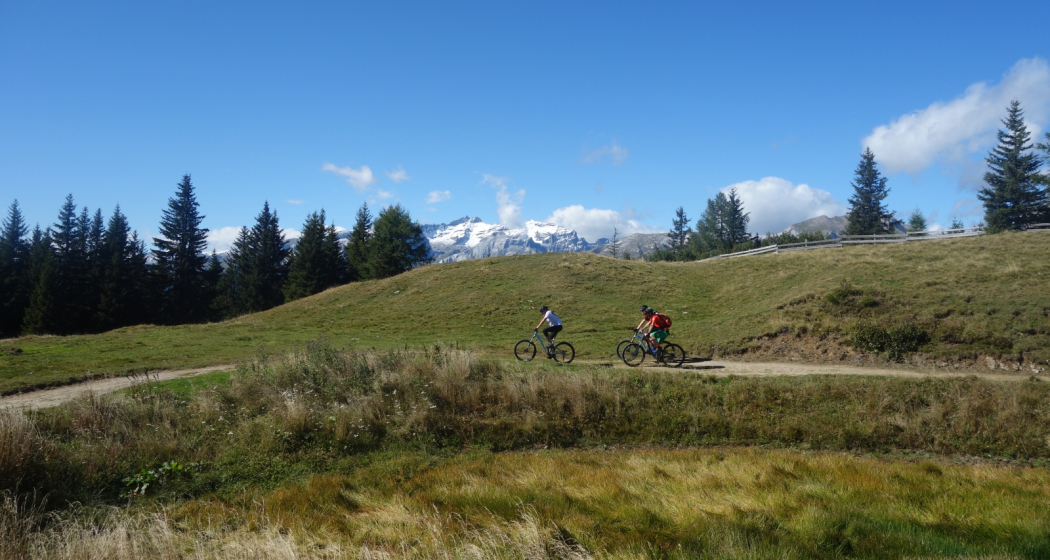
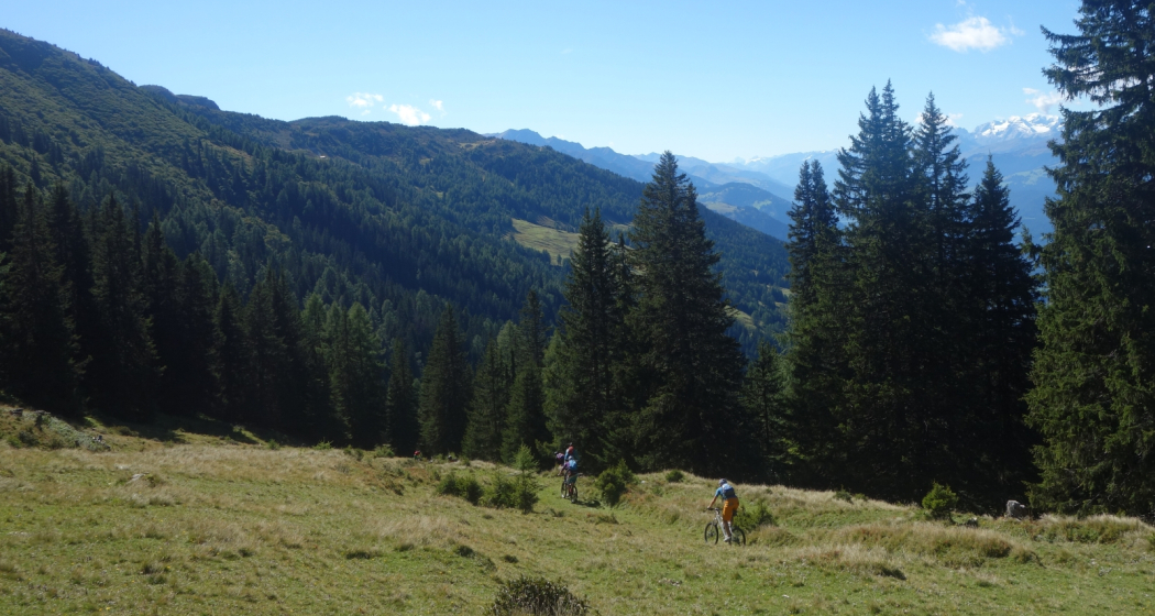
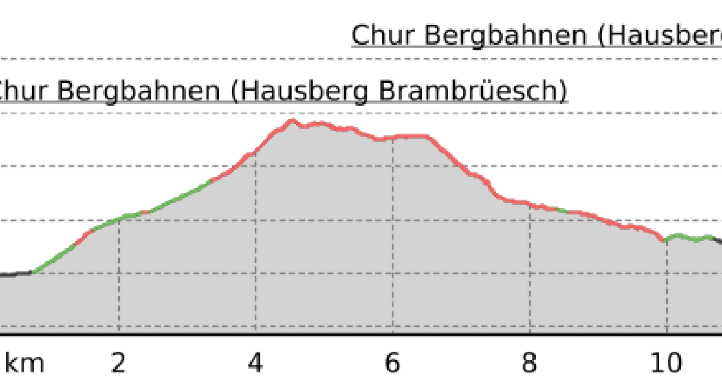
With 15.3 km and 845 meters of altitude, this route is favored by runners who are good at single-lane running and good confidence in downhill skiing. This trail also offers beautiful views over several sections.
Technique 4/6
Fitness 4/6
Highest Point  2159 m
Lowest Point  1599 m
Best Season
Jan
Feb
Mär
Apr
Mai
Jun
Jul
Aug
Sep
Okt
Nov
Dez
Start
Bergbaiz, Brambrüesch
Destination
Bergbaiz, Brambrüesch
Coordinates
46.822199, 9.514909

Details

Description

The first kilometer of the Panorama Trail OBA leads on an asphalt road past the Edelweisshütte to the parking lot, from where it goes over a panoramic path to the mountain station Pradaschier. Via the Alp Pradaschier the trail leads back to the Grüenenbüel, where the ascent leads to the high plateau of the Term Bel. This is the historically significant Dreibündenstein, the highest point of the route, reached, which offers a magnificent view over the whole of Central Grisons. On a varied trail, it goes down to the ski lodge Term Bel and from there on the Panoramaweg, past the Lady Patricia memorial stone, with a fascinating view of Domat Ems and Chur. The last section corresponds to the route of the KURZA.

Directions

Public Transport

Take the train to Chur station. From there, the city bus (line 1) takes 3 minutes to the valley station of the mountain railways (Stadthalle/Brambrüeschbahn stop).

Anreise Information

  • Motorway exit Chur Süd

  • Drive into the city (Kasernenstrasse)

  • The valley station and car park are on the right-hand side in front of the town centre

Parking

More about parking for guests of the Chur mountain railways.

Responsible for this content Brambrüesch.
This content has been translated automatically.

Enduro-Tour Spundis-Juchs

Difficult
11.7 km
1:20 h
227 mhd
1228 mhd
Abfahrt zur Alp Juchs
Alp Spundis, Ziel des des Aufstiegs

Show all 8 images

Beginn der Abfahrt nach Juchs
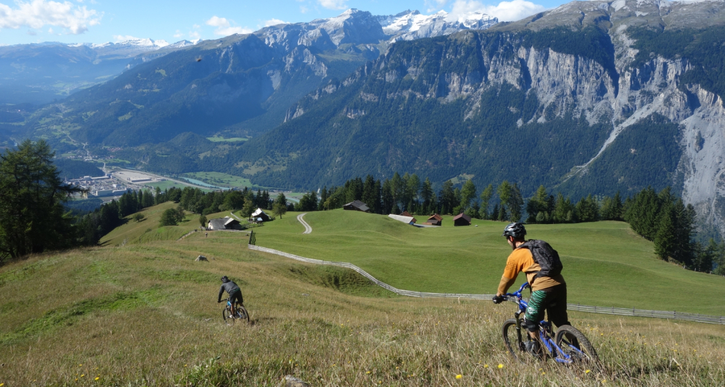
Short ascent, long descent - and what a great one! Something of the best when it comes to demanding single trail tours in the region.
Technique 3/6
Fitness 2/6
Highest Point  1818 m
Lowest Point  592 m
Best Season
Jan
Feb
Mär
Apr
Mai
Jun
Jul
Aug
Sep
Okt
Nov
Dez
Start
Brambrüesch, top station of gondola
Destination
Chur, valley station of gondola
Coordinates
46.829141, 9.516117

Details

Description

After the cableway ascent from Chur to Brambrüesch, a short and pleasant ascent over the Malixeralp to Lake Spundis follows. There you take the exit via Juchs to Chur. And it's got it in it! At the beginning a flowing trail leads across the meadows, which inspires jumps of joy. Later it becomes steeper and more demanding until you have crossed the ravine and descend over a meadow to Alp Juchs. After following the alp road for a short while, a hiking trail soon branches off to the left again. Now begins a technical, partially exposed single trail, traversed by demanding (but with some practice rideable - please avoid abbreviations) hairpin bends. The trail crosses the road several times until one follows the alp road a bit further down. And then after a bend another trail branches off to the right. Here begins a flow firework, the trail leads relatively flat in several sections up to the Rosenhügel above Chur. On this last section, especially before the curves, drive with foresight and caution, as hikers or bikers might also come across. From Rosenhügel one follows the road and behind the Welschdörfli through back to the valley station of the Chur cableways.

Directions

Public Transport

Take the train to Chur station. From there you can reach the valley station by bike in 5 minutes.

Anreise Information

  • Highway exit Chur Süd

  • Drive in direction of the city centre (Kasernenstrasse)

  • The valley station and parking lot are located in front of the city centre on the right-hand side.

Parking

Guests of the Chur cableways park for free at the parking lot at the cableway station. But you must indicate the plate number of your car at the cash desk!

Responsible for this content Brambrüesch.

Dreibündenstein circular hike Brambrüesch

Medium
12.5 km
5:10 h
588 mhd
590 mhd
Dreibündenstein
Chur Bergbahnen im Sommer mit Blick zur Stadt Chur und ins Rheintal

Show all 3 images

Dreibündenstein Rundwanderung Brambrüesch (oua_23253148_d19b918_profile)
This scenic hike leads from Brambrüesch to the Dreibündenstein and back to Brambrüesch in a beautiful round trip over the Galtialp.
Technique 3/6
Fitness 4/6
Highest Point  2172 m
Lowest Point  1588 m
Best Season
Jan
Feb
Mär
Apr
Mai
Jun
Jul
Aug
Sep
Okt
Nov
Dez
Start
Brambrüesch top station of the gondola
Destination
Brambrüesch top station of the gondola
Coordinates
46.828665, 9.515585

Details

Description

The high plateau Brambrüesch can be reached comfortably with the cableways from the city of Chur. The hike first leads straight on to the mountain restaurant and then up to the Malixeralp on the right side of the ski lift and on to Spundis, where a fantastic panorama opens up towards the region of the Surselva. Via Hühnerköpfe (top station ski lift) the trail continues upwards through a varied and beautiful alpine flora. At Furggabüel you finally reach the highest point and are rewarded with an impressive all-round panorama. At this point, a two-part panorama board provides information about the surrounding mountain world and also the clearly visible mountain ranges of the Tectonic Arena Sardona (UNESCO World Heritage). Just a short walk and you reach the Dreibündenstein, marked by a clearly visible boundary stone, where you can also sign the summit book. With a magnificent view you continue your hike towards Pradaschier. After a relatively steep descent, turn right. Now it goes more gently downhill to Galtialp and one crosses on a beautiful hiking trail over Trittwald back towards Brambrüesch. On the way, a detour to the idyllic Edelweisshütte, where you can eat. Back in Brambrüesch, there are finally three mountain restaurants with sun terraces available, so that you can finish this wonderful circular hike with pleasure before taking the cableways back to Chur.

Directions

Public Transport

Take the train to Chur station. From there, the city bus (line 1) takes 3 minutes to the valley station of the mountain railways (Stadthalle/Brambrüeschbahn stop).

Anreise Information

  • Motorway exit Chur Süd

  • Drive into the city (Kasernenstrasse)

  • The valley station and car park are on the right-hand side in front of the town centre

Parking

More about parking for guests of the Chur mountain railways.

Responsible for this content Brambrüesch.
This content has been translated automatically.

Event Domat/Ems

8th International Sidecar Meeting 2025, CH-7013 Domat/Ems

8. Internationales Gespanntreffen 2025, CH-7013 Domat/Ems (gdl_837274438_image)
8th International Carriage Meeting 2025, CH-7013 Domat/Ems, Fri. 27 June, 4.00 p.m. - 29 June, 11.00 a.m. 2025

Description

Date
27.06.2025 to 29.06.2025
daily
Ort
Schützenhaus Gonda
Organizer
Crestas Biker Fründa

We were able to enjoy three great days at the 7th International Sidecar Meeting 2024, with interesting encounters, a great atmosphere, good-humoured sidecar drivers and visitors from near and far.

We would like to invite you to the 8th International Carriage Meeting from Fri. June 27, 4:00 p.m. - Sun June 29, 11:00 a.m.

More information on our homepage: www.crestas-biker.ch/

Veranstaltungsort

Responsible for this content Guidle.
This content has been translated automatically.

Guidle Logo

This website uses content from Guidle.