discover.swiss ID
osm_1684071
discover.swiss Additional Type
City

Event Domat/Ems

Autumn Stock Exchange 2025

Children's clothes and toy exchange
Saturday, September 20, 2025
Sales: 14.00-16.00
Vial Leisure Centre, Domat/Ems

Description

Date
20.09.2025 from 14:00 to 16:00 o'clock
Zeit
Goods receiving: 08.30 - 10.30 a.m.
Ort
Vial Leisure Centre

Children's Clothes and Toy Exchange on Saturday, September 20, 2025
Sales: 14.00-16.00
Vial Leisure Centre, Domat/Ems

Autumn and winter dresses, shoes, toys, books, bicycles, skis and snowboards including accessories, bobsleighs, ice skates, prams, car seats and various baby items are sold.
With a coffee shop and free parking.

Sales: 2.00 pm - 4.00 pm

Do you want to sell goods? The children's and toy exchange Pingu works with the stock exchange software Basarlino.
In order to sell items with us, you must register there basarlino.de/4681. For information and questions, contact info@pinguboerse.ch or www.pinguboerse.ch/.

Goods receiving: 08.30 - 10.30 a.m.

New helpers are constantly being sought. Interest? Registration at www.pinguboerse.ch/.

Veranstaltungsort

Vial Leisure Centre

7013 Domat / Ems

Responsible for this content Guidle.
This content has been translated automatically.

Guidle Logo

This website uses content from Guidle.

Panorama Trail OBA

Medium
15.3 km
3:05 h
845 mhd
815 mhd
Panorama Trail OBA (oua_25230554_image)
Panorama Trail OBA

Show all 12 images

Panorama Trail OBA
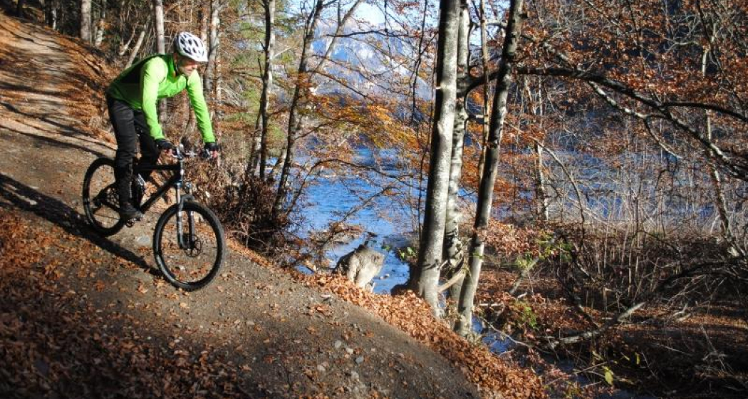
With 15.3 km and 845 meters of altitude, this route is favored by runners who are good at single-lane running and good confidence in downhill skiing. This trail also offers beautiful views over several sections.
Technique 4/6
Fitness 4/6
Highest Point  2159 m
Lowest Point  1599 m
Best Season
Jan
Feb
Mär
Apr
Mai
Jun
Jul
Aug
Sep
Okt
Nov
Dez
Start
Bergbaiz, Brambrüesch
Destination
Bergbaiz, Brambrüesch
Coordinates
46.822199, 9.514909

Details

Description

The first kilometer of the Panorama Trail OBA leads on an asphalt road past the Edelweisshütte to the parking lot, from where it goes over a panoramic path to the mountain station Pradaschier. Via the Alp Pradaschier the trail leads back to the Grüenenbüel, where the ascent leads to the high plateau of the Term Bel. This is the historically significant Dreibündenstein, the highest point of the route, reached, which offers a magnificent view over the whole of Central Grisons. On a varied trail, it goes down to the ski lodge Term Bel and from there on the Panoramaweg, past the Lady Patricia memorial stone, with a fascinating view of Domat Ems and Chur. The last section corresponds to the route of the KURZA.

Directions

Public Transport

Take the train to Chur station. From there, the city bus (line 1) takes 3 minutes to the valley station of the mountain railways (Stadthalle/Brambrüeschbahn stop).

Anreise Information

  • Motorway exit Chur Süd

  • Drive into the city (Kasernenstrasse)

  • The valley station and car park are on the right-hand side in front of the town centre

Parking

More about parking for guests of the Chur mountain railways.

Responsible for this content Brambrüesch.
This content has been translated automatically.

Enduro-Tour Spundis-Juchs

Difficult
11.7 km
1:20 h
227 mhd
1228 mhd
Abfahrt zur Alp Juchs
Alp Spundis, Ziel des des Aufstiegs

Show all 8 images

Beginn der Abfahrt nach Juchs
Short ascent, long descent - and what a great one! Something of the best when it comes to demanding single trail tours in the region.
Technique 3/6
Fitness 2/6
Highest Point  1818 m
Lowest Point  592 m
Best Season
Jan
Feb
Mär
Apr
Mai
Jun
Jul
Aug
Sep
Okt
Nov
Dez
Start
Brambrüesch, top station of gondola
Destination
Chur, valley station of gondola
Coordinates
46.829141, 9.516117

Details

Description

After the cableway ascent from Chur to Brambrüesch, a short and pleasant ascent over the Malixeralp to Lake Spundis follows. There you take the exit via Juchs to Chur. And it's got it in it! At the beginning a flowing trail leads across the meadows, which inspires jumps of joy. Later it becomes steeper and more demanding until you have crossed the ravine and descend over a meadow to Alp Juchs. After following the alp road for a short while, a hiking trail soon branches off to the left again. Now begins a technical, partially exposed single trail, traversed by demanding (but with some practice rideable - please avoid abbreviations) hairpin bends. The trail crosses the road several times until one follows the alp road a bit further down. And then after a bend another trail branches off to the right. Here begins a flow firework, the trail leads relatively flat in several sections up to the Rosenhügel above Chur. On this last section, especially before the curves, drive with foresight and caution, as hikers or bikers might also come across. From Rosenhügel one follows the road and behind the Welschdörfli through back to the valley station of the Chur cableways.

Directions

Public Transport

Take the train to Chur station. From there you can reach the valley station by bike in 5 minutes.

Anreise Information

  • Highway exit Chur Süd

  • Drive in direction of the city centre (Kasernenstrasse)

  • The valley station and parking lot are located in front of the city centre on the right-hand side.

Parking

Guests of the Chur cableways park for free at the parking lot at the cableway station. But you must indicate the plate number of your car at the cash desk!

Responsible for this content Brambrüesch.

Dreibündenstein circular hike Brambrüesch

Medium
12.5 km
5:10 h
588 mhd
590 mhd
Dreibündenstein
Chur Bergbahnen im Sommer mit Blick zur Stadt Chur und ins Rheintal

Show all 3 images

Dreibündenstein Rundwanderung Brambrüesch (oua_23253148_d19b918_profile)
This scenic hike leads from Brambrüesch to the Dreibündenstein and back to Brambrüesch in a beautiful round trip over the Galtialp.
Technique 3/6
Fitness 4/6
Highest Point  2172 m
Lowest Point  1588 m
Best Season
Jan
Feb
Mär
Apr
Mai
Jun
Jul
Aug
Sep
Okt
Nov
Dez
Start
Brambrüesch top station of the gondola
Destination
Brambrüesch top station of the gondola
Coordinates
46.828665, 9.515585

Details

Description

The high plateau Brambrüesch can be reached comfortably with the cableways from the city of Chur. The hike first leads straight on to the mountain restaurant and then up to the Malixeralp on the right side of the ski lift and on to Spundis, where a fantastic panorama opens up towards the region of the Surselva. Via Hühnerköpfe (top station ski lift) the trail continues upwards through a varied and beautiful alpine flora. At Furggabüel you finally reach the highest point and are rewarded with an impressive all-round panorama. At this point, a two-part panorama board provides information about the surrounding mountain world and also the clearly visible mountain ranges of the Tectonic Arena Sardona (UNESCO World Heritage). Just a short walk and you reach the Dreibündenstein, marked by a clearly visible boundary stone, where you can also sign the summit book. With a magnificent view you continue your hike towards Pradaschier. After a relatively steep descent, turn right. Now it goes more gently downhill to Galtialp and one crosses on a beautiful hiking trail over Trittwald back towards Brambrüesch. On the way, a detour to the idyllic Edelweisshütte, where you can eat. Back in Brambrüesch, there are finally three mountain restaurants with sun terraces available, so that you can finish this wonderful circular hike with pleasure before taking the cableways back to Chur.

Directions

Public Transport

Take the train to Chur station. From there, the city bus (line 1) takes 3 minutes to the valley station of the mountain railways (Stadthalle/Brambrüeschbahn stop).

Anreise Information

  • Motorway exit Chur Süd

  • Drive into the city (Kasernenstrasse)

  • The valley station and car park are on the right-hand side in front of the town centre

Parking

More about parking for guests of the Chur mountain railways.

Responsible for this content Brambrüesch.
This content has been translated automatically.

Event Domat/Ems

8th International Sidecar Meeting 2025, CH-7013 Domat/Ems

8. Internationales Gespanntreffen 2025, CH-7013 Domat/Ems (gdl_837274438_image)
8th International Carriage Meeting 2025, CH-7013 Domat/Ems, Fri. 27 June, 4.00 p.m. - 29 June, 11.00 a.m. 2025

Description

Date
27.06.2025 to 29.06.2025
daily
Ort
Schützenhaus Gonda

We were able to enjoy three great days at the 7th International Sidecar Meeting 2024, with interesting encounters, a great atmosphere, good-humoured sidecar drivers and visitors from near and far.

We would like to invite you to the 8th International Carriage Meeting from Fri. June 27, 4:00 p.m. - Sun June 29, 11:00 a.m.

More information on our homepage: www.crestas-biker.ch/

Veranstaltungsort

Responsible for this content Guidle.
This content has been translated automatically.

Guidle Logo

This website uses content from Guidle.

Event Domat/Ems

Annual Concert Choir viril with Coro maschile Ortisei

Annual Concert Choir viril Domat

Description

Date
10.05.2025
Ort
Multi-purpose hall Tircal

Annual Concert of the Choir viril Domat
At this year's annual concert, the choir viril Domat will perform together with the Coro maschile from Ortisei. This is a well-known male choir from South Tyrol. The audience can expect a musically varied program, which will be performed by the two choirs partly alone and then together at the end.

Veranstaltungsort

Multi-purpose hall Tircal

Tircal 9, 7013 Domat / Ems

Responsible for this content Guidle.
This content has been translated automatically.

Guidle Logo

This website uses content from Guidle.

Event Domat/Ems

Federal Day of Repentance and Prayer

Participation in the Federal Day of Repentance and Prayer

Description

Date
14.09.2025
Ort
Multi-purpose hall Tircal

Federal Day of Repentance and Prayer
The choir viril Domat enriches the penitential and prayer devotion in the parish church with some songs

Veranstaltungsort

Multi-purpose hall Tircal

Tircal 9, 7013 Domat / Ems

Responsible for this content Guidle.
This content has been translated automatically.

Guidle Logo

This website uses content from Guidle.

Simple
25 km
6:25 h
440 mhd
950 mhd
Rheinschlucht
Churer Altstadt

Show all 6 images

Alpenstadt Chur
This stage is completely under the spell of the Flims landslide. The extent of this can be experienced impressively from the new viewing platform near Conn. Gold was mined at Calanda, between Tamins and Felsberg, in the 19th century.
Technique /6
Fitness 6/6
Highest Point   m
Lowest Point   m
Best Season
Jan
Feb
Mär
Apr
Mai
Jun
Jul
Aug
Sep
Okt
Nov
Dez
Start
Laax
Destination
Chur
Coordinates
46.820350246328, 9.2649899753137

Details

Description

This stage focuses on the fascination of the Flims rock slide. Gain an impression of its dimension from the new vantage platform at Conn. Gold was mined at Calanda, between Tamins and Felsberg, in the 19th century.

Book Package «Senda Sursilvana»  and benefit from the free luggage transport from hotel to hotel.

Geheimtipp

Long section, please note overnight accommodation possibility in Tamins

Responsible for this content SwitzerlandMobility.
This content has been translated automatically.

Simple
31 km
3:45 h
1000 mhd
900 mhd
Hinteres Taminatal
Das Dorf Vättis und der Kunkelspass von oben

Show all 7 images

Mapraggsee
The bike tour over the Kunkels Pass is a real classic and connects the spa town of Bad Ragaz in St. Gallen with Tamins in Grisons. At the same time, you completely circle the well-known Calanda Mountain.
Technique /6
Fitness 4/6
Highest Point   m
Lowest Point   m
Best Season
Jan
Feb
Mär
Apr
Mai
Jun
Jul
Aug
Sep
Okt
Nov
Dez
Start
Bad Ragaz
Destination
Tamins
Coordinates
47.009750789946, 9.5051280774612

Details

Description

From Bad Ragaz, the pass route, which was already used by the Romans, leads steadily uphill to the spa town of Valens. There you drive rather flat over the almost 100 meter high bridge further down to Vasön and the Mapragg reservoir. Before the dam, turn right and drive along the lakeshore before continuing on the main road at the end of the lake.


Through a wild valley basin with almost vertical mountain flanks rising on both sides, we continue to Vättis. The final ascent to the pass now runs away from traffic in an untouched, grandiose landscape. Shortly after the Eggwald mountain restaurant, you leave the canton of St.Gallen and you are now on Graubünden soil before you reach the top of the pass.


At the transition from the Tamina Valley to the Rhine Valley, the great differences on both sides of the watershed are astonishing. The descent to Tamins is a real treat with a view of the confluence of the Anterior and Rear Rhine.

Geheimtipp

A breather in the mountain restaurant Eggwald at Kunkelspass.

Sicherheitshinweis

The route runs partly on hiking trails, please be considerate of other trail users.

Ausrüstung

Normal bike equipment. Functional clothing is an advantage, as ascents and descents alternate.

Directions

Bad Ragaz - Valens - Vättis - Kunkelspass - Tamins

Directions

Public Transport

By train to Bad Ragaz.

Anreise Information

Motorway exit Bad Ragaz, then on the main road to the village center Bad Ragaz.

Parking

Public parking available at the parking garage zentrum (chargeable)

Responsible for this content Graubünden Ferien.
This content has been translated automatically.