Please note: from 10. until and including 27. June, the facilities in the indoor pool building will be closed for the annual maintenance works. Sauna and gym will reopen on 21. June.

Additional infos.
discover.swiss ID
osm_1684071
discover.swiss Additional Type
City

Brambrüesch–Feldis Trail

8 km
4:50 h
760 mhd
380 mhd
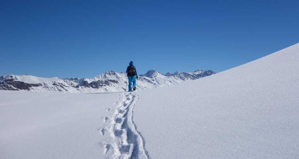
Hochebene Dreibündenstein mit Blick Richtung Feldis und Bündner Oberland
Hochebene Dreibündenstein

Show all 9 images

Beim Dreibündenstein, Blick Richtung Lenzerheide
Tour with a panorama: the varied snowshoe hike on the Dreibündenstein plateau connects the winter sports regions of Brambrüesch and Feldis. Impressive: the well visible Glarus thrust, a UNESCO World Heritage site.
Technique /6
Fitness 6/6
Highest Point   m
Lowest Point   m
Best Season
Jan
Feb
Mär
Apr
Mai
Jun
Jul
Aug
Sep
Okt
Nov
Dez
Start
Chur, Brambrüesch
Destination
Feldis, Mutta
Coordinates
46.828795460085, 9.5159724733297

Details

Description

This trail from Brambrüesch to Feldis – or the other way around – leads over the gentle plateau with many vistas around the Dreibündenstein. At the stone monument of the former Three Leagues of Rhaetia, you can admire a 360-degree panorama extending from the town’s home mountains surrounding Chur, the Arosa and Lenzerheide, up to the Glarus Alps.

Well visible on the Ringelspitz, lying opposite and reaching up to the Flims Mountains (Segnes, Tschingelhörner) is the UNESCO World Heritage site «Tektonikarena Sardona» (Glarus thrust). In this area, processes of the formation of the Alps can be seen particularly well. The central element is the Glarus main thrust fault, which is as sharp as a blade in an area where older rocks were thrust over the younger material when the Alps formed. The panorama info board at the highest point of the hike (Furggabüel, 2174 m above sea level) provides information about the World Heritage site and all names and altitudes of the surrounding mountain peaks.

The descent leads along idyllic landscapes with snow-covered forests and Alp settlements to Mutta, where you can take a comfortable ride on the chairlift to Feldis. The terrace on the slope of the Stätzerhornkette is the northern-most location in the mountain villages of the Domleschg. Cozy restaurants with sun terraces can be found in Brambrüesch, Mutta, and Feldis for enjoyment and recreation.

Directions

Public Transport

Take the train to Chur station. From there, the city bus (line 1) takes 3 minutes to the valley station of the mountain railways (Stadthalle/Brambrüeschbahn stop).

Anreise Information

  • Motorway exit Chur Süd
  • Drive into the city (Kasernenstrasse)
  • The valley station and car park are on the right-hand side in front of the town centre

Parking

More about parking for guests of the Chur mountain railways.

Responsible for this content SwitzerlandMobility.
This content has been translated automatically.

Simple
13 km
3:30 h
360 mhd
300 mhd
Kathedrale St. Mariä Himmelfahrt
43.12 Chur - Tamins, Jakobsweg Graubünden
Shortly after the start there is a superb view of Chur. The route leads across a ravine, fields and meadows to Domat/Ems, which was built around seven hills. We continue along the Senda Sursilvana to Tamins.
Technique /6
Fitness 4/6
Highest Point   m
Lowest Point   m
Best Season
Jan
Feb
Mär
Apr
Mai
Jun
Jul
Aug
Sep
Okt
Nov
Dez
Start
Chur
Destination
Tamins
Coordinates
46.84741892032, 9.5319447087352

Details

Description

A view over Chur from the Rosenhügel. Through a cutting, over fields and meadows, to Domat/Ems - built around 7 hills. And along the Senda Sursilvana river to Tamins, where the Vorder and Hinterrhein meet. A visit to Rhäzüns and the famous Kirche Son Gieri with Jakobus display is well recommended.

Responsible for this content SwitzerlandMobility.

Playground Domat/Ems

Playground Domat/Ems

Spielplatz Domat/Ems mit Feuerstelle
Spielplatz Domat/Ems
Playground with fireplace invites you to linger.

Description

 Spacious playground with fireplace, table and benches. 

Directions:

City bus line 1 to Domat/Ems, get off at stop Plarenga. Walk back to the roundabout and turn south towards the forest (5 minutes).

Directions by bicycle: From Chur via Rossboden - cross Rhine bridge towards Felsberg - back across the Rhine and the motorway, turn right straight after the bridge. Follow the dirt road to Domat/Ems. Turn left as you get to the village.

Directions by car: On the main road from Chur to Domat/Ems - turn left at the first roundabout in the village. Parking available.

Contact

Playground Domat/Ems

7013 Domat/Ems

Responsible for this content Chur Tourism.

Event Domat/Ems

10 years of Plarenga-Center

Wheel of fortune, taster lessons at NayFit, decorating cookies for children, ice cream cart, deployment demo of the fire brigade, barbecue stand, visit to Ardisla Fitness

Description

Date
04.10.2025 from 10:00 to 16:00 o'clock
Ort
Fire station Domat/Ems
Organizer
Feuerwehrverband Domat/Ems-Felsberg

We celebrate 10 years of the Plarenga-Center

Domat/Ems-Felsberg Fire Brigade Association
Migros
Merz Bakery Confiserie
Denner
Ardisla Fitness
NayFit

Details about the event and other participants will follow....

Veranstaltungsort

Fire station Domat/Ems

Via La Val 1, 7013 Domat / Ems

Responsible for this content Guidle.
This content has been translated automatically.

Guidle Logo

This website uses content from Guidle.

Natural Monument Domat/Ems

Tumas

Tumas, Domat/ems
The small hills in Domat/Ems are called Tumas in romanish language

Description

Domat/Ems lies at the beginning of the wide Chur Rhine valley, surrounded by wooded hills and high mountain ranges - a landscape in grand style. The location of Domat/Ems between small round hills, known as the «Tumas», is also distinctive. The «Tumas» are relics of past landslides that have shaped the lowlands around Domat/Ems. They were originally formed from harder debris that was not washed away by erosion. The distinctive talus slopes lean against the southern foot of the mountain; they jut out in the shape of a fan and roll in gentle slopes down to the plain. The «Tumas» are under conservation.

Contact

Tumas

7013 Domat/Ems

Responsible for this content Chur Tourism.

Rhine Gorge Railway Hike: Reichenau - Trin Station

Geschlossen
Simple
4.9 km
1:15 h
17 mhd
13 mhd
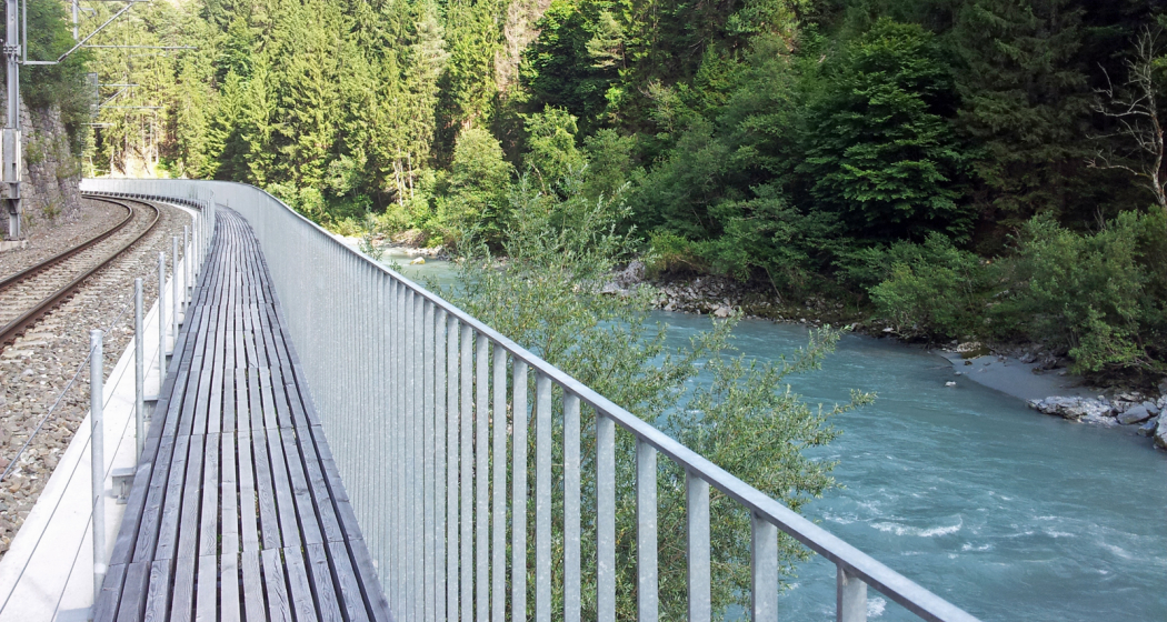
Wandersteg am Rhein
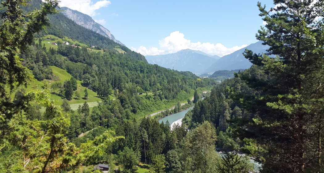
Blick auf Reichenau-Tamins und das Churer Rheintal

Show all 6 images

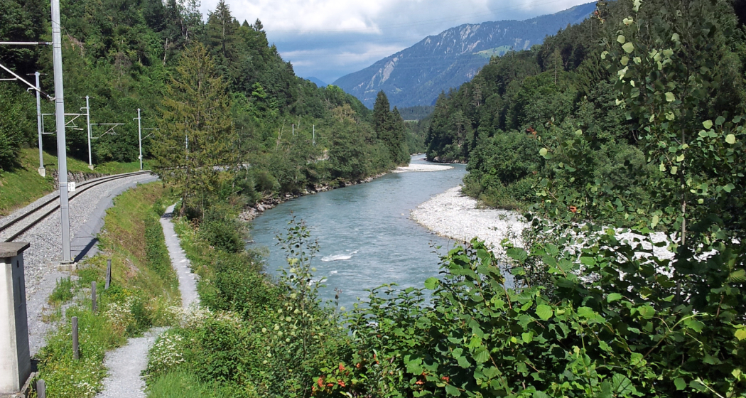
Ausblick auf den Rhein und den Wanderweg
A rewarding, easy hike along the Rhine Gorge from Reichenau to Trin Station.
Technique /6
Fitness 1/6
Highest Point  608 m
Lowest Point  591 m
Best Season
Jan
Feb
Mär
Apr
Mai
Jun
Jul
Aug
Sep
Okt
Nov
Dez
Start
Reichenau railway station
Destination
Trin railway station
Coordinates
46.823889, 9.412874

Details

Description

The hike starts at Reichenau railway station, where you first cross the confluence of the Vorderrhein and Hinterrhein rivers and then walk along the Vorderrhein to Trin Station. After an initial stretch through the village, a beautiful hiking trail follows, always along the Rhine. In between there are always beautiful vantage points and good opportunities for breaks or barbecues. The hike is also ideal for families with small children, who can already hike on their own or are otherwise carried in a carry backpack (but not recommended for prams). At Trin Station you can optionally cross the Rhine on the suspension bridge.

Responsible for this content Chur Tourism.

Rhine Gorge Suspension Bridge - Wackenau Ruin (656.4)

Geschlossen
Medium
12.3 km
3:25 h
160 mhd
157 mhd
Wanderung zwischen Bahngleis und Rheinfluss
Ausblick auf den Rhein und den Wanderweg

Show all 6 images

Wandersteg am Rhein
Great round trip through the Rhine Gorge with crossing the bridge Punt Ruinaulta near Trin and the ruins and viewing platform Wackenau as another highlight.
Technique 2/6
Fitness 3/6
Highest Point  749 m
Lowest Point  591 m
Best Season
Jan
Feb
Mär
Apr
Mai
Jun
Jul
Aug
Sep
Okt
Nov
Dez
Start
Reichenau station
Destination
Reichenau station
Coordinates
46.824711, 9.408565

Details

Description

This circuit leads from Reichenau, the confluence of the Vorderrhein and Hinterrhein, along the Vorderrhein to Trin Station. Here you cross the Rhine over a 100 meter long suspension bridge (Punt Ruinaulta). A short, steep ascent follows. On the further way it is worth visiting the ruins of Wackenau and the viewing platform, which is slightly below the ruins and accessible from May to October. Through the Bonaduz forest you then return to Reichenau.

Responsible for this content Chur Tourism.
This content has been translated automatically.

Stage 1 Gravel Bike Route Hinterrhein: Chur - Thusis

Geschlossen
Medium
29.8 km
2:35 h
404 mhd
257 mhd
Kunstwerke des bekannten Künstlers Robert Indermaur
Etappe 1 Gravelbike-Route Hinterrhein: Chur – Thusis

Show all 5 images

Sonnenuntergang
Deep ravines, impressive panoramic views and witnesses to the history of Graubünden’s transport routes await discovery at the Posterior Rhine.
Technique 3/6
Fitness 3/6
Highest Point  805 m
Lowest Point  559 m
Best Season
Jan
Feb
Mär
Apr
Mai
Jun
Jul
Aug
Sep
Okt
Nov
Dez
Start
Chur
Destination
Thusis
Coordinates
46.861438, 9.506374

Details

Description

 You start the journey in Chur (593 m above sea level) and get on bike path no. 6 on the Polenweg to the imposing fortification Porta Rhaetica. From Rothenbrunnen the route makes its way over the gentle hills of the Domleschg fruit and castle country. In Paspels (757 m above sea level), you can marvel at the art works by the well-known artist Robert Indermaur. Lake Canova invites you to take a break, especially to cool down during summer. From here, it’s not far to Thusis, the historical trading place (680 m above sea level).

Stages

Overall route: Chur  – Chur

Stage 1: Chur – Thusis

Stage 2: Thusis – Glaspass – Thusis

Stage 3: Thusis – Andeer

Stage 4 Andeer – Lai da Vons – Splügen

Stage 5. Splügen – Splügen

Stage 6. Splügen – Chur

Geheimtipp

Tip: Gravel bikers with lots of leg power will manage stages 1 and 2 in one day.

Responsible for this content Graubünden Ferien.
This content has been translated automatically.

Event Domat/Ems

Cumin / Citizens' Assembly

Cumin / Bürgerversammlung (gdl_804484989_image)
Our Cumins/Citizens' Assemblies will take place on March 28 and October 31, 2025 and on March 27 and October 30, 2026.

Description

Date
31.10.2025 at 20:15 o'clock
27.03.2026 at 20:15 o'clock
30.10.2026 at 20:15 o'clock
Ort
Kirch- und Kulturzentrum Sentupada
Organizer
Vischnanca burgaisa Domat / Bürgergemeinde Domat/Ems

Our Cumins/Citizens' Assemblies will take place on March 28 and October 31, 2025 and on March 27 and October 30, 2026.

The agenda and dispatch will be available on our homepage in due course.

Veranstaltungsort

Kirch- und Kulturzentrum Sentupada

Plaz 2, 7013 Domat / Ems

Responsible for this content Guidle.
This content has been translated automatically.

Guidle Logo

This website uses content from Guidle.

Trans Grischun: Castrisch–Scuol (Stage 3)

Difficult
134.7 km
0:00 h
6402 mhd
5820 mhd
Abfahrt ins Safiental
Aufstieg nach Guarda im Unterengadin

Show all 13 images

Biketransport mit dem Zug oder Postauto ist in Graubünden ein Kinderspiel
Today is a long day ahead – including a transfer with the Rhaetian Railway. So it's always worth getting up early. The highlights? A small Maiensässbeizli with a great view, a spectacular road through the Rhine Gorge and typical Lower Engadine villages.
Technique 5/6
Fitness 4/6
Highest Point  2946 m
Lowest Point  517 m
Best Season
Jan
Feb
Mär
Apr
Mai
Jun
Jul
Aug
Sep
Okt
Nov
Dez
Start
Castrisch or Ilanz
Destination
Chur / Scuol
Coordinates
46.84462199, 9.72071553

Details

Description

The stage starts in the tranquil village of Castrisch. You first follow the official Rhine Veloroute No. 3, which is only slightly uphill - perfect for taking it easy on your legs. In Valendas, you can fill your water bottle with fresh mountain spring water from the largest wooden fountain in Europe. Shortly after Carrera, turn off onto the road to Brün and continue up to Imschlacht. The road and views are fantastic. Tip: you can fortify yourself with a portion of mountain cheese, salsiz or a nut tart at the Maiensässbeizli. Continue down into the Safiental valley. Then comes another highlight: the spectacular panoramic road along the Rhine Gorge. The rock faces of the “Swiss Grand Canyon” tower 300 meters high. From Bonaduz, you cycle along side roads to Chur. The section between the capital of Graubünden and Lavin in the Lower Engadine is covered comfortably on the Rhaetian Railway.

From the Lower Engadin village of Lavin, your muscle power is needed once again. The route to the stage finish takes you along a fine gravel path via Guarda to Scuol. Below you, the bright turquoise Inn River flows. The landscape in the Lower Engadin presents a completely different picture. The sunburnt stables of the Surselva have given way to houses adorned with colorful paintings. The art of Sgraffito, the traditional stucco technique of the region, is now mastered by only a few in the valley. And in Scuol, not only does mountain spring water flow from the fountains, but even mineral water. Simply gschpunna.

Total distance and elevation gain (excluding public transport sections): 66 km, 1,400 meters of ascent, 1,900 meters of descent.

Geheimtipp

The Trans Grischun passes through inhabited areas at regular intervals, so that you can always find places to stay overnight and adapt the stages to your needs.

Sicherheitshinweis

The tour should not be undertaken in uncertain weather conditions. Weather changes are frequent in the mountains. If a rain front or similar is approaching during the hike, you should turn back in good time.

144 Emergency call, first aid

1414 Mountain rescue REGA

112 International emergency call

Ausrüstung

Helmet, gloves, cycling shoes, glasses, rain and sun protection, drinks, repair kit, first aid kit

Directions

Castrisch - Valendas - Brün - Imschlacht - Arezen - Versam - Versamer Tobel - Bonaduz - Reichenau - Tamins - Felsberg - Chur - public transport - Lavin - Guarda - Ftan - Ardez - Scuol

Directions

Public Transport

Stage tour

Anreise Information

Stage tour

Parking

Stage tour

Responsible for this content Surselva Tourism.
This content has been translated automatically.

Outdooractive Logo

This website uses technology and content from the Outdooractive platform.