discover.swiss ID
osm_1684071
discover.swiss Additional Type
City
Simple
13 km
3:30 h
360 mhd
300 mhd
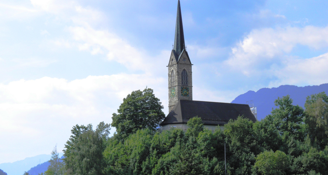
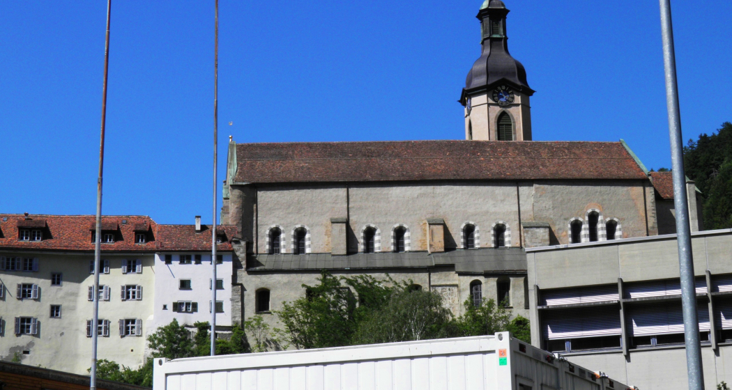
Kathedrale St. Mariä Himmelfahrt
43.12 Chur - Tamins, Jakobsweg Graubünden

Show all 3 images

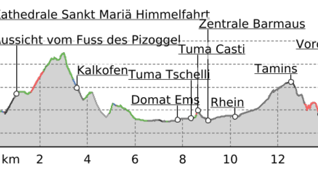
43.12 Chur - Tamins, Jakobsweg Graubünden (oua_9702316_e2802cc_profile)
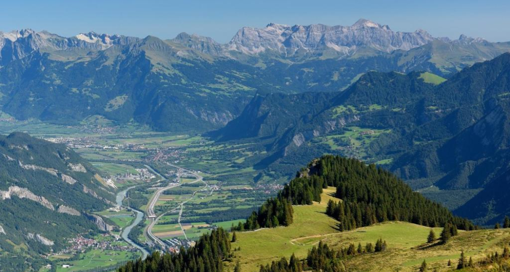
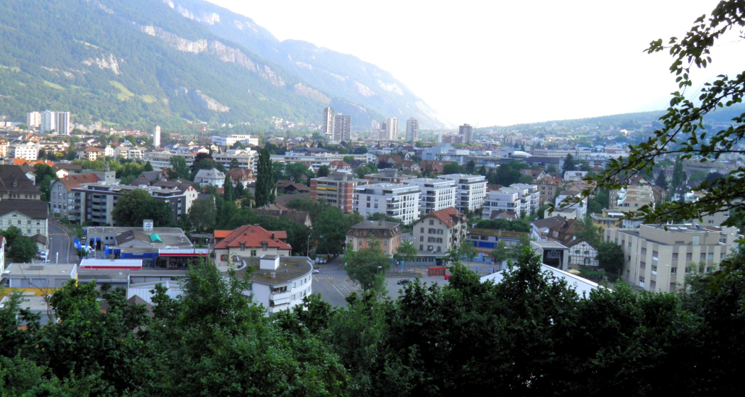
Shortly after the start there is a superb view of Chur. The route leads across a ravine, fields and meadows to Domat/Ems, which was built around seven hills. We continue along the Senda Sursilvana to Tamins.
Technique /6
Fitness 4/6
Highest Point   m
Lowest Point   m
Best Season
Jan
Feb
Mär
Apr
Mai
Jun
Jul
Aug
Sep
Okt
Nov
Dez
Start
Chur
Destination
Tamins
Coordinates
46.84741892032, 9.5319447087352

Details

Description

A view over Chur from the Rosenhügel. Through a cutting, over fields and meadows, to Domat/Ems - built around 7 hills. And along the Senda Sursilvana river to Tamins, where the Vorder and Hinterrhein meet. A visit to Rhäzüns and the famous Kirche Son Gieri with Jakobus display is well recommended.

Responsible for this content SwitzerlandMobility.

Playground Domat/Ems

Playground Domat/Ems

Spielplatz Domat/Ems mit Feuerstelle
Spielplatz Domat/Ems
Playground with fireplace invites you to linger.

Description

 Spacious playground with fireplace, table and benches. 

Directions:

City bus line 1 to Domat/Ems, get off at stop Plarenga. Walk back to the roundabout and turn south towards the forest (5 minutes).

Directions by bicycle: From Chur via Rossboden - cross Rhine bridge towards Felsberg - back across the Rhine and the motorway, turn right straight after the bridge. Follow the dirt road to Domat/Ems. Turn left as you get to the village.

Directions by car: On the main road from Chur to Domat/Ems - turn left at the first roundabout in the village. Parking available.

Contact

Playground Domat/Ems

7013 Domat/Ems

Responsible for this content Chur Tourism.
Event Domat/Ems

10 years of Plarenga-Center

Wheel of fortune, taster lessons at NayFit, decorating cookies for children, ice cream cart, deployment demo of the fire brigade, barbecue stand, visit to Ardisla Fitness

Description

Date
04.10.2025 from 10:00 to 16:00 o'clock
Ort
Fire station Domat/Ems

We celebrate 10 years of the Plarenga-Center

Domat/Ems-Felsberg Fire Brigade Association
Migros
Merz Bakery Confiserie
Denner
Ardisla Fitness
NayFit

Details about the event and other participants will follow....

Veranstaltungsort

Fire station Domat/Ems

Via La Val 1, 7013 Domat / Ems

Responsible for this content Guidle.
This content has been translated automatically.

Guidle Logo

This website uses content from Guidle.

Natural Monument Domat/Ems

Tumas

Tumas, Domat/ems
The small hills in Domat/Ems are called Tumas in romanish language

Description

Domat/Ems lies at the beginning of the wide Chur Rhine valley, surrounded by wooded hills and high mountain ranges - a landscape in grand style. The location of Domat/Ems between small round hills, known as the «Tumas», is also distinctive. The «Tumas» are relics of past landslides that have shaped the lowlands around Domat/Ems. They were originally formed from harder debris that was not washed away by erosion. The distinctive talus slopes lean against the southern foot of the mountain; they jut out in the shape of a fan and roll in gentle slopes down to the plain. The «Tumas» are under conservation.

Contact

Tumas

7013 Domat/Ems

Responsible for this content Chur Tourism.
Event Domat/Ems

Concert Jugend Brass Band Imboden und Jungtambouren Domat/Ems

Konzert Jugend Brass Band Imboden und Jungtambouren Domat/Ems (gdl_770036433_image)
Annual concert of the Jugend Brass Band Imboden together with the Jungtambouren Domat/Ems

Description

Date
03.05.2025 at 20:15 o'clock
Ort
Tircal High School Building

Veranstaltungsort

Tircal High School Building

7013 Domat / Ems

Responsible for this content Guidle.
This content has been translated automatically.

Guidle Logo

This website uses content from Guidle.

Rhine Gorge Railway Hike: Reichenau - Trin Station

Geschlossen
Simple
4.9 km
1:15 h
17 mhd
13 mhd
Wandersteg am Rhein
Blick auf Reichenau-Tamins und das Churer Rheintal

Show all 7 images

Ausblick auf den Rhein und den Wanderweg
A rewarding, easy hike along the Rhine Gorge from Reichenau to Trin Station.
Technique /6
Fitness 1/6
Highest Point  608 m
Lowest Point  591 m
Best Season
Jan
Feb
Mär
Apr
Mai
Jun
Jul
Aug
Sep
Okt
Nov
Dez
Start
Reichenau railway station
Destination
Trin railway station
Coordinates
46.823889, 9.412874

Details

Description

The hike starts at Reichenau railway station, where you first cross the confluence of the Vorderrhein and Hinterrhein rivers and then walk along the Vorderrhein to Trin Station. After an initial stretch through the village, a beautiful hiking trail follows, always along the Rhine. In between there are always beautiful vantage points and good opportunities for breaks or barbecues. The hike is also ideal for families with small children, who can already hike on their own or are otherwise carried in a carry backpack (but not recommended for prams). At Trin Station you can optionally cross the Rhine on the suspension bridge.

Responsible for this content Chur Tourism.
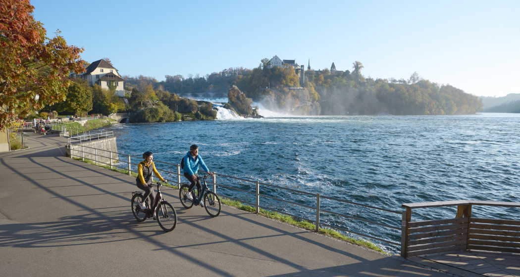
E-bike Kunkelspass (tour around the Calanda mountain range)

Medium
58.2 km
4:45 h
995 mhd
995 mhd
Churer Rheintal mit Calanda und Kunkelspass
Das eindrückliche Calanda-Massiv, von Brambrüesch aus gesehen (links der Ringelspitz)

Show all 10 images

Schlussaufstieg zum Kunkelspass
The circular tour of the Calanda massif over the Kunkelspass is a real classic. The historic pass route also offers an impressive scenic experience.
Technique 2/6
Fitness 3/6
Highest Point  1358 m
Lowest Point  515 m
Best Season
Jan
Feb
Mär
Apr
Mai
Jun
Jul
Aug
Sep
Okt
Nov
Dez
Start
Station Chur
Destination
Station Chur
Coordinates
46.853294, 9.529913

Details

Description

You have to do this tour once. For many cyclists it is one of the annual highlights. You experience the mighty Calanda massif from all sides. And who would have thought that it looks so rugged and jagged from the back. The route is extremely varied with the enjoyable start along the Rhine route. Via a side road with little traffic, you reach Pfäfers, where you cross the impressive Tamina bridge that spans the gorge. A long path through the Tamina valley follows via Valens, past the Mapragg reservoir and via Vättis finally to the Kunkelspass. The Überruf mountain inn stands at the top of the pass and offers the ideal opportunity for refreshments before the descent via the Forstrasse, at the beginning through tunnels hewn into the rock, leads down towards Tamins. The way back from there again follows the Rhine back to the Alpine City of Chur.

The Kunkelspass connects the Tamina valley (SG) with the municipality of Tamins (GR). It lies between the steep walls of the Calanda in the east and the mountain group around the Ringelspitz in the west. The narrow road and the tunnel on the Tamins side with the panoramic openings in the tunnel wall were built during the First World War. The Kunkelspass also forms the eastern entrance to the geological wonderland of the Tectonic Arena Sardona. At the pass near the Überruf mountain restaurant there is a seminar room with information about the UNESCO World Heritage Site. A telescope offers the opportunity to have a close look at the Ringelspitz and the Glarus thrust or the demolition niche of the Tamins mountain fall.

The Calanda massif consists of the four peaks Haldensteiner Calanda (at 2,805m the highest), Felsberger Calanda, Taminser Calanda and Berger Calanda (above Untervaz).

Directions

From Chur you follow the Rhine route 2 to Landquart. There you cross the Rhine and follow a little-used mountain road to Pfäfers, cross the Tamina gorge on the impressive Tamina bridge and then follow the mountain bike route 482 to the Mapragg dam. There you leave the route and ride on the road along the lake. After the lake, you follow route 482 again via Vättis to the Kunkelspass and down to Tamins, from where you finally return to the city of Chur on Rhine route 2.

Directions

Public Transport

Chur train station is easily accessible by SBB (Swiss Federal Railways), Rhaetian Railways, Postbus or Chur Bus.

Anreise Information

Motorway exit Chur Nord or Chur Süd and then drive to the city centre.

Parking

At Chur railway station two multi-storey car parks are available (Otto & Alex / SBB Park & Rail).

Responsible for this content Graubünden Ferien.

Rhine Gorge Suspension Bridge - Wackenau Ruin (656.4)

Geschlossen
Medium
12.3 km
3:25 h
160 mhd
157 mhd
Wanderung zwischen Bahngleis und Rheinfluss
Ausblick auf den Rhein und den Wanderweg

Show all 7 images

Wandersteg am Rhein
Great round trip through the Rhine Gorge with crossing the bridge Punt Ruinaulta near Trin and the ruins and viewing platform Wackenau as another highlight.
Technique 2/6
Fitness 3/6
Highest Point  749 m
Lowest Point  591 m
Best Season
Jan
Feb
Mär
Apr
Mai
Jun
Jul
Aug
Sep
Okt
Nov
Dez
Start
Reichenau station
Destination
Reichenau station
Coordinates
46.824711, 9.408565

Details

Description

This circuit leads from Reichenau, the confluence of the Vorderrhein and Hinterrhein, along the Vorderrhein to Trin Station. Here you cross the Rhine over a 100 meter long suspension bridge (Punt Ruinaulta). A short, steep ascent follows. On the further way it is worth visiting the ruins of Wackenau and the viewing platform, which is slightly below the ruins and accessible from May to October. Through the Bonaduz forest you then return to Reichenau.

Responsible for this content Chur Tourism.
This content has been translated automatically.

Stage 1 Gravel Bike Route Hinterrhein: Chur - Thusis

Geschlossen
Medium
29.8 km
2:35 h
404 mhd
257 mhd
Kunstwerke des bekannten Künstlers Robert Indermaur
Etappe 1 Gravelbike-Route Hinterrhein: Chur – Thusis

Show all 5 images

Sonnenuntergang
Deep ravines, impressive panoramic views and witnesses to the history of Graubünden’s transport routes await discovery at the Posterior Rhine.
Technique 3/6
Fitness 3/6
Highest Point  805 m
Lowest Point  559 m
Best Season
Jan
Feb
Mär
Apr
Mai
Jun
Jul
Aug
Sep
Okt
Nov
Dez
Start
Chur
Destination
Thusis
Coordinates
46.861438, 9.506374

Details

Description

 You start the journey in Chur (593 m above sea level) and get on bike path no. 6 on the Polenweg to the imposing fortification Porta Rhaetica. From Rothenbrunnen the route makes its way over the gentle hills of the Domleschg fruit and castle country. In Paspels (757 m above sea level), you can marvel at the art works by the well-known artist Robert Indermaur. Lake Canova invites you to take a break, especially to cool down during summer. From here, it’s not far to Thusis, the historical trading place (680 m above sea level).

Stages

Overall route: Chur  – Chur

Stage 1: Chur – Thusis

Stage 2: Thusis – Glaspass – Thusis

Stage 3: Thusis – Andeer

Stage 4 Andeer – Lai da Vons – Splügen

Stage 5. Splügen – Splügen

Stage 6. Splügen – Chur

Geheimtipp

Tip: Gravel bikers with lots of leg power will manage stages 1 and 2 in one day.

Responsible for this content Graubünden Ferien.
This content has been translated automatically.

E-bike Domleschg castle tour

Geschlossen
Medium
61.3 km
4:25 h
618 mhd
618 mhd
Burg Castelberg
Schloss Ortenstein bei Tomils

Show all 8 images

Paspels mit Schloss Sins
An impressive circular tour through the Domleschg valley south of Chur, which is characterised by rolling hills, orchards and numerous castles.
Technique 2/6
Fitness 3/6
Highest Point  805 m
Lowest Point  564 m
Best Season
Jan
Feb
Mär
Apr
Mai
Jun
Jul
Aug
Sep
Okt
Nov
Dez
Start
Station Chur
Destination
Station Chur
Coordinates
46.853236, 9.529987

Details

Description

Along the right bank of the Rhine via Felsberg and Tamins, this tour first leads to Reichenau, where the confluence of the Vorderrhein and Hinterrhein is located, which can be seen impressively from the bridge. The tour continues picturesquely over the plateau of Bonaduz and Rhäzüns until you finally reach the Domleschg at Rothenbrunnen. Now follows a magnificent round tour through the southern-looking valley, which is characterized by rolling hills, orchards and numerous castles. A landscape that invites you to explore it on an e-bike. Again and again, the view sweeps over impressive castles, palaces and castle ruins - from Juvalt Castle near Rothenbrunnen to Hohen Rätien Castle near Sils, they characterize the Domleschg landscape. Lake Canova near Paspels invites you to take a refreshing dip in the water (bathing season from May to mid-October). The trail continues along the Polenweg with a view of the Rhäzünser Rheinauen, which are among the most intact floodplain landscapes in Switzerland and are of national importance. Behind the golf course of Domat/Ems with a view of the "Tumas" (the striking hills that originate from landslides and are under nature protection) then follows the last stretch back to the Alpine City of Chur. 

Directions

From Chur on the Rhine route 2 to Bonaduz. There ride across the plateau to Rhäzüns and along the road to Rothenbrunnen. Now follow the Graubünden Route 6 to Thusis and on to Sils. The return journey then follows through the hilly landscape along the castles and via Canova Lake back to Rothenbrunnen. From there on the Graubünden Route 6 back to Chur.

Directions

Public Transport

Chur train station is easily accessible by SBB (Swiss Federal Railways), Rhaetian Railways, Postbus or Chur Bus.

Anreise Information

Motorway exit Chur Nord or Chur Süd and then drive to the city centre.

Parking

At Chur railway station two multi-storey car parks are available (Otto & Alex / SBB Park & Rail).

Responsible for this content Graubünden Ferien.