discover.swiss ID
osm_1684071
discover.swiss Additional Type
City

Event Domat/Ems

Cumin / Citizens' Assembly

Cumin / Bürgerversammlung (gdl_804484989_image)
Our Cumins/Citizens' Assemblies will take place on March 28 and October 31, 2025 and on March 27 and October 30, 2026.

Description

Date
31.10.2025 at 20:15 o'clock
27.03.2026 at 20:15 o'clock
30.10.2026 at 20:15 o'clock
Ort
Sentupada Church and Cultural Centre

Our Cumins/Citizens' Assemblies will take place on March 28 and October 31, 2025 and on March 27 and October 30, 2026.

The agenda and dispatch will be available on our homepage in due course.

Veranstaltungsort

Sentupada Church and Cultural Centre

Plaz 2, 7013 Domat / Ems

Responsible for this content Guidle.
This content has been translated automatically.

Guidle Logo

This website uses content from Guidle.

Trans Grischun: Castrisch–Scuol (Stage 3)

Difficult
134.7 km
0:00 h
6402 mhd
5820 mhd
Abfahrt ins Safiental
Aufstieg nach Guarda im Unterengadin

Show all 13 images

Biketransport mit dem Zug oder Postauto ist in Graubünden ein Kinderspiel
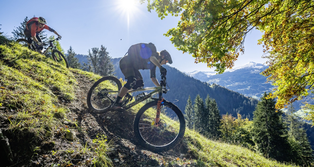
Today is a long day ahead – including a transfer with the Rhaetian Railway. So it's always worth getting up early. The highlights? A small Maiensässbeizli with a great view, a spectacular road through the Rhine Gorge and typical Lower Engadine villages.
Technique 5/6
Fitness 4/6
Highest Point  2946 m
Lowest Point  517 m
Best Season
Jan
Feb
Mär
Apr
Mai
Jun
Jul
Aug
Sep
Okt
Nov
Dez
Start
Castrisch or Ilanz
Destination
Chur / Scuol
Coordinates
46.84462199, 9.72071553

Details

Description

The stage starts in the tranquil village of Castrisch. You first follow the official Rhine Veloroute No. 3, which is only slightly uphill - perfect for taking it easy on your legs. In Valendas, you can fill your water bottle with fresh mountain spring water from the largest wooden fountain in Europe. Shortly after Carrera, turn off onto the road to Brün and continue up to Imschlacht. The road and views are fantastic. Tip: you can fortify yourself with a portion of mountain cheese, salsiz or a nut tart at the Maiensässbeizli. Continue down into the Safiental valley. Then comes another highlight: the spectacular panoramic road along the Rhine Gorge. The rock faces of the “Swiss Grand Canyon” tower 300 meters high. From Bonaduz, you cycle along side roads to Chur. The section between the capital of Graubünden and Lavin in the Lower Engadine is covered comfortably on the Rhaetian Railway.

From the Lower Engadin village of Lavin, your muscle power is needed once again. The route to the stage finish takes you along a fine gravel path via Guarda to Scuol. Below you, the bright turquoise Inn River flows. The landscape in the Lower Engadin presents a completely different picture. The sunburnt stables of the Surselva have given way to houses adorned with colorful paintings. The art of Sgraffito, the traditional stucco technique of the region, is now mastered by only a few in the valley. And in Scuol, not only does mountain spring water flow from the fountains, but even mineral water. Simply gschpunna.

Total distance and elevation gain (excluding public transport sections): 66 km, 1,400 meters of ascent, 1,900 meters of descent.

Geheimtipp

The Trans Grischun passes through inhabited areas at regular intervals, so that you can always find places to stay overnight and adapt the stages to your needs.

Sicherheitshinweis

The tour should not be undertaken in uncertain weather conditions. Weather changes are frequent in the mountains. If a rain front or similar is approaching during the hike, you should turn back in good time.

144 Emergency call, first aid

1414 Mountain rescue REGA

112 International emergency call

Ausrüstung

Helmet, gloves, cycling shoes, glasses, rain and sun protection, drinks, repair kit, first aid kit

Directions

Castrisch - Valendas - Brün - Imschlacht - Arezen - Versam - Versamer Tobel - Bonaduz - Reichenau - Tamins - Felsberg - Chur - public transport - Lavin - Guarda - Ftan - Ardez - Scuol

Directions

Public Transport

Stage tour

Anreise Information

Stage tour

Parking

Stage tour

Responsible for this content Surselva Tourism.
This content has been translated automatically.

Outdooractive Logo

This website uses technology and content from the Outdooractive platform.

Event Domat/Ems

Singing and Music Day of the Domat/Ems Schools together with Imboden Music School

Sing- und Musiktag der Schulen Domat/Ems zusammen mit Musikschule Imboden (gdl_811682475_image)
Singing and Music Day of the Domat/Ems Schools in cooperation with the Imboden Music School

Description

Date
24.05.2025 from 09:30 to 18:00 o'clock
Price
Entrance free
Ort
Mehrzweckhalle Tircal

The Domat/Ems schools are holding a singing day. 50 years ago, the Domat/Ems Teachers' Association founded the Domat/Ems Music School, which is now regionally organised in the Imboden Music School. For this reason, this day will take place in 2025 as a singing and music day in cooperation with the Imboden Music School. School classes, children's choir, youth orchestra, youth brass band and bands take part.

Veranstaltungsort

Responsible for this content Guidle.
This content has been translated automatically.

Guidle Logo

This website uses content from Guidle.

Art Gallery Domat/Ems

Art gallery Fravi Domat/Ems

Galaria Fravi
Here contemporary art finds the present.

Description

 Galaria Fravi exhibits contemporary art with a real connection to the present, enabling and encouraging fresh dialogues and discourse right on site. Currently, Galaria Fravi is showing artworks by regional, national and international artists. Galaria Fravi does not blindly follow trends and tendencies in the art market but exhibits art in its true sense - as something essential, a possibility to expand one's own existence. The gallery constantly aims to capture: To capture dialogue, positions and experiences.

Opening hours

Friday - Saturday 6pm-8pm
Sunday 4pm - 6 pm
Other dates by prior agreement.

Contact

Responsible for this content Chur Tourism.

RheinWelten on the Rhine Route

Medium
438.5 km
30:00 h
1838 mhd
2913 mhd
RheinWelten
RheinWelten

Show all 8 images

RheinWelten führt dich zum Rheinfall
The "RheinWelten" e-bike route now connects Switzerland's existing cycling destination "Rhine Route 2" with regional, cultural and culinary highlights in 15 worlds of experience.
Technique 1/6
Fitness 3/6
Highest Point  2044 m
Lowest Point  258 m
Best Season
Jan
Feb
Mär
Apr
Mai
Jun
Jul
Aug
Sep
Okt
Nov
Dez
Start
Andermatt
Destination
Basel
Coordinates
46.634663, 8.596397

Details

Description

"RheinWelten" is a unique two-wheeler offer from the source of the Rhine to Basel for enjoyable explorers. 45 local tours in 15 adventure worlds can be discovered in Switzerland and Liechtenstein on an e-bike.  The tours combine visits to producers and farm shops, visits to museums or wineries, as well as local restaurants and overnight accommodations with the most beautiful cycling routes or hikes in the regions. The adventure worlds can be visited individually as a day trip or as a multi-day bike tour. 

Selected information on the new digital platform www.rheinwelten.com encourage people to discover new things. RheinWelten takes you through 12 tourist destinations in six cantons as well as the Principality of Liechtenstein. Experience unique cultural landscapes and the culinary diversity along the Rhine by e-bike.

Geheimtipp

Not the way is the goal, but the worlds of experience of the RheinWelten.

Ausrüstung

Roadworthy (e-)trekking bike, bicycle helmet, saddlebags or trekking backpack (approx. 35 litres) with rain cover, comfortable sports shoes, possibly cycling shoes, weather-adapted and durable clothing in the multi-layer principle, if necessary cycling jersey, change of clothes, cycling gloves, air pump, bicycle tools, sun and rain protection, provisions and drinking water, drinking bottle and suitable holder, first aid kit, pocket knife, mobile phone, if necessary mobile phone holder for the handlebar, headlamp and Reflectors, maps, travel documents, toiletry bags and towels, hand detergent and clothesline.

Directions

Rhine Route 2: Andermatt - Oberalppass - Disentis - Trun - Ilanz - Versam - Reichenau - Chur - Landquart - Jenins - Maienfeld - Sargans - Buchs - Oberriet - Altstätten - St.Margrethen - Fussach (D) - Gaissau (D) - Rohrschach - Arbon - Romanshorn - Kreuzlingen - Steckborn - Stein am Rhein - Gailingen (D) - Schaffhausen - Dachsen - Ellikon - Eglisau - Zurzach - Felsenau - Laufenburg - Stein - Rheinfelden - Pratteln - Muttenz - Basel

Directions

Public Transport

Arrival by train to Andermatt possible

Anreise Information

Motorway exit Göschnen direction Andermatt

Parking

Paid parking available

Responsible for this content Graubünden Ferien.
This content has been translated automatically.

D01 - T22 Via Francisca des Lukmaniers

Medium
476.1 km
125:15 h
6852 mhd
7191 mhd
T01 - T22 Via Francisca des Lukmaniers
T01 - T22 Via Francisca des Lukmaniers (oua_24516016_0e20ae1_profile)
The "Via Francisca des Lukmaniers" is also known as the "Street of the Emperors". It leads from Constance over the Lukmanier Pass to Pavia, where it meets the Via Francigena. Here is the official route in 15 Swiss stages, plus 7 stages in Italy.
Technique 1/6
Fitness 4/6
Highest Point  1978 m
Lowest Point  55 m
Best Season
Jan
Feb
Mär
Apr
Mai
Jun
Jul
Aug
Sep
Okt
Nov
Dez
Start
Konstanz ( Münster )
Destination
Pavia Church, San Pietro in Ciel d'oro. ( - Rome)
Coordinates
47.663249, 9.175472

Details

Description

www.viafrancisca.ch/wegbeschreibung/

Geheimtipp

For more explanations on the trail, visit us on www.viafrancisca.ch

Sicherheitshinweis

November - April possibly snow stages 10 and 11, Disentis-Lukmanierpass-Olivone. Use public transport.

Ausrüstung

Backpack with rain cover, well-worn footwear, durable clothing appropriate to the season, rain and sun protection, hiking stick or trekking poles, pilgrim's passport.

Directions

www.viafrancisca.ch/wegbeschreibung

Directions

Public Transport

Public transport to Konstanz and from Pavia. All stage towns can be reached by public transport.

Anreise Information

-

Parking

-

Responsible for this content Graubünden Ferien.
This content has been translated automatically.

Dreibündenstein Trail

Medium
17.3 km
2:05 h
364 mhd
1500 mhd
Dreibündenstein Trail
Spundis

Show all 6 images

Dreibündenstein Trail
This varied and panoramic trail connects the local mountain Brambrüesch in Chur with the Domleschg.
Technique /6
Fitness /6
Highest Point  2039 m
Lowest Point  682 m
Best Season
Jan
Feb
Mär
Apr
Mai
Jun
Jul
Aug
Sep
Okt
Nov
Dez
Coordinates
46.817884, 9.503647

Details

Description

The Dreibündenstein is a summit that is both a plateau and a place steeped in history. But the ascent to it must be earned. Not only the view is worthwhile, but also the long downhill run that leads to Domleschg. 

Responsible for this content Arosa Lenzerheide.

Outdooractive Logo

This website uses technology and content from the Outdooractive platform.

Piz Scalottas - Brambrüesch

Medium
16.6 km
7:25 h
880 mhd
1611 mhd
Piz Scalottas.
Scalottas Terrasse Sommer

Show all 11 images

June Hütte Sommer
A ridge walk from Piz Scalottas to Brambrüesch. Endless , beautiful panorama included.
Technique /6
Fitness 4/6
Highest Point  2573 m
Lowest Point  1588 m
Best Season
Jan
Feb
Mär
Apr
Mai
Jun
Jul
Aug
Sep
Okt
Nov
Dez
Start
Piz Scalottas
Destination
Brambrüesch
Coordinates
46.721798, 9.510781

Details

Description

A long ascent to reach the ridge is not necessary on this tour. The two chairlifts Tgantieni and Scalottas go from Lenzerheide directly to Piz Scalottas. The time saved is needed for the full tour.

The hike leads from Piz Scalottas to Piz Danis and via Stätzerhorn and Fulhorn to Dreibündenstein. At Fulbergegg it descends towards Hühnerköpfe, Alp Malix and finally Brambrüesch, where the hike ends. From there you can take the cable car down to Chur.

The trail is exposed in places and requires surefootedness, but rewards you with a breathtaking panorama of Piz after Piz.

Geheimtipp

Those who do not want to do the whole tour can follow the hiking trail from Piz Danis towards Alp Stätz. There the cable car Heidbüel is waiting for you, with which you can comfortably ride down to Churwalden.

Ausrüstung

hiking boots

clothes suitable for the weather

Sufficient drinks and snacks for the tour

Directions

Piz Scalottas - Piz Danis - Stätzerhorn - Fulaberg - Fulhorn - Fulbergegg - Furggabüel - Hühnerköpfe - Alp Malix - Brambrüesch

Directions

Public Transport

With the sports bus from Lenzerheide to Val Sporz. The Tgantieni chairlift runs directly there. From Chur you can return to Lenzerheide by post bus.

Anreise Information

From Lenzerheide to the Val Sporz car park. As this is a route tour, however, we recommend travelling by public transport.

Parking

Val Sporz

Responsible for this content Graubünden Ferien.

T 07 Via Francisca: Chur - Bonaduz

Geschlossen
Simple
16 km
4:25 h
286 mhd
245 mhd
RhB vor Domat Ems
Pilgerweg in Plessur: Via Francisca: Chur - Bonaduz

Show all 3 images

T 07 Via Francisca: Chur - Bonaduz (oua_24511571_00f683b_profile)
The "Via Francisca" is also known as the "Road of the Emperors". It leads from Constance over the Lukmanier to Pavia, where it meets the Via Francigena.
Technique /6
Fitness 2/6
Highest Point  725 m
Lowest Point  575 m
Best Season
Jan
Feb
Mär
Apr
Mai
Jun
Jul
Aug
Sep
Okt
Nov
Dez
Start
Chur, Cathedral of the Assumption of the Virgin Mary
Destination
Bonaduz, Railway Station
Coordinates
46.847633, 9.53524

Details

Description

There are now two pilgrimage routes between Chur and Disentis, with the Via Francisca running mainly on the southern side of the Rhine, while the Way of St. James Graubünden, called Via SonGiachen, runs on the northern side. However, the two paths are almost identical up to Tamins. So it may happen that the two hikers in front are also pilgrims, but on their way from South Tyrol to Central Switzerland.
Both paths lead from Chur towards the Graubünden Oberland, called Surselva. Initially, we hike along the southern edge of the wide Rhine valley. At Domat/Ems we first cross the tracks of the Rhaetian Railway at the station, then walk between the two hills "Tuma Tschelli" and "Tuma Casti" and then circle the second to the north. This brings us first to the Rhine power plant, and after crossing the Rhine over the weir, the paths then separate to meet again briefly on the main square of Tamins. But only as far as crossing the village square, where we separate again. Now it's down to cross the Vorderrhein on the railway bridge. And so we arrive at Bonaduz.


Geheimtipp

The stages in this documentation are suggestions that each pilgrim can adapt to his wishes. however, the technical data always concern the assumption that these stages are completed in one day.

Sicherheitshinweis

.

Ausrüstung

Normal hiking/trekking equipment: backpack with rain cover, well-worn footwear, durable clothing appropriate to the season, rain and sun protection, hiking stick or trekking poles, pilgrim's passport.

Directions

Chur - River Plessur - Rose Hill - Lime kiln - Paleu sura - Domat/Ems - Tuma Casté - Power plant - Rhine weir - Tamins - Anterior Rhine - Campagna - Bonaduz

Directions

Public Transport

SBB, RhB

Anreise Information

A 13

Responsible for this content Graubünden Ferien.
This content has been translated automatically.

Gravel Bike Route Hinterrhein

Medium
202.6 km
21:00 h
5327 mhd
5326 mhd
Gravel&Road Graubünden
Reichenau

Show all 8 images

Gravel&Road Graubünden
Deep ravines, impressive panoramic views and witnesses to the history of Graubünden’s transport routes await discovery at the Posterior Rhine.
Technique 3/6
Fitness 3/6
Highest Point  2073 m
Lowest Point  559 m
Best Season
Jan
Feb
Mär
Apr
Mai
Jun
Jul
Aug
Sep
Okt
Nov
Dez
Start
Chur
Destination
Chur
Coordinates
46.861587, 9.507176

Details

Description

Your journey starts in Chur where you’ll discover the rolling hills of the Domleschg fruit and castle country. The Glaspass is an insider tip that will take you to the Beverin Nature Park. The slope is long, but not too steep. A beautiful panorama tour takes you over the Heinzenberg back to the historic trading town of Thusis. The journey continues through the natural monument of Viamala Gorge, where 300-meter high cliffs will have you in awe. The route to Andeer leads through the villages of Schamserberg, which tower high above the valley and score points for their panoramic views. The route climbs up towards Lai da Vons. Here you’ll be able to enjoy the tranquility of nature and an epic panorama. You can ride down the hill until you reach Sufers, and through the valley floor of the Rheinwald you’ll reach Splügen, Graubünden's oldest pass village. From Medels via Nufenen and Posterior Rhine you’ll continue following the young Rhine towards its source. On the other side of the Rhine, the route leads down into the valley again and you’ll ride through the idyllic landscape passing the Posterior Rhine through the valley floor of the Rheinwald back to Splügen. The ascent through the Fugscht forest is short but steep. A rapid descent brings you to Sufnersee and on the Northern shore; you ride along a little-used road towards Roflaschlucht (gorge), which guarantees breathtaking views into a wild gorge. Via Bärenburg and Pignia, the route leads to Zillis, where the Capuns Swiss champion invites you to lunch at the hotel Post. Via Reischen you ride through the Viamala to Thusis and along the Posterior Rhine through the Domleschg. From Reichenau, where the Anterior Rhine and the Posterior Rhine merge, you have a comfortable ride back to Chur.

Stages

Stage 1: Chur – Thusis

Stage 2: Thusis – Glaspass - Thusis

Stage 3: Thusis - Andeer

Stage 4: Andeer – Lai da Vons – Splügen

Stage 5: Splügen – Splügen

Stage 6: Splügen – Chur

Geheimtipp

Tip: Gravelbikers with lots of leg power will manage stages 1 and 2 in one day.

Tip: Don’t worry about carrying your luggage on this trip multi-day trip. Book the luggage transfer from hotel to hotel - convenient and easy.

Directions

Chur - Thusis: 29.8 kilometers - 404 altitude

You start the journey in Chur (593 m above sea level) and get on bike path no. 6 on the Polenweg to the imposing fortification Porta Rhaetica. From Rothenbrunnen the route makes its way over the gentle hills of the Domleschg fruit and castle country. In Paspels (757 m above sea level), you can marvel at the art works by the well-known artist Robert Indermaur. Lake Canova invites you to take a break, especially to cool down during summer. From here, it’s not far to Thusis, the historical trading place (680 m above sea level).

Thusis - Glaspass - Thusis: 36.1 kilometers - 1659 altitude

The Glaspass is an insider tip. The MTB route no. 90 takes you from Thusis (680 m above sea level) past the villages of Urmein and Tschappina into the Beverin nature park. The ascent to the Glaspass (1846 m above sea level) is long, but in addition to steep ramps, there are always flat roads where you can relax a little. Once you arrive at the pass, it’s worthwhile to ride a few meters further to the Beverin mountain inn. You definitely deserve to take a little break here! You only follow the road down the valley for a little while longer now, and then turn onto MTB route no. 623 "Heinzenberger Maiensäss Route". This will lead you high above the Domleschg over an impressive panoramic path. From Obergmeind (1813 m above sea level) via Plau to Prau da l'Alp, you’ll encounter several short steep slopes, but the great view makes up for it. The rapid descent to Präz (1170 m above sea level) and Raschlegnas will definitely put a smile on your face. The trail leads you through Cruttis Tobel and Tartar back to Thusis (680 m above sea level).

Thusis - Andeer: 27.1 kilometers - 983 altitude

From Thusis (680 m above sea level), the old Viamala road leads through the "lost hole" to Rongellen. The 300-meter high cliffs of the Viamala Gorge natural monument will amaze you. The road runs high over the Viamala and looking into the gorge is worth it. A stop at the Visitor Center not only gives you a chance to rest, but also brings you closer to the AlpTransit’s history. The route continues in the direction of the Muntogna da Schons and Schamserberg villages. Through Zillis (945 m above sea level) and Donat you’ll reach Lohn (1585 m above sea level), Mathon and Wergenstein. A great view over the whole valley, including the fantastic road to Wergenstein, which towers high above the Schamsertal will be your reward. A nice descent on an agricultural road brings you to Casti. An imposing wooden bridge takes you to Clugin, before you start the last stretch of the journey riding on a dirt road to Andeer (982 m above sea level). Andeer is known for its healing spring. Enjoy the mineral bath with a wellness area – it’s a guaranteed rest for your sore muscles.

Andeer - Lai da Vons - Splügen: 22 kilometers - 1237 altitude

The road from Andeer (982 m above sea level) in the direction of Lai da Vons ascends without mercy. As you climb higher and higher through the forest of the Tranter Tschaingel, you’ll get to enjoy wonderful views over the whole valley. At Pastgaglia, you have almost already climbed up one thousand meters and will leave the tree line behind you. There will hardly be any flat roads to offer a chance to take a breath. You do have to persevere for a bit. Turn left once you reach Larisch. The natural road is now a bit bumpy. Shortly after the highest point of the climb (2050 m above sea level), you’ll be able to see the Lai da Vons (1994 m above sea level). In the tranquility of nature, enjoy the epic panorama, pat yourself on the back and roll down the mountain to Sufer's. The cycle route no. 505 "Rheinwaldroute" takes you through the valley floor of the Rheinwald to Splügen (1458 m above sea level), the oldest pass village in Graubünden.

Splügen - Splügen: 33.2 kilometers - 361 altitude

From Splügen (1458 m above sea level) follow the Rhine towards its source. Via Medels and Nufenen you’ll ride through the Rheinwald to the Posterior Rhine (1620 m above sea level), the oldest Walser settlement in Graubünden. From the Posterior Rhine it’s not far to the shooting range. During the week, the trip ends here, but on the weekends, you can reach the valley via a natural road in the direction of the Rheinquellhorn. On the other side of the Rhine, the route leads down the valley on a dirt road. Via the old Landbrugg, you’ll return to the village Posterior Rhine. If you like taking the easy path, take bicycle route no. 6 to Nufenen. Riders who are interested in a more technical road should tackle the meadow path on the other side of the Rhine. From Nufenen the cycle route no. 505 "Rheinwaldroute" leads down into the valley. You’ll make your way back to Splügen (1458 m above sea level) while riding along the Posterior Rhine through the valley floor of the Rheinwald.

Splügen - Chur: 58.6 kilometers - 580 altitude

You’ll leave Splügen (1458 m above sea level) on cycle route no. 505 "Rheinwaldroute" down the valley. At first, the road heads a few meters in the direction of Splügen Pass.

In the first bend, you’ll turn left and reach a short but steep climb through the Fugscht forest (1589 m above sea level). A rapid descent brings you to the Sufnersee, whose water shines turquoise. On the Northern shore of the lake, you’ll take the little-traveled road in the direction of Roflaschlucht (gorge). Even from the road, you’re guaranteed great views of the wild canyon. Through Bärenburg (1040 m above sea level), you’ll take a side road to Pignia. From here, a nature trail leads to Zillis (945 m above sea level). An insider's tip is Capun's, a local specialty - prepared by the Swiss Capuns champion at the hotel Post. Strengthened from the food the route leads you over Reischen (1024 meters) through the Viamala gorge to Thusis (680 m above sea level). Cycle route no. 6 takes you along the Posterior Rhine through the Domleschg. In Reichenau, where the Anterior Rhine merges the Rhine Anterior, change onto the Rheinrad route no. 2 and a comfortable ride back to Chur (593 m above sea level).

Responsible for this content Graubünden Ferien.
This content has been translated automatically.