discover.swiss ID
osm_1684184
discover.swiss Additional Type
City
Geschlossen
Medium
18 km
1:15 h
300 mhd
300 mhd
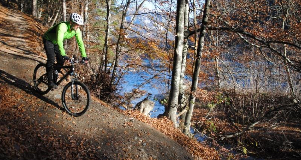
Rheinauen Ufer
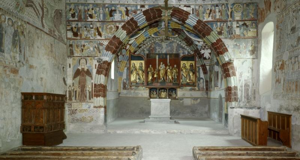
Kirche Sogn Gieri Chor

Show all 4 images

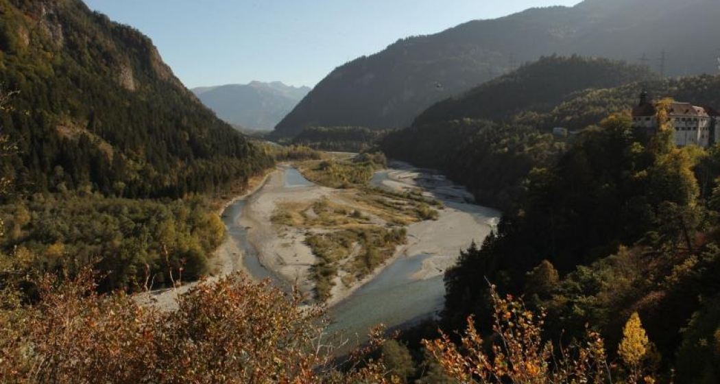
Panorama Rheinauen
This pleasant mountain bike tour takes you along the Rhäzünser Rheinauen and features unique views of these wetlands of national importance. It also takes in a visit of the church at Sogn Gieri, famous for its murals, considered unrivalled by art historians.
Technique /6
Fitness 2/6
Highest Point   m
Lowest Point   m
Best Season
Jan
Feb
Mär
Apr
Mai
Jun
Jul
Aug
Sep
Okt
Nov
Dez
Start
Rhäzüns
Destination
Rhäzüns
Coordinates
46.799042540309, 9.3991089621148

Details

Description

From the railway station at Rhäzüns we soon reach the water's edge, our nostrils filling with the fresh air from the wetlands. The Rhäzünser Rheinauen are among the most best preserved wetland areas in Switzerland and are considered of national importance. We continue along the single trail as it rises and falls until we reach the flatter section along the Rhine dam after Rothenbrunnen. Along the Polenweg to Reichenau the sparse forest lets us glimpse wonderful views of these unique Rheinauen wetlands. Along this section of the route the Hinterrhein meanders from one side of the valley to the other. In Reichenau, the confluence of the Hinterrhein and Vorderrhein, we once again switch to the other side of the river and roll on towards Bonaduz. After a short, steep ascent up to the high plateau of Rhäzüns and Bonaduz the route continues past Sogn Gieri (St. Georg), which is well worth a stop. The Romanesque church, more than 1,000 years old, is famous beyond Switzerland's borders for its astonishing and beautifully preserved murals. After the rewarding visit of Sogn Gieri we happily cycle back to Rhäzüns.

Directions

Rhäzüns - Saulzas - Undrau - Rothenbrunnen - Polenweg - Schafweide - Stn. Reichenau-Tamins - Nulez - Plazzas - Sogn Gieri - Rhäzüns

Directions

Public Transport

By train to Rhäzüns.

Anreise Information

Take the A13/E432 in the direction of and to Rhäzüns.

Responsible for this content SwitzerlandMobility.
This content has been translated automatically.

Medium
260 km
0:00 h
11100 mhd
10300 mhd
43 Jakobsweg Gesamttour (20 Etappen)

Show all 7 images

43 Jakobsweg Gesamttour (20 Etappen)
Scenic pass and valley landscapes on the Jakobsweg route through multifaceted Graubünden. Cultural and historical signs of the Santiago pilgrim’s path – and stunning scenery inviting one to reflect on own values and the beauty of nature.
Technique /6
Fitness 4/6
Highest Point   m
Lowest Point   m
Best Season
Jan
Feb
Mär
Apr
Mai
Jun
Jul
Aug
Sep
Okt
Nov
Dez
Start
Müstair
Destination
Oberalppass
Coordinates
46.629913962633, 10.450571784142

Details

Description

Graubünden’s 150 km route between Müstair and Mustér (Disentis) presents the stunning valley landscapes of the Münstertal and dreamy Susaunatal, deep Schanfigg and varied Cadi– together with the four challenging passes, Costainer, Scaletta, Strela and Chrüzlipass.

 Physical efforts are however rewarded by the sight of picturesque Graubünden villages nestled between beautiful valley landscapes. Each valley portrays an independent community concerning history, culture, religion and laws. In fact, Graubünden reflects a concentrated picture of European variety – where the Jakobsweg Graubünden leads from east to west through the impressive region.

 Müstair with signs of Middle Ages lifestyle – and preceding Chur, Switzerland’s oldest town, Tschiertschen’s cathedral (Jakobskirche), displaying a mural from the hand of the Waltensburg master. And before Disentis, numerous traces remind one of the ancient pilgrims’ paths. From Amsteg the way then leads through the Urnerland to the National Route 4 ViaJacobi.

Geheimtipp

Book Package «Jakobsweg Tour»  and benefit from the free luggage transport from hotel to hotel.

Sicherheitshinweis

Attention stage 43.07:

In October and from the end of April to the end of May, the Swiss Army conducts shooting exercises in the S-chanf area. Thus, the area between S-chanf  and the mountain inn Dürrboden over the Scaletta Pass is closed, or it is life-threatening to walk there as a pilgrim.

Further information:

Directions

Directions

Public Transport

This tour can be facilitated by public transport.

Are you planning a multi-day tour?  Buy our graubündenPass and enjoy free travel throughout Graubünden. Available here!

Responsible for this content SwitzerlandMobility.
This content has been translated automatically.

Medium
105 km
39:05 h
3300 mhd
4800 mhd
85 Senda Sursilvana (5 Etappen)
Disla

Show all 8 images

Lag da Pigniu
The Senda Sursilvana affords an insight into a whole region, one which holds many natural and cultural treasures. A high-level hike with several detours to the banks of the young Rhine.
Technique /6
Fitness 6/6
Highest Point   m
Lowest Point   m
Best Season
Jan
Feb
Mär
Apr
Mai
Jun
Jul
Aug
Sep
Okt
Nov
Dez
Start
Oberalppass
Destination
Chur
Coordinates
46.659430793349, 8.6712675537454

Details

Description

The Surselva is more than a mere mountain valley. The Surselva - meaning «above the forest» – is a world apart, with its own language (Sursilvan), its own history shaped by the Disentis Monastery and the mountain passes, its own breed of men and a natural character shaped by one particular element, one which is continually gaining in value: water. It’s for a good reason that the official source of the Rhine rises at Tomasee near the Oberalppass. The water, collected in dozens of reservoirs is an energy provider. It has also eaten its way through the world’s largest mapped rockslide at Flims. It has created the imposing Ruinaulta Gorge, which can hardly be beaten for ruggedness – particularly when seen from the vantage platform at Conn.

The hike through the Surselva leads through an intact landscape but also arouses culturally historic curiosity, whether with the paintings in the Waltensburg Protestant Church or in the light of the mystifying menhir at Falera.The finale of four very varied hiking days is a tour around the old town quarter of Chur, Switzerland’s oldest town.

Book Package «Senda Sursilvana»  and benefit from the free luggage transport from hotel to hotel.

Further Information in German

Directions

Directions

Public Transport

This tour can be simplified by public transport.

Are you planning a multi-day tour?  Buy our graubündenPass and enjoy free travel throughout Graubünden. Available here!

Responsible for this content SwitzerlandMobility.
This content has been translated automatically.

64 km
4:30 h
760 mhd
1350 mhd
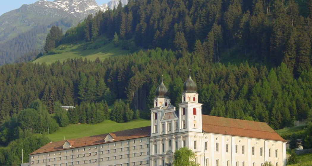
Benediktiner Kloster
02.02 Rhein-Route Etappe 2 Disentis - Chur (oua_8580502_6403454_profile)
The Surselva is the largest Romansch-speaking area in the Grisons region. Up and down we go, following the burbling Rhine through pretty little hamlets. The amazing wild gorge of the Anterior Rhine is known as the Grand Canyon of Switzerland. The day ends in Chur, the oldest Swiss town north of the Alps.
Technique /6
Fitness 6/6
Highest Point   m
Lowest Point   m
Best Season
Jan
Feb
Mär
Apr
Mai
Jun
Jul
Aug
Sep
Okt
Nov
Dez
Start
Disentis
Destination
Chur
Coordinates
46.705270682288, 8.8554213182519

Details

Description

Surselva - «above the forest» - Graubunden’s largest Romansch-speaking region. The wild gorge of the Vorderrhein is awe-inspiring - Switzerland’s Grand Canyon. Chur, the oldest town north of the Alps boasts the highest density of restaurants.

Directions

Disentis - Trun - Ilanz - Rheinschlucht - Tamins - Chur

Responsible for this content SwitzerlandMobility.
This content has been translated automatically.

Simple
13 km
3:30 h
360 mhd
300 mhd
Kathedrale St. Mariä Himmelfahrt
43.12 Chur - Tamins, Jakobsweg Graubünden

Show all 3 images

43.12 Chur - Tamins, Jakobsweg Graubünden (oua_9702316_e2802cc_profile)
Shortly after the start there is a superb view of Chur. The route leads across a ravine, fields and meadows to Domat/Ems, which was built around seven hills. We continue along the Senda Sursilvana to Tamins.
Technique /6
Fitness 4/6
Highest Point   m
Lowest Point   m
Best Season
Jan
Feb
Mär
Apr
Mai
Jun
Jul
Aug
Sep
Okt
Nov
Dez
Start
Chur
Destination
Tamins
Coordinates
46.84741892032, 9.5319447087352

Details

Description

A view over Chur from the Rosenhügel. Through a cutting, over fields and meadows, to Domat/Ems - built around 7 hills. And along the Senda Sursilvana river to Tamins, where the Vorder and Hinterrhein meet. A visit to Rhäzüns and the famous Kirche Son Gieri with Jakobus display is well recommended.

Responsible for this content SwitzerlandMobility.

Geschlossen
Difficult
375 km
69:20 h
15300 mhd
15300 mhd
90 Graubünden Bike - Gesamttour
Weissfluh by Andrea Badrutt

Show all 4 images

Vals@Stefan Schlumpf
Breathtaking Alpine bike tour with a vast total height difference, sensational passes and incredible long- distance views. Lovely trails, little asphalt. Mountain bikers will really be in their element on this route, which demands fitness and technique
Technique /6
Fitness 6/6
Highest Point   m
Lowest Point   m
Best Season
Jan
Feb
Mär
Apr
Mai
Jun
Jul
Aug
Sep
Okt
Nov
Dez
Start
Trun
Destination
Trun
Coordinates
46.743138415152, 8.9909979408772

Details

Description

The imposing castle ruins of Zignau and Schlans face each other on opposite sides of the gentle Surselva slopes, as if resembling a gateway to mark the beginning or end of this breathtaking bike tour. This tour quite simply has everything a biker could wish for.

An Alpine to high-Alpine route with numerous height metres, testing passes, breathtaking views, remote valleys and sensational trails. A gentle, simple meadow trail winds over the Durannapass, the ascent to the Strelapass is steep, rough and challenging and the Kunkelspass is romantic biking bliss. The top highlight is the seemingly unspectacular section between Filisur and Lenzerheide. This cave, meadow, forest, tunnel and reed-bed trail is great fun and will also give less experienced bikers a true biking tingle.

The technically and physically demanding route is recommended for experienced bikers and best travelled in high summer and early autumn.

Sicherheitshinweis

In Davos Klosters there are many alps with livestock farming. Therefore, you can expect to encounter animals everywhere. Please be considerate and drive the terrain at an appropriate speed.

Directions

Responsible for this content SwitzerlandMobility.

SAC hut tour: Tamins - Ringelspitzhütte (stage 1)

9.3 km
4:00 h
1359 mhd
0 mhd
Tamins is the starting point of this hut hike. On the northern edge of the village, you walk on a forest road through the Sgai forest in a northerly direction to the Lavoitobel. On a hiking trail you continue along the Lavoibach through the ravine. Shortly before leaving the partly steep ravine, you cross the rushing stream on a bridge. From here it is only a few metres in altitude to the Ringelspitzhütte.
Technique 2/6
Fitness /6
Highest Point  1992 m
Lowest Point  624 m
Best Season
Jan
Feb
Mär
Apr
Mai
Jun
Jul
Aug
Sep
Okt
Nov
Dez
Coordinates
46.8539, 9.53159

Details

Description

Guidelines

  • Duration: 4 hours 
  • Altitude difference: +1359m (start bus stop Tamins Unterdorf)
  • Distance: 9.3km

Directions

Anreise Information

  • Bus No. 10 in the direction of Tamins Unterdorf 
  • Postbus in the direction of Falera Center (get off at Tamins Unterdorf)

Responsible for this content Chur Tourism.
This content has been translated automatically.

SAC Hut Tour: Ringelspitzhütte - Calanda Hut (Stage 2)

12.6 km
6:00 h
854 mhd
766 mhd
From the Ringelspitzhütte, the hike continues over the Kunkelspass to the Calanda Hut. A charming high-altitude hike high above the Graubünden Rhine Valley awaits you. Enjoy the panorama and the insight into the UNESCO World Heritage Site Sardona.
Technique 0/6
Fitness 0/6
Highest Point  2083 m
Lowest Point  1339 m
Best Season
Jan
Feb
Mär
Apr
Mai
Jun
Jul
Aug
Sep
Okt
Nov
Dez
Coordinates
46.8539, 9.53159

Details

Description

Guidelines

  • Duration: approx. 6 hours
  • Distance: 12.5km
  • Altitude difference: +850m/-800m

Responsible for this content Chur Tourism.
This content has been translated automatically.

Castle Tamins

Reichenau Castle

Weinbau von Tscharner · Schloss Reichenau
The location of Reichenau Castle at the confluence of the Vorder and Hinterrhein rivers is unique.

Description

Reichenau castle lies at the birthplace of the Alpine Rhine, where the two arms of the Rhine join together. Built in the 16th century by the clergy family Schauenstein, the castle looks back on a long and eventful history. At one time it even housed the last King of France.

Today, the historic building serves as a winery for the Tscharner family. Visit and meet wine producer Gian Battista von Tscharner and his smooth, honest wines during a castle tour with wine tasting.

Contact

Responsible for this content Chur Tourism.

City Tamins

Tamins

Reichenau-Tamins
Zusammenfluss des Rheins

Show all 5 images

Schloss Reichenau
Tamins and Reichenau are two villages that for most people have merged into one over time, located an the juncture of Vorder and Hinter Rhine. The Rhaetian Railway station where the lines to Surselva valley and to central Graubünden separate isn't called Reichenau-Tamins for nothing. Kunkels Pass is a well-known location for mountain bikers from near and far. The peak of Ringelspitze is the top of Tamins at 3,247 metres above sea level. Tamins shares its peak with the neighbouring village of Trin and with the canton of St. Gallen across the pass.

Description

The uniquely sunny location makes Reichenau and Tamins a fantastic place to live. Inhabitants profit from a well-developed infrastructure and modern school facilities. Locals and tourists alike find excellent public transport links. Tamins is located along the main north-to-south traffic axis, the A13 motorway.

The natural landscape around Tamins is one of a kind, with many hiking trails through forests and meadows and a diverse flora and fauna. The diversity of nature's beauty knows no bounds in this wonderful area. The unique oak forest, the adjacent rough pastures and the dry landscapes are of national importance. The natural reserve Rattena is characterised by its species-rich hedges, old deciduous trees, dry walls and reptile habitats, ponds and the Valtonis creek. The adjacent forests also have an impressive biodiversity. More than 20 different species of deciduous trees can be found here, amongst them some "exotic" species like the downy oak and the chestnut tree. The entire area is integrated into the Eichwald forest reserve. An exciting nature learning trail introduces visitors to the beauty and the inner workings of this unique landscape.

Where earth meets the skies, atop the Kunkels Pass at 1,357 metres above sea level, the municipality of Tamins owns the mountain restaurant "überuf. Here, hikers and cyclists can refill their batteries, for example with locally produced cheese from the alp at "überuf". For mountaineers wanting to climb up to Ringelspitze, the Ringelspitz cabin offers shelter and an ideal starting point for the expedition.

History

Excavations at burial sites suggest that the area has been inhabited since the Iron Age (around 500 BCE). The Romans were here, too, witnessed by a number of graves and Roman coins that were found top the Kunkels Pass. The grave of an Alemannic warrior suggests that the area remained settled after the fall of the Roman empire. The first written sources mentioning Tamins date back to 1399. In 1540, the parish adopted the Reformation. The village was repeatedly devastated by fires, for instance in the years 1616 and 1631. In 1799, it was set ablaze during the French invasion. The last great fire occurred in 1905.

Reichenau

The name Reichenau goes back to the monastery of the same name at Lake Constance which purchased property in this area during the early Middle Ages. Reichenau Castle was probably built when the seat of the house of Schauenstein was moved to Reichenau in the early 17th century. Around 1755, the residential buildings and workshops in the castle were extended under supervision of Johann Anton Buol.

In 1793 Johann Baptista von Tscharner's educational institution called "Philanthropinum" moved to Reichenau Castle. Teachers like Johann Peter Nesemann and Johann Heinrich Zschokke made the school a renowned institution until its end in 1798. Even Louis-Philippe I, later king of France, thought at Reichenau Castle for some time, adopting the pseudonym "Monsieur Chabos". In 1820 the castle came into possession of the Planta family who gave it its current appearance. Especially noteworthy are the dining room and a small hall in the garden wing.

Kunkels Pass

A particular challenge for bikers is the Kunkels Pass leading to Tamina valley, itself part of the canton of St. Gallen. In old times the route was often used by smugglers trying to avoid tolls around Chur and elsewhere, but it was also an alternate route whenever the Rhine flooded or bridges spanning it had collapsed. 

Rhine gorge

Tamins is the gate to the fascinating world of the Rhine gorge at Ruinaulta. (For water sports, it's the destination!) It is one of the greatest and most diverse landscapes of the Alps. A wild gorge with a raging river, white cliffs and vast forests. Quiet lakes are filled as if by magic and rare birds breed in the forests along the river. Even orchids can be found in this little Paradise. The Ruinaulta is also easy to discover and explore on your own. In the forests and along the Rhine you will find a dense network of hiking trails, various cycling routes and beautiful rest areas. Three stations of the Rhaetian railway (Trin, Versam-Safien and Valendas-Sagogn) are located at either entrance and even in the middle of the Rhine gorge. Those wanting to get to know the Rhine gorge intimately can do so riding on the waves of the river. Ruinaulta offers one of Europe's most exciting routes for canoeing, kayaking and river rafting!

Contact

Responsible for this content Chur Tourism.