Please note: from 10. until and including 27. June, the facilities in the indoor pool building will be closed for the annual maintenance works. Sauna and gym will reopen on 21. June.

Additional infos.
discover.swiss ID
osm_1684184
discover.swiss Additional Type
City

Castle Tamins

Reichenau Castle

Weinbau von Tscharner · Schloss Reichenau
The location of Reichenau Castle at the confluence of the Vorder and Hinterrhein rivers is unique.

Description

Reichenau castle lies at the birthplace of the Alpine Rhine, where the two arms of the Rhine join together. Built in the 16th century by the clergy family Schauenstein, the castle looks back on a long and eventful history. At one time it even housed the last King of France.

Today, the historic building serves as a winery for the Tscharner family. Visit and meet wine producer Gian Battista von Tscharner and his smooth, honest wines during a castle tour with wine tasting.

Contact

Responsible for this content Chur Tourism.

City Tamins

Tamins

Reichenau-Tamins
Zusammenfluss des Rheins

Show all 5 images

Schloss Reichenau
Tamins and Reichenau are two villages that for most people have merged into one over time, located an the juncture of Vorder and Hinter Rhine. The Rhaetian Railway station where the lines to Surselva valley and to central Graubünden separate isn't called Reichenau-Tamins for nothing. Kunkels Pass is a well-known location for mountain bikers from near and far. The peak of Ringelspitze is the top of Tamins at 3,247 metres above sea level. Tamins shares its peak with the neighbouring village of Trin and with the canton of St. Gallen across the pass.

Description

The uniquely sunny location makes Reichenau and Tamins a fantastic place to live. Inhabitants profit from a well-developed infrastructure and modern school facilities. Locals and tourists alike find excellent public transport links. Tamins is located along the main north-to-south traffic axis, the A13 motorway.

The natural landscape around Tamins is one of a kind, with many hiking trails through forests and meadows and a diverse flora and fauna. The diversity of nature's beauty knows no bounds in this wonderful area. The unique oak forest, the adjacent rough pastures and the dry landscapes are of national importance. The natural reserve Rattena is characterised by its species-rich hedges, old deciduous trees, dry walls and reptile habitats, ponds and the Valtonis creek. The adjacent forests also have an impressive biodiversity. More than 20 different species of deciduous trees can be found here, amongst them some "exotic" species like the downy oak and the chestnut tree. The entire area is integrated into the Eichwald forest reserve. An exciting nature learning trail introduces visitors to the beauty and the inner workings of this unique landscape.

Where earth meets the skies, atop the Kunkels Pass at 1,357 metres above sea level, the municipality of Tamins owns the mountain restaurant "überuf. Here, hikers and cyclists can refill their batteries, for example with locally produced cheese from the alp at "überuf". For mountaineers wanting to climb up to Ringelspitze, the Ringelspitz cabin offers shelter and an ideal starting point for the expedition.

History

Excavations at burial sites suggest that the area has been inhabited since the Iron Age (around 500 BCE). The Romans were here, too, witnessed by a number of graves and Roman coins that were found top the Kunkels Pass. The grave of an Alemannic warrior suggests that the area remained settled after the fall of the Roman empire. The first written sources mentioning Tamins date back to 1399. In 1540, the parish adopted the Reformation. The village was repeatedly devastated by fires, for instance in the years 1616 and 1631. In 1799, it was set ablaze during the French invasion. The last great fire occurred in 1905.

Reichenau

The name Reichenau goes back to the monastery of the same name at Lake Constance which purchased property in this area during the early Middle Ages. Reichenau Castle was probably built when the seat of the house of Schauenstein was moved to Reichenau in the early 17th century. Around 1755, the residential buildings and workshops in the castle were extended under supervision of Johann Anton Buol.

In 1793 Johann Baptista von Tscharner's educational institution called "Philanthropinum" moved to Reichenau Castle. Teachers like Johann Peter Nesemann and Johann Heinrich Zschokke made the school a renowned institution until its end in 1798. Even Louis-Philippe I, later king of France, thought at Reichenau Castle for some time, adopting the pseudonym "Monsieur Chabos". In 1820 the castle came into possession of the Planta family who gave it its current appearance. Especially noteworthy are the dining room and a small hall in the garden wing.

Kunkels Pass

A particular challenge for bikers is the Kunkels Pass leading to Tamina valley, itself part of the canton of St. Gallen. In old times the route was often used by smugglers trying to avoid tolls around Chur and elsewhere, but it was also an alternate route whenever the Rhine flooded or bridges spanning it had collapsed. 

Rhine gorge

Tamins is the gate to the fascinating world of the Rhine gorge at Ruinaulta. (For water sports, it's the destination!) It is one of the greatest and most diverse landscapes of the Alps. A wild gorge with a raging river, white cliffs and vast forests. Quiet lakes are filled as if by magic and rare birds breed in the forests along the river. Even orchids can be found in this little Paradise. The Ruinaulta is also easy to discover and explore on your own. In the forests and along the Rhine you will find a dense network of hiking trails, various cycling routes and beautiful rest areas. Three stations of the Rhaetian railway (Trin, Versam-Safien and Valendas-Sagogn) are located at either entrance and even in the middle of the Rhine gorge. Those wanting to get to know the Rhine gorge intimately can do so riding on the waves of the river. Ruinaulta offers one of Europe's most exciting routes for canoeing, kayaking and river rafting!

Contact

Responsible for this content Chur Tourism.

Mountain Restaurant Tamins

Berggasthaus Überuf Kunkelspass

Berggasthaus Überuf Kunkelspass

Show all 3 images

Berggasthaus Überuf Kunkelspass
Mountain inn in the Grisons mountains. Both sports enthusiasts and bon vivants will get their money's worth here - whether you're travelling at a leisurely pace or fast; there's something for everyone to experience on the Kunkelspass.

Description

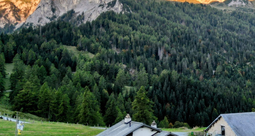
On a beautiful plateau on the historic Kunkelspass. Mountain inn next to the cow farm with the opportunity to watch the milking. Sunny, cosy terrace and rustic parlour. Simple dishes during the day, special menus in the evening. Our mountain inn has various beds in the tourist dormitory (20 places) as well as two double rooms and a family room with 4 beds. Showroom of the Sardona Arena tectonics. Can also be used as a conference or meeting room. Ideal, around 50 km long, bike tour from Chur. Hiking trails off the road. By car / motorbike via Tamins or Bad Ragaz/Vättis. Driving ban . Permits possible with EasyPark. CHF 20.00 car / CHF 10.00 motorbike.

Contact

Berggasthaus Überuf Kunkelspass

Kunkelsstrasse 89, 7315 Tamins

Responsible for this content Graubünden Ferien.

Rhine Gorge Railway Hike: Reichenau - Trin Station

Simple
4.9 km
1:15 h
17 mhd
13 mhd
Wandersteg am Rhein
Blick auf Reichenau-Tamins und das Churer Rheintal

Show all 6 images

Ausblick auf den Rhein und den Wanderweg
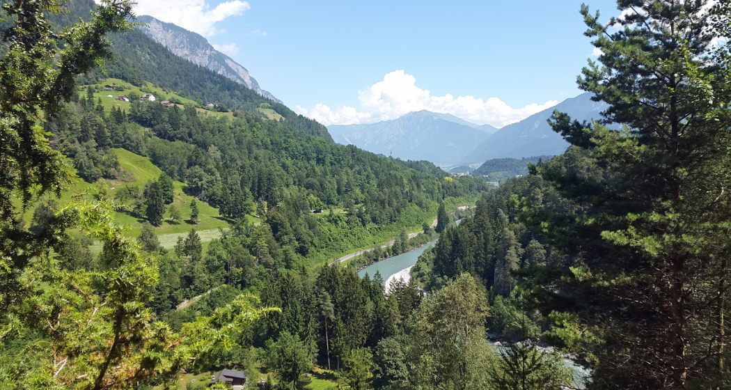
A rewarding, easy hike along the Rhine Gorge from Reichenau to Trin Station.
Technique /6
Fitness 1/6
Highest Point  608 m
Lowest Point  591 m
Best Season
Jan
Feb
Mär
Apr
Mai
Jun
Jul
Aug
Sep
Okt
Nov
Dez
Start
Reichenau railway station
Destination
Trin railway station
Coordinates
46.823889, 9.412874

Details

Description

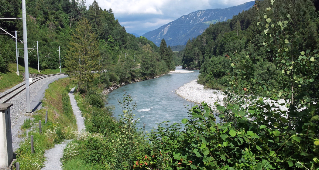
The hike starts at Reichenau railway station, where you first cross the confluence of the Vorderrhein and Hinterrhein rivers and then walk along the Vorderrhein to Trin Station. After an initial stretch through the village, a beautiful hiking trail follows, always along the Rhine. In between there are always beautiful vantage points and good opportunities for breaks or barbecues. The hike is also ideal for families with small children, who can already hike on their own or are otherwise carried in a carry backpack (but not recommended for prams). At Trin Station you can optionally cross the Rhine on the suspension bridge.

Responsible for this content Chur Tourism.

Kunkelspass round trip

Difficult
56 km
4:30 h
963 mhd
963 mhd
Aufstieg zum Kunkelspass
Kunkelspass - hier fährt kaum ein Biker vorbei

Show all 8 images

Kunkelspass
The Kunkels Pass bike tour is a real classic and well known among mountain bikers, cyclists and e-bikers. You completely ride around the impressive Calanda mountain on this tour.
Technique 1/6
Fitness 5/6
Highest Point  1357 m
Lowest Point  514 m
Best Season
Jan
Feb
Mär
Apr
Mai
Jun
Jul
Aug
Sep
Okt
Nov
Dez
Start
Chur, train station
Destination
Chur, train station
Coordinates
46.85416, 9.528797

Details

Description

From the Chur railway station, follow the national cycling route no. 2 (Rhine route) and cycle at the riverbank to Landquart. In Landquart, cross the Rhine river and later at Sarelli go left and follow the road up to Pfäfers and carry on to Vättis through a rugged basin with almost vertical mountain slopes.

The final ascent to the pass takes you away from the traffic through unspoilt, splendid countryside. Shortly past the Eggwald mountain restaurant, you leave the Canton of St. Gallen and enter Grisons again before reaching the pass summit.

When crossing from the Tamina Valley into the Rhine Valley, the great differences at either side of the water divide are amazing. The final descent to Tamins is a special treat, offering views of the confluence of the Vorder and Hinter Rhine. From Tamins take the national cycle route No. 2 (Rhine route) back to Chur (or return by rail from Reichenau station).

Responsible for this content Chur Tourism.
Rhine Gorge Suspension Bridge - Wackenau Ruin (656.4)

Geschlossen
Medium
12.3 km
3:25 h
160 mhd
157 mhd
Wanderung zwischen Bahngleis und Rheinfluss
Ausblick auf den Rhein und den Wanderweg

Show all 6 images

Wandersteg am Rhein
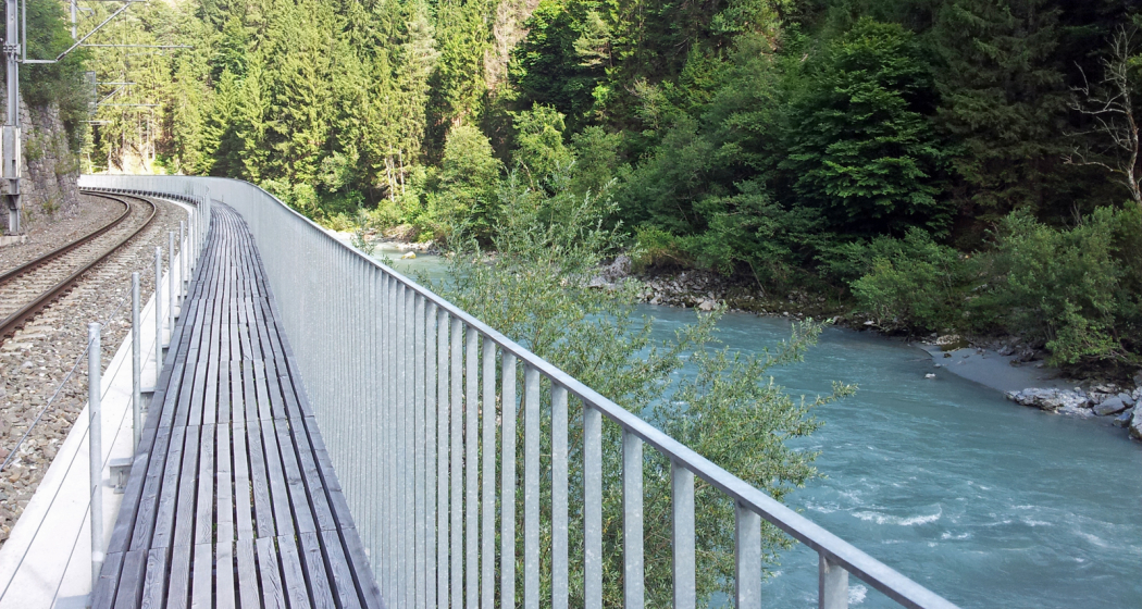
Great round trip through the Rhine Gorge with crossing the bridge Punt Ruinaulta near Trin and the ruins and viewing platform Wackenau as another highlight.
Technique 2/6
Fitness 3/6
Highest Point  749 m
Lowest Point  591 m
Best Season
Jan
Feb
Mär
Apr
Mai
Jun
Jul
Aug
Sep
Okt
Nov
Dez
Start
Reichenau station
Destination
Reichenau station
Coordinates
46.824711, 9.408565

Details

Description

This circuit leads from Reichenau, the confluence of the Vorderrhein and Hinterrhein, along the Vorderrhein to Trin Station. Here you cross the Rhine over a 100 meter long suspension bridge (Punt Ruinaulta). A short, steep ascent follows. On the further way it is worth visiting the ruins of Wackenau and the viewing platform, which is slightly below the ruins and accessible from May to October. Through the Bonaduz forest you then return to Reichenau.

Responsible for this content Chur Tourism.
This content has been translated automatically.

Trans Grischun: Castrisch–Scuol (Stage 3)

Difficult
134.7 km
0:00 h
6402 mhd
5820 mhd
Abfahrt ins Safiental
Aufstieg nach Guarda im Unterengadin

Show all 13 images

Biketransport mit dem Zug oder Postauto ist in Graubünden ein Kinderspiel
Today is a long day ahead – including a transfer with the Rhaetian Railway. So it's always worth getting up early. The highlights? A small Maiensässbeizli with a great view, a spectacular road through the Rhine Gorge and typical Lower Engadine villages.
Technique 5/6
Fitness 4/6
Highest Point  2946 m
Lowest Point  517 m
Best Season
Jan
Feb
Mär
Apr
Mai
Jun
Jul
Aug
Sep
Okt
Nov
Dez
Start
Castrisch or Ilanz
Destination
Chur / Scuol
Coordinates
46.84462199, 9.72071553

Details

Description

The stage starts in the tranquil village of Castrisch. You first follow the official Rhine Veloroute No. 3, which is only slightly uphill - perfect for taking it easy on your legs. In Valendas, you can fill your water bottle with fresh mountain spring water from the largest wooden fountain in Europe. Shortly after Carrera, turn off onto the road to Brün and continue up to Imschlacht. The road and views are fantastic. Tip: you can fortify yourself with a portion of mountain cheese, salsiz or a nut tart at the Maiensässbeizli. Continue down into the Safiental valley. Then comes another highlight: the spectacular panoramic road along the Rhine Gorge. The rock faces of the “Swiss Grand Canyon” tower 300 meters high. From Bonaduz, you cycle along side roads to Chur. The section between the capital of Graubünden and Lavin in the Lower Engadine is covered comfortably on the Rhaetian Railway.

From the Lower Engadin village of Lavin, your muscle power is needed once again. The route to the stage finish takes you along a fine gravel path via Guarda to Scuol. Below you, the bright turquoise Inn River flows. The landscape in the Lower Engadin presents a completely different picture. The sunburnt stables of the Surselva have given way to houses adorned with colorful paintings. The art of Sgraffito, the traditional stucco technique of the region, is now mastered by only a few in the valley. And in Scuol, not only does mountain spring water flow from the fountains, but even mineral water. Simply gschpunna.

Total distance and elevation gain (excluding public transport sections): 66 km, 1,400 meters of ascent, 1,900 meters of descent.

Geheimtipp

The Trans Grischun passes through inhabited areas at regular intervals, so that you can always find places to stay overnight and adapt the stages to your needs.

Sicherheitshinweis

The tour should not be undertaken in uncertain weather conditions. Weather changes are frequent in the mountains. If a rain front or similar is approaching during the hike, you should turn back in good time.

144 Emergency call, first aid

1414 Mountain rescue REGA

112 International emergency call

Ausrüstung

Helmet, gloves, cycling shoes, glasses, rain and sun protection, drinks, repair kit, first aid kit

Directions

Castrisch - Valendas - Brün - Imschlacht - Arezen - Versam - Versamer Tobel - Bonaduz - Reichenau - Tamins - Felsberg - Chur - public transport - Lavin - Guarda - Ftan - Ardez - Scuol

Directions

Public Transport

Stage tour

Anreise Information

Stage tour

Parking

Stage tour

Responsible for this content Surselva Tourism.
This content has been translated automatically.

Outdooractive Logo

This website uses technology and content from the Outdooractive platform.

Hut hike high above the Chur Rhine Valley (stage 3)

Medium
8.8 km
1:50 h
0 mhd
1320 mhd
Stage 3: Ringelspitzhütte SAC - Tamins
Technique /6
Fitness 4/6
Highest Point  1992 m
Lowest Point  665 m
Best Season
Jan
Feb
Mär
Apr
Mai
Jun
Jul
Aug
Sep
Okt
Nov
Dez
Start

Ringelspitzhütte SAC

Destination

Tamins

Coordinates
46.8539, 9.53159

Details

Description

After a second overnight stay at the Ringelspitzhütte, the path leads down through the Lavoitobel, which is characterized by its alpine rocky landscapes and the Lavoibach. The descent continues down through forests, back into the Chur Rhine Valley. Finally, you will reach the charming village of Tamins, which marks the end point of this unforgettable hike.

For the return journey, you can take the bus directly to Chur in Tamins. On the way back, enjoy the beauty of the landscape once again and review the experiences of this hike.

Responsible for this content Chur Tourism.
This content has been translated automatically.

E-bike charging station Tamins

E-Bike-Ladestation Berggasthaus Überuf, Kunkelspass

At the Überuf mountain inn on the Kunkelspass, the energy stores of the connoisseurs as well as their e-bikes can be recharged.

Description

The e-bike charging station is located at the Überuf mountain inn, and chargers are available for the most common systems. If you want to be on the safe side, take your own charger and, if necessary, the battery key with you.

Contact

E-Bike-Ladestation Berggasthaus Überuf, Kunkelspass

Kunkelspass, 7015 Tamins

Responsible for this content Chur Tourism.
This content has been translated automatically.

Fauna Tamins

Wolves in the Tamina Valley

Die Wölfin kam 2017 am Calandamassiv, das im Grenzgebiet zwischen den Kantonen Graubünden und St. Gallen liegt, zur Welt
Dieser Wolf wurde als Jungwolf des neuen Stagias-Rudels ausgemacht

Show all 5 images

Fotofallen helfen die Entwicklung von Wolfs-Rudeln zu beobachten
The history of the Calanda pack

Description

Extinct at the end of the 19th century, the wolf has been protected in Switzerland since 1982 and has been migrating to Switzerland from France and Italy since 1995 and is also spreading naturally again in the Glarus region.

Food supply and habitat

Thanks to the forest area, which is now 30% again in the canton of Glarus, as well as the high population of red deer and roe deer, the wolf finds refuge here as well as sufficient food.

The wolves that have immigrated to Switzerland are now reproducing. They live in territories from which young animals migrate at the age of 2 years to form their own packs. 

A pair of wolves was also able to reproduce at Calanda for the first time in 2012. This created the first wolf pack in Switzerland in around 150 years, which became known as the Calanda pack. It used a grazing area around the Calanda, which also included the Tamina Valley and in the west at times reached as far as Flims.

The development of wolf packs

The pair reproduced annually from 2012 to 2018. At least five puppies were born in 2018. The two parent wolves were last seen in January 2020. By then, they had already reached an age above average for wild wolves. It is unclear whether the pack and its territory were taken over by a juvenile.

The majority of the young animals born have migrated and left the pack. It is assumed that a new pack formation immediately west of the Calanda south of the Ringelspitz in the Surselva. The appearance of the Calanda pack in the Weisstannental in autumn 2018 indicates the shift of territorial boundaries and thus the formation of a new pack. This pack, descended from the Calanda pack, is known as the Stagas pack settled in the Surselva.

You can find more information about wolf packs in Switzerland at https://www.gruppe-wolf.ch/Rudel.htm

Living together with wolves

The presence of the wolf strengthens the populations of native species, as e.g. the fitness of its prey populations improves when sick or weak animals fall victim to the wolf. In addition, deer and roe deer are better distributed in the forests and chamois retreat from the forest into steep rock faces. Both have a positive effect on our protection forests, as there is less damage to the trees.

Wolves avoid humans and pose no danger to us. To keep it that way, we must not lure them into our villages with food. Livestock farmers need to protect their animals against wolves again, which is especially true for flocks of sheep. For this reason, livestock guard dogs are once again being used on many sheep alps.

Wolf stories at the Kunkelspass

The Kunkelspass is known for its wolves, as individual animals or even entire packs have been spotted here several times.

The Überuf mountain inn on the Kunkelspass invites you to linger and is surrounded by celebrities: right in front of your nose, the Calanda with its wolves towers and the Ringelspitz invites you to climb. From Kunkelspass, countless hiking trails lead through the UNESCO World Heritage Tectonic Arena Sardona, with the chance to discover the tracks of the local wolves on your own!

Directions

Public Transport

From Bad Ragaz the Postbus runs every hour to Vättis. From there it is 2 hours hiking time to the Kunkelspass.

From the train station Reichenau-Tamins you walk a good 2 hours. This can be reached by train from all directions (Chur, Thusis and Ilanz). With the post bus you can continue to the village square.

Timetable: www.sbb.ch

Directions

Tamins

From Tamins you can reach the plateau of Kunkelspass by car in about 10 minutes. For the road you need a driving license: Available from the municipality or also by SMS / app, there are instructions at the beginning of the driving ban near the workshop. A day trip costs you 20,--, motorcycles half and vehicles over 3.5 t twice as much.

Vättis

From Bad Ragaz or Landquart to Vättis. Then follow the road in the direction of Kunkels. Also from this side you need a driving license:

Can be solved via SMS or app. At the Langwies car park you will find instructions for this

Contact

Wolves in the Tamina Valley

Kunkelspass, 7015 Tamins

Responsible for this content UNESCO-Welterbe Tektonikarena Sardona.
This content has been translated automatically.

Outdooractive Logo

This website uses technology and content from the Outdooractive platform.