discover.swiss ID
osm_1684184
discover.swiss Additional Type
City

Mountain Restaurant Tamins

Berggasthaus Überuf Kunkelspass
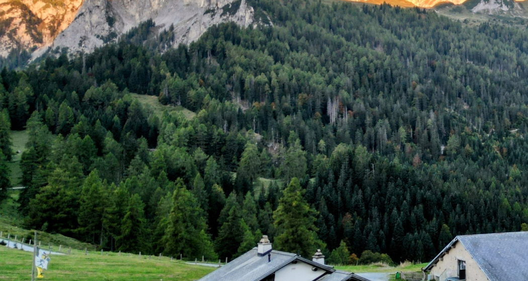
Berggasthaus Überuf Kunkelspass

Show all 9 images

Berggasthaus Überuf Kunkelspass
Mountain inn in the Grisons mountains. Both sports enthusiasts and bon vivants will get their money's worth here - whether you're travelling at a leisurely pace or fast; there's something for everyone to experience on the Kunkelspass.

Description

On a beautiful plateau on the historic Kunkelspass. Mountain inn next to the cow farm with the opportunity to watch the milking. Sunny, cosy terrace and rustic parlour. Simple dishes during the day, special menus in the evening. Our mountain inn has various beds in the tourist dormitory (20 places) as well as two double rooms and a family room with 4 beds. Showroom of the Sardona Arena tectonics. Can also be used as a conference or meeting room. Ideal, around 50 km long, bike tour from Chur. Hiking trails off the road. By car / motorbike via Tamins or Bad Ragaz/Vättis. Driving ban . Permits possible with EasyPark. CHF 20.00 car / CHF 10.00 motorbike.

Contact

Berggasthaus Überuf Kunkelspass

Kunkelsstrasse 89, 7315 Tamins

Responsible for this content Heidiland Tourism Ltd..

Outdooractive Logo

This website uses technology and content from the Outdooractive platform.

Geological E-Bike tour: over the Kunkelspass around Calanda

Medium
60.5 km
4:30 h
1063 mhd
1064 mhd
Gemeinsam um den Calanda
Auf dem Weg zum Kunkelspass

Show all 5 images

Gemeinsam über den Kunkelspass
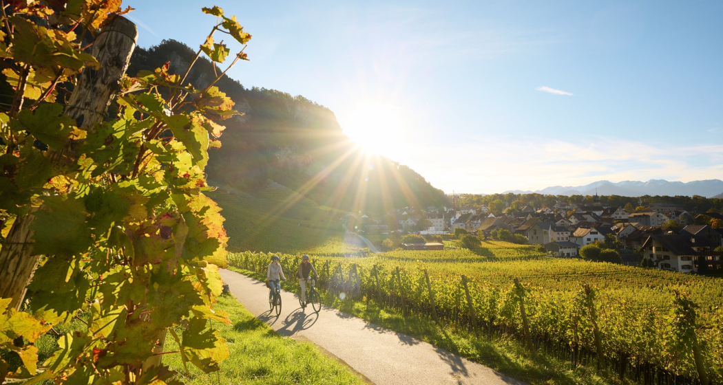
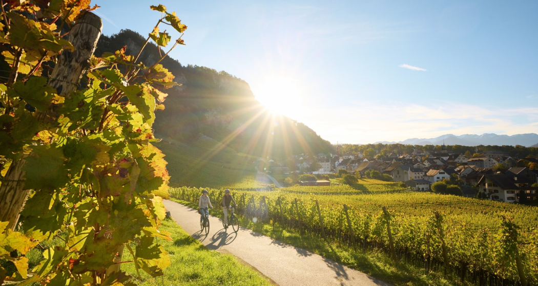
This round trip is a classic for E-Bikers. Especially those interested in geology will enjoy the Calanda Circuit.
Technique 3/6
Fitness 4/6
Highest Point  1358 m
Lowest Point  500 m
Best Season
Jan
Feb
Mär
Apr
Mai
Jun
Jul
Aug
Sep
Okt
Nov
Dez
Start
Bad Ragaz train station
Destination
Bad Ragaz train station
Coordinates
47.010059, 9.504616

Details

Description

The start of this geologically highly interesting round trip is in Bad Ragaz. After the village centre, you turn onto the old, picturesque road towards Valens, where you have to climb 300 metres in altitude for the first 4.5 kilometres. A panoramic stop on the Tamina Bridge, which opened in 2017, is a must. With a span of 260 metres, it is the largest arch bridge in Switzerland. From Pfäfers, follow the gently ascending main road into the Tamina Valley. The next stop is worth a stop at the Windegg viewpoint in front of Vadura. Here you can enjoy a wonderful view of the Glarus main thrust and the Wildseehörner. World Heritage information boards, viewing judges and cool loungers invite you to linger... but you probably want to go further.

At kilometre 16 you reach Vättis, where the exhibition 'BergeQuake!' shows the connection between earthquakes and mountain building in the Sardona tectonic arena... very impressive thanks to the live transmission of seismic recordings! Over the next few kilometres at the bottom of the bubbling Görbsbach, you can enjoy the view of the rugged limestone formations of the Haldensteiner (2,805 m) and Felsberger Calanda (2,697 m). The Eggwald mountain restaurant in Ober Kunkels (1148 m a.s.l.) invites you to stop for a bite to eat. A last short ascent, you have reached Graubünden soil and soon also the Kunkelspasshöhe (1,357 m a.s.l.). The garden terrace of the mountain inn Überuf is irresistible. The lovely pass plateau presents itself like an arena, surrounded by the Calanda (2805 m above sea level), the Crap Mats (2947 m above sea level) and the Ringelspitz (3247 m above sea level), the highest mountain in St.Gallen, located in the Tectonic Arena. Inside the inn, an educational information room is  dedicated to the UNESCO World Heritage Site of the Sardona Tectonic Arena.

The descent to Tamins (660 m a.s.l.) leads over a steep and bumpy natural road built during the First World War. The view from the tunnel blasted into the rock is spectacular. You can overlook the Domleschg and even see the Bernina massif in the distance. From Tamins, follow the national Veloland route no. 2 to Felsberg, where you continue along the right bank of the Rhine to Chur. Once again, you can educate yourself in geology: In the Chur Natural History Museum, a comprehensive geology exhibition focuses on the topic of Alpine formation. Then you can easily roll down the Rhine to Landquart and Bad Ragaz... or you can swing to the train station, look up again to the Calanda... and end the round on the railway.

Geheimtipp

Rent an e-bike at the e-bike station Bad Ragaz. This is located right next to the Tamina Therme, where you can treat yourself to a soothing bath after the tour.

Sicherheitshinweis

Take appropriate equipment with you to the tour and stay on the marked trails.

Ausrüstung

Normal bike equipment. Functional clothing is an advantage, as ascents and descents alternate.

Directions

Bad Ragaz – Pfäfers – Vättis – Kunkelspass – Tamins – Chur – Landquart – Bad Ragaz

Directions

Public Transport

By train to Bad Ragaz station

Anreise Information

Via motorway A13 exit Bad Ragaz

Parking

Parking directly at Bad Ragaz train station (chargeable)

Responsible for this content Graubünden Ferien.
This content has been translated automatically.

RheinWelten on the Rhine Route

Medium
438.5 km
30:00 h
1838 mhd
2913 mhd
RheinWelten
RheinWelten

Show all 8 images

RheinWelten führt dich zum Rheinfall
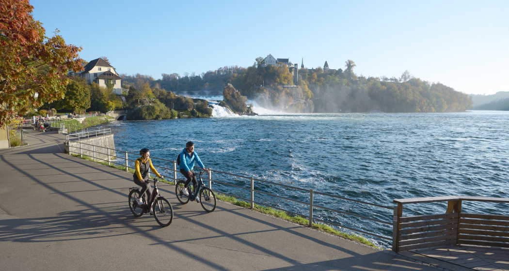
The "RheinWelten" e-bike route now connects Switzerland's existing cycling destination "Rhine Route 2" with regional, cultural and culinary highlights in 15 worlds of experience.
Technique 1/6
Fitness 3/6
Highest Point  2044 m
Lowest Point  258 m
Best Season
Jan
Feb
Mär
Apr
Mai
Jun
Jul
Aug
Sep
Okt
Nov
Dez
Start
Andermatt
Destination
Basel
Coordinates
46.634663, 8.596397

Details

Description

"RheinWelten" is a unique two-wheeler offer from the source of the Rhine to Basel for enjoyable explorers. 45 local tours in 15 adventure worlds can be discovered in Switzerland and Liechtenstein on an e-bike.  The tours combine visits to producers and farm shops, visits to museums or wineries, as well as local restaurants and overnight accommodations with the most beautiful cycling routes or hikes in the regions. The adventure worlds can be visited individually as a day trip or as a multi-day bike tour. 

Selected information on the new digital platform www.rheinwelten.com encourage people to discover new things. RheinWelten takes you through 12 tourist destinations in six cantons as well as the Principality of Liechtenstein. Experience unique cultural landscapes and the culinary diversity along the Rhine by e-bike.

Geheimtipp

Not the way is the goal, but the worlds of experience of the RheinWelten.

Ausrüstung

Roadworthy (e-)trekking bike, bicycle helmet, saddlebags or trekking backpack (approx. 35 litres) with rain cover, comfortable sports shoes, possibly cycling shoes, weather-adapted and durable clothing in the multi-layer principle, if necessary cycling jersey, change of clothes, cycling gloves, air pump, bicycle tools, sun and rain protection, provisions and drinking water, drinking bottle and suitable holder, first aid kit, pocket knife, mobile phone, if necessary mobile phone holder for the handlebar, headlamp and Reflectors, maps, travel documents, toiletry bags and towels, hand detergent and clothesline.

Directions

Rhine Route 2: Andermatt - Oberalppass - Disentis - Trun - Ilanz - Versam - Reichenau - Chur - Landquart - Jenins - Maienfeld - Sargans - Buchs - Oberriet - Altstätten - St.Margrethen - Fussach (D) - Gaissau (D) - Rohrschach - Arbon - Romanshorn - Kreuzlingen - Steckborn - Stein am Rhein - Gailingen (D) - Schaffhausen - Dachsen - Ellikon - Eglisau - Zurzach - Felsenau - Laufenburg - Stein - Rheinfelden - Pratteln - Muttenz - Basel

Directions

Public Transport

Arrival by train to Andermatt possible

Anreise Information

Motorway exit Göschnen direction Andermatt

Parking

Paid parking available

Responsible for this content Graubünden Ferien.
This content has been translated automatically.

Heidiland Bike Tour

168.5 km
18:35 h
5370 mhd
5264 mhd
Heidiland Bike Tour (oua_24515991_0c70eab_profile)
Heidiland Bike Tour
Technique 0/6
Fitness 0/6
Highest Point  1428 m
Lowest Point  421 m
Best Season
Jan
Feb
Mär
Apr
Mai
Jun
Jul
Aug
Sep
Okt
Nov
Dez
Coordinates
47.13502, 9.09802

Details

Responsible for this content Graubünden Ferien.

D01 - T22 Via Francisca des Lukmaniers

Medium
476.1 km
125:15 h
6852 mhd
7191 mhd
T01 - T22 Via Francisca des Lukmaniers
T01 - T22 Via Francisca des Lukmaniers (oua_24516016_0e20ae1_profile)
The "Via Francisca des Lukmaniers" is also known as the "Street of the Emperors". It leads from Constance over the Lukmanier Pass to Pavia, where it meets the Via Francigena. Here is the official route in 15 Swiss stages, plus 7 stages in Italy.
Technique 1/6
Fitness 4/6
Highest Point  1978 m
Lowest Point  55 m
Best Season
Jan
Feb
Mär
Apr
Mai
Jun
Jul
Aug
Sep
Okt
Nov
Dez
Start
Konstanz ( Münster )
Destination
Pavia Church, San Pietro in Ciel d'oro. ( - Rome)
Coordinates
47.663249, 9.175472

Details

Description

www.viafrancisca.ch/wegbeschreibung/

Geheimtipp

For more explanations on the trail, visit us on www.viafrancisca.ch

Sicherheitshinweis

November - April possibly snow stages 10 and 11, Disentis-Lukmanierpass-Olivone. Use public transport.

Ausrüstung

Backpack with rain cover, well-worn footwear, durable clothing appropriate to the season, rain and sun protection, hiking stick or trekking poles, pilgrim's passport.

Directions

www.viafrancisca.ch/wegbeschreibung

Directions

Public Transport

Public transport to Konstanz and from Pavia. All stage towns can be reached by public transport.

Anreise Information

-

Parking

-

Responsible for this content Graubünden Ferien.
This content has been translated automatically.

303.1 km
89:45 h
9688 mhd
10093 mhd
Sumvitg mit seiner von weither sichtbaren Kirche
Müstair: Kloster San Gian

Show all 10 images

S-charl: Kapelle
The pilgrimage route Via Son Giachen leads from South Tyrol through the Val Müstair in the canton of Graubünden towards Central Switzerland or Valais.  The partly alpine pilgrimage route is only accessible continuously in warm seasons.
Technique 0/6
Fitness 0/6
Highest Point  2605 m
Lowest Point  435 m
Best Season
Jan
Feb
Mär
Apr
Mai
Jun
Jul
Aug
Sep
Okt
Nov
Dez
Coordinates
46.629432, 10.449222

Details

Responsible for this content Pilgerwege Schweiz.
This content has been translated automatically.

Outdooractive Logo

This website uses technology and content from the Outdooractive platform.

T 07 Via Francisca: Chur - Bonaduz

Geschlossen
Simple
16 km
4:25 h
286 mhd
245 mhd
RhB vor Domat Ems
Pilgerweg in Plessur: Via Francisca: Chur - Bonaduz

Show all 3 images

T 07 Via Francisca: Chur - Bonaduz (oua_24511571_00f683b_profile)
The "Via Francisca" is also known as the "Road of the Emperors". It leads from Constance over the Lukmanier to Pavia, where it meets the Via Francigena.
Technique /6
Fitness 2/6
Highest Point  725 m
Lowest Point  575 m
Best Season
Jan
Feb
Mär
Apr
Mai
Jun
Jul
Aug
Sep
Okt
Nov
Dez
Start
Chur, Cathedral of the Assumption of the Virgin Mary
Destination
Bonaduz, Railway Station
Coordinates
46.847633, 9.53524

Details

Description

There are now two pilgrimage routes between Chur and Disentis, with the Via Francisca running mainly on the southern side of the Rhine, while the Way of St. James Graubünden, called Via SonGiachen, runs on the northern side. However, the two paths are almost identical up to Tamins. So it may happen that the two hikers in front are also pilgrims, but on their way from South Tyrol to Central Switzerland.
Both paths lead from Chur towards the Graubünden Oberland, called Surselva. Initially, we hike along the southern edge of the wide Rhine valley. At Domat/Ems we first cross the tracks of the Rhaetian Railway at the station, then walk between the two hills "Tuma Tschelli" and "Tuma Casti" and then circle the second to the north. This brings us first to the Rhine power plant, and after crossing the Rhine over the weir, the paths then separate to meet again briefly on the main square of Tamins. But only as far as crossing the village square, where we separate again. Now it's down to cross the Vorderrhein on the railway bridge. And so we arrive at Bonaduz.


Geheimtipp

The stages in this documentation are suggestions that each pilgrim can adapt to his wishes. however, the technical data always concern the assumption that these stages are completed in one day.

Sicherheitshinweis

.

Ausrüstung

Normal hiking/trekking equipment: backpack with rain cover, well-worn footwear, durable clothing appropriate to the season, rain and sun protection, hiking stick or trekking poles, pilgrim's passport.

Directions

Chur - River Plessur - Rose Hill - Lime kiln - Paleu sura - Domat/Ems - Tuma Casté - Power plant - Rhine weir - Tamins - Anterior Rhine - Campagna - Bonaduz

Directions

Public Transport

SBB, RhB

Anreise Information

A 13

Responsible for this content Graubünden Ferien.
This content has been translated automatically.

Gravel Bike Route Hinterrhein

Medium
202.6 km
21:00 h
5327 mhd
5326 mhd
Gravel&Road Graubünden
Reichenau

Show all 8 images

Gravel&Road Graubünden
Deep ravines, impressive panoramic views and witnesses to the history of Graubünden’s transport routes await discovery at the Posterior Rhine.
Technique 3/6
Fitness 3/6
Highest Point  2073 m
Lowest Point  559 m
Best Season
Jan
Feb
Mär
Apr
Mai
Jun
Jul
Aug
Sep
Okt
Nov
Dez
Start
Chur
Destination
Chur
Coordinates
46.861587, 9.507176

Details

Description

Your journey starts in Chur where you’ll discover the rolling hills of the Domleschg fruit and castle country. The Glaspass is an insider tip that will take you to the Beverin Nature Park. The slope is long, but not too steep. A beautiful panorama tour takes you over the Heinzenberg back to the historic trading town of Thusis. The journey continues through the natural monument of Viamala Gorge, where 300-meter high cliffs will have you in awe. The route to Andeer leads through the villages of Schamserberg, which tower high above the valley and score points for their panoramic views. The route climbs up towards Lai da Vons. Here you’ll be able to enjoy the tranquility of nature and an epic panorama. You can ride down the hill until you reach Sufers, and through the valley floor of the Rheinwald you’ll reach Splügen, Graubünden's oldest pass village. From Medels via Nufenen and Posterior Rhine you’ll continue following the young Rhine towards its source. On the other side of the Rhine, the route leads down into the valley again and you’ll ride through the idyllic landscape passing the Posterior Rhine through the valley floor of the Rheinwald back to Splügen. The ascent through the Fugscht forest is short but steep. A rapid descent brings you to Sufnersee and on the Northern shore; you ride along a little-used road towards Roflaschlucht (gorge), which guarantees breathtaking views into a wild gorge. Via Bärenburg and Pignia, the route leads to Zillis, where the Capuns Swiss champion invites you to lunch at the hotel Post. Via Reischen you ride through the Viamala to Thusis and along the Posterior Rhine through the Domleschg. From Reichenau, where the Anterior Rhine and the Posterior Rhine merge, you have a comfortable ride back to Chur.

Stages

Stage 1: Chur – Thusis

Stage 2: Thusis – Glaspass - Thusis

Stage 3: Thusis - Andeer

Stage 4: Andeer – Lai da Vons – Splügen

Stage 5: Splügen – Splügen

Stage 6: Splügen – Chur

Geheimtipp

Tip: Gravelbikers with lots of leg power will manage stages 1 and 2 in one day.

Tip: Don’t worry about carrying your luggage on this trip multi-day trip. Book the luggage transfer from hotel to hotel - convenient and easy.

Directions

Chur - Thusis: 29.8 kilometers - 404 altitude

You start the journey in Chur (593 m above sea level) and get on bike path no. 6 on the Polenweg to the imposing fortification Porta Rhaetica. From Rothenbrunnen the route makes its way over the gentle hills of the Domleschg fruit and castle country. In Paspels (757 m above sea level), you can marvel at the art works by the well-known artist Robert Indermaur. Lake Canova invites you to take a break, especially to cool down during summer. From here, it’s not far to Thusis, the historical trading place (680 m above sea level).

Thusis - Glaspass - Thusis: 36.1 kilometers - 1659 altitude

The Glaspass is an insider tip. The MTB route no. 90 takes you from Thusis (680 m above sea level) past the villages of Urmein and Tschappina into the Beverin nature park. The ascent to the Glaspass (1846 m above sea level) is long, but in addition to steep ramps, there are always flat roads where you can relax a little. Once you arrive at the pass, it’s worthwhile to ride a few meters further to the Beverin mountain inn. You definitely deserve to take a little break here! You only follow the road down the valley for a little while longer now, and then turn onto MTB route no. 623 "Heinzenberger Maiensäss Route". This will lead you high above the Domleschg over an impressive panoramic path. From Obergmeind (1813 m above sea level) via Plau to Prau da l'Alp, you’ll encounter several short steep slopes, but the great view makes up for it. The rapid descent to Präz (1170 m above sea level) and Raschlegnas will definitely put a smile on your face. The trail leads you through Cruttis Tobel and Tartar back to Thusis (680 m above sea level).

Thusis - Andeer: 27.1 kilometers - 983 altitude

From Thusis (680 m above sea level), the old Viamala road leads through the "lost hole" to Rongellen. The 300-meter high cliffs of the Viamala Gorge natural monument will amaze you. The road runs high over the Viamala and looking into the gorge is worth it. A stop at the Visitor Center not only gives you a chance to rest, but also brings you closer to the AlpTransit’s history. The route continues in the direction of the Muntogna da Schons and Schamserberg villages. Through Zillis (945 m above sea level) and Donat you’ll reach Lohn (1585 m above sea level), Mathon and Wergenstein. A great view over the whole valley, including the fantastic road to Wergenstein, which towers high above the Schamsertal will be your reward. A nice descent on an agricultural road brings you to Casti. An imposing wooden bridge takes you to Clugin, before you start the last stretch of the journey riding on a dirt road to Andeer (982 m above sea level). Andeer is known for its healing spring. Enjoy the mineral bath with a wellness area – it’s a guaranteed rest for your sore muscles.

Andeer - Lai da Vons - Splügen: 22 kilometers - 1237 altitude

The road from Andeer (982 m above sea level) in the direction of Lai da Vons ascends without mercy. As you climb higher and higher through the forest of the Tranter Tschaingel, you’ll get to enjoy wonderful views over the whole valley. At Pastgaglia, you have almost already climbed up one thousand meters and will leave the tree line behind you. There will hardly be any flat roads to offer a chance to take a breath. You do have to persevere for a bit. Turn left once you reach Larisch. The natural road is now a bit bumpy. Shortly after the highest point of the climb (2050 m above sea level), you’ll be able to see the Lai da Vons (1994 m above sea level). In the tranquility of nature, enjoy the epic panorama, pat yourself on the back and roll down the mountain to Sufer's. The cycle route no. 505 "Rheinwaldroute" takes you through the valley floor of the Rheinwald to Splügen (1458 m above sea level), the oldest pass village in Graubünden.

Splügen - Splügen: 33.2 kilometers - 361 altitude

From Splügen (1458 m above sea level) follow the Rhine towards its source. Via Medels and Nufenen you’ll ride through the Rheinwald to the Posterior Rhine (1620 m above sea level), the oldest Walser settlement in Graubünden. From the Posterior Rhine it’s not far to the shooting range. During the week, the trip ends here, but on the weekends, you can reach the valley via a natural road in the direction of the Rheinquellhorn. On the other side of the Rhine, the route leads down the valley on a dirt road. Via the old Landbrugg, you’ll return to the village Posterior Rhine. If you like taking the easy path, take bicycle route no. 6 to Nufenen. Riders who are interested in a more technical road should tackle the meadow path on the other side of the Rhine. From Nufenen the cycle route no. 505 "Rheinwaldroute" leads down into the valley. You’ll make your way back to Splügen (1458 m above sea level) while riding along the Posterior Rhine through the valley floor of the Rheinwald.

Splügen - Chur: 58.6 kilometers - 580 altitude

You’ll leave Splügen (1458 m above sea level) on cycle route no. 505 "Rheinwaldroute" down the valley. At first, the road heads a few meters in the direction of Splügen Pass.

In the first bend, you’ll turn left and reach a short but steep climb through the Fugscht forest (1589 m above sea level). A rapid descent brings you to the Sufnersee, whose water shines turquoise. On the Northern shore of the lake, you’ll take the little-traveled road in the direction of Roflaschlucht (gorge). Even from the road, you’re guaranteed great views of the wild canyon. Through Bärenburg (1040 m above sea level), you’ll take a side road to Pignia. From here, a nature trail leads to Zillis (945 m above sea level). An insider's tip is Capun's, a local specialty - prepared by the Swiss Capuns champion at the hotel Post. Strengthened from the food the route leads you over Reischen (1024 meters) through the Viamala gorge to Thusis (680 m above sea level). Cycle route no. 6 takes you along the Posterior Rhine through the Domleschg. In Reichenau, where the Anterior Rhine merges the Rhine Anterior, change onto the Rheinrad route no. 2 and a comfortable ride back to Chur (593 m above sea level).

Responsible for this content Graubünden Ferien.
This content has been translated automatically.

Via Son Giachen: Chur - Trin-Digg

Medium
17.3 km
4:55 h
499 mhd
284 mhd
Kirche Tamins mal von der Bergseite
Kathedrale Chur

Show all 12 images

Blick am Morgen über Chur vom Fuss des Pizoggel
The pilgrimage route Via Son Giachen leads from South Tyrol through the Val Müstair in the canton of Graubünden towards Central Switzerland or Valais.  The partly alpine pilgrimage route is only accessible continuously in warm seasons.
Technique 2/6
Fitness 4/6
Highest Point  818 m
Lowest Point  571 m
Best Season
Jan
Feb
Mär
Apr
Mai
Jun
Jul
Aug
Sep
Okt
Nov
Dez
Start
Chur, Martinsplatz
Destination
District *Digg" of the place Trin/Digg
Coordinates
46.848316, 9.5327

Details

Description

This stage takes us from Chur towards the Graubünden Oberland, also called Surselva by the locals. From Chur, we initially hike along the southern edge of the wide Rhine valley and cross a few side valleys here. From Kalkofen, the path leads us to Domat/Ems, mostly across fields at the bottom of the valley. At Domat/Ems we first cross the tracks of the Rhaetian Railway at the station, then walk between the two hills "Tuma Tschelli" and "Tuma Casti" and then circle the second to the north. This brings us to the Rhine power plant, where we cross the weir to reach the island of Barnaus, which we leave a little upstream towards the north bank.
Here we reach the «Senda Sursilvana», the hiking trail through the Surselva, which will be part of our route again and again for the next few days. If the way to Trin-Digg is too long for you, you can already look for a suitable place to stay in Domat/Ems or Tamins.

Responsible for this content Graubünden Ferien.
This content has been translated automatically.

Kunkelspass in the World Heritage Site Sardona

Medium
14.6 km
4:15 h
423 mhd
763 mhd
Bergrestaurant Überuf auf dem Kunkelspass
UNESCO-Infotafeln auf dem Kunkelspass

Show all 4 images

Felstunnel auf dem Abstieg vom Kunkelspass
The Kunkelspass is more than just a crossing, it is a popular destination as well. Walkers and leisure hikers will find the mountain restaurants Eggwald in Oberkunkels and Überuf on the pass summit. From here, hikers approach the UNESCO World Heritage Tectonic Arena Sardona to the SAC-Ringelspitzhütte.
Technique 3/6
Fitness 4/6
Highest Point  1358 m
Lowest Point  595 m
Best Season
Jan
Feb
Mär
Apr
Mai
Jun
Jul
Aug
Sep
Okt
Nov
Dez
Start
Vättis/SG
Destination
Reichenau/Tamins train station
Coordinates
46.909101, 9.440192

Details

Description

The Kunkelspass (1357 m a.s.l.) connects Vättis with Tamins. The lovely plateau presents itself like an arena, surrounded by the mountains of the Calanda (2805 m above sea level), the Crap Mats (2947 m above sea level) and the Ringelspitz (3247 m above sea level), the highest mountain in St.Gallen, located in the Tectonic Arena Sardona.

From Vättis (943 m a.s.l.) an easy hike leads to the Kunkel Pass. Along the bubbling Görbsbach, the path leads gently uphill through meadows and forest sections to Unter Kunkels (1073 m above sea level). What a feast for the eyes, especially in early summer, when the alpine flora comes to life! Above the left side of the valley are the Haldensteiner and the Felsberger Calanda with their rugged limestone formations. When the path becomes a little steeper, you approach the Eggwald mountain restaurant in Ober Kunkels (1148 m a.s.l.). In the case of pleasure hikers, the 'autopilot' takes over in view of the neat restaurant, and you steer straight into the garden restaurant. But it is also not far to the Kunkelspasshöhe (1357 m.a.s.l.).

Kunkelspass as a goal or intermediate destination

In the mountain inn Überuf you can linger with pleasure on the garden terrace or in the wood-fired warmed dining room. Next door is a seminar room with information about the UNESCO World Heritage Site Tectonic Arena Sardona. They are proud to be able to offer the eastern entrance to the geological wonderland with Kunkels. A telescope offers the opportunity to take a close look at the Ringelspitz and the Glarus main thrust or the demolition niche of the Tamins landslide. Sometimes on the seabed, sometimes under 800 metres of glacial ice - the history of the earth also offers a lot of variety for Kunkels.

The shortest route into the valley is via a small road built during the First World War to Tamins (660 m above sea level). The view from the tunnel blasted into the rock is spectacular. If you want to continue uphill, climb via Grossalp to the SAC-Ringelspitzhütte (1998 m.a.s.l.). The hospitable hut can be enjoyed as a panoramic east-facing balcony of the Tectonic Arena Sardona.

Geheimtipp

Visit the earthquake exhibition in Vättis and learn, among other things, how earthquakes are related to the formation of mountains.

Sicherheitshinweis

Take appropriate equipment with you to the tour and stay on the marked trails.

Ausrüstung

Normal hiking equipment. Depending on the weather, good footwear (hiking boots) is recommended, otherwise light trekking shoes are sufficient for the tour.

Directions

Vättis – Unter Kunkels – Ober Kunkels – Kunkelspass - Reichenau

Directions

Public Transport

Postbus from Bad Ragaz station to Vättis, at x.35 a.m., return journey: with the RhB from Reichenau/Tamins station

Responsible for this content Graubünden Ferien.
This content has been translated automatically.