Please note: the indoor pool and wellness pool will remain closed until and including 27. June due to the annual maintenance works. All other facilities are open.

Additional infos.
discover.swiss ID
osm_1684212
discover.swiss Additional Type
City
39 km
2:40 h
360 mhd
360 mhd
Churer Rheinroute 501, Pardislabrücke Haldenstein-Chur
Übergang Maschänser Rüfe

Show all 8 images

Trimmiser Mittelweg
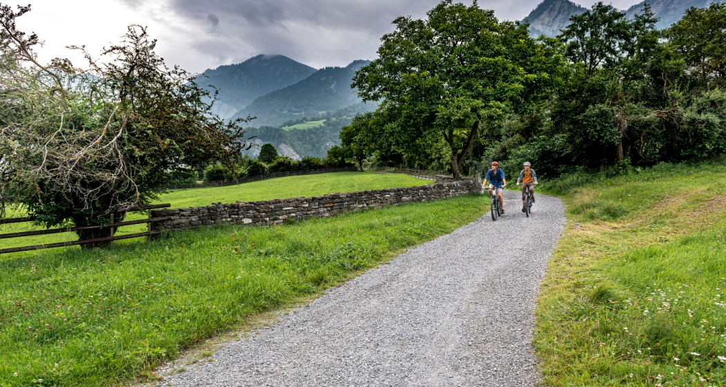
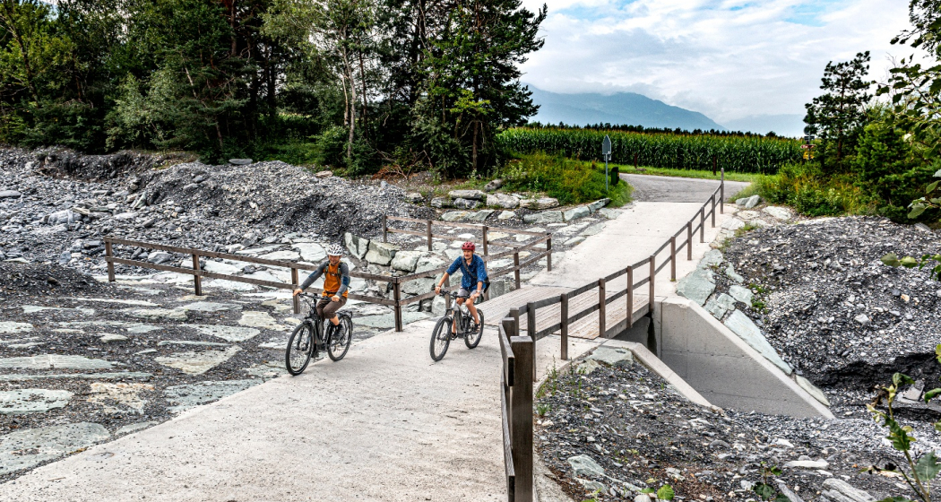
Nothing but wine and water: on this circular route, you will discover the winegrowing villages between Chur and Landquart. The return journey takes place on the popular Rhine route and along the regional rivers Landquart and Plessur.
Technique /6
Fitness 2/6
Highest Point   m
Lowest Point   m
Best Season
Jan
Feb
Mär
Apr
Mai
Jun
Jul
Aug
Sep
Okt
Nov
Dez
Start
Chur
Destination
Chur
Coordinates
46.853287078552, 9.5299169101921

Details

Description

This varied loop tour begins in the middle of the Graubünden capital. But the busy city life is soon left far behind, because the route takes you on a tranquil neighbourhood road into nature. You cross the Fürstenwald, a popular local recreation area with views of the city and the Calanda. The historic Trimmiser Mittelweg then takes you through open pastures to the village of Trimmis. The route follows the "Bündner Rheintal Wine Trail" on several sections. Accordingly, it provides an insight into the local winegrowing culture. This has a long tradition as first mentions go back to the year 765. The Graubünden Rhine valley winegrowing region stretches from Bonaduz to Fläsch and covers around 420 hectares. Thanks to the mild climate and the foehn, the grapes thrive magnificently in the calcareous soils - especially the typical Blauburgunder variety.

Past the imposing, former moated castle of Marschlins, the route follows the Landquart river to the village of the same name. The Landquart has its source above Klosters, flows through the Prättigau valley and finally into the Rhine at Landquart. Here you return on the popular cycling route no. 2, the Rhine route. From Zizers, the path repeatedly follows the young Alpine Rhine. This has its source at the Oberalp pass as the Vorderrhein and at Rheinwald as the Hinterrhein. At Reichenau-Tamins, the two main arms join to form the Rhine. Switzerland’s largest river flows for a total of 1230 kilometres via Lake Constance through Germany, on to Holland, and into the North Sea.

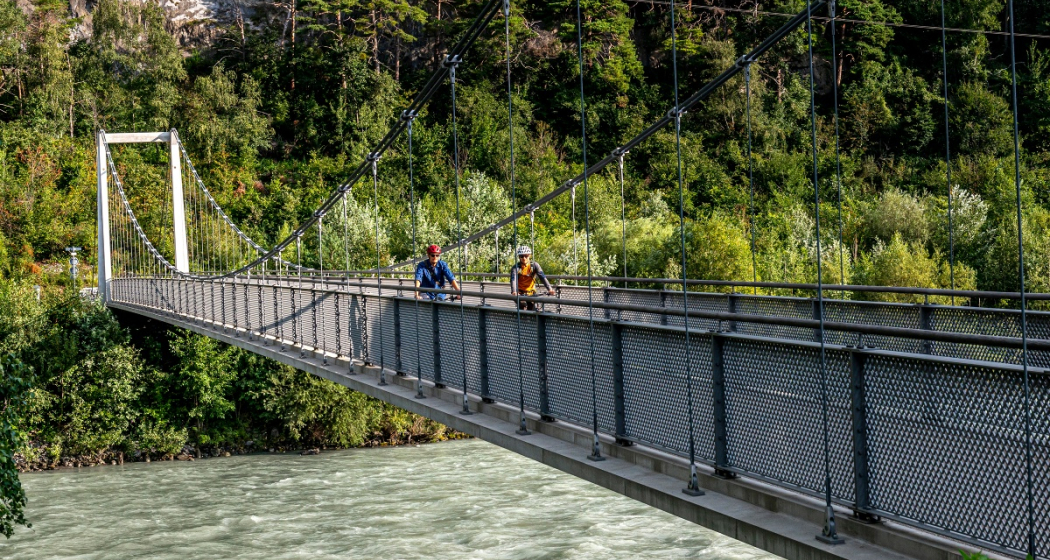
At Haldenstein, you cross to the other river bank. At the level of the town of Chur, the cycle path crosses the Rhine again on the Pardisla bridge which was built especially for cyclists and pedestrians. Shortly afterwards you reach another regional river: the Plessur has its source in the mountainous area between Arosa and Lenzerheide, flows past Arosa through the Schanfigg valley and into the Rhine at Chur. The route follows the river, and over the arched bicycle and pedestrian bridge, built in 2020, you finally dive right into the centre of Chur with its picturesque, car-free old town. Before returning to the station, you can stop at one of the numerous restaurants with sun terraces. The tour comes to a leisurely end in the unique ambience of Switzerland's oldest city.

Directions

Public Transport

  • Start at railway station in Chur or Landquart

Anreise Information

  • On the motorway to Chur or Landuqart
  • Start at railway station in Chur or Landquart

Parking

  • Park & Ride at railway station in Chur or Landquart

Responsible for this content SwitzerlandMobility.

50 km
3:25 h
300 mhd
420 mhd
02.03 Rhein-Route Etappe 3 Chur - Buchs
02.03 Rhein-Route Etappe 3 Chur - Buchs (oua_8580518_6124df0_profile)
The Bündner Herrschaft, the fertile garden and wine region of the canton, is located on a mound of slate detritus. The Tamina Gorge carries healing water down to the valley and Johanna Spyri‘s Heidi is stirring up nostalgic feelings.
Technique /6
Fitness 4/6
Highest Point   m
Lowest Point   m
Best Season
Jan
Feb
Mär
Apr
Mai
Jun
Jul
Aug
Sep
Okt
Nov
Dez
Start
Chur
Destination
Buchs
Coordinates
46.85441765959, 9.5053531224222

Details

Description

The Bündner Herrschaft, Graubunden’s fertile garden and winery lies on a mound of slate detritus. Also the home of Heidi, Peter and Alpöhi (Heidi’s grandfather).

Directions

Chur - Igis - Maienfeld - Fläsch - Bad Ragaz - Sargans - Buchs

Responsible for this content SwitzerlandMobility.
This content has been translated automatically.

Castle Zizers

Burg Friedau und Haus zur Glocke

Burg Friedau und Haus zur Glocke

Description

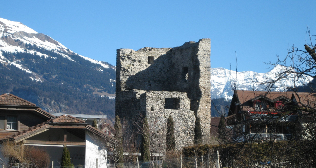
The complex was built by the Bishop of Chur Volkhart (1237-1251). The once mighty fortification was the centre of the episcopal jurisdiction. Later, the delinquents from the Five Villages district were imprisoned in the castle. The village fire of 1897 severely damaged the complex. Today, the castle is owned by the Five Villages District. In 2001, structural safety measures were taken. One of the oldest buildings still inhabited in Zizers is the House of the Bell. Once it was an inn, to which probably also Susten (warehouses with horse positions) were attached. Later, the Haus zur Glocke served as the town hall of the Five Villages district. It housed the district administration, the district office, the district notary's office, the debt collection and bankruptcy office, and the guardianship authority. Today, the beautifully spruced up Haus zur Glocke is used purely as a residential building.

Contact

Burg Friedau und Haus zur Glocke

Rathaus, 7205 Zizers

Responsible for this content Chur Tourism.
This content has been translated automatically.

Kunkelspass round trip

Difficult
56 km
4:30 h
963 mhd
963 mhd
Aufstieg zum Kunkelspass
Kunkelspass - hier fährt kaum ein Biker vorbei

Show all 8 images

Kunkelspass
The Kunkels Pass bike tour is a real classic and well known among mountain bikers, cyclists and e-bikers. You completely ride around the impressive Calanda mountain on this tour.
Technique 1/6
Fitness 5/6
Highest Point  1357 m
Lowest Point  514 m
Best Season
Jan
Feb
Mär
Apr
Mai
Jun
Jul
Aug
Sep
Okt
Nov
Dez
Start
Chur, train station
Destination
Chur, train station
Coordinates
46.85416, 9.528797

Details

Description

From the Chur railway station, follow the national cycling route no. 2 (Rhine route) and cycle at the riverbank to Landquart. In Landquart, cross the Rhine river and later at Sarelli go left and follow the road up to Pfäfers and carry on to Vättis through a rugged basin with almost vertical mountain slopes.

The final ascent to the pass takes you away from the traffic through unspoilt, splendid countryside. Shortly past the Eggwald mountain restaurant, you leave the Canton of St. Gallen and enter Grisons again before reaching the pass summit.

When crossing from the Tamina Valley into the Rhine Valley, the great differences at either side of the water divide are amazing. The final descent to Tamins is a special treat, offering views of the confluence of the Vorder and Hinter Rhine. From Tamins take the national cycle route No. 2 (Rhine route) back to Chur (or return by rail from Reichenau station).

Responsible for this content Chur Tourism.

Trans Grischun: Castrisch–Scuol (Stage 3)

Geschlossen
Difficult
134.7 km
0:00 h
6402 mhd
5820 mhd
Abfahrt ins Safiental
Aufstieg nach Guarda im Unterengadin

Show all 13 images

Biketransport mit dem Zug oder Postauto ist in Graubünden ein Kinderspiel
Today is a long day ahead – including a transfer with the Rhaetian Railway. So it's always worth getting up early. The highlights? A small Maiensässbeizli with a great view, a spectacular road through the Rhine Gorge and typical Lower Engadine villages.
Technique 5/6
Fitness 4/6
Highest Point  2946 m
Lowest Point  517 m
Best Season
Jan
Feb
Mär
Apr
Mai
Jun
Jul
Aug
Sep
Okt
Nov
Dez
Start
Castrisch or Ilanz
Destination
Chur / Scuol
Coordinates
46.84462199, 9.72071553

Details

Description

The stage starts in the tranquil village of Castrisch. You first follow the official Rhine Veloroute No. 3, which is only slightly uphill - perfect for taking it easy on your legs. In Valendas, you can fill your water bottle with fresh mountain spring water from the largest wooden fountain in Europe. Shortly after Carrera, turn off onto the road to Brün and continue up to Imschlacht. The road and views are fantastic. Tip: you can fortify yourself with a portion of mountain cheese, salsiz or a nut tart at the Maiensässbeizli. Continue down into the Safiental valley. Then comes another highlight: the spectacular panoramic road along the Rhine Gorge. The rock faces of the “Swiss Grand Canyon” tower 300 meters high. From Bonaduz, you cycle along side roads to Chur. The section between the capital of Graubünden and Lavin in the Lower Engadine is covered comfortably on the Rhaetian Railway.

From the Lower Engadin village of Lavin, your muscle power is needed once again. The route to the stage finish takes you along a fine gravel path via Guarda to Scuol. Below you, the bright turquoise Inn River flows. The landscape in the Lower Engadin presents a completely different picture. The sunburnt stables of the Surselva have given way to houses adorned with colorful paintings. The art of Sgraffito, the traditional stucco technique of the region, is now mastered by only a few in the valley. And in Scuol, not only does mountain spring water flow from the fountains, but even mineral water. Simply gschpunna.

Total distance and elevation gain (excluding public transport sections): 66 km, 1,400 meters of ascent, 1,900 meters of descent.

Geheimtipp

The Trans Grischun passes through inhabited areas at regular intervals, so that you can always find places to stay overnight and adapt the stages to your needs.

Sicherheitshinweis

The tour should not be undertaken in uncertain weather conditions. Weather changes are frequent in the mountains. If a rain front or similar is approaching during the hike, you should turn back in good time.

144 Emergency call, first aid

1414 Mountain rescue REGA

112 International emergency call

Ausrüstung

Helmet, gloves, cycling shoes, glasses, rain and sun protection, drinks, repair kit, first aid kit

Directions

Castrisch - Valendas - Brün - Imschlacht - Arezen - Versam - Versamer Tobel - Bonaduz - Reichenau - Tamins - Felsberg - Chur - public transport - Lavin - Guarda - Ftan - Ardez - Scuol

Directions

Public Transport

Stage tour

Anreise Information

Stage tour

Parking

Stage tour

Responsible for this content Surselva Tourism.
This content has been translated automatically.

Outdooractive Logo

This website uses technology and content from the Outdooractive platform.

Hotel Zizers

Hotel Sportcenter Fünf Dörfer

Aussenansicht
Hotel Aussenansicht 25.JPG

Show all 77 images

P1070306.JPG
Hotel on the Rhine, quiet location, all mod cons. 2 min. from Zizers motorway exit.

Description

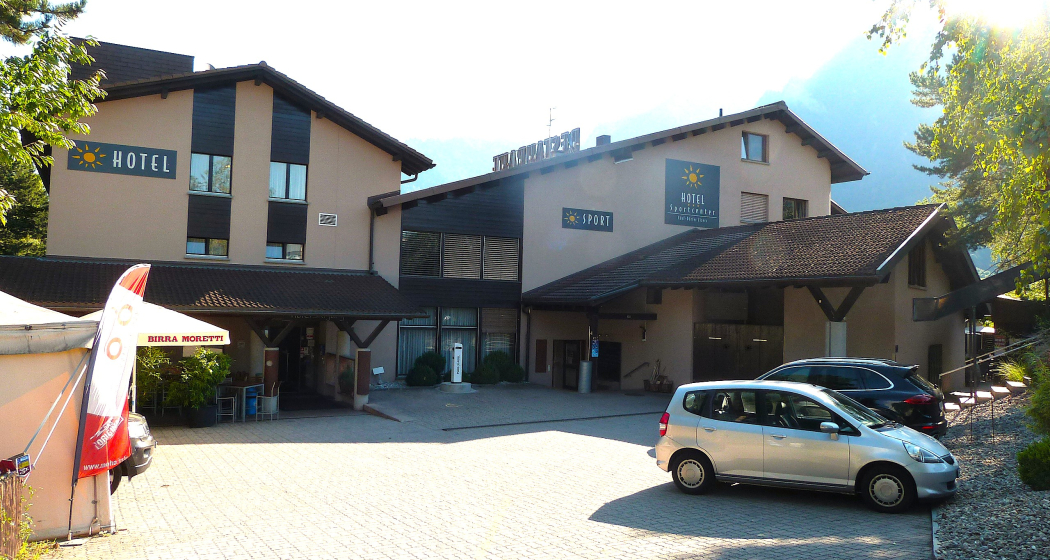
Our hotel is quietly located near the A/N13 motorway between Chur and Landquart. The 34 quiet rooms with all 3 star comforts and our business services will make your stay as pleasant as possible. Special services are available for motorcyclists. Sports facilities include tennis, squash, badminton and table tennis. Our friendly dining restaurant with garden terrace is open from Monday to Friday from 08.00 to 23.00 and Sunday from 08.00 to 17.00. At lunch and dinner times we spoil you with delicacies from the kitchen and exquisite wines.

Prices

Prices incl. VAT, excl. visitor's tax. Sports offer free of charge: table tennis and billiards. Reduced sports prices: tennis, squash, badminton, sauna and infrared cabin. Large parking free of charge. Dogs allowed, CHF 20.00 per night. For motorcyclists: covered car park, drying room, tour documentation, workshop, washing area and navigation system rental.

Contact

Hotel Sportcenter Fünf Dörfer

Oberauweg 20, 7205 Zizers

Responsible for this content Chur Tourism.
This content has been translated automatically.

Castle Zizers

Zizers Castle

Schloss Zizers
Unteres Schloss Zizers

Show all 9 images

Schloss Zizers
Old small castle around 1620; castle 1670-87, until 20th c.

Description

You have stepped through the archway of Villa Maria and are standing in the former forecourt of the Salis-Zizers family. The three-storey Baroque castle is surrounded by arcades with massive columns on three sides and a park on the valley side. The octagonal tower, covered by a dome, is the landmark of the Zizers region and marks the centre of the castle.

Audio Guide

Unteres Schloss Zizers

Contact

Zizers Castle

Vialstrasse 16 / 18, 7205 Zizers

Responsible for this content Heidiland Tourism Ltd..

Outdooractive Logo

This website uses technology and content from the Outdooractive platform.

Castle Zizers

Burg Friedau und Haus zur Glocke

Burg Friedau und Haus zur Glocke
Burg Friedau und Haus zur Glocke (oua_604495056_image)
Burg Friedau und Haus zur Glocke

Description

The complex was built by the Bishop of Chur Volkhart (1237-1251). The once mighty fortification was the centre of the episcopal jurisdiction. Later, the delinquents from the Five Villages district were imprisoned in the castle. The village fire of 1897 severely damaged the complex. Today, the castle is owned by the Five Villages District. In 2001, structural safety measures were taken. One of the oldest buildings still inhabited in Zizers is the House of the Bell. Once it was an inn, to which probably also Susten (warehouses with horse positions) were attached. Later, the Haus zur Glocke served as the town hall of the Five Villages district. It housed the district administration, the district office, the district notary's office, the debt collection and bankruptcy office, and the guardianship authority. Today, the beautifully spruced up Haus zur Glocke is used purely as a residential building.

Contact

Burg Friedau und Haus zur Glocke

Rathaus, 7205 Zizers

Responsible for this content Heidiland Tourism Ltd..
This content has been translated automatically.

Outdooractive Logo

This website uses technology and content from the Outdooractive platform.