Please note: from 10. until and including 27. June, the facilities in the indoor pool building will be closed for the annual maintenance works. Sauna and gym will reopen on 21. June.

Additional infos.
Name plural
Theme SUI
Original Name
Theme SUI
discover.swiss ID
sui_root

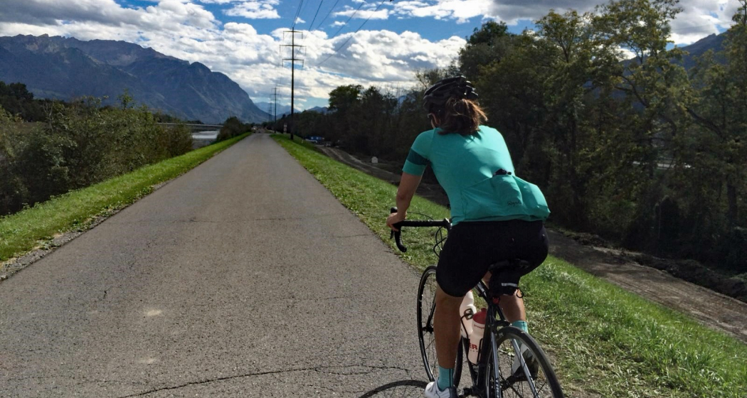
Chur - Bündner Herrschaft - Luzisteig - Rheindamm - Chur
61.6 km
3:15 h
420 mhd
420 mhd
Chur - Bündner Herrschaft - Luzisteig - Rheindamm - Chur
Technique 0/6
Fitness 0/6
Highest Point  716 m
Lowest Point  472 m
Best Season
Jan
Feb
Mär
Apr
Mai
Jun
Jul
Aug
Sep
Okt
Nov
Dez
Coordinates
46.850822, 9.531945

Details

Description

This route takes you through the hills of the Bündner Herrschaft, past huge vineyards and picturesque Torkeln, up to the St. Luzisteig. At 713 metres above sea level, the top of the pass is reached.  A rapid descent leads further down into Liechtenstein. From there it goes back on the Rhine dam in the direction of Chur. Flat and without car traffic, the Rhine dam invites you to really push your pedals. The Rhine dam ends at Bad Ragaz and the route leads along country roads via Bad Ragaz back to Landquart. From there, take  the same route back to Chur as you came. 

Responsible for this content Chur Tourism.
This content has been translated automatically.

Rundroute Dreibündenstein (GR 4)

Medium
13.5 km
5:00 h
559 mhd
559 mhd
Beim Dreibündenstein
Bei Spundis - mit Aussicht zum Calanda

Show all 6 images

Panoramatafel auf Furggabüel
Rundroute Dreibündenstein (GR 4)
Technique 2/6
Fitness 4/6
Highest Point  2165 m
Lowest Point  1591 m
Best Season
Jan
Feb
Mär
Apr
Mai
Jun
Jul
Aug
Sep
Okt
Nov
Dez
Start
Brambrüesch
Destination
Brambrüesch
Coordinates
46.829178, 9.516093

Details

Description

The area between the 3 mountain railways of Chur-Dreibündenstein (Brambrüesch), Pradaschier and Feldis is a paradise for snow shoeing. The high plateau in the centre of these areas offers spectacular panorama views of the surrounding mountain scenery (Calanda, Arosa, Lenzerheide, Flims-Laax and Surselva). The peak point where the different routes merge is the landmark of the Dreibündenstein at 2160 m, a stone monument to the freedom fighters of Graubünden, which marks the common border point of the former Three Leagues of Raetia. This signposted route goes from Brambrüesch to the Dreibündenstein and back to Brambrüesch (GR 4).

Directions

Public Transport

Take the train to Chur station. From there, the city bus (line 1) takes 3 minutes to the valley station of the mountain railways (Stadthalle/Brambrüeschbahn stop).

Anreise Information

  • Motorway exit Chur Süd

  • Drive into the city (Kasernenstrasse)

  • The valley station and car park are on the right-hand side in front of the town centre

Parking

More about parking for guests of the Chur mountain railways.

Responsible for this content Brambrüesch.
This content has been translated automatically.

Helsana Trail Chur: Grosser Trail

Medium
13 km
2:20 h
438 mhd
438 mhd
Helsana Trail Chur: Grosser Trail
The long trail is signposted yellow and with a length of 13 km the longest round and rather challenging.
Technique 2/6
Fitness 4/6
Highest Point  922 m
Lowest Point  643 m
Best Season
Jan
Feb
Mär
Apr
Mai
Jun
Jul
Aug
Sep
Okt
Nov
Dez
Start
Waldhausstall Fürstenwald, Chur
Destination
Waldhausstall Fürstenwald, Chur
Coordinates
46.870252, 9.544071

Details

Description

In the Fürstenwald near Chur there are three signposted jogging / nordic walking trails available:

  • Short Trail (blue route)
  • Medium Trail (green route)
  • Long Trail (yellow route)

The Fürstenwald is a recreational area near Chur. It offers a diverse and popular route network for joggers and nordic walkers.

Responsible for this content Chur Tourism.
This content has been translated automatically.

Helsana Trail Chur: Medium Trail

Medium
10.2 km
1:40 h
267 mhd
267 mhd
Helsana Trail Chur: Mittlerer Trail
The middle trail is signposted green and with a length of 10 km a varied and mediocre demanding round.
Technique 2/6
Fitness 4/6
Highest Point  864 m
Lowest Point  641 m
Best Season
Jan
Feb
Mär
Apr
Mai
Jun
Jul
Aug
Sep
Okt
Nov
Dez
Start
Waldhausstall Fürstenwald, Chur
Destination
Waldhausstall Fürstenwald, Chur
Coordinates
46.870216, 9.544077

Details

Description

In the Fürstenwald near Chur there are three signposted jogging / nordic walking trails available:

  • Short Trail (Route blue)
  • Medium Trail (route green)
  • Long Trail (Route yellow) 

The Fürstenwald is a recreational area near Chur. It offers a diverse and popular route network for joggers and nordic walkers.

Responsible for this content Chur Tourism.
This content has been translated automatically.
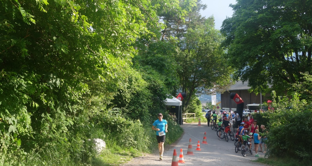
rhiienergie Trail Rhäzüns

Medium
9.9 km
2:10 h
90 mhd
90 mhd
rhiienergie Trail Rhäzüns
The Rhäzüns Trail (green signage) is 10 km long with a height difference of almost 100 meters.
Technique 2/6
Fitness 3/6
Highest Point  670 m
Lowest Point  587 m
Best Season
Jan
Feb
Mär
Apr
Mai
Jun
Jul
Aug
Sep
Okt
Nov
Dez
Start
Rhaezüns
Destination
Rhaezüns
Coordinates
46.800072, 9.400274

Details

Description

In the communes of Bonaduz, Domat / Ems, Felsberg, Rhäzüns and Tamins, rhiienergie created five interconnected Nordic Walking routes (also suitable for jogging / running). Each route runs for about 10 kilometers on existing paths and roads across meadows and through forests. A corresponding signage shows on the one hand the way direction and on the other the respective distance covered.

Responsible for this content Chur Tourism.
This content has been translated automatically.

20 Miles Chur - Lenzerheide

Geschlossen
Difficult
31.4 km
6:00 h
1324 mhd
440 mhd
20 Miles Chur - Lenzerheide
Heidsee.

Show all 6 images

Plessur
From 2003 - 2014 the Graubünden Marathon took place annually. This was considered one of the toughest mountain marathons in Europe and also had a 20 miles route.
Technique 4/6
Fitness 5/6
Highest Point  1758 m
Lowest Point  587 m
Best Season
Jan
Feb
Mär
Apr
Mai
Jun
Jul
Aug
Sep
Okt
Nov
Dez
Start
Chur
Destination
Lenzerheide
Coordinates
46.853814, 9.535538

Details

Description

The start is in Chur on the Quaderwiese, from there it leads through the old town on the road Chur-Arosa to sand. Over a gravel road it continues to Passugg. In Passugg the route leads around the building of the beverage manufacturer Passugger and leaves the road again on a dirt road. From Passugg the route follows the Polenweg to Churwalden. In Churwalden the route first goes through the village and then towards Büel, Foppa. From Foppa it goes down via Mittelberg to Parpan. From there the route leads over the Parpanerhöhe to Valbella. From Canols it continues once around the Heidsee to Lenzerheide.

Geheimtipp

To finish off, a jump into the Heidsee offers the perfect cooling off and an optimal start to the recovery phase.

Sicherheitshinweis

The course is considered good training and can be tackled independently with appropriate preparation.

Ausrüstung

Sturdy and well broken-in shoes, clothes adapted to the weather, sufficient refreshments.

Directions

The start is in Chur on the Quader meadow. From there you take the route through the old town and then turn to the road Chur-Arosa. At the junction “Arosa” continue straight towards Sand. At Sand, the route leaves the asphalt road on a gravel road towards Passugg. In Passugg, the route leads around the building of the drink manufacturer Passugger and leaves the road again on a dirt road. After a climb, you turn onto a wide gravel road. Follow the “Polish” path to Churwalden. You run through the village Churwalden (1’240m asl) past the post office, Coop and after the hotel Hemmi you turn left. Afterwards a longer section starts up to Büel, Foppa. In Foppa (1’753 m asl) turn into the asphalt road direction Parpan. After about 1 km down the road, turn left onto a narrow path towards Mittelberg. At Mittelberg, turn left onto the asphalt road that leads to Parpan. At the first junction in Parpan (1’493m asl), turn right into the main road just before the main road, turn left and then go up the parallel to the Hotel Alpina. After the post office, turn left. After about 15m turn right and after another 10m turn right again. You then turn directly into a narrow path that leads over roots to the Valbellnerhöhe. There you walk past a very small lake and then you run parallel to the road until you reach Canols. On your right, you can see the big lake Heidsee. Cross the main street and walk past the Canols kiosk. After a round around the right side of lake Heidsee you cross the main road at the Rothorn valley station. After the underpass turn right and then walk up the sidewalk and after about 100m cross the side of road and run straight into the forest. After about 1.5 km on a gravel road in the forest you cross a side road and cross the main road at the underpass. Then you turn into the finishing line at the school Lenzerheide.

Directions

Public Transport

With the train or bus to Chur.

Anreise Information

Take A13 to Chur.

Parking

Parking available by Quader.

Responsible for this content Graubünden Ferien.

Nature trail Eichwald Tamins

Simple
4.1 km
1:20 h
186 mhd
186 mhd
Naturlehrpfad Eichwald Tamins
Nature trail through a beautiful and very diverse forest landscape with information boards on various forest topics.
Technique 1/6
Fitness 2/6
Highest Point  792 m
Lowest Point  606 m
Best Season
Jan
Feb
Mär
Apr
Mai
Jun
Jul
Aug
Sep
Okt
Nov
Dez
Start
Tamins
Destination
Tamins
Coordinates
46.834524, 9.411363

Details

Description

The nature trail informs you on 19 thematic panels about the origin and the diverse habitats around Eichwald. The path is walkable all year round, especially interesting, of course, during the growing season, when countless plants and microorganisms can be observed. The panels are arranged along the way, the tour takes about 2 hours. The path is easily accessible even for smaller children. In the area Benis Boden there is a picnic area with a fire pit.

Responsible for this content Chur Tourism.
This content has been translated automatically.

Mittenberg Run

Medium
4.9 km
1:00 h
450 mhd
0 mhd
Mittenberg Run
Mittenberg mit Blick ins Churer Rheintal
The route from Waldhausstall to Mittenberg is a classic. 5 kilometers and 450 meters of altitude are to be mastered.
Technique /6
Fitness 4/6
Highest Point  1102 m
Lowest Point  663 m
Best Season
Jan
Feb
Mär
Apr
Mai
Jun
Jul
Aug
Sep
Okt
Nov
Dez
Start
Waldhausstall Fürstenwald, Chur
Destination
Mittenberg
Coordinates
46.870288, 9.544138

Details

Description

From Waldhausstall at Fürstenwald follow the forest road to Mittenberg at 1'100 meters. The track is signposted and the venue of the twice-yearly Mittenberg race. For the descent back there are different variants. Either follow the forest road back to Waldhausstall or one of the various trails back to the valley.

Responsible for this content Chur Tourism.
This content has been translated automatically.

Chur – Ilanz

Medium
49.9 km
4:50 h
1249 mhd
1006 mhd
Rheinschlucht
Gravel&Road Graubünden

Show all 6 images

Gravel&Road Graubünden
Between the Alpine town of Chur and Ilanz there are 35 kilometres and 500 metres of altitude difference – if you choose the direct route. On this gravel bike tour you will diligently collect additional kilos and altitude meters thanks to a worthwhile additional loop into the Safiental.
Technique 3/6
Fitness 3/6
Highest Point  1581 m
Lowest Point  559 m
Best Season
Jan
Feb
Mär
Apr
Mai
Jun
Jul
Aug
Sep
Okt
Nov
Dez
Start
Chur
Destination
Anonymous
Coordinates
46.861349, 9.50708

Details

Description

You start in Chur (593 m above sea level) and ride along the Rhine on the cycle path to Reichenau, where the Anterior and Rear Rhines meet. On side roads, follow cycle path number 3 to Bonaduz (662 m above sea level). Here you can access the spectacular road through the Ruinaulta. The Rhine Gorge, with its 300-metre-high rock faces and rock formations, is also called the "Swiss Grand Canyon". Take a short break to enjoy one of the most diverse landscapes in the Alps. Over the bridge at the end of the first short descent, you will enter a short climb with magnificent hairpin bends that leads to Versam (909 m above sea level). Right at the entrance to the village, turn off in the direction of Safiental and follow the mountain bike route no. 157 "Calörtsch". Via Arezen you reach the mountain pastures near Calörtsch (1401 m above sea level) on dirt roads through forests and meadows. Here you can enjoy a particularly impressive panoramic view of the Flimserstein. Following the MTB route, a short forest path through the Calörtscher Forest (1580 m above sea level) will take you back to a road that will take you to the idyllic village of Brno (1287 m above sea level). The fast descent from Brno will take you back to cycle route 3, which you will follow in the direction of Valendas (809 m above sea level). Valendas delights not only with countless well-preserved manor houses, but also with the largest wooden fountain in Europe. From here, follow the cycle route to Ilanz (699 m above sea level), the first town on the Rhine. From Ilanz you can take the Rhaetian Railway back to the starting point in Chur.

Responsible for this content Graubünden Ferien.
This content has been translated automatically.

rhiienergie Trail Domat/Ems

Medium
12.9 km
3:05 h
300 mhd
300 mhd
rhiienergie Trail Domat/Ems
The Domat / Ems Trail (blue signage) is about 12 km long with a height difference of almost 300 meters.
Technique 2/6
Fitness 4/6
Highest Point  743 m
Lowest Point  585 m
Best Season
Jan
Feb
Mär
Apr
Mai
Jun
Jul
Aug
Sep
Okt
Nov
Dez
Start
Domat/Ems
Destination
Domat/Ems
Coordinates
46.819269, 9.424038

Details

Description

In the communes of Bonaduz, Domat / Ems, Felsberg, Rhäzüns and Tamins, rhiienergie created five interconnected Nordic Walking routes (also suitable for jogging / running). Each route runs for about 10 kilometers on existing paths and roads across meadows and through forests. A corresponding signage shows on the one hand the way direction and on the other the respective distance covered.

Responsible for this content Chur Tourism.
This content has been translated automatically.