Name plural
Activities
Original Name
Activities
discover.swiss ID
sui_01

Golf Course Chur

Lifestyle Golf

Lifestyle Golf
Lifestyle Golf

Show all 5 images

Lifestyle Golf
Indoor golf course in Chur

Description

We live GOLF and offer you unforgettable experiences in INDOOR GOLF. Play on the golf courses of the world or train with Trackman's powerful measuring instruments. The world's No. 1 and partner of the best players on the tour.

Contact

Responsible for this content Chur Tourism.
This content has been translated automatically.

E-Bike Short tour from Chur

Simple
19.3 km
1:25 h
128 mhd
126 mhd
Unterwegs auf der Churer Rheinroute 501
Überquerung des Rheins zwischen Haldenstein und Chur (Pardislabrücke)

Show all 6 images

Fürstenwald oberhalb Chur
This loop leads on continuously signposted cycle paths in a short time out of the city of Chur through the beautiful Fuerstenwald forest and back along the Rhine. Ideal if you only have a little time available, but still want to experience a beautiful tour.
Technique /6
Fitness 1/6
Highest Point  655 m
Lowest Point  540 m
Best Season
Jan
Feb
Mär
Apr
Mai
Jun
Jul
Aug
Sep
Okt
Nov
Dez
Start
Chur rail station
Destination
Chur rail station
Coordinates
46.853267, 9.529947

Details

Description

A worthwhile short tour out of the city of Chur. It leads through the beautiful Fuerstenwald forest recreation area to the rural village of Trimmis and along the Rhine back to the Alpine City. On the way back, you cross the Rhine on the Pardislabrücke bridge, which is well worth seeing, the Plessur on the Italian bridge and finally you return through the picturesque old town to the starting point at Chur railway station.  

Directions

From Chur station, simply follow the signposted route 501 (Churer Rheinroute) through the Fürstenwald, to Trimmis and to the Rhine. Turn left there and follow the route again to Haldenstein and through the old town back to the starting point at Chur station.

Directions

Public Transport

Chur train station is easily accessible by SBB (Swiss Federal Railways), Rhaetian Railways, Postbus or Chur Bus.

Anreise Information

Motorway exit Chur Nord or Chur Süd and then drive to the city centre.

Parking

At Chur railway station two multi-storey car parks are available (Otto & Alex / SBB Park & Rail).

Responsible for this content Graubünden Ferien.

Skigebiete Chur

Chur - Brambrüesch

0/5 Anlagen geöffnet
Wetterprognose heute:
Chur - Brambrüesch (st_mail_background_86cf1b1)
Chur - Brambrüesch (st_station_picture_2_0f90939)

Show all 3 images

Chur - Brambrüesch (st_skimap_ab9c74d)
Letzte Aktualisierung: 07.05.2025, 08:03

From the city straight into a natural snow paradise: Brambrüesch combines a variety of winter sports with peace and space. Whether on the pistes, the toboggan run or the snowshoe trails – here you can experience winter in its most beautiful form.

Description

The Brambrüesch cable car takes you directly from Chur to the winter sports area - a convenience that can only be found here in Switzerland. Winter fans can expect a variety of activities: 20 kilometres of natural snow slopes, a 5-kilometre-long toboggan run and marked trails. The red Tschu-Tschu cable car connects the mountain station with the ski lift and is a particular highlight for children.

Brambrüesch is also a popular starting point for snowshoe hikes. The Dreibündenstein snowshoe arena offers circular tours with magnificent views as far as the Glarus Alps. If you want to actively explore nature, you can book equipment and courses at the AIS sports school.

Wetterprognose

Berg

Today
Th
Fr
Sa
Su
Mo
Tu

Tal

Today
13°
Th
15°
Fr
16°
Sa
20°
Su
21°
Mo
22°
Tu
22°

Wintersportbericht

Schneebericht

Schneezustand no info
Letzter Schneefall 14.03.2025

Piste

Piste (heute offen/total) 0/20 km
Anlagen (heute offen/total) 0/5
Pistenzustand no info
0/0 Talabfahrten (offen/total)

Schlitteln

Schlittelpisten offen 0 / 1
Zustand der Anlagen closed

Winterwandern/Schneeschuhwandern

Schneeschuhtrail (offen/total) 0 / 33 km

Betriebszeiten

Saison Start: 07.12.2024
Saison Ende: 16.03.2025

Pistenplan

Contact

Bergbahnen Chur - Dreibündenstein AG

Kasernenstrasse15, 7007 Chur

Mittenberg circuit

Medium
9.1 km
1:35 h
513 mhd
513 mhd
Mittenberg
Aussicht auf die Stadt Chur

Show all 5 images

Aussicht in Richtung Passugg und die Bergwelt in Richtung Lenzerheide
This trail run starts in the middle of the city and first leads in the direction of Maladers. From there it continues up to Chur's Mittenberg. This is where the zigzag downhill starts back to Chur.
Technique 4/6
Fitness 3/6
Highest Point  1106 m
Lowest Point  593 m
Best Season
Jan
Feb
Mär
Apr
Mai
Jun
Jul
Aug
Sep
Okt
Nov
Dez
Start
Steinbruchstrasse in Chur
Destination
Steinbruchstrasse in Chur
Coordinates
46.851768, 9.535036

Details

Description

The tour starts in the old town of Chur and then leads over varied trails in the direction of Maladers. Shortly before entering the village, turn left and follow a hilly Panorama Trail, which offers a unique view of the city of Chur and the surrounding mountains. After a short final ascent to the Mittenberg, the breathtaking view can be enjoyed before the attractive downhill towards the starting point follows. The Mittenberg Circuit offers quick access to nature from the urban area and is a unique experience for beginners as well as advanced hikers.

Sicherheitshinweis

Running shoes with a good profile

Ausrüstung

Running shoes with a good profile

Responsible for this content Chur Tourism.
This content has been translated automatically.

E-Bike Rundtour Arosa - Tschiertschen

Geschlossen
Difficult
54.1 km
5:15 h
1760 mhd
1760 mhd
Obersee Frühling
Aussicht vom Rot Tritt

Show all 8 images

Langwieser Viadukt.
Beautiful round tour from Chur to Arosa and via Ochsenalp and Tschiertschen back to the Alpine City.
Technique /6
Fitness 5/6
Highest Point  2009 m
Lowest Point  585 m
Best Season
Jan
Feb
Mär
Apr
Mai
Jun
Jul
Aug
Sep
Okt
Nov
Dez
Start
Chur rail station
Destination
Chur rail station
Coordinates
46.853157, 9.530077

Details

Description

From Chur, the ascent is via the mountain road to Langwies with its impressive railway viaduct. In Langwies, turn left and head downhill towards the railway station, cross the Plessur and then climb uphill off the road in the quiet forest to Litzirüti. There you cross the road again before continuing in the forest towards the reservoir and completing the last part of the climb to Arosa via Untersee to Obersee.

By the way: If you want to shorten the tour, you can take the Arosa railway from Chur to Langwies, Litzirüti or Arosa and thus do a large part of the ascent with the e-bike by train.

From Arosa there is a pleasant ascent to Ochsenalp, which is already the highest point of this tour and is open to the public in the summer months.

Now follows the descent to Tschiertschen. The scenery is spectacular and the trail is also varied and exciting. You reach Tschiertschen on a single trail, with a short counter-climb at the end. The pretty mountain village is truly a feast for the eyes - and an ideal place for a break to refuel in one of the restaurants. Now the descent follows along the little-used mountain road to Praden and on to Passugg. After the hotel management school, a beautiful and easy trail branches off to the right and leads flowingly down to Meiersboden. Now it is not far back to Chur. After a detour through the old town, you return to the starting point at the railway station.


Geheimtipp

If you want to shorten the tour, you can take the Arosa railway from Chur to Langwies, Litzirüti or Arosa and thus make a large part of the ascent, including the e-bike, by train.

Directions

Public Transport

Chur train station is easily accessible by SBB (Swiss Federal Railways), Rhaetian Railways, Postbus or Chur Bus.

Anreise Information

Motorway exit Chur Nord or Chur Süd and then drive to the city centre.

Parking

At Chur railway station two multi-storey car parks are available (Otto & Alex / SBB Park & Rail).

Responsible for this content Graubünden Ferien.

Churer millstreams

Medium
10.7 km
2:40 h
60 mhd
53 mhd
Churer Mühlbäche
Ententeich

Show all 3 images

Churer Mühlbäche (oua_802246422_9729e63_profile)
The Chur mill streams are witnesses of days long past. Today, they still rush through Chur and offer a special kind of local recreation area in the Obere Au.
Technique 2/6
Fitness 3/6
Highest Point  609 m
Lowest Point  552 m
Best Season
Jan
Feb
Mär
Apr
Mai
Jun
Jul
Aug
Sep
Okt
Nov
Dez
Start
bus station Obere Au, Chur
Destination
bus station Obere Au, Chur
Coordinates
46.85809, 9.506397

Details

Description

Anyone walking through Chur often hears the water gurgling beneath them or sees small streams rushing past. No, it is not a sewer, it is the Chur mill streams. Since Chur itself has no water of its own and still obtains its drinking water from sources of value, the mill streams were the lifelines of the city for centuries. The Plessur as the dominant river in the landscape flows through Chur, but it has much of a wild mountain stream on which neither goods could be transported nor mills could be driven. Therefore, the construction of the mill streams was the prerequisite for a regulated water supply of Chur. They provided the city with service water and hydroelectric power and enabled industry and the population to survive in Chur. Did you know, for example, that the Chur Quadereis was produced annually with the water of the Mühlbach or that the repair workshop of the SBB was powered by the same water? 

Geheimtipp

  • The tour is suitable for strollers
  • The tour is wheelchair accessible
  • Book the tour as a culinary tour and enjoy a delicious 3-course menu during your tour

Ausrüstung

Comfortable footwear

Directions

You start your tour directly at the bus stop of the Obere Au. Follow the mill streams past the concrete garden and the Kneipp bath to coffee Merz. Cross the road and go under the highway along Pulvermühle street. Immediately after the roundabout on the right side of the road is the former Pulvermühle. Follow the road a little further and you will also see the mill streams open again. At the end of the Pulvermühle, directly at the roundabout, turn right and after a few meters you will see the mill streams again. Cross the road at the signalized crossing and follow Küblereiweg and later Vogelsangweg onto Sägenstrasse; turn right at the road junction near the climbing center. Follow Sägenstrasse until you have passed Merkle Metallbau and are in front of the CADA small power station. Continue along Sägenstrasse until you reach the roundabout, turn right there and continue to the end of the road. Turn left at the next roundabout and follow Kasernenstrasse to the entrance "Welschdörfli". Diagonally opposite the hotel Schweizerhaus, turn right into Seilerbahnweg and then directly left into St. Margrethenstrasse. Follow this street, cross Malixerstrasse and turn into Höhenbühlweg. Follow this, turn right a little up the slope and then take the first staircase on the left down to Lindenquai (with strollers / wheelchairs follow Malixerstrasse, turn right at the traffic circle and into Lindenquai). Follow the Lindenquai and the Bodmerstrasse; at the retirement home cross the Plessur and follow the Plessurquai and the Sandstrasse to the right until you reach the aqueduct. Immediately afterwards - at the train depot - take the left fork Sandstrasse and follow the path around the sports field. At the end of the path cross St. Luzistrasse and go opposite into Münzweg. Follow the Münzweg until you reach Willy Sand mill; after the mill follow Jochstrasse. After the sculptor's workshop Bianchi turn right and follow the Jochstrasse until the end and the Arcas square. At Arcas go through the "Brotlaube" to Martinsplatz and follow Poststrasse to the crossroads by the UBS building. Cross the big main street (Grabenstrasse) and follow Bahnhofsstrasse to Alexanderplatz and further Alexanderstrasse (past Mc Donald's) to the intersection at Gürtelstrasse. Cross under the tracks and then turn directly left. Between the allotment gardens you will see the millstreams open again. Immediately after, turn right twice until you are in front of the old chocolate factory, now Activ Fitness. Walk across the parking lot (opposite the Activ Fitness entrance) and follow Calandastrasse. At the intersection with Calandastrasse turn right and follow the street until the end and the intersection with Ringstrasse. Turn left here until you reach the roundabout and there turn right into Tittwiesenstrasse. Follow this road until you reach the two high-rise buildings and you will see the millstreams open again in the field opposite these buildings. Follow the mill streams until you reach the "Ententeich" near Mehli Landmaschinen. From here on you can no longer walk along the mill streams, but follow the Rheinmühleweg until you reach the field path. Turn right there and follow the path for a few meters until just before the allotment gardens. Turn left there and follow the path to the banks of the Rhine and the Rhine promenade. At the Rhine turn left and follow the shore to Camp Au; during this walk you will see the mouth of the mill streams on the Rhine. From Camp Au, use the Tennisplatzweg back to Obere Au, the starting and also the end point of your tour.

Directions

Public Transport

Travel by train to Chur and continue with the Chur Bus Line 2 to the Obere Au sports facilities.

Anreise Information

Take the Chur Süd freeway exit and at the traffic circle take the "Obere Au" exit. Follow the signs to the Obere Au, where there are sufficient parking facilities.

Parking

There are enough parking spaces available, but they are used for the sports facilities both in summer and winter. Thus, there is a possibility that the capacity will be exhausted at some point.

Price:

  • first hour free of charge (parking must be started from the first hour onwards
  • after that CHF 1.00 per hour

Further information here.

Responsible for this content Chur Tourism.

Ice Rink Chur

Quader outdoor ice rink

Eisfeld Quader
Eisfeld Quader

Show all 10 images

Eisfeld Quader
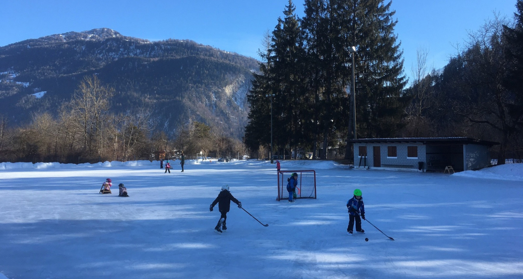
The romantic ice rink in the city center.

Description

The season on the Quader ice rink is over - we look forward to welcoming you again from 15 November 2025.

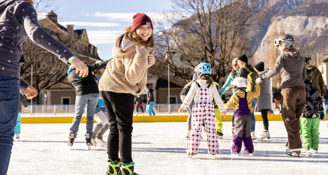
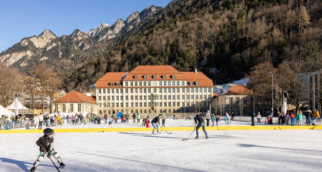
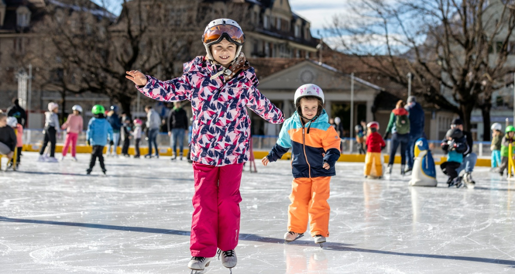
The Quader outdoor ice rink, with its romantic lighting and atmospheric music, is the winter meeting place in the heart of the city, just a two-minute walk from Chur railway station. Allow yourself to be enchanted by the fairy-tale ambience on the ice rink in front of the imposing Quader school building. A separate section is reserved for hockey enthusiasts, while the remaining area is open to people of all ages wishing to practise their ice-skating skills.

Khurer Gnusswaga
The "Khurer Gnusswaga" - Chur food stall - stands next to the Quader outdoor ice rink. The food stall offers homemade dishes for every appetite. A small heated tent next to the ice rink provides cosy warmth where you can enjoy your drink or meal. More information about the Khurer Gnusswaga 

Skating for wheelchair users
The Cerebral foundation has provided the city of Chur with a so-called "ice glider", a platform with its own blades that allows wheelchair users to access the ice. The gliders are designed to adapt to most common wheelchair models. The glider can be used free of charge. See flyer for images.

Prices

Please find ice sports prices here.

Ticket Shop
Buy your tickets online at the ticket shop www.sportanlagenchur.ch/ticketshop

  • buy your ticket online with or without ChurCard, adult or child
  • pay by credit/debit card or Twint
  • receive your ticket with QR code by e-mail
  • validate your QR code at the entry to the ice rink
  • let the ice fun begin!

The tickets are valid on the date of purchase. Purchased tickets cannot be cancelled.

Children unter 6 years are free when accompanied by a paying adult.

Equipment rental

  • Ice skates CHF 6.-
  • Beginners ice skates (2 blades) CHF 3.-
  • Sharpen ice skates CHF 14.- (within 1 to 3 days)
  • Skating aids per hour CHF 4.- 
  • Ice hockey stick CHF 3.-
  • Ice hockey helmet CHF 4.-
  • Soft puck CHF 4.- (sale only)

An ID-card has to be deposited for all rental items.

Please kindly place your group reservation via this format least 48 hrs in advance (reservations for Monday have to be done by Friday 12pm), thank you. You'll find the booking plan with the time slots already booked by groups here: Booking plan.

Opening hours

16.11.2024-02.03.2025* | Season start winter 2025/2026: 15.11.2025

  • Monday-Friday 11am-9pm
  • Saturday 10am-9pm
  • Sunday 10am-8pm, except 2. March 2025 open until 6pm
  • School classes possible from 10am on Tuesdays and Thursdays. Mandatory registration at least 48 hrs in advance (reservations for Monday have to be done by Friday 12pm). Please use this form. You'll find the booking plan with the time slots already booked by groups here: Booking plan.

*Season depending on weather

The Quader outdoor ice rink is generally always open, except in heavy rain or with lots of fresh snowfall. If the weather is uncertain, we will be happy to inform you on: +41 81 254 42 99

Holidays

  • Christmas Eve, 10am-4pm
  • Christmas Day closed
  • Boxing Day, 10am-8pm
  • New Years Eve, 10am-4pm
  • New Year, 10am-4pm
  • 2nd January, 10am-8pm

Special opening hours

  • Christmas holidays 23.12.2024-03.01.2025 opening at 10am on weekdays (food truck open daily from 11am)
  • Sports holidays 24.-28.02.2025 opening at 10am on weekdays (food truck opening daily from 11am)

Directions

Directions

Contact

Responsible for this content Chur Sports and Event Facilities.

E-bike round trip wine region Graubünden Rhine Valley

Medium
55.1 km
3:50 h
259 mhd
259 mhd
Weinregion Bündner Rheintal von oben
Unterwegs auf der Churer Rheinroute 501

Show all 7 images

Überquerung des Rheins zwischen Haldenstein und Chur (Pardislabrücke)
This extended circular tour is all about wine and water. It crosses the wine region of the Graubünden Rhine Valley between Chur and Fläsch and leads along the popular Rhine route back to Chur.
Technique 1/6
Fitness 3/6
Highest Point  655 m
Lowest Point  494 m
Best Season
Jan
Feb
Mär
Apr
Mai
Jun
Jul
Aug
Sep
Okt
Nov
Dez
Start
Station Chur
Destination
Station Chur
Coordinates
46.853441, 9.52974

Details

Description

Directly from the city of Chur, this circular tour leads through the wine-growing villages in the Graubünden Rhine valley and later the "Bündner Herrschaft". Part of the route runs along the Graubünden wine hiking trail, where various panels provide interesting information about regional viticulture. From the outermost Graubünden village of Fläsch, the return journey then takes place along the Alpine Rhine and, at the end, with a detour through the old town of Chur, which is well worth seeing, to the starting point at the train station.

Directions

Chur train station - Chur Rhine Route 501 to Ganda. From there on the Rhine Route 2 through the wine-growing villages of the Bündner Herrschaft to Fläsch and the Rhine. After crossing the Fläsch bridge over the Rhine on the Prättigau Route 21 to Landquart and along the Chur Rhine Route 501 back to Chur.

Directions

Public Transport

Chur train station is easily accessible by SBB (Swiss Federal Railways), Rhaetian Railways, Postbus or Chur Bus.

Anreise Information

Motorway exit Chur Nord or Chur Süd and then drive to the city centre.

Parking

At Chur railway station two multi-storey car parks are available (Otto & Alex / SBB Park & Rail).

Responsible for this content Graubünden Ferien.

Schanfigger Dörferweg (Schanfigger village trail)

Geschlossen
Medium
63.1 km
21:50 h
3014 mhd
3419 mhd
Langwies GR
Litzirüti Wasserfall_Schanfigger Dörferweg

Show all 17 images

Dörferweg Schanfigg (oua_804445298_75e962b_profile)
On the hiking trail you have the opportunity to experience the Schanfigg valley in several days, along the traditional villages.
Technique 3/6
Fitness 4/6
Highest Point  1739 m
Lowest Point  588 m
Best Season
Jan
Feb
Mär
Apr
Mai
Jun
Jul
Aug
Sep
Okt
Nov
Dez
Start
Chur
Destination
Chur
Coordinates
46.784042, 9.679589

Details

Description

The Schanfigg village trail now connects the villages of Schanfigg from Chur to Arosa on both sides of the valley for hikers. Traditional and authentic village culture can be experienced on the 52 km long (mountain) hiking trail.

The Dörferweg leads through intact and varied landscapes with magnificent views, through meadows and forests, across Töbel and past Maiensässen and, last but not least, through the villages with their characteristic wooden knitted buildings, farm and village shops, restaurants and Besenbeizen. The alternation of natural and cultural landscapes can be experienced at every turn, as can be seen, for example, in the scenically magnificent sections at Gründji & Frauentobel.

The village trail enriches the range of hiking opportunities in Schanfigg. Thanks to the good public transport connections between the villages, a variety of circular hikes can be planned, e.g. in connection with the Schanfigger Höhenweg.

Translated with www.DeepL.com/Translator (free version)

Geheimtipp

Learn the insider tips from the locals at the village fountain or during a short chat in the village shop. Divide the hike into different stages.

Sicherheitshinweis

- Constantly monitor the weather development

- Make sure you have suitable and complete equipment

- Good shoes are necessary on the Langwies-Peist section, and you should also be sure-footed and free from vertigo!

- Inform third parties about your tour. Report back when you arrive at your destination

- Enjoy hiking with a smile on your face

Ausrüstung

Clothing suitable for the weather, walking sticks and good walking shoes. Enough to drink and a small pharmacy.

Directions

Chur-Praden-Tschiertschen-Molinis-Peist-Langwies-Litzirüti-Arosa

Arosa-Litzirüti-Langwies-Peist-St.Peter-Castiel-Calfreisen-Maladers-Chur

Directions

Public Transport

By train to the Alpine town of Chur.

Here more info about the timetable

Of course, the trail can be started at any point along the Dörferweg. You can divide the Dörferweg into different stages as you wish.

Arrival in Arosa.

Anreise Information

By car via the motorway or main road to the Graubünden capital Chur.

Of course, the trail can be started at any point along the Dörferweg. You can divide the Dörferweg into different stages as you wish.

Arrival in Arosa.

Parking

Various parking options in Chur.

Of course, the trail can be started anywhere along the Dörferweg.

Parking options in Arosa.

Responsible for this content Graubünden Ferien.