Medium
105 km
39:05 h
3300 mhd
4800 mhd
85 Senda Sursilvana (5 Etappen)
Disla

Show all 8 images

Lag da Pigniu
The Senda Sursilvana affords an insight into a whole region, one which holds many natural and cultural treasures. A high-level hike with several detours to the banks of the young Rhine.
Technique /6
Fitness 6/6
Highest Point   m
Lowest Point   m
Best Season
Jan
Feb
Mär
Apr
Mai
Jun
Jul
Aug
Sep
Okt
Nov
Dez
Start
Oberalppass
Destination
Chur
Coordinates
46.659430793349, 8.6712675537454

Details

Description

The Surselva is more than a mere mountain valley. The Surselva - meaning «above the forest» – is a world apart, with its own language (Sursilvan), its own history shaped by the Disentis Monastery and the mountain passes, its own breed of men and a natural character shaped by one particular element, one which is continually gaining in value: water. It’s for a good reason that the official source of the Rhine rises at Tomasee near the Oberalppass. The water, collected in dozens of reservoirs is an energy provider. It has also eaten its way through the world’s largest mapped rockslide at Flims. It has created the imposing Ruinaulta Gorge, which can hardly be beaten for ruggedness – particularly when seen from the vantage platform at Conn.

The hike through the Surselva leads through an intact landscape but also arouses culturally historic curiosity, whether with the paintings in the Waltensburg Protestant Church or in the light of the mystifying menhir at Falera.The finale of four very varied hiking days is a tour around the old town quarter of Chur, Switzerland’s oldest town.

Book Package «Senda Sursilvana»  and benefit from the free luggage transport from hotel to hotel.

Further Information in German

Directions

Directions

Public Transport

This tour can be simplified by public transport.

Are you planning a multi-day tour?  Buy our graubündenPass and enjoy free travel throughout Graubünden. Available here!

Responsible for this content SwitzerlandMobility.
This content has been translated automatically.

Geschlossen
Medium
11 km
3:35 h
640 mhd
540 mhd
Chur aus dem Schanfigg
Tschiertschen

Show all 5 images

Tschiertschen
The first section of the Schanfigger Höhenweg leads from Arosa across the sunny plateau of Medergen to Sapün. An extraordinary scenic tour past old Walser settlements, culminating in amazing views of the Schanfigg.
Technique /6
Fitness 4/6
Highest Point   m
Lowest Point   m
Best Season
Jan
Feb
Mär
Apr
Mai
Jun
Jul
Aug
Sep
Okt
Nov
Dez
Start
Arosa
Destination
Langwies, Heimeli
Coordinates
46.783147981893, 9.6795491710288

Details

Description

The starting point of the first stage is left up to the hiker: directly from the station or by bus to Meiersboden. The signposting to the Schanfigger Höhenweg begins at the St. Hilarienbrüggli. On the way, you pass the hotel management school in Passugg. The building of the former spa hotel is impressive. The Grida-Praden section of the trail is physically demanding, but the reward is wild and romantic passages in the Steinbachtobel. You then pass the village sawmill in Praden. Afterwards you can see the village church from the 17th century. Then you walk partly on the Churer Alpweg (before 1890) past the larch forest to Tschiertschen. In the village centre is the 15th-century church with exposed relics of late Gothic frescoes and a listed Toggenburg organ from 1820. If you still have energy left, visit Füxliweg. A special attraction is also the Tschiertscher Säge (saw), which is still operated by the water power of the Sagenbach stream.

Geheimtipp

Visit the Güdahof farm shop - with honey from the region, syrup and jams made from seasonal fruit or herbs from the farm garden, Filisurer ice cream and gift articles to complement the carefully compiled range. Bring a piece of your holiday home with you!

Sicherheitshinweis

In bad weather, the Steinbachtobel can be difficult to pass. Partly demanding physical requirements. Alternatively, parts of the route can be completed by public transport.

Ausrüstung

Good shoes, rain jacket, walking sticks if necessary, enough to drink, snack to eat.

Directions

Chur Bahnhof - Chur Meiersboden - Passugg- Oberer Grida - Maiensäss - Ricaldei - Usser Praden - Sagentobel - Inner Praden - Tschiertschen

Directions

Public Transport

By train to the Alpine town of Chur.  

Anreise Information

By car via the motorway or main road to the Graubünden capital Chur

Parking

Various car parks in Chur.

Responsible for this content Graubünden Ferien.

Medium
110 km
36:55 h
4500 mhd
4800 mhd
64 Via Sett Gesamttour (6 Etappen)

Show all 10 images

Museumskaffee Chur
Cross the Septimer on foot, from one Alpine town to another: the route runs from Chur through the Churwalden Valley, Lenzerheide, Surses in Parc Ela and Bregaglia to Chiavenna (Italy). Explore three linguistic and cultural regions and a diverse cultural landscape – from pastures to chestnut groves.
Technique /6
Fitness 6/6
Highest Point   m
Lowest Point   m
Best Season
Jan
Feb
Mär
Apr
Mai
Jun
Jul
Aug
Sep
Okt
Nov
Dez
Start
Chur
Destination
Chiavenna (I)
Coordinates
46.853222455222, 9.5300062165975

Details

Description

Traders, armies, kings and emperors all crossed the Alps via the Septimer route. Its advantages were the convenient location with a direct north-south link and ideal topographical conditions. Finds of lead slingshot on the Septimer bear witness to the fact that the Roman army made early use of the pass. Above all in the High Middle Ages, the Septimerpass was one of the most important trading routes and brought wealth to the Bishop of Chur. Today, one of Switzerland's most diverse cultural and long-distance hiking routes travels over what was once an arduous Alpine crossing. From Chur to Chiavenna in Italy, it gradually traces a chequered history and leads through three different cultural regions. The natural setting is just as varied. There is plenty to discover, the open space of the high plateau in the Surses, the rocky landscape at the head of the Septimerpass and the Mediterranean mountain valleys of Bergell and Valchiavenna.

Geheimtipp

The Via Sett is accessible from mid-June to mid-October, depending on weather conditions. The 93 km long long-distance hike from Chur (CH) to Chiavenna (IT) can be hiked in 6 or 7 daily stages. The average walking time per day is 4 - 7 hours. The stages can be simplified by public transport.

Book Via Sett now at:

Tour Explorer

+41 81 356 22 44

info@tour-explorer.ch 

www.tour-explorer.ch

Sicherheitshinweis

attention:

Due to the instability of the rocks in the Boca Naira area above Casaccia, the path to Alp Maroz Dora and the Septimer Pass is closed until further notice.

A detour for hikers/mountain bikers is signposted. However, mountain bikers have to get off the bike for this section.

For horses, the diversion is not suitable and impassable.

Ausrüstung

Crossing the border between Switzerland and ItalyA valid identity card or passport is required to cross the border.

Directions

Directions

Public Transport

All stage destinations Via Sett are accessible by public transport (train or bus). Partial Reservations are required. The return from Chiavenna can be done via Splügenpass or Maloja to St. Moritz.

Anreise Information

From Chur on the motorway to Thusis. Savognin via Tiefencastel to Thusis.

Parking

Parking is available at the train station in Thusis. There are a number of parking spaces.

Responsible for this content Graubünden Ferien.
This content has been translated automatically.
Medium
47 km
25:15 h
2400 mhd
3200 mhd
Medergen mit Aussicht nach Arosa
Arosa

Show all 11 images

Tschiertschen
The Schanfigger Höhenweg is a journey through time and a spectacle of nature at the same time. On old mule tracks, the mountain path leads from the holiday resort of Arosa to the Alpine city of Chur. Through the Schanfigg with its picturesque side valleys Sapün and Fondei, you walk across sunny plateaus, explore original Walser settlements and rugged canyons.
Technique /6
Fitness 4/6
Highest Point   m
Lowest Point   m
Best Season
Jan
Feb
Mär
Apr
Mai
Jun
Jul
Aug
Sep
Okt
Nov
Dez
Start
Arosa
Destination
Maladers, alte Post
Coordinates
46.783147981893, 9.6795491710288

Details

Description

The Schanfigg region is characterised by the two important towns of Chur and Arosa at the entrance and end of the valley. In between there are small and medium-sized villages that have retained their original character despite the tourist development in Arosa.

5 tips on the Schanfigger Höhenweg:

1. Tschiertschen: This picturesque village was voted the most beautiful mountain village in Graubünden.

2. Arosa: There is much to discover here; the Arosa Bärenland, the Eichhörnliweg (squirrel trail) or loosen up tired hiking legs in the cool waters of the Untersee lido.

3. Sapün and Heimeli mountain inn: The side valley of Sapün is one of the scenic highlights of this long-distance hike. With a bit of luck, you can observe wild animals from the terrace of the mountain inn.

4. Lake Grüensee in Fondei: Lake Grüensee on the Durannapass is too beautiful to simply walk past. Treat yourself to a break.

5. Hochwang: The section between Fondei and Hochwang is perfect as a photo subject: moorland landscapes, flower meadows, sun-baked wooden stables.

The individual Schanfigger stages are between three and six hours long. Since some of the stage locations are served by public transport, there are various options for getting on and off. This allows flexible tour planning to suit your own needs and ambitions.

Route 1: Chur - Tschiertschen

Route 2: Tschiertschen - Arosa

Route 3: Arosa - Sapün

Route 4: Sapün - Fondei

Route 5: Fondei - Hochwang

Route 6: Hochwang - Chur

Geheimtipp

Enjoy the tour as a multi-day stage hike. Let yourself be spoilt in the rustic "Bergbeizli" or enjoy a picnic in the middle of unique Alpine flora.

Overnight accommodation: in each case at the Etappe location.

Tschiertschen, Arosa, Berggasthaus Heimeli, Berggasthaus Strassberg or Casanna, Hochwanghütte, Chur.

Sicherheitshinweis

  • Constantly monitor the weather development
  • Make sure you have suitable and complete equipment
  • Inform third parties about your tour. Report back when you arrive at your destination
  • Observe the principle "if in doubt, turn back".
  • Enjoy hiking with a smile on your face

Ausrüstung

Clothing suitable for the weather, walking sticks and good walking shoes. Enough to drink and a small pharmacy. 

Directions

Bahnhof Chur - Tschiertschen - Arosa - Sapün (Heimeli) - Strassberg - Hochwang - Maladers - Chur

Directions

Public Transport

By train to the Alpine town of Chur.

Here more info about the timetable.

Of course, the trail can be started at any point along the Höhenweg.

Anreise Information

By car via the motorway or main road to the Graubünden capital Chur.

Of course, the trail can be started at any point along the Höhenweg.

Parking

Various parking options in Chur.

Of course, the trail can be started at any point along the Höhenweg.

Responsible for this content Graubünden Ferien.

Heidiland Bike Tour

168.5 km
18:35 h
5370 mhd
5264 mhd
Heidiland Bike Tour (oua_24515991_0c70eab_profile)
Heidiland Bike Tour
Technique 0/6
Fitness 0/6
Highest Point  1428 m
Lowest Point  421 m
Best Season
Jan
Feb
Mär
Apr
Mai
Jun
Jul
Aug
Sep
Okt
Nov
Dez
Coordinates
47.13502, 9.09802

Details

Responsible for this content Graubünden Ferien.

D01 - T22 Via Francisca des Lukmaniers

Medium
476.1 km
125:15 h
6852 mhd
7191 mhd
T01 - T22 Via Francisca des Lukmaniers
T01 - T22 Via Francisca des Lukmaniers (oua_24516016_0e20ae1_profile)
The "Via Francisca des Lukmaniers" is also known as the "Street of the Emperors". It leads from Constance over the Lukmanier Pass to Pavia, where it meets the Via Francigena. Here is the official route in 15 Swiss stages, plus 7 stages in Italy.
Technique 1/6
Fitness 4/6
Highest Point  1978 m
Lowest Point  55 m
Best Season
Jan
Feb
Mär
Apr
Mai
Jun
Jul
Aug
Sep
Okt
Nov
Dez
Start
Konstanz ( Münster )
Destination
Pavia Church, San Pietro in Ciel d'oro. ( - Rome)
Coordinates
47.663249, 9.175472

Details

Description

www.viafrancisca.ch/wegbeschreibung/

Geheimtipp

For more explanations on the trail, visit us on www.viafrancisca.ch

Sicherheitshinweis

November - April possibly snow stages 10 and 11, Disentis-Lukmanierpass-Olivone. Use public transport.

Ausrüstung

Backpack with rain cover, well-worn footwear, durable clothing appropriate to the season, rain and sun protection, hiking stick or trekking poles, pilgrim's passport.

Directions

www.viafrancisca.ch/wegbeschreibung

Directions

Public Transport

Public transport to Konstanz and from Pavia. All stage towns can be reached by public transport.

Anreise Information

-

Parking

-

Responsible for this content Graubünden Ferien.
This content has been translated automatically.
303.1 km
89:45 h
9688 mhd
10093 mhd
Sumvitg mit seiner von weither sichtbaren Kirche
Müstair: Kloster San Gian

Show all 10 images

S-charl: Kapelle
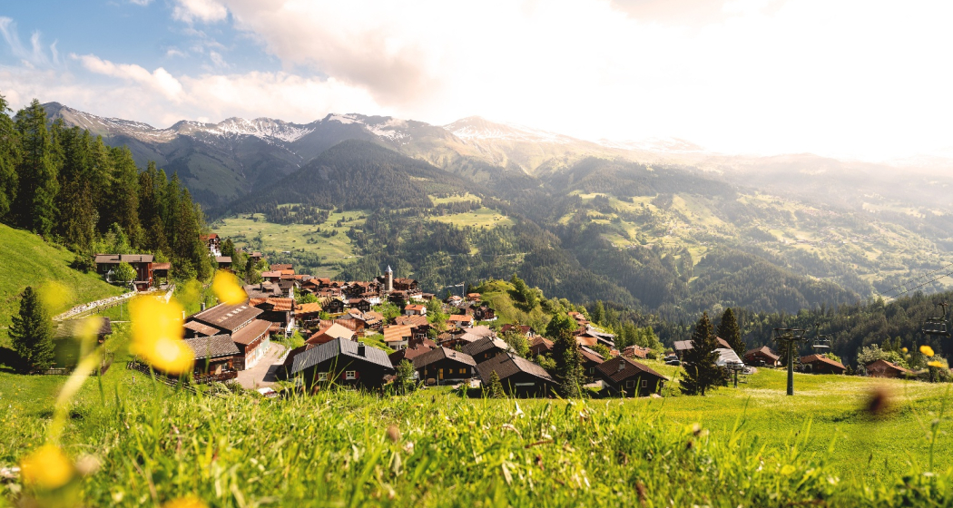
The pilgrimage route Via Son Giachen leads from South Tyrol through the Val Müstair in the canton of Graubünden towards Central Switzerland or Valais.  The partly alpine pilgrimage route is only accessible continuously in warm seasons.
Technique 0/6
Fitness 0/6
Highest Point  2605 m
Lowest Point  435 m
Best Season
Jan
Feb
Mär
Apr
Mai
Jun
Jul
Aug
Sep
Okt
Nov
Dez
Coordinates
46.629432, 10.449222

Details

Responsible for this content Pilgerwege Schweiz.
This content has been translated automatically.
Outdooractive Logo

This website uses technology and content from the Outdooractive platform.

T 07 Via Francisca: Chur - Bonaduz

Geschlossen
Simple
16 km
4:25 h
286 mhd
245 mhd
RhB vor Domat Ems
Pilgerweg in Plessur: Via Francisca: Chur - Bonaduz

Show all 3 images

T 07 Via Francisca: Chur - Bonaduz (oua_24511571_00f683b_profile)
The "Via Francisca" is also known as the "Road of the Emperors". It leads from Constance over the Lukmanier to Pavia, where it meets the Via Francigena.
Technique /6
Fitness 2/6
Highest Point  725 m
Lowest Point  575 m
Best Season
Jan
Feb
Mär
Apr
Mai
Jun
Jul
Aug
Sep
Okt
Nov
Dez
Start
Chur, Cathedral of the Assumption of the Virgin Mary
Destination
Bonaduz, Railway Station
Coordinates
46.847633, 9.53524

Details

Description

There are now two pilgrimage routes between Chur and Disentis, with the Via Francisca running mainly on the southern side of the Rhine, while the Way of St. James Graubünden, called Via SonGiachen, runs on the northern side. However, the two paths are almost identical up to Tamins. So it may happen that the two hikers in front are also pilgrims, but on their way from South Tyrol to Central Switzerland.
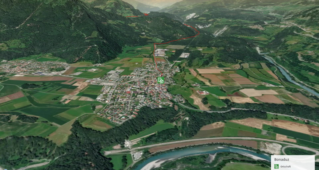
Both paths lead from Chur towards the Graubünden Oberland, called Surselva. Initially, we hike along the southern edge of the wide Rhine valley. At Domat/Ems we first cross the tracks of the Rhaetian Railway at the station, then walk between the two hills "Tuma Tschelli" and "Tuma Casti" and then circle the second to the north. This brings us first to the Rhine power plant, and after crossing the Rhine over the weir, the paths then separate to meet again briefly on the main square of Tamins. But only as far as crossing the village square, where we separate again. Now it's down to cross the Vorderrhein on the railway bridge. And so we arrive at Bonaduz.


Geheimtipp

The stages in this documentation are suggestions that each pilgrim can adapt to his wishes. however, the technical data always concern the assumption that these stages are completed in one day.

Sicherheitshinweis

.

Ausrüstung

Normal hiking/trekking equipment: backpack with rain cover, well-worn footwear, durable clothing appropriate to the season, rain and sun protection, hiking stick or trekking poles, pilgrim's passport.

Directions

Chur - River Plessur - Rose Hill - Lime kiln - Paleu sura - Domat/Ems - Tuma Casté - Power plant - Rhine weir - Tamins - Anterior Rhine - Campagna - Bonaduz

Directions

Public Transport

SBB, RhB

Anreise Information

A 13

Responsible for this content Graubünden Ferien.
This content has been translated automatically.

T 06 Via Francisca: Maienfeld - Chur

Medium
24.9 km
6:45 h
479 mhd
373 mhd
T 06 Via Francisca: Maienfeld - Chur
Pilgerweg in Graubünden: Via Francisca: Maienfeld - Chur

Show all 3 images

T 06 Via Francisca: Maienfeld - Chur (oua_24511570_6eddf74_profile)
The "Via Francisca" is also known as the "Road of the Emperors". It leads from Constance over the Lukmanier to Pavia, where it meets the Via Francigena.
Technique /6
Fitness 4/6
Highest Point  753 m
Lowest Point  514 m
Best Season
Jan
Feb
Mär
Apr
Mai
Jun
Jul
Aug
Sep
Okt
Nov
Dez
Start
Maienfeld, railway station
Destination
Chur, Cathedral of the Assumption of the Virgin Mary
Coordinates
47.006933, 9.531564

Details

Description

After leaving Maienfeld, we walk through the vineyards of Jenins and Malans. After the village of Malans, we leave the "Graubünden dominion", as this wine-growing region is called.
Afterwards we cross the Landquart, which has left the Prättigau shortly before through a very narrow rock cut. In the upper part of this valley are the well-known ski resorts of Klosters and Davos.
We stay on the eastern side of the Rhine in the relatively wide valley to Trimmis, passing through other, smaller vine-growing areas. The Rhine Valley is now gradually changing direction to the west.
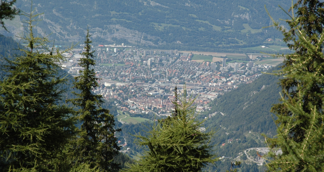
Leaving Trimmis, we then go up again to the valley flank, which brings us shade in the forest and also gives us the opportunity to look at the Rhine Valley from the heights. In doing so, we also bypass the extensive outskirts of Chur, which lie at the bottom of the valley. This takes us through a lot of nature directly to the cathedral of Chur, the capital of the canton of  Graubünden. 

Geheimtipp

The stages in this documentation are suggestions that each pilgrim can adapt to his wishes. however, the technical data always concern the assumption that these stages are completed in one day.

Sicherheitshinweis

.

Ausrüstung

Normal hiking/trekking equipment: backpack with rain cover, well-worn footwear, durable clothing appropriate to the season, rain and sun protection, hiking stick or trekking poles, pilgrim's passport.

Directions

Maienfeld - Eichholz - Erlenböden - Buochwald - Malans - River Landquart - Marschlins Castle - Igis - Zizers - Molinära - Trimmis - Bach Maschänser Rüfi - Fürstenwald - Waldhaus - Eulengut - Chur Cathedral

Directions

Public Transport

SBB

Anreise Information

A13 / E43

Responsible for this content Graubünden Ferien.
This content has been translated automatically.
T 08 Via Francisca: Bonaduz - Ilanz

Difficult
22.9 km
6:35 h
527 mhd
479 mhd
Beweis unserer Wegführung
T 08 Via Francisca: Bonaduz - Ilanz

Show all 4 images

Pilgerweg in Imboden: Via Francisca: Bonaduz - Ilanz
The "Via Francisca" is also known as the "Road of the Emperors". It leads from Constance over the Lukmanier to Pavia, where it meets the Via Francigena.
Technique 1/6
Fitness 5/6
Highest Point  936 m
Lowest Point  658 m
Best Season
Jan
Feb
Mär
Apr
Mai
Jun
Jul
Aug
Sep
Okt
Nov
Dez
Start
Bonaduz, Railway Station
Destination
Ilanz. Railway station
Coordinates
46.810677, 9.397203

Details

Description

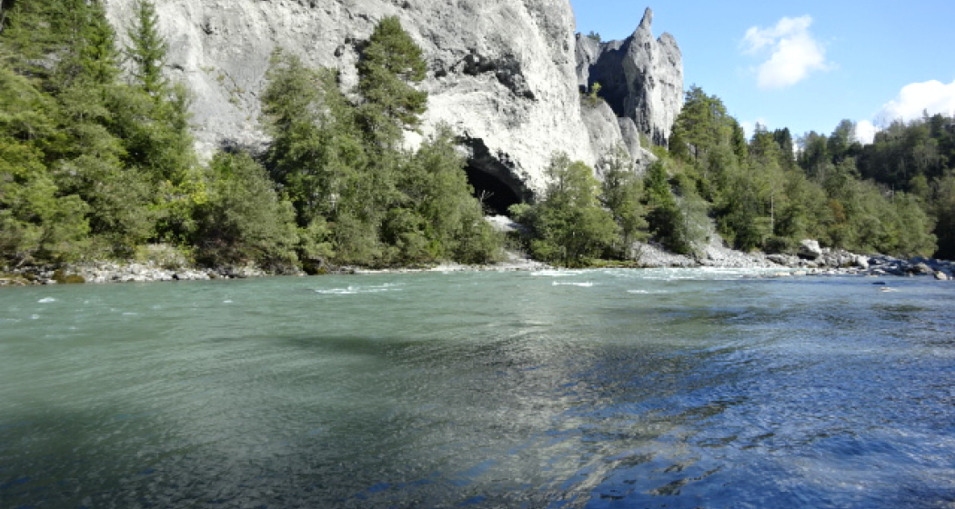
Today's stage is impressive, it takes us on the southern flank through the Rhine Gorge, the Swiss version of the "Grand Canyon", popular especially with water sports enthusiasts such as canoeists or rafters. The gorge has very steep flanks on both sides, so that the embarkation usually takes place in Ilanz and the disembarkation at the confluence of the Vorderrhein and Hinterrhein near Reichenau. However, there is still a transport option, because the Rhaetian Railway (narrow gauge) runs on the Chur - Ilanz route through the gorge, with some bridges and tunnels. This route is also used in winter. So whatever the weather has in store for capers, we will definitely come to Ilanz.
Of course, we hope for sunny weather, because then this stage with its breathtaking views is an unforgettable treat. We will ascend at the beginning and enjoy the gorge from above, then we will descend to the Rhine, where we will then meet the Rhaetian Railway and follow it and the Rhine to Ilanz.

Geheimtipp

The stages in this documentation are suggestions that each pilgrim can adapt to his wishes. however, the technical data always concern the assumption that these stages are completed in one day.

Sicherheitshinweis

.

Ausrüstung

Normal hiking/trekking equipment: backpack with rain cover, well-worn footwear, durable clothing appropriate to the season, rain and sun protection, hiking stick or trekking poles, pilgrim's passport.

Directions

Bonaduz - Caumas - Tschavir - Zault - Puz da Mattauns - Versam - Hübschera - Carnifels - Alatobel - Carrera - Carreratobel - Valendas - Station Valendas - Castrisch - Glenner - Ilanz

Directions

Public Transport

RhB (Rhaetian Railway)

Responsible for this content Graubünden Ferien.
This content has been translated automatically.