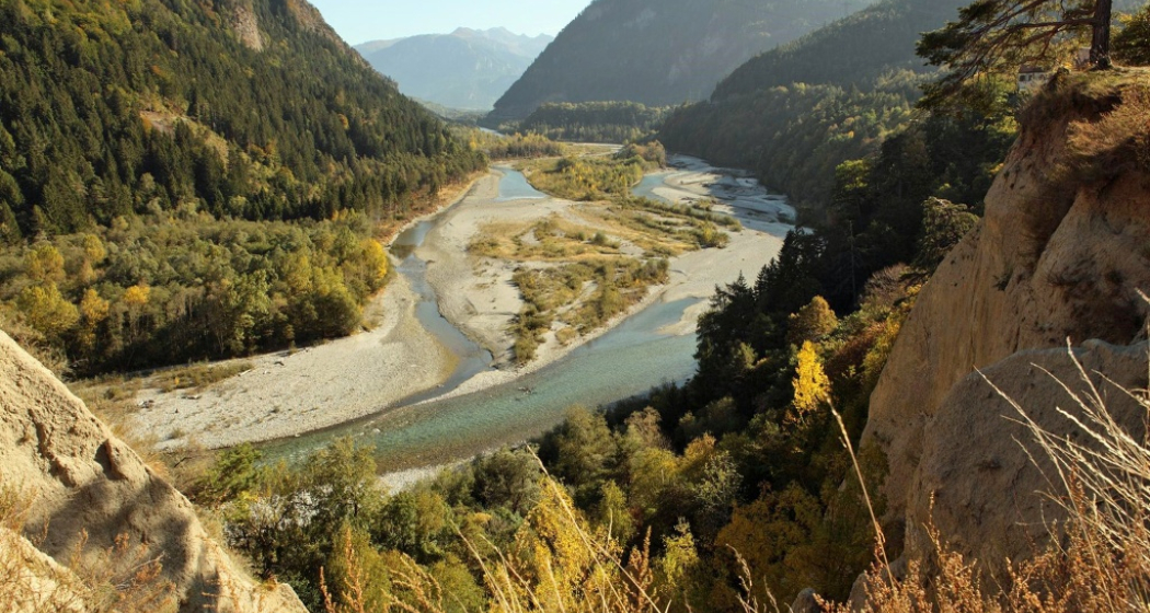
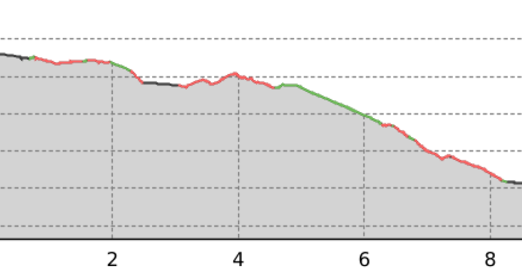
Calanda (hut) Challenge

Difficult
31.5 km
5:00 h
1500 mhd
1500 mhd
Calanda(hütte) Challenge

Show all 10 images

Calanda(hütte) Challenge
Tough, panoramic, varied: The bike trip to the Calanda hut is quite a tour - a real challenge!
Technique 3/6
Fitness 5/6
Highest Point  2075 m
Lowest Point  546 m
Best Season
Jan
Feb
Mär
Apr
Mai
Jun
Jul
Aug
Sep
Okt
Nov
Dez
Start
Chur (Alexanderplatz)
Destination
Haldenstein (village)
Coordinates
46.852106, 9.531509

Details

Description

This challenging mountain bike tour starts in the heart of Chur city. The Calanda mountain is situated on the sunny side of the Rhine valley, therefore the tour is possible already in springtime (in summertime early start recommend). At first, follow the national cycling route no. 2 (Rhine route) northwards until you reach the village of Haldenstein. Cross the Rhine river and drive into the village, in direction of the castle. In the village centre, the mountain road branches off to the right side. Now get ready for a long ascent of total 1'500 meters in height. On the way up you pass by several alps as Arella, Funtanolja, Neusäss, Altsäss until you finally reach the Calanda hut.

The hut is feasted during the summer months, so you can have a drink and a meal there. If you really want a challenge, then you can climb up (by foot) to the peak of the Haldensteiner Calanda (730 meters in height and appr. 1 ½ hours from the hut). To have enough time and being able to enjoy the scenery, an overnight in the Calanda hut is absolutely recommended then.

For the descent, take the singletrail right from the hut. Later, you will follow the ascent road for a short track, before a narrow and technical trail branches off to the left at Alp Neusäss, that leads to the Vazer Alp. After a descent on the alp road, at point 1515 another trail branches off to the right side and will take you to the beautiful settlement of Batänja. From there follow the forest road until you pass by the ruin of Lichtenstein. Shortly later for the last piece of the descent, another trail on the left side will take you back down to the village of Haldenstein.

Geheimtipp

Dave Kilshaw's Calanda Challenge by swissrent

The ascent route is signposted as "Dave Kilshaw's Calanda Challenge", a free, interactive outdoor sports adventure. You'll find 6 signposts along the way, which contain a Scan-Point. If you master the more than 20 km, and 1,500 vertical meters along the well-kept forest road up to the Calanda hut, and can scan the respective points with the swissrent-App you can earn 20 «mountainmiles» per scan, which can be redeemed for rental with swissrent. The first Scan-Point signpost is right in the middle of the city center (Alexanderplatz, in front of the City Shop Chur).

Responsible for this content Chur Tourism.

Enduro-Tour Brambrüesch - Passugg

Medium
10.9 km
1:00 h
17 mhd
1006 mhd
Trail zwischen Malix und Passugg

Show all 5 images

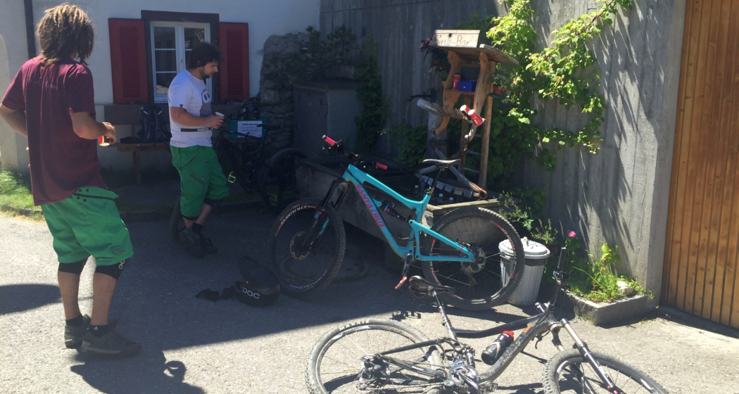
Pause beim Sirupbrunnen in Spina
Single trail descent from Chur's local mountain to Malix, Passugg and back to Chur.
Technique 3/6
Fitness 2/6
Highest Point  1605 m
Lowest Point  599 m
Best Season
Jan
Feb
Mär
Apr
Mai
Jun
Jul
Aug
Sep
Okt
Nov
Dez
Start
Brambrüesch, top station of gondola
Destination
Chur, valley station of gondola
Coordinates
46.829109, 9.516378

Details

Description

Start of the tour at the top station of the Chur cableways at Brambrüesch. First follow the signposted route no. 616 (Biketicket 2 RIDE red), but at Spina turn left towards Malix - and refresh yourself first at the syrup fountain! After a stretch on the road follows a steep trail that leads into the Passugger Gorge. Finally, there is another single track taking you back to Chur.

Directions

Public Transport

Take the train to Chur station. From there you can reach the valley station by bike in 5 minutes.

Anreise Information

  • Highway exit Chur Süd

  • Drive in direction of the city centre (Kasernenstrasse)

  • The valley station and parking lot are located in front of the city centre on the right-hand side.

Parking

More about parking for guests of the Chur mountain railways.

Responsible for this content Brambrüesch.
This content has been translated automatically.

Churer Joch round trip

Geschlossen
Medium
37.3 km
5:00 h
1500 mhd
1500 mhd
Churer Joch Rundtour
Aufstieg zum Churer Joch

Show all 11 images

Churer Joch Rundtour
An exciting circuit tour with a fantastic viewpoint and a picturesque mountain village.
Technique 3/6
Fitness 4/6
Highest Point  2042 m
Lowest Point  584 m
Best Season
Jan
Feb
Mär
Apr
Mai
Jun
Jul
Aug
Sep
Okt
Nov
Dez
Start
Chur
Destination
Chur
Coordinates
46.853084, 9.529097

Details

Description

The tour starts at the Chur railway station and leads over the Plessurquai in the direction of Meiersboden. As far as Churwalden, follow the signposted route 255, which leads pleasantly upwards along the beautiful Polenweg. In Churwalden you leave route 255 and shortly afterwards turn left, where the second part of the ascent follows (if the whole tour is too long for you, you can take the post bus in Chur with your bike and start the tour from Churwalden). The route climbs higher and higher and the landscape becomes more and more picturesque, characterised by a rich alpine flora, especially in early summer.  At Foppa, already at 1753 m above sea level, the road branches off to the left. The highest point, the Churer Joch, can be seen from far away. But the legs still have to pedal bravely until then. It's worth it! A far view to the Calanda, the Lenzerheide and the Arosa mountain range opens up. And those who continue at the hut to the summit can see the Alpine City of Chur deep down in the valley.

The descent leads on a single trail in the direction of Tschietschen. Later one drives on a forest road to Furgglis, where there is a beautiful mountain inn. On another trail over the Geissboden the trail continues down to the pretty mountain village of Tschiertschen. The red shining geraniums and many coloured flowers decorate the wooden houses darkened by the sun. The further descent first follows the main road, changing to a single trail above the road to Praden. There again a bit of descent follows on the road until finally a beautiful single trail branches off to the right through the Steinbach forest and leads to the valley near Meiersboden/Araschgen. From there take the road back to Chur.

Chur, the Alpine City, here a visit to the picturesque Old Town is worthwhile. Refresh yourself, for example, on the Kornplatz with a fine Alpine City ice cream in the Gelateria Evviva Plankis.

Responsible for this content Chur Tourism.

Walking tour through the Alpine City

Simple
4.5 km
1:45 h
20 mhd
20 mhd
City E-Guide Chur
Blick auf die Churer Altstadt

Show all 14 images

Arcas Platz in der Altstadt
Discover Switzerland's oldest town on a tour through the city center and the historic Old town. In addition with the Audio Guide from Chur Tourism, you will enjoy an interesting and individual city tour.
Technique 1/6
Fitness 1/6
Highest Point  623 m
Lowest Point  574 m
Best Season
Jan
Feb
Mär
Apr
Mai
Jun
Jul
Aug
Sep
Okt
Nov
Dez
Start
Chur, train station
Destination
Chur, train station
Coordinates
46.853748, 9.529188

Details

Description

The City E-Guide by Chur Tourism is the individual city tour for your mobile phone or tablet. With the free app, you can explore the city on your own. All kinds of interesting facts about history, culture, sights and much more are available in the app at any time. You can choose from various tours of different lengths, which can be adapted to your starting point thanks to GPS positioning.

In 43 chapters you will learn many interesting facts about the history and culture of the Alpine City of Chur and the holiday canton of Graubünden. A further 32 chapters deal with the Cathedral Treasure Museum of the Diocese of Chur - you will learn many interesting facts about the history of the diocese, about the cathedral treasure of Chur and the Death Pictures from the Episcopal Castle.

At the Tourist Info at Chur mainstation, you have also the possibility to rent a tablet with the City E-Guide on it. Thanks to the larger screen, tablets are ideal for experiencing the tours together with one device.  

Directions

Public Transport

The tour begins directly at the Chur railway station.

Responsible for this content Chur Tourism.
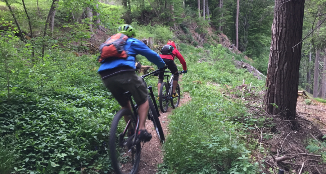
Chur - Trimmis - Zizers - Haldenstein - Chur

Simple
26.4 km
2:15 h
139 mhd
139 mhd
Trimmiser Mittelweg
Trimmiser Mittelweg

Show all 7 images

Churer Rheinroute 501, Pardislabrücke Haldenstein-Chur
Beautiful round tour from Chur, connecting the two new cycle paths Chur-Trimmis and Haldenstein-Chur with the Rhine route.
Technique 1/6
Fitness 2/6
Highest Point  655 m
Lowest Point  539 m
Best Season
Jan
Feb
Mär
Apr
Mai
Jun
Jul
Aug
Sep
Okt
Nov
Dez
Start
Chur railway station
Destination
Chur railway station
Coordinates
46.85354, 9.529757

Details

Description

The Chur-Trimmis cycle path over the Trimmiser Mittelweg was opened on 27 November 2019. It leads from the end of the Cadonaustrasse in Chur to the Blutmarchweg in the Fürstenwald and over a new bridge at the Maschänserrüfe and the Trimmiser Mittelweg to Trimmis. The Haldenstein-Chur cycle path was opened on 14 December 2018. It leads from Haldenstein along the Rhine to the Pardisla bridge, which was newly built and crosses the Rhine in the direction of Chur.

The two new cycle paths can be combined in a round tour from Chur via Zizers to a beautiful round tour. Provided there is no snow all the way down to the valley, this route can be used practically all year round and is also suitable in winter as a round route for cyclists, cross-country bikers, e-bikers or gravel bikers. Between Trimmis and Zizers, the tour leads through the vineyard landscape and on to Molinära Hof over a piece of unpaved ground (hiking trail). If you prefer to do the whole round on a paved surface, you can go in Trimmis directly down to the Deutsche Strasse and along it to Zizers - so the round is even suitable for racing cyclists (a short section through the Fürstenwald on the new cycle path Chur-Trimmis runs on a not asphalted but paved forest path).

Responsible for this content Chur Tourism.
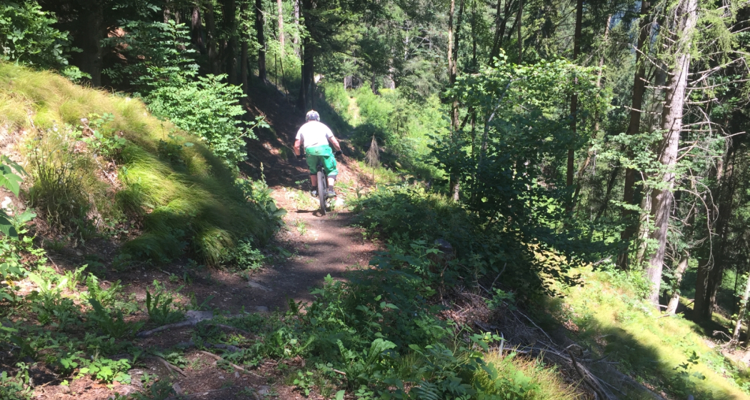
Alpenride (702)

Difficult
2 km
0:10 h
1 mhd
408 mhd
Alpenride Trail im Alpenbikepark Chur
Alpenride (702)

Show all 4 images

Drop-Batterie auf der roten Strecke
The Alpenride is a freeride trail in the upper section of the Alpenbikepark Chur.
Technique 3/6
Fitness 2/6
Highest Point  1593 m
Lowest Point  1184 m
Best Season
Jan
Feb
Mär
Apr
Mai
Jun
Jul
Aug
Sep
Okt
Nov
Dez
Start
Brambrüesch, top station of gondola
Destination
Känzeli, middle station of gondola
Coordinates
46.829463, 9.516248

Details

Description

The Alpenride trail is a freeride classic with several jumps, drops and a good mix between easier and more difficult sections.

Directions

Public Transport

Take the train to Chur station. From there, the city bus (line 1) takes 3 minutes to the valley station of the mountain railways (Stadthalle/Brambrüeschbahn stop).

Anreise Information

  • Motorway exit Chur Süd
  • Drive into the city (Kasernenstrasse)
  • The valley station and car park are on the right-hand side in front of the town centre

Parking

More about parking for guests of the Chur mountain railways.

Responsible for this content Brambrüesch.
This content has been translated automatically.

CampAu Family tour

Simple
22.6 km
1:30 h
135 mhd
135 mhd
CampAu am Rhein-Ufer
Blick auf Reichenau-Tamins und das Churer Rheintal

Show all 4 images

Restaurant beim CampAu
Pleasant family cycling tour at the border of the Rhine river through the villages of the Chur Rhine valley.
Technique 1/6
Fitness 1/6
Highest Point  662 m
Lowest Point  557 m
Best Season
Jan
Feb
Mär
Apr
Mai
Jun
Jul
Aug
Sep
Okt
Nov
Dez
Start
Chur, Campsite Au
Destination
Chur, Campsite Au
Coordinates
46.861849, 9.507594

Details

Description

Start your tour at the campsite Obere Au. Cycle along the Rhine river to the village of Felsberg (in case the path is closed due to military exercises in this area, you can follow the official cycling route no. 2 and 6). The tour takes you then through the villages of Felsberg, Tamins, Reichenau, Domat/Ems and back to Felsberg and Chur. The campsite Obere Au has a playground for children and a restaurant, where you can have a meal and drinks.

Responsible for this content Chur Tourism.
Rhine Gorge hike: Turnerweg (659.10)

Simple
6.1 km
1:45 h
83 mhd
83 mhd
Bonaduz
Rheinauen Rhäzüns

Show all 4 images

Sogn Mang
The leisurely round tour begins in Bonaduz and leads on a hiking trail first to the Hinterrhein, along which you walk to the confluence with the Vorderrhein. A wide path then leads back to the village of Bonaduz.
Technique /6
Fitness 2/6
Highest Point  660 m
Lowest Point  587 m
Best Season
Jan
Feb
Mär
Apr
Mai
Jun
Jul
Aug
Sep
Okt
Nov
Dez
Coordinates
46.810442, 9.397925

Details

Description

From Bonaduz railway station, the route leads across wide fields and after a short descent directly to the bank of the Hinter Rhine. Now you can enjoy a wonderful walk along the banks of the Rhine with fascinating views of the Rhine floodplains, one of the last large natural river landscapes of the Rhine above Lake Constance. The trail leads towards Reichenau, where the Vorder Rhine joins the Hinter Rhine. The route finally leads back to the village of Bonaduz via a beautiful country lane.

Responsible for this content Chur Tourism.

Tschiertschen - Grida - Chur (10)

Geschlossen
9.8 km
3:15 h
109 mhd
846 mhd
Dominic Frei
Tschiertschen - Grida - Chur (10) (oua_49811119_1e457eb_profile)
Leisurely hike from Tschiertschen via Passugg, down to Chur - over hill and dale off the cantonal road
Technique 0/6
Fitness 0/6
Highest Point  1338 m
Lowest Point  600 m
Best Season
Jan
Feb
Mär
Apr
Mai
Jun
Jul
Aug
Sep
Okt
Nov
Dez
Coordinates
46.818241, 9.606541

Details

Description

From the village centre (1343 m above sea level) M) as on Route 9 via the car park at the entrance to the village, «Fraumatten» and «Usser Praden» (1160 m.a.s.l. M) to the fork in the path before the "Steinbachtobel", where the path to Runcalier–Churwalden branches off to the left. Here you turn right, cross the "Steinbachtobel" after a short descent and traverse the steep slope to the ravine on a narrow footpath. This passage requires careful walking, especially in wet weather! Via the mountain hut "Ricaldei" (1136 m.a.s.l. M) you soon reach the road (1146 m.a.s.l. M), over which you can now comfortably descend to "Grida". Here you leave the road to the left and hike via "Obergrida" (982 m above sea level). M) and «Untergrida» (942 m above sea level). M) along a footpath through meadows steeply to "Passugg Alte Post" (770 m above sea level). M). From here, it is recommended to take the path via "Meiersboden" and then hike above the "Rabiusa" to reach the outskirts of Chur.

Responsible for this content Info Tschiertschen-Praden.
This content has been translated automatically.

Fürhörnli

Geschlossen
Medium
35.8 km
5:50 h
1832 mhd
2730 mhd
Trail Tales: Fürhörnli – Über den Dächern von Chur
Fürhörnli

Show all 10 images

Fürhörnli
1,300m over the roofs of Graubünden’s capitol Chur, a summit register is waiting for the adventurous bikers entries. Add a detour over Chur’s mountain range to your lengthy tour and enjoy the mix of great views and magnificent trails.
Technique 4/6
Fitness 4/6
Highest Point  2025 m
Lowest Point  590 m
Best Season
Jan
Feb
Mär
Apr
Mai
Jun
Jul
Aug
Sep
Okt
Nov
Dez
Start
Parpan
Destination
Chur
Coordinates
46.760159, 9.557338

Details

Description

We will start our tour this morning in Parpan, gently beginning our ascent on asphalt roads until we reach Chur’s pass. The first descent starts here. The steep descent, full of roots, will definitely get your adrenaline flowing. The ride downhill is challenging but no match for bikers with good riding technique. The first descent ends in Chur.  

We take a little tour of the town by bike and fill our energy reserves in one of the town’s many restaurants. Now we’re ready for the second part of our tour. From Chur we climb to Fürhörnli. We can either bike the whole way up, or take the postbus as far as Maladers, which saves 400m of elevation. You might want to save your energy for later when the ascent up paved paths turns extremely steep.

The panorama from the top of Fürhörnli is breath-taking. The mountain face falls vertically and we have a fantastic view over the town and the Rhine Valley. As always, the best is saved for last – the trails that take you down 1,300m of elevation into Chur. ther bike the whole way up, or take the postbus as far as Maladers, which saves 400m of elevation. You might want to save your energy for later when the ascent up paved paths turns extremely steep.

Responsible for this content Graubünden Ferien.
This content has been translated automatically.