Rhäzünser Alp - Heinzenberg - Domleschg

Geschlossen
Difficult
55 km
6:00 h
1585 mhd
1585 mhd
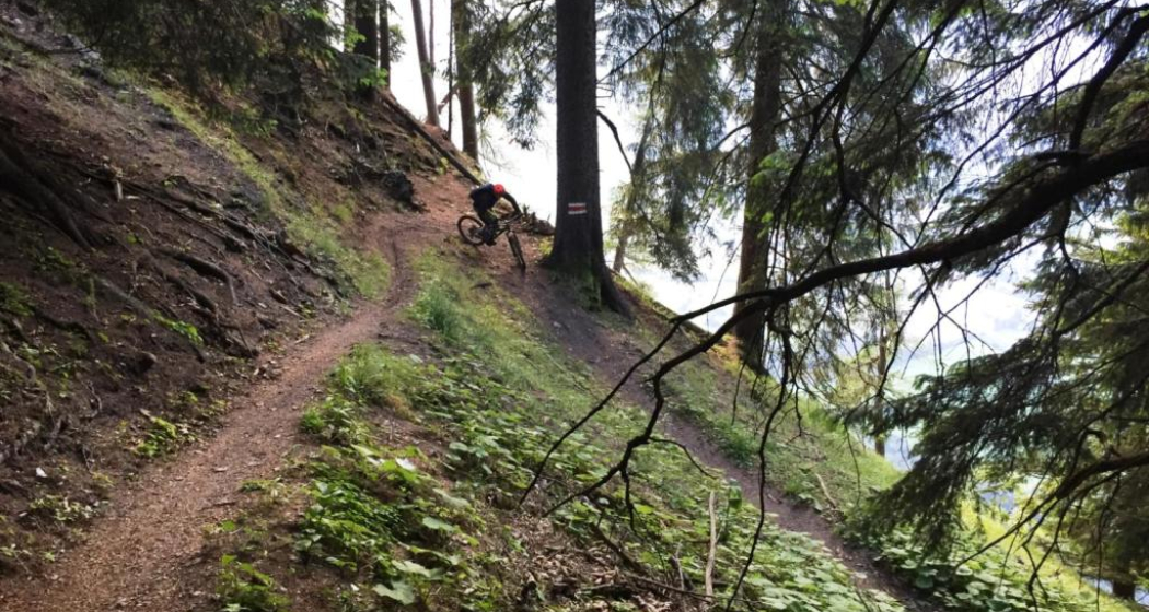
Auf der Rhäzünser Alp
Blick auf Rhäzüns mit der Rhäzünser Alp oberhalb

Show all 8 images

Rhäzünser Alp mit Blick zur gegenüberliegenden Flimser Bergwelt
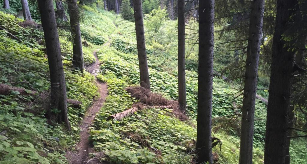
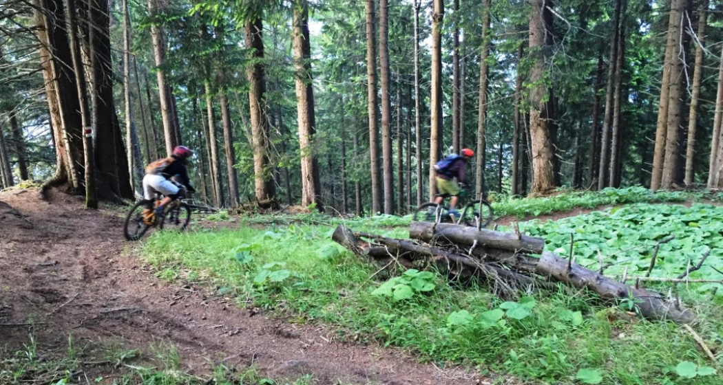
Extensive bike tour on cultural-historical paths.
Technique 2/6
Fitness 5/6
Highest Point  1771 m
Lowest Point  589 m
Best Season
Jan
Feb
Mär
Apr
Mai
Jun
Jul
Aug
Sep
Okt
Nov
Dez
Start
Reichenau, train station
Destination
Reichenau, train station
Coordinates
46.823982, 9.412735

Details

Description

Many castles and mansions can be found in the Domleschg. Some of them are still inhabited nowadays and used as cultural sites or for catering services (Schloss Tagstein & Schloss Schauenstein), while others are fallen into ruin.

This tour is mainly on asphalted and graveled roads. The first part of the tour takes you to the mountainside of Domleschg with the Bonaduzer and Rhäzünser Alp, the Heinzenberg and wonderful views into the Domleschg and Sa-fien valleys. On the second part you leasurely ride through the handsome villages and scenery of the Domleschg valley. The beautiful Canova lake is a good spot for taking a swim and relaxing at the lakeside. The last section then is on the historical Polenweg, a path above the Rhine river, that has been built by Polish internees during the second world war. At the junction of point 665 take a left and ride back to Reichenau-Tamins, the starting point of the tour.

Responsible for this content Chur Tourism.

Rothorn-Chur

Geschlossen
Medium
33.8 km
4:30 h
440 mhd
3380 mhd
Rothorn
Danny MacAskill & Claudio Caluori: Home of Trails

Show all 3 images

Rothorn-Chur (oua_27209741_da46695_profile)
From the Parpaner Rothorn, there are a large number of departures to Chur. One of the legendary routes is that to Arosa and on that the one from Hörnli over the Urdental to Chur - a classic endurance tour in which the great fun to be had on this trail stands prominently in the foreground
Technique /6
Fitness 3/6
Highest Point  2855 m
Lowest Point  585 m
Best Season
Jan
Feb
Mär
Apr
Mai
Jun
Jul
Aug
Sep
Okt
Nov
Dez
Start
Lenzerheide
Destination
Chur
Coordinates
46.74267, 9.59752

Details

Description

Ride with gondola up from Lenzerheide to the Parpaner Rothorn and navigate to the run through the large rock basin in the direction of Lawinengalerie. Here you are already on your way on the stretch termed, „Bike Attack“, which you will leave behind at Gredigs Fürggli and which leads to the right in the direction of Arosa. This trail through the Schafälpi-Tal is a first-class flow trail in the middle of a wonderfully undeveloped and pristine alpine valley. Finally you reach the Älplisee and later Innerarosa. Here lies the bottom station of Hörnlibahn, which you now use to get up to the summit station. It follows the single trail ride through Urdental, spending a bit of time on an alpine road, then shifting over again to small paths. From Tschiertschen, you reach Praden on the hiking trails above the road, then go through the Steinbachtobel to Passugg. The final segment to Chur leads over the single trail from Passugg to the valley floor from Chur. It is no longer very far to the city centre or to the train station, or likewise if you wish to take the postal bus to the post office back in Lenzerheide.

HOME OF TRAILS

Incidentally: Danny MacAskill and Claudio Caluori enjoyed the trails on the Parpaner Rothorn in the "Home of Trails" video.

Discover the Parpaner Rothorn

Directions

(Lenzerheide – ) Parpaner Rothorn – Gredigs Fürggli – Schafälpli – Innerarosa – Hörnlihütte – Urdensee – Inner Urden – Tschiertschen – Innerpraden – Usser Praden – Grida – Passugg – Chur

Responsible for this content Graubünden Ferien.
This content has been translated automatically.

Dreibündenstein (Lady Patricia)

Difficult
40.8 km
5:00 h
1500 mhd
1500 mhd
Lady Patricia Trail
Lady Patricia Trail, gegenüber der Calanda

Show all 6 images

Kurz vor der Alp Juchs
This multifaceted and partly challenging day tour has all, what makes mountainbiking so special. The panorama trail with the crash site of "Lady Patricia" is also known as "Bomber Trail".
Technique 4/6
Fitness 5/6
Highest Point  2044 m
Lowest Point  559 m
Best Season
Jan
Feb
Mär
Apr
Mai
Jun
Jul
Aug
Sep
Okt
Nov
Dez
Start
Chur, train station
Destination
Chur, train station
Coordinates
46.817587, 9.50373

Details

Description

This challenging round tour starts at the northern side of the Chur railway station. Through the villages of Felsberg and Domat/Ems you reach the golf course in Domat/Ems. That's where the ascent starts. The mountain road is quite steep and it will take you some power to reach the mountain village of Feldis at 1'500 m. This is the perfect place to recharge your batteries in one of the restaurants.

From Feldis, continue on the level street in direction of Scheid. At point 1498 the next as-cent begins. Follow the paved mountain road up to the Alp di Plaun on 1953 m. At this point you can decide, whether you want to continue on the «Lady Patricia Trail» to Brambrüesch, or branch off and ascent to the Dreibündenstein. To continue on the here suggested route, follow the hiking trail to the ski hut Term Bel, turn right there and after 200 meters the trail branches off to the left side (follow the signal «Lady Patricia»). Before you reach the high route, the ascent continues and in the end you have to push your bike for appr. 10-15 minutes. When you have finally reached the height, a very panoramic and quite technical single track lies before you.

In the middle of the high route, you will find a memorial stone, where 1944 a US bomber has crashed into the mountain. The narrow single track traverses below of the Dreibündenstein. After that part, you come to enjoy the flow on the descent to Spundis. There, the trail branches off to the left and runs fluently at first, later more technical, to the Alp Juchs. From there, the trail continues demanding and challenging, before the last part of the descent will take you with a lot of flow back into the Alpine City of Chur.

Responsible for this content Brambrüesch.

Trailrun LANGA

Difficult
28 km
5:55 h
2140 mhd
1066 mhd
Trailrun LANGA
Trailrun LANGA

Show all 18 images

Trailrun LANGA
The Long Trail LANGA connects the two trails UFFA and OBA and is aimed at 28.2 km and 2,140 vertical meters to complete and well-trained, persevering runners.
Technique 4/6
Fitness 6/6
Highest Point  2158 m
Lowest Point  589 m
Best Season
Jan
Feb
Mär
Apr
Mai
Jun
Jul
Aug
Sep
Okt
Nov
Dez
Start
Alexanderplatz, City of Chur
Destination
VIVA berg.baiz, Brambrüesch
Coordinates
46.852216, 9.53128

Details

Description

Further information on the two individual trails can be found on the separate tours:

Directions

Public Transport

Take the train to Chur station. From there, the city bus (line 1) takes 3 minutes to the valley station of the mountain railways (Stadthalle/Brambrüeschbahn stop).

Anreise Information

  • Motorway exit Chur Süd
  • Drive into the city (Kasernenstrasse)
  • The valley station and car park are on the right-hand side in front of the town centre

Parking

More about parking for guests of the Chur mountain railways.

Responsible for this content Brambrüesch.
This content has been translated automatically.

Trek Runcatrail - Caumasee - Tamins

Medium
21.7 km
1:55 h
290 mhd
1470 mhd
Trek Runcatrail - Caumasee - Tamins

Show all 8 images

Trek Runcatrail - Caumasee - Tamins
The Runca Trail is the classic single trail starting in Flims. The route becomes particularly interesting when you extend it from Flims to Tamins and incorporate highlights such as Lake Cauma or the Conn viewing platform into the route.
Technique /6
Fitness 3/6
Highest Point  1845 m
Lowest Point  660 m
Best Season
Jan
Feb
Mär
Apr
Mai
Jun
Jul
Aug
Sep
Okt
Nov
Dez
Start
Flims
Destination
Tamins
Coordinates
46.860235, 9.269049

Details

Description

The tour starts with the chairlift ride to Naraus. The start of the descent leads for a little way along a gravel road until the actual Runca Trail begins at the Flembach stream. This varied route meanders fluidly to the Runca Höhe and along numerous good, wooden trails to the Waldhaus area of Flims. This is usually where the Runca Trail descent ends, but not in this version. Cycle on small gravel roads down to the idyllic Lake Cauma and then climb up to the Conn viewing platform with its wonderful view of the Rhine Gorge. Both places are ideal as a lunchtime stop-off before starting on the trip to Tamins. From Conn, you ride mainly on single trails to Pintrun, and then ascend a little way to Digg - from where you travel on the signposted mountain bike route to Tamins along a mix of trails and little gravel roads.Tip: Instead of taking the post bus in Tamins back to Flims, extend the tour to Chur. A wonderful singletrail hugs the left bank of the Rhine to the outskirts of Chur.

HOME OF TRAILS

Incidentally: Danny MacAskill and Claudio Caluori took a relaxing break at Lake Cauma in the "Home of Trails" video.

Discover the Lake Cauma

Geheimtipp

Instead of getting back to Flims in Tamins in Postbus, you continue the tour to Chur. A wonderful single trail nestles along the left bank of the Rhine to the outskirts of Chur.

Responsible for this content Graubünden Ferien.
This content has been translated automatically.

Endurotour Antennatrail Brambrüesch

Difficult
11 km
1:00 h
183 mhd
1200 mhd
Antennatrail Brambrüesch

Show all 7 images

Antennatrail Brambrüesch
A classical enduro tour with a short uphill and a lot of downhill on very cool single trails.
Technique 4/6
Fitness 2/6
Highest Point  1764 m
Lowest Point  592 m
Best Season
Jan
Feb
Mär
Apr
Mai
Jun
Jul
Aug
Sep
Okt
Nov
Dez
Start
Brambrüesch, top of gondola station
Destination
Brambrüesch, top of gondola station
Coordinates
46.829107, 9.516011

Details

Description

Start at the gondola station in Chur, where rider and bike can enjoy the gondola ride and start fresh at Brambrüesch. After the short uphill to Malixeralp the upper part of the downhill uncovers a hidden trail gem. The lower part then follows the freeride trail «Chur Flow» of the Alpenbikepark Chur. End of the tour at the gondola valley station. If you like, just go for another round....

Responsible for this content Brambrüesch.

Chur Flow (707)

Simple
3.8 km
0:25 h
0 mhd
552 mhd
Chur Flow Trail im Alpenbikepark Chur

Show all 4 images

Chur Flow (707)
The Chur Flow is a freeride trail in the lower section of the Alpenbikepark Chur.
Technique 2/6
Fitness 2/6
Highest Point  1184 m
Lowest Point  632 m
Best Season
Jan
Feb
Mär
Apr
Mai
Jun
Jul
Aug
Sep
Okt
Nov
Dez
Start
Känzeli, middle station of gondola
Destination
Chur, valley station of the gondola
Coordinates
46.838581, 9.526002

Details

Description

The route is moderately steep and very varied. The main line works well for beginners. But also freeride cracks appreciate the route thanks to some crunchy side lines with jumps, drops, step-up & step-down and more elements.

Directions

Public Transport

Take the train to Chur station. From there, the city bus (line 1) takes 3 minutes to the valley station of the mountain railways (Stadthalle/Brambrüeschbahn stop).

Anreise Information

  • Motorway exit Chur Süd
  • Drive into the city (Kasernenstrasse)
  • The valley station and car park are on the right-hand side in front of the town centre

Parking

More about parking for guests of the Chur mountain railways.

Responsible for this content Brambrüesch.
This content has been translated automatically.

Chur panorama trail

Simple
8.1 km
2:15 h
168 mhd
168 mhd
Beim Fürstenwald mit Aussicht ins Rheintal
Fürstenwald mit Blick zum Calanda

Show all 9 images

Aussicht auf Stadt Chur mit Calanda
Out of the city into the beautiful recreational area of the Fürstenwald and with panoramic views back into the heart of the Alpine City.
Technique 1/6
Fitness 2/6
Highest Point  753 m
Lowest Point  584 m
Best Season
Jan
Feb
Mär
Apr
Mai
Jun
Jul
Aug
Sep
Okt
Nov
Dez
Start
Chur, train station
Destination
Chur, train station
Coordinates
46.853643, 9.529653

Details

Description

The sun-kissed panoramic trail starts in the city center and takes you in a circuit out of the city and into the beautiful forest of Chur. Along the edge of the forest you continue to the most beautiful viewpoint of the city (don't forget to bring your camera). Passing by the episcopal courtyard and the famous cathedral the tour finally leads into the historic old town of Chur and back to the starting point.

Responsible for this content Chur Tourism.

Mittenberg round trip

Simple
12.1 km
1:40 h
520 mhd
520 mhd
Prächtige Aussicht vom Mittenberg
Auf dem Mittenberg oberhalb Chur

Show all 4 images

Aussicht am Ziel ins Churer Rheintal
The Mittenberg is a classic among the mountain bike tours around Chur.
Technique 2/6
Fitness 2/6
Highest Point  111 m
Lowest Point  585 m
Best Season
Jan
Feb
Mär
Apr
Mai
Jun
Jul
Aug
Sep
Okt
Nov
Dez
Start
Chur, train station
Destination
Chur, train station
Coordinates
46.85311, 9.530094

Details

Description

Start at the Chur train station and cycle out of the city in eastern direction. Follow the Loestrasse, pass by the hospital and branch off right to the Fürstenwald, a nearby recreational area of Chur. The Fürstenwald (parking area) is a popular meeting place for outdoor athletes with several biking and running trails. Follow the forest road all the way up to the Mittenberg. In the upper part of the ascent you will find a fireplace with fresh spring water.

Up at Mittenberg, you have a wonderful panorama view into the Chur Rhine valley, on the opposite situated house mountain Brambrüesch and the mountains around Lenzerheide and the Bündner Oberland.

The descent route follows a smaller forest trail into direction of Vogelboden - Lürlibad - Lärchenboden - Chur city. Of course you can follow the easy route uf the uphill, as well. And if you prefer some technical trails, you will find some interesting options from the MIttenberg back to Chur.

Responsible for this content Chur Tourism.

Rhine Gorge hike: Bot Tschavier (656.7)

Simple
7.1 km
2:00 h
116 mhd
116 mhd
Aussicht auf den Vorderrhein Richtung Reichenau
Bonaduz

Show all 6 images

Rheinschlucht
A leisurely walk from Bonaduz around the Bot Tschavier hill, with beautiful views of the fascinating Rhine Gorge.
Technique /6
Fitness 2/6
Highest Point  749 m
Lowest Point  636 m
Best Season
Jan
Feb
Mär
Apr
Mai
Jun
Jul
Aug
Sep
Okt
Nov
Dez
Start
Bonaduz, train station
Destination
Bonaduz, train station
Coordinates
46.810478, 9.397953

Details

Description

A leisurely walk from Bonaduz, past the picturesque chapel of Sogn Mang and on a beautiful circular path with views of the Rhine Gorge and around the Bot Tschavier hill back to Bonaduz. A detour to the Wackenau ruin is possible. 

Responsible for this content Chur Tourism.