Brambrüesch-Pradaschier (via Dreibündenstein – big route)

Simple
12.3 km
4:25 h
601 mhd
988 mhd
Brambrüesch-Pradaschier (via Dreibündenstein - grosse Route)

Show all 6 images

Brambrüesch-Pradaschier (via Dreibündenstein - grosse Route)

Beautiful and scenic tour with picturesque wooded sections and panoramic views.
From the train station Chur you can reach the valley station of Chur-Dreibündenstein mountain railways either by city bus (line 1, stop Stadthalle) or on foot in about 15 minutes. The hike begins at the summit station of the Brambrüesch cable car. Through picturesque woodland sections the Malix Alp is soon reached. Relatively flat and with wonderful panoramic views you first pass the Galtialp, later the Bärenalp and finally the Pradaschieralp. Several fireplaces for a rest and a magnificent mountain flora accompany the hiker - a real pleasure hike! Soon the mountain station of the Pradaschier-Bahn is reached, where a cozy mountain restaurant with a large sun terrace invites you to a visit. You will reach the village Churwalden by the longest toboggan run in the world, a truly memorable experience! Alternatively, you can reach Churwalden by chair lift or on foot on the hiking trail. From Churwalden the, Postauto will return to Chur within 30 minutes.

Technique 2/6
Fitness 1/6
Highest Point  2172 m
Lowest Point  1209 m
Best Season
Jan
Feb
Mär
Apr
Mai
Jun
Jul
Aug
Sep
Okt
Nov
Dez
Start
Valley station of the Chur-Dreibündenstein cable cars
Destination
Churwalden
Coordinates
46.828876, 9.515455

Details

Description

For the hike, an attractive round trip ticket is available at the Chur-Dreibündenstein mountain railways, which includes the ascend from Chur to Brambrüesch, two runs with the toboggan run Pradaschier - Churwalden and the return trip by Postauto from Churwalden to Chur.
 
Option A: From the mountain restaurant Brambrüesch follow the hiking trail to the Malixer Alp and further to the Dreibündenstein. Descent over Grüenenbüel to Pradaschier (hiking time approx. 3 h 15 min.)


Option B: Hiking trail to Churwalden.

Geheimtipp

Catering in the mountain restaurant Pradaschier

Directions

Public Transport

From the train station Chur you can reach the valley station of the Chur-Dreibündenstein mountain railways either by city bus (line 1, stop Stadthalle) or on foot in about 15 minutes.

Anreise Information

From Basel and Zurich - Chur-Sued (exit no. 17)

From Milano - Lugano - San Bernadino Tunnel - Thusis - Chur.

Parking

Guests of the Chur mountain railways park on the Stadthallen parking free of charge. For this purpose, mentioning   the plate number at the cash desk is mandatory!

Responsible for this content Brambrüesch.
This content has been translated automatically.

Cultural Hike: Maladers - Chur

Simple
4.7 km
1:30 h
41 mhd
428 mhd
St. Luzikapelle
Wanderweg nach Chur

Show all 4 images

Aussicht Chur

From the countryside of Schanfigg to the capital of Grisons - an adventurous hike for bon-vivants.

The easy hike is suitable for young and old. Especially kids love the diverse natural path through the forest. If you feel the hike is too short, you may also prolong it by detouring on the Mittenberg.

Technique 1/6
Fitness 2/6
Highest Point  1016 m
Lowest Point  623 m
Best Season
Jan
Feb
Mär
Apr
Mai
Jun
Jul
Aug
Sep
Okt
Nov
Dez
Start
Maladers
Destination
Chur
Coordinates
46.836774, 9.560407

Details

Description

The hike lasts almost 2 hours and leads from sunny Maladers through the forest towards the Mittenbergbelt and via the St.Luzi Chapel to the Haldenhüttli (small hut) from where you have a fantastic view over the city.

Comfortable arrival, enjoyable hike

The easy hike from Maladers (1000m) to Chur (600m) is suitable for everyone. With only a 15 minute bus ride from Chur we arrive at the starting point from where we start walking towards Oberdorf. After the first intersecting road we turn left and follow the directional sign to Chur. If you need supplies for the hike or a small souvenir, you might find it at Sina's farm shop. The path to Chur passes the cemetery and leads towards Mittenberg/Kleinwaldegg where it enters the forest. After a while we arrive at the little chapel St.Luzi. From there it is not far until we reach the Haldenhüttli (small hut) in the vineyards above Chur.

Author: Hansjürg Gredig, ZHAW Life Sciences and Facility Management

Geheimtipp

Sina's farm shop for a souvenir

Author: Hansjürg Gredig, ZHAW Life Sciences and Facility Management

Ausrüstung

Sturdy shoes, rain protection

Directions

The hike lasts almost 2 hours and leads from sunny Maladers through the forest towards the Mittenbergbelt and via the St.Luzi Chapel to the Haldenhüttli (small hut) from where you have a fantastic view over the city.

Comfortable arrival, enjoyable hike

The easy hike from Maladers (1000m) to Chur (600m) is suitable for everyone. With only a 15 minute bus ride from Chur we arrive at the starting point from where we start walking towards Oberdorf. After the first intersecting road we turn left and follow the directional sign to Chur. If you need supplies for the hike or a small souvenir, you might find it at Sina's farm shop. The path to Chur passes the cemetery and leads towards Mittenberg/Kleinwaldegg where it enters the forest. After a while we arrive at the little chapel St.Luzi. From there it is not far until we reach the Haldenhüttli (small hut) in the vineyards above Chur.

Author: Hansjürg Gredig, ZHAW Life Sciences and Facility Management

Directions

Public Transport

After a 15 minute bus ride from Chur we arrive at the starting point.

Responsible for this content Graubünden Ferien.
This content has been translated automatically.

Alter Schyn-Runde

Geschlossen
Medium
59.9 km
3:50 h
1353 mhd
1353 mhd
Alter Schyn-Runde
SKODA Velowelt

Show all 3 images

Alter Schyn-Runde (oua_3617435_a80a4de_profile)
Technically less demanding, but altogether long tour for enduring biker.
Technique 2/6
Fitness 4/6
Highest Point  1558 m
Lowest Point  562 m
Best Season
Jan
Feb
Mär
Apr
Mai
Jun
Jul
Aug
Sep
Okt
Nov
Dez
Start
Tourist Office, Lenzerheide
Destination
Tourist Office, Lenzerheide
Coordinates
46.7277, 9.557867

Details

Description

This tour includes the descent on the "Alter Schin", a road high above the Albula Gorge into the steep mountain flank, connecting the rear Rhine Valley with the Lenzerheide holiday region. Via Lain and Muldain you reach this partly vertiginous trade route from the Middle Ages. The tour then leads through spectacular rock tunnels and tranquil villages such as Scharans and Tomils down to Domleschg with its southern charm. On the way, many different inns invite you to take a breather. The long round to Chur continues on agricultural side roads and cycle paths before an ascent via the "Polenweg" to Churwalden and then via Salez and the Mittelberg back to Parpan and Lenzerheide. A bit of endurance is required on the day trip, but the technical difficulties are limited.

Directions

Public Transport

Arriving by train to Chur, then change directly to the buses from PostbusGraubünden and get to Lenzerheide within 30 minutes.

In the village the free sports bus is available.

Anreise Information

From Basel and Zurich - Chur-Süd (exit no. 17) - Lenzerheide.

From Milano - Lugano - San Bernadino Tunnel - Thusis - Chur (exit Lenzerheide) - Lenzerheide.

Parking

Parking spaces entrance Lenzerheide or valley station Rothornbahn.

Responsible for this content Graubünden Ferien.
This content has been translated automatically.

Mittenberg-Nasstobel-Sand

Medium
12.7 km
2:20 h
520 mhd
520 mhd
Nasstobel Trail
Trail Richtung Maladers mit Ausblick auf die Stadt

Show all 6 images

Sand Trail
Tour variant on Chur's Mittenberg with a varied single track downhill, which has everything from flowy to technical passages.
Technique 3/6
Fitness 3/6
Highest Point  1111 m
Lowest Point  585 m
Best Season
Jan
Feb
Mär
Apr
Mai
Jun
Jul
Aug
Sep
Okt
Nov
Dez
Start
Chur railway station
Destination
Chur railway station
Coordinates
46.85319, 9.530176

Details

Description

The bike tour to the Mittenberg is a classic in Chur. From the city centre, the ascent leads to the Fürstenwald forest and along the forest road towards Mittenberg. The downhill variant via Nasstobel-Sand, on the other hand, is less well known. Via a beautiful single trail and the flowing high-level trail towards Maladers you reach the somewhat hidden entrance to the Nasstobel Trail. The entrance is exposed and narrow, so it is a good idea to get off the bike here. After the first challenging hairpin bends the character changes and the path leads relatively flat and flowy downwards (in between there are even a few hand-shaped curves and jumps). The first section ends at the junction with the road. Here you drive uphill for a short time and already the entrance to the second section, the sand trail, follows on the right. A varied single trail with a hairpin derby at the end (which can also be avoided). In the old town you can finish the tour with pleasure.

Responsible for this content Chur Tourism.
This content has been translated automatically.

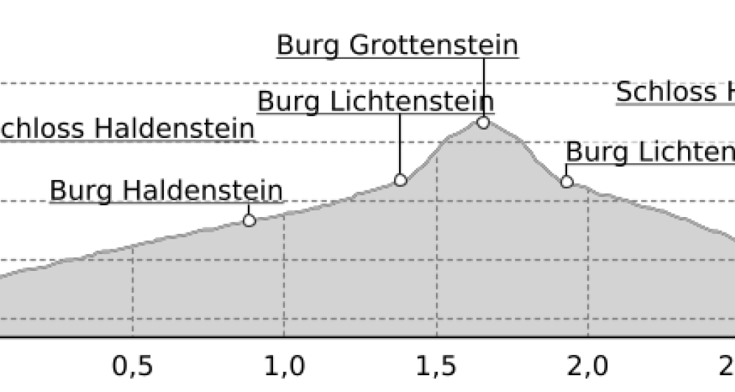
Grottenstein - mystical castle ruins

Simple
2.9 km
1:15 h
268 mhd
268 mhd
Andreas Sommer (AnimaHelvetia) in der Burgruine Grottenstein
Grottenstein - mystische Burgruine (oua_31358472_73fd20d_profile)
Circular hike to the hidden castle ruins above the village of Haldenstein.
Technique 2/6
Fitness 2/6
Highest Point  835 m
Lowest Point  567 m
Best Season
Jan
Feb
Mär
Apr
Mai
Jun
Jul
Aug
Sep
Okt
Nov
Dez
Start
Bus stop Haldenstein Dorf
Destination
Bus stop Haldenstein Dorf
Coordinates
46.878763, 9.526762

Details

Description

As part of the 2nd Legends and Fairy Tale Days Chur, a guided hike to the Grottenstein castle ruins will take place on 25 November 2018 at 10 a.m. with exciting stories from the local world of legends, treasure-guarding cave fairies, enchanted toads and the golden skittles...  The stories are mysteriously interwoven with the direct experience of nature in the wintry mountain forest and in the enigmatic cave castle, where the campfire makes twitching shadows dance on the rock faces.

The ruins of Grottenstein Castle are located above Haldenstein. Little is known about its history, but a spring in the castle cave indicates a possible use as a refuge in times of need. Contrary to expectations, the name Grottenstein does not derive from the word Grotte in the sense of cave. Rather, the cave castle was originally called Chrottenstein, where Chrott means "toad". The reference to the toad now allows for completely different associations. The coinage as a toad place as well as local legends of a white maiden who guards sunken treasures and guards unborn souls inside the mountain, build mysterious bridges to mythology. In numerous legends, the toad and the white maiden appear as contrasting manifestations of the same entity, which often guards a hidden treasure of gold in caves and castle ruins. The auspicious treasure of gold is analogous to the basic maxim of alchemy, but is to be understood above all as a symbol for an inner treasure of the soul, an essential step in development or a realization. 

Ausrüstung

Sturdy footwear recommended.

Directions

The hike leads along the alpine road to the top and finally on a mountain hiking trail to the castle ruins. The descent takes place first on the same path as the ascent, but before the ruin Haldenstein you branch off to the right and follow the hiking trail back to the village.

Directions

Public Transport

Take the Chur city bus line 3 to the Haldenstein Dorf stop

Anreise Information

Motorway exit Chur Nord, turn off towards Haldenstein

Parking

Public parking in the village of Haldenstein.

Responsible for this content Chur Tourism.
This content has been translated automatically.

Cross Country Trail Chur Rhine valley

Medium
30.1 km
2:45 h
611 mhd
611 mhd
Trail-Spass in den Wäldern
Abzweigung auf den Trail Richtung Reichenau

Show all 7 images

Trail mit Blick auf den Rhein
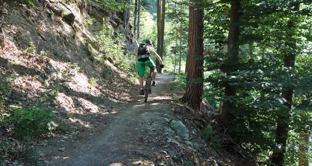
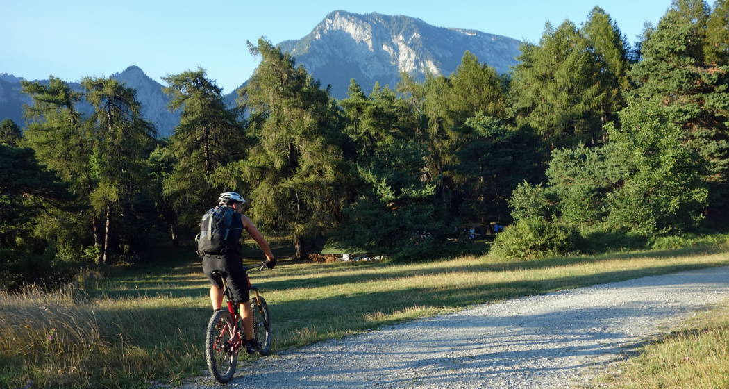
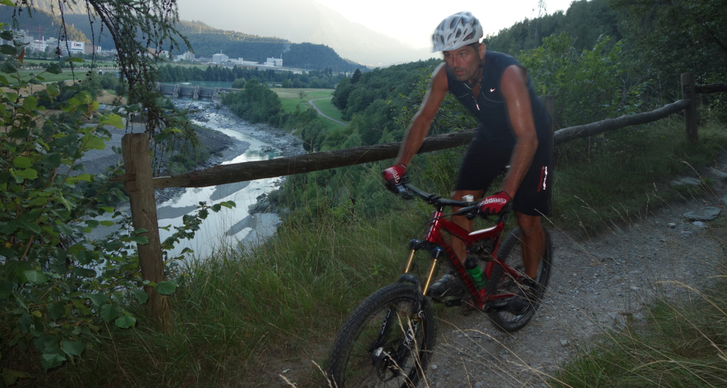
This tour offers superb single tracks and is well suited as a veritable cross country training tour.
Technique 3/6
Fitness 3/6
Highest Point  857 m
Lowest Point  559 m
Best Season
Jan
Feb
Mär
Apr
Mai
Jun
Jul
Aug
Sep
Okt
Nov
Dez
Start
Chur, train station
Destination
Chur, train station
Coordinates
46.847544, 9.531373

Details

Description

Due to the low elevation, the Chur Rhine valley offers good mountain biking conditions already at the end of winter time until late in the autumn time. The tour combines attractive single tracks with some ascents and descents, as well as panoramic trails.

Along the tour you will get a good view into the diverse scenery of the  Rhine valley and the Alpine City of Chur. At Rei-chenau/Tamins you will cross the Rhine river just where the Vorder and Hinter Rhine confluence.

Directions

Public Transport

The tour starts at the Chur train station.

Responsible for this content Chur Tourism.

Rhine river trail in Chur

Simple
7.6 km
1:45 h
22 mhd
22 mhd
Uferweg am Alpenrhein
Unterhalb des Camp Au am Rhein-Ufer

Show all 10 images

Weg der Plessur entlang
A pleasant hiking tour from Chur to the nearby Rhine river.
Technique 1/6
Fitness 1/6
Highest Point  585 m
Lowest Point  554 m
Best Season
Jan
Feb
Mär
Apr
Mai
Jun
Jul
Aug
Sep
Okt
Nov
Dez
Start
Chur, train station
Coordinates
46.853525, 9.52957

Details

Description

The tour starts at the Chur train station, from where you soon follow the local stream called Plessur, which later on flows into the Rhine. Along the tree-covered riverside of the Rhine, you walk at the foot of the impressive Calanda mountain. On the way back to the city you will pass Switzerland's largest mural painting at the Mühleturm, then follow the Mühlebach stream and pass by the 1'200 m2 large sculpture park at the Forum Würth, where you can see artworks of famous artists like Jean Tinguely, Bernhard Luginbühl, Not Vital or Niki de Saint Phalle.

Directions

Public Transport

The tour starts directly at the train station of Chur.

Responsible for this content Chur Tourism.

Rock'n'Roll (703)

Difficult
1.9 km
0:10 h
4 mhd
408 mhd
Alpenbikepark Chur
Alpenbikepark Chur

Show all 7 images

Rock'n'Roll (703)
The Rock'n'Roll is a freeride trail in the upper section of the Alpenbikepark Chur.
Technique 4/6
Fitness 2/6
Highest Point  1593 m
Lowest Point  1185 m
Best Season
Jan
Feb
Mär
Apr
Mai
Jun
Jul
Aug
Sep
Okt
Nov
Dez
Start
Brambrüesch, top station of gondola
Destination
Känzeli, middle station of gondola
Coordinates
46.829589, 9.516213

Details

Description

As the name implies: The thing rocks and rolls! Technically demanding and with many jumps advanced freeriders get their money's worth.

Directions

Public Transport

Take the train to Chur station. From there, the city bus (line 1) takes 3 minutes to the valley station of the mountain railways (Stadthalle/Brambrüeschbahn stop).

Anreise Information

  • Motorway exit Chur Süd
  • Drive into the city (Kasernenstrasse)
  • The valley station and car park are on the right-hand side in front of the town centre

Parking

More about parking for guests of the Chur mountain railways.

Responsible for this content Brambrüesch.
This content has been translated automatically.

Uphill Trail UFFA

Difficult
12.5 km
2:50 h
1295 mhd
254 mhd
Uphill Trail UFFA
Uphill Trail UFFA

Show all 12 images

Uphill Trail UFFA
With 12.5 km and 1'295 vertical meters, this route also offers serious mountain runners a real sporting challenge.
Technique 4/6
Fitness 5/6
Highest Point  1841 m
Lowest Point  589 m
Best Season
Jan
Feb
Mär
Apr
Mai
Jun
Jul
Aug
Sep
Okt
Nov
Dez
Start
Alexanderplatz, City of Chur
Destination
VIVA berg.baiz, Brambrüesch
Coordinates
46.852219, 9.531286

Details

Description

After starting on the Alexanderplatz in the heart of Chur, the Uphill Trail UFFA leads through the picturesque old town of the canton's main town, through the Obergasse and the Obertor up to the Rosenhügel. There, the track changes from asphalt to forest roads and varied (single) trails, which lead up to the first lookout point on Juchs. Over a steep and challenging climb, it goes up to the highest point at Spundisköpf lake, from there on a varied trail over the Spundisköpfe to the mountain station and the finish at the mountain restaurant.

Directions

Public Transport

Take the train to Chur station. From there, the city bus (line 1) takes 3 minutes to the valley station of the mountain railways (Stadthalle/Brambrüeschbahn stop).

Anreise Information

  • Motorway exit Chur Süd
  • Drive into the city (Kasernenstrasse)
  • The valley station and car park are on the right-hand side in front of the town centre

Parking

More about parking for guests of the Chur mountain railways.

Responsible for this content Brambrüesch.
This content has been translated automatically.

Rhäzünser Alp - Heinzenberg - Domleschg

Geschlossen
Difficult
55 km
6:00 h
1585 mhd
1585 mhd
Auf der Rhäzünser Alp
Blick auf Rhäzüns mit der Rhäzünser Alp oberhalb

Show all 8 images

Rhäzünser Alp mit Blick zur gegenüberliegenden Flimser Bergwelt
Extensive bike tour on cultural-historical paths.
Technique 2/6
Fitness 5/6
Highest Point  1771 m
Lowest Point  589 m
Best Season
Jan
Feb
Mär
Apr
Mai
Jun
Jul
Aug
Sep
Okt
Nov
Dez
Start
Reichenau, train station
Destination
Reichenau, train station
Coordinates
46.823982, 9.412735

Details

Description

Many castles and mansions can be found in the Domleschg. Some of them are still inhabited nowadays and used as cultural sites or for catering services (Schloss Tagstein & Schloss Schauenstein), while others are fallen into ruin.

This tour is mainly on asphalted and graveled roads. The first part of the tour takes you to the mountainside of Domleschg with the Bonaduzer and Rhäzünser Alp, the Heinzenberg and wonderful views into the Domleschg and Sa-fien valleys. On the second part you leasurely ride through the handsome villages and scenery of the Domleschg valley. The beautiful Canova lake is a good spot for taking a swim and relaxing at the lakeside. The last section then is on the historical Polenweg, a path above the Rhine river, that has been built by Polish internees during the second world war. At the junction of point 665 take a left and ride back to Reichenau-Tamins, the starting point of the tour.

Responsible for this content Chur Tourism.