Sunday opening hours apply on Whit Monday, 9 June. Please note: from Tuesday, 10 June, the facilities in the indoor pool building will be closed for the annual maintenance works.

Additional infos.
Name plural
Mountain Bike Tours
Original Name
Mountain bike
discover.swiss ID
sui_010205

Chur Flow (707)

Simple
3.8 km
0:25 h
0 mhd
552 mhd
Chur Flow Trail im Alpenbikepark Chur

Show all 3 images

Chur Flow (707)
The Chur Flow is a freeride trail in the lower section of the Alpenbikepark Chur.
Technique 2/6
Fitness 2/6
Highest Point  1184 m
Lowest Point  632 m
Best Season
Jan
Feb
Mär
Apr
Mai
Jun
Jul
Aug
Sep
Okt
Nov
Dez
Start
Känzeli, middle station of gondola
Destination
Chur, valley station of the gondola
Coordinates
46.838581, 9.526002

Details

Description

The route is moderately steep and very varied. The main line works well for beginners. But also freeride cracks appreciate the route thanks to some crunchy side lines with jumps, drops, step-up & step-down and more elements.

Directions

Public Transport

Take the train to Chur station. From there, the city bus (line 1) takes 3 minutes to the valley station of the mountain railways (Stadthalle/Brambrüeschbahn stop).

Anreise Information

  • Motorway exit Chur Süd
  • Drive into the city (Kasernenstrasse)
  • The valley station and car park are on the right-hand side in front of the town centre

Parking

More about parking for guests of the Chur mountain railways.

Responsible for this content Brambrüesch.
This content has been translated automatically.

Mittenberg round trip

Simple
12.1 km
1:40 h
520 mhd
520 mhd
Prächtige Aussicht vom Mittenberg
Auf dem Mittenberg oberhalb Chur

Show all 3 images

Aussicht am Ziel ins Churer Rheintal
The Mittenberg is a classic among the mountain bike tours around Chur.
Technique 2/6
Fitness 2/6
Highest Point  111 m
Lowest Point  585 m
Best Season
Jan
Feb
Mär
Apr
Mai
Jun
Jul
Aug
Sep
Okt
Nov
Dez
Start
Chur, train station
Destination
Chur, train station
Coordinates
46.85311, 9.530094

Details

Description

Start at the Chur train station and cycle out of the city in eastern direction. Follow the Loestrasse, pass by the hospital and branch off right to the Fürstenwald, a nearby recreational area of Chur. The Fürstenwald (parking area) is a popular meeting place for outdoor athletes with several biking and running trails. Follow the forest road all the way up to the Mittenberg. In the upper part of the ascent you will find a fireplace with fresh spring water.

Up at Mittenberg, you have a wonderful panorama view into the Chur Rhine valley, on the opposite situated house mountain Brambrüesch and the mountains around Lenzerheide and the Bündner Oberland.

The descent route follows a smaller forest trail into direction of Vogelboden - Lürlibad - Lärchenboden - Chur city. Of course you can follow the easy route uf the uphill, as well. And if you prefer some technical trails, you will find some interesting options from the MIttenberg back to Chur.

Responsible for this content Chur Tourism.

Chur - Herrentobel - Chur

Simple
20.4 km
2:45 h
620 mhd
640 mhd
Ausblick vom Herrentobel auf Chur
Chur - Herrentobel - Chur

Show all 5 images

Ausblick von der Burg Lichtenstein auf Haldenstein
Easy and short, but appealing round tour, that leads past some castles and ruins in the area.
Technique 1/6
Fitness 2/6
Highest Point  1143 m
Lowest Point  534 m
Best Season
Jan
Feb
Mär
Apr
Mai
Jun
Jul
Aug
Sep
Okt
Nov
Dez
Start
Chur, train station
Destination
Chur, train station
Coordinates
46.854276, 9.528356

Details

Description

This round tour starts at the Chur train station. Follow the official cycling route no. 2 to Haldenstein - Untervaz. At the sports centre Fünf Dörfer in Untervaz branch off to the right, cross the Rhine river and cycle into the village of Untervaz. The ruins of the two castles Neuenburg and Rappenstein in Untervaz can be visited.

In the upper part of Untervaz go left in direction of the Vazer Alp. Follow this partly very steep path until you reach Zalt at 930 m. Here, take the left road and enjoy the panoramic and smooth ride through the forests of the Herrentobel. On the opposite site you can see the impressive Montalin mountain and the lower situated Fürhörnli, which is the highest point of Chur.

On a forest road you continue to Oldiswald. At Bild (point 805) leave the road and continue straight ahead, pass by the ruin of Lichtenstein and descent into the village of Haldenstein with the remarkable caste of Haldenstein.

Responsible for this content Chur Tourism.

Stams - Mittagsplatte

Difficult
39.9 km
5:30 h
1600 mhd
1600 mhd
Calanda im Hintergrund
Im Aufstieg nach Says

Show all 7 images

Abfahrt von Stams Richtung Valzeina
Extended day tour with beautful viewing points and single tracks on the descent.
Technique 4/6
Fitness 5/6
Highest Point  1727 m
Lowest Point  546 m
Best Season
Jan
Feb
Mär
Apr
Mai
Jun
Jul
Aug
Sep
Okt
Nov
Dez
Start
Chur, train station
Destination
Chur, train station
Coordinates
46.85346, 9.529688

Details

Description

The start of this tour is at the train station Chur. Cycle out of the city in eastern direction, through the Fürstenwald (forest) to the village of Trimmis. When you have crossed the stream in Trimmis, the ascent begins on the right side up to Says and further up to Stams, where you will have a splendid panorama view. During the summer months, the restaurant in Stams is feasted and you can refresh yourself with some drinks and snacks.

From Stams follow the trail uphill across the meadow. And then the first downill begins on a challenging but ridable single track into direction of Clavadatsch. Back on the street you continue to Valzeina, where the second (but short) ascent begins and leads you up to the Mittagsplatte, where a 120 m high transmitting mast is positioned. Shortly before, you branch off to the left and follow a trail through the meadow to a fence. Here, the second part of the descent begins. At first quite steep and demanding, but soon getting easier and smoother, through the "Schlund" back into the valley. Leave the village of Zizers to your right and continue along Molinära back to Trimmis. After crossing the village, follow the trail to the Rhine river. From there, follow the official cycling path Rhine route No. 2 back to Chur.

Responsible for this content Chur Tourism.

Calanda (hut) Challenge

Difficult
31.5 km
5:00 h
1500 mhd
1500 mhd
Calanda(hütte) Challenge

Show all 9 images

Calanda(hütte) Challenge
Tough, panoramic, varied: The bike trip to the Calanda hut is quite a tour - a real challenge!
Technique 3/6
Fitness 5/6
Highest Point  2075 m
Lowest Point  546 m
Best Season
Jan
Feb
Mär
Apr
Mai
Jun
Jul
Aug
Sep
Okt
Nov
Dez
Start
Chur (Alexanderplatz)
Destination
Haldenstein (village)
Coordinates
46.852106, 9.531509

Details

Description

This challenging mountain bike tour starts in the heart of Chur city. The Calanda mountain is situated on the sunny side of the Rhine valley, therefore the tour is possible already in springtime (in summertime early start recommend). At first, follow the national cycling route no. 2 (Rhine route) northwards until you reach the village of Haldenstein. Cross the Rhine river and drive into the village, in direction of the castle. In the village centre, the mountain road branches off to the right side. Now get ready for a long ascent of total 1'500 meters in height. On the way up you pass by several alps as Arella, Funtanolja, Neusäss, Altsäss until you finally reach the Calanda hut.

The hut is feasted during the summer months, so you can have a drink and a meal there. If you really want a challenge, then you can climb up (by foot) to the peak of the Haldensteiner Calanda (730 meters in height and appr. 1 ½ hours from the hut). To have enough time and being able to enjoy the scenery, an overnight in the Calanda hut is absolutely recommended then.

For the descent, take the singletrail right from the hut. Later, you will follow the ascent road for a short track, before a narrow and technical trail branches off to the left at Alp Neusäss, that leads to the Vazer Alp. After a descent on the alp road, at point 1515 another trail branches off to the right side and will take you to the beautiful settlement of Batänja. From there follow the forest road until you pass by the ruin of Lichtenstein. Shortly later for the last piece of the descent, another trail on the left side will take you back down to the village of Haldenstein.

Geheimtipp

Dave Kilshaw's Calanda Challenge by swissrent

The ascent route is signposted as "Dave Kilshaw's Calanda Challenge", a free, interactive outdoor sports adventure. You'll find 6 signposts along the way, which contain a Scan-Point. If you master the more than 20 km, and 1,500 vertical meters along the well-kept forest road up to the Calanda hut, and can scan the respective points with the swissrent-App you can earn 20 «mountainmiles» per scan, which can be redeemed for rental with swissrent. The first Scan-Point signpost is right in the middle of the city center (Alexanderplatz, in front of the City Shop Chur).

Responsible for this content Chur Tourism.

Enduro-Tour Brambrüesch - Passugg

Medium
10.9 km
1:00 h
17 mhd
1006 mhd
Trail zwischen Malix und Passugg

Show all 5 images

Pause beim Sirupbrunnen in Spina
Single trail descent from Chur's local mountain to Malix, Passugg and back to Chur.
Technique 3/6
Fitness 2/6
Highest Point  1605 m
Lowest Point  599 m
Best Season
Jan
Feb
Mär
Apr
Mai
Jun
Jul
Aug
Sep
Okt
Nov
Dez
Start
Brambrüesch, top station of gondola
Destination
Chur, valley station of gondola
Coordinates
46.829109, 9.516378

Details

Description

Start of the tour at the top station of the Chur cableways at Brambrüesch. First follow the signposted route no. 616 (Biketicket 2 RIDE red), but at Spina turn left towards Malix - and refresh yourself first at the syrup fountain! After a stretch on the road follows a steep trail that leads into the Passugger Gorge. Finally, there is another single track taking you back to Chur.

Directions

Public Transport

Take the train to Chur station. From there you can reach the valley station by bike in 5 minutes.

Anreise Information

  • Highway exit Chur Süd

  • Drive in direction of the city centre (Kasernenstrasse)

  • The valley station and parking lot are located in front of the city centre on the right-hand side.

Parking

More about parking for guests of the Chur mountain railways.

Responsible for this content Brambrüesch.
This content has been translated automatically.

Churer Joch round trip

Geschlossen
Medium
37.3 km
5:00 h
1500 mhd
1500 mhd
Churer Joch Rundtour
Aufstieg zum Churer Joch

Show all 10 images

Churer Joch Rundtour
An exciting circuit tour with a fantastic viewpoint and a picturesque mountain village.
Technique 3/6
Fitness 4/6
Highest Point  2042 m
Lowest Point  584 m
Best Season
Jan
Feb
Mär
Apr
Mai
Jun
Jul
Aug
Sep
Okt
Nov
Dez
Start
Chur
Destination
Chur
Coordinates
46.853084, 9.529097

Details

Description

The tour starts at the Chur railway station and leads over the Plessurquai in the direction of Meiersboden. As far as Churwalden, follow the signposted route 255, which leads pleasantly upwards along the beautiful Polenweg. In Churwalden you leave route 255 and shortly afterwards turn left, where the second part of the ascent follows (if the whole tour is too long for you, you can take the post bus in Chur with your bike and start the tour from Churwalden). The route climbs higher and higher and the landscape becomes more and more picturesque, characterised by a rich alpine flora, especially in early summer.  At Foppa, already at 1753 m above sea level, the road branches off to the left. The highest point, the Churer Joch, can be seen from far away. But the legs still have to pedal bravely until then. It's worth it! A far view to the Calanda, the Lenzerheide and the Arosa mountain range opens up. And those who continue at the hut to the summit can see the Alpine City of Chur deep down in the valley.

The descent leads on a single trail in the direction of Tschietschen. Later one drives on a forest road to Furgglis, where there is a beautiful mountain inn. On another trail over the Geissboden the trail continues down to the pretty mountain village of Tschiertschen. The red shining geraniums and many coloured flowers decorate the wooden houses darkened by the sun. The further descent first follows the main road, changing to a single trail above the road to Praden. There again a bit of descent follows on the road until finally a beautiful single trail branches off to the right through the Steinbach forest and leads to the valley near Meiersboden/Araschgen. From there take the road back to Chur.

Chur, the Alpine City, here a visit to the picturesque Old Town is worthwhile. Refresh yourself, for example, on the Kornplatz with a fine Alpine City ice cream in the Gelateria Evviva Plankis.

Responsible for this content Chur Tourism.

Alpenride (702)

Difficult
2 km
0:10 h
1 mhd
408 mhd
Alpenride Trail im Alpenbikepark Chur
Alpenride (702)

Show all 3 images

Drop-Batterie auf der roten Strecke
The Alpenride is a freeride trail in the upper section of the Alpenbikepark Chur.
Technique 3/6
Fitness 2/6
Highest Point  1593 m
Lowest Point  1184 m
Best Season
Jan
Feb
Mär
Apr
Mai
Jun
Jul
Aug
Sep
Okt
Nov
Dez
Start
Brambrüesch, top station of gondola
Destination
Känzeli, middle station of gondola
Coordinates
46.829463, 9.516248

Details

Description

The Alpenride trail is a freeride classic with several jumps, drops and a good mix between easier and more difficult sections.

Directions

Public Transport

Take the train to Chur station. From there, the city bus (line 1) takes 3 minutes to the valley station of the mountain railways (Stadthalle/Brambrüeschbahn stop).

Anreise Information

  • Motorway exit Chur Süd
  • Drive into the city (Kasernenstrasse)
  • The valley station and car park are on the right-hand side in front of the town centre

Parking

More about parking for guests of the Chur mountain railways.

Responsible for this content Brambrüesch.
This content has been translated automatically.

Fürhörnli

Geschlossen
Medium
35.8 km
5:50 h
1832 mhd
2730 mhd
Trail Tales: Fürhörnli – Über den Dächern von Chur
Fürhörnli

Show all 10 images

Fürhörnli
1,300m over the roofs of Graubünden’s capitol Chur, a summit register is waiting for the adventurous bikers entries. Add a detour over Chur’s mountain range to your lengthy tour and enjoy the mix of great views and magnificent trails.
Technique 4/6
Fitness 4/6
Highest Point  2025 m
Lowest Point  590 m
Best Season
Jan
Feb
Mär
Apr
Mai
Jun
Jul
Aug
Sep
Okt
Nov
Dez
Start
Parpan
Destination
Chur
Coordinates
46.760159, 9.557338

Details

Description

We will start our tour this morning in Parpan, gently beginning our ascent on asphalt roads until we reach Chur’s pass. The first descent starts here. The steep descent, full of roots, will definitely get your adrenaline flowing. The ride downhill is challenging but no match for bikers with good riding technique. The first descent ends in Chur.  

We take a little tour of the town by bike and fill our energy reserves in one of the town’s many restaurants. Now we’re ready for the second part of our tour. From Chur we climb to Fürhörnli. We can either bike the whole way up, or take the postbus as far as Maladers, which saves 400m of elevation. You might want to save your energy for later when the ascent up paved paths turns extremely steep.

The panorama from the top of Fürhörnli is breath-taking. The mountain face falls vertically and we have a fantastic view over the town and the Rhine Valley. As always, the best is saved for last – the trails that take you down 1,300m of elevation into Chur. ther bike the whole way up, or take the postbus as far as Maladers, which saves 400m of elevation. You might want to save your energy for later when the ascent up paved paths turns extremely steep.

Responsible for this content Graubünden Ferien.
This content has been translated automatically.

Juchs / Schönegg

Medium
14.3 km
2:00 h
600 mhd
600 mhd
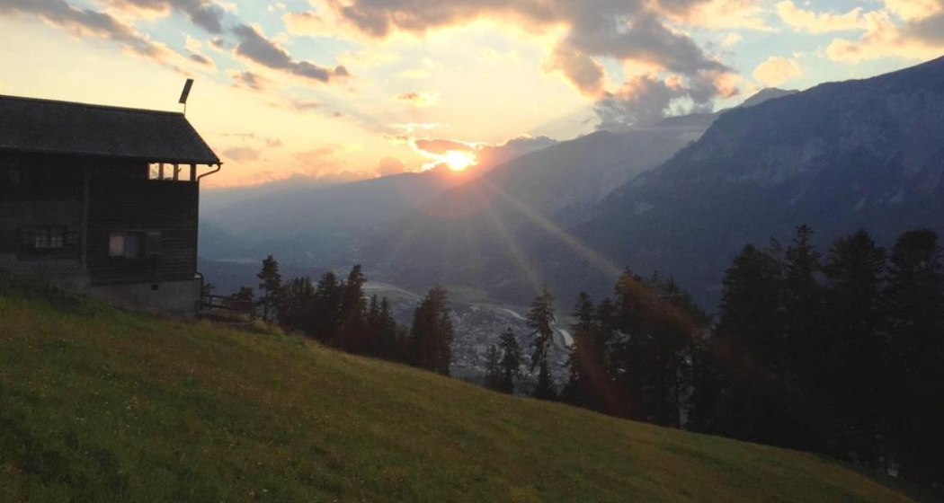
Abendstimmung auf Schönegg
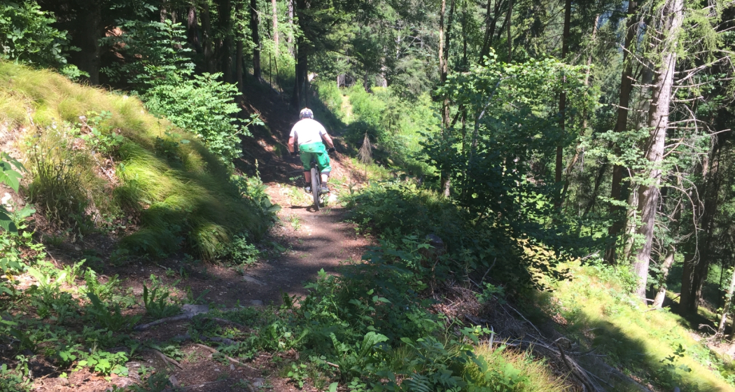
Flowiger Trail zurück in die Stadt Chur

Show all 3 images

Aussicht von Schönegg bei Sonnenuntergang
Short but very nice bike tour to Schönegg. Enjoy the splendid views up there, before you will have fun on the singletrack that takes you back to the Alpine City.
Technique 3/6
Fitness 2/6
Highest Point  1389 m
Lowest Point  583 m
Best Season
Jan
Feb
Mär
Apr
Mai
Jun
Jul
Aug
Sep
Okt
Nov
Dez
Start
Chur, train station
Destination
Chur, train station
Coordinates
46.853765, 9.529228

Details

Description

First you cycle through the historic Old town, cross the Plessur river and ride out of the city on a marked cycling path. Soon you get into the forest. At point 729 you can either take a left and ascent to Schönegg. On top you will enjoy gorgeous views into the surrounding mountain scenery (Calanda, Ringelspitz, Rhätikon, mountains around Flims) and the Chur Rhine valley.

For the descent cross the small alp and follow the narrow and technical single track on the right side. Two times you will cross the street and then follow it for a short track, befor finally you will ride a trail with lots of flow back to the city.

Responsible for this content Chur Tourism.