Event Chur

Christmas Bazaar

Weihnachtsbazar (gdl_849969829_image)
Traditional Christmas Bazaar

Description

Date
27.11.2025 from 09:00 to 16:00 o'clock
Ort
Kirchgemeindehaus Titthof

Beautiful handicrafts, Advent arrangements, homemade cakes, pies, pittas and much more are sold.
At lunchtime we serve our hearty barley soup with meat loaf and potato salad.
The entire proceeds go to charitable institutions

Veranstaltungsort

Kirchgemeindehaus Titthof

Tittwiesenstrasse 8, 7000 Chur

Responsible for this content Guidle.
This content has been translated automatically.

Guidle Logo

This website uses content from Guidle.

Event Chur

Christmas market with the women's working group and the confirmands

Weihnachtsmarkt mit dem Frauenarbeitskreis und den Konfirmanden (gdl_841036108_image)
At the stand of the women's working group you will find comfortably warm hats, scarves and gloves for the cold season and many other handicrafts that are perfect as Christmas gifts.

Description

Date
28.11.2025 from 14:00 to 21:00 o'clock
29.11.2025 from 11:00 to 19:00 o'clock
Ort
Untere Gasse, Chur, 7000, Switzerland

At the stand of the women's working group you will find comfortably warm hats, scarves and gloves for the cold season and many other handicrafts that are perfect as Christmas gifts.

Veranstaltungsort

Untere Gasse, Chur, 7000, Switzerland

Untere Gasse, 7000 Chur

Responsible for this content Guidle.
This content has been translated automatically.

Guidle Logo

This website uses content from Guidle.

Brambrüesch-Känzeli-Schlittelweg

Simple
4 km
0:30 h
0 mhd
400 mhd
Schlittelweg Brambrüesch mit Aussicht
Beim Start

Show all 7 images

Unterwegs
A few minutes to go up the mountain on the cable car to then go directly downhill at a racing speed: the ride from Chur’s home mountain, the Brambrüesch, to Känzeli leads through the forests and the Alps with a fantastic view of Schanfigg-Arosa.
Technique /6
Fitness /6
Highest Point   m
Lowest Point   m
Best Season
Jan
Feb
Mär
Apr
Mai
Jun
Jul
Aug
Sep
Okt
Nov
Dez
Start
Chur, Brambrüesch
Destination
Chur, Känzeli
Coordinates
46.827471520881, 9.5155411751768

Details

Description

It is just one kilometre from the railway station of Chur to the valley station of the modern Brambrüeschbahn cable car. From the town limits, the cable car first stops at the Känzeli mid station and then the gondola continues to the home mountain of Chur – continuously along the ridge and with a view of the town and the Rhine valley of Chur.

The sledding adventure starts at an altitude of exactly 1000 metres above the canton capital, either directly at the mountain station or alternatively a little down from there near the ski lift. The slope features fast downhills, sweeping curves and some straight and relaxing passages, as well. On these particularly you are able to enjoy the panorama into the Grisons alpine world: The pristine Schanfigg valley with its Walser villages literally lie at your feet and on the right side of the valley, the Arosa Weisshorn is well visible.

Thanks to the even slope, the sled run is ideal for families and children. As the grand finale before the finish line at the Känzeli mid station, the view once more trails over the valley deep down to Chur below.

Directions

Public Transport

Take the train to Chur train station. From there, the city bus (line 1) takes 3 minutes to the valley station of the mountain railways (Stadthalle/Brambrüeschbahn stop).

Anreise Information

  •  Motorway exit Chur Süd

  • Drive into the city (Kasernenstrasse)

  • The valley station and car park are on the right-hand side in front of the town centre

Parking

Large car park on Weststrasse, right next to the Brambrüeschbahn and in front of the town hall. It is a 5-10 minute walk to the old town and the city centre. 

Suitable for passenger cars and taller vehicles

Responsible: Chur City Police, +41 81 254 53 00

Responsible for this content Brambrüesch.
This content has been translated automatically.

Event Felsberg

Long Night of the Churches: Musical, Cabaret, Gospel

Lange Nacht der Kirchen: Musical, Kabarett, Gospel (gdl_864854550_image)
Lange Nacht der Kirchen: Musical, Kabarett, Gospel (gdl_864854551_image)

Show all 6 images

Lange Nacht der Kirchen: Musical, Kabarett, Gospel (gdl_864854552_image)
The church region Am Rhein invites you to the Long Night of the Churches in the Protestant churches of Tamins, Domat/Ems and Felsberg.

Description

Date
23.05.2025 at 18:00 o'clock
Price
Free admission, collection
Ort
Evang.-ref. Church Felsberg

Long Night of the Churches organized by the Church Region Am Rhein:
6pm Church Tamins: Children's Musical Mirjam
7pm Tamins Church: Non-alcoholic aperitif
20h Kirche Domat/Ems: Deus in Burnout - rettet Graubünden die Welt, cabaret artist Luca Maurizio
9:15 p.m. Domat/Ems Church: Dinner at bar tables
10:45 p.m. Felsberg Church: Gospel singing with the quartet Four4you
23:30h Felsberg Church: Nightcap
There is a bus between the churches (please register for the bus rides at bit.ly/4lmiFnD).
Collection to cover the expenses of the Church Region on the Rhine: Evangelical-Reformed Parish of Felsberg, Domat/Ems and Tamins-Bonaduz-Rhäzüns

Veranstaltungsort

Evang.-ref. Church Felsberg

Obere Gasse, 7012 Felsberg

Responsible for this content Guidle.
This content has been translated automatically.

Guidle Logo

This website uses content from Guidle.

39 km
2:40 h
360 mhd
360 mhd
Churer Rheinroute 501, Pardislabrücke Haldenstein-Chur
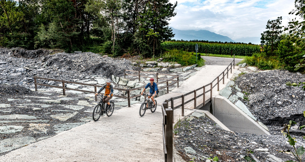
Übergang Maschänser Rüfe

Show all 9 images

Trimmiser Mittelweg
Nothing but wine and water: on this circular route, you will discover the winegrowing villages between Chur and Landquart. The return journey takes place on the popular Rhine route and along the regional rivers Landquart and Plessur.
Technique /6
Fitness 2/6
Highest Point   m
Lowest Point   m
Best Season
Jan
Feb
Mär
Apr
Mai
Jun
Jul
Aug
Sep
Okt
Nov
Dez
Start
Chur
Destination
Chur
Coordinates
46.853287078552, 9.5299169101921

Details

Description

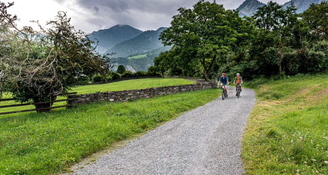
This varied loop tour begins in the middle of the Graubünden capital. But the busy city life is soon left far behind, because the route takes you on a tranquil neighbourhood road into nature. You cross the Fürstenwald, a popular local recreation area with views of the city and the Calanda. The historic Trimmiser Mittelweg then takes you through open pastures to the village of Trimmis. The route follows the "Bündner Rheintal Wine Trail" on several sections. Accordingly, it provides an insight into the local winegrowing culture. This has a long tradition as first mentions go back to the year 765. The Graubünden Rhine valley winegrowing region stretches from Bonaduz to Fläsch and covers around 420 hectares. Thanks to the mild climate and the foehn, the grapes thrive magnificently in the calcareous soils - especially the typical Blauburgunder variety.

Past the imposing, former moated castle of Marschlins, the route follows the Landquart river to the village of the same name. The Landquart has its source above Klosters, flows through the Prättigau valley and finally into the Rhine at Landquart. Here you return on the popular cycling route no. 2, the Rhine route. From Zizers, the path repeatedly follows the young Alpine Rhine. This has its source at the Oberalp pass as the Vorderrhein and at Rheinwald as the Hinterrhein. At Reichenau-Tamins, the two main arms join to form the Rhine. Switzerland’s largest river flows for a total of 1230 kilometres via Lake Constance through Germany, on to Holland, and into the North Sea.

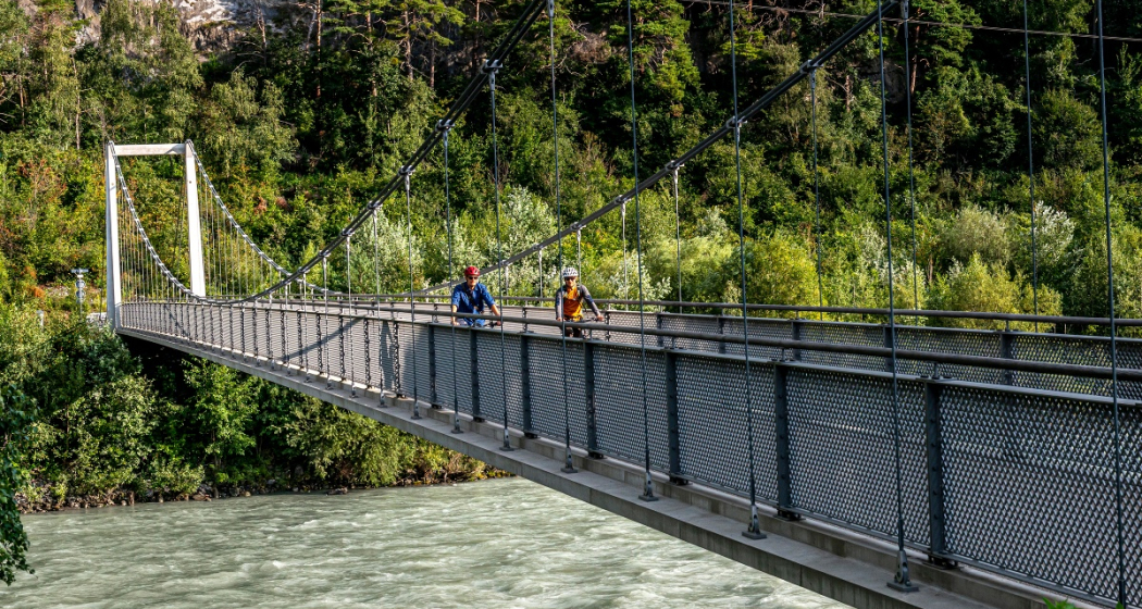
At Haldenstein, you cross to the other river bank. At the level of the town of Chur, the cycle path crosses the Rhine again on the Pardisla bridge which was built especially for cyclists and pedestrians. Shortly afterwards you reach another regional river: the Plessur has its source in the mountainous area between Arosa and Lenzerheide, flows past Arosa through the Schanfigg valley and into the Rhine at Chur. The route follows the river, and over the arched bicycle and pedestrian bridge, built in 2020, you finally dive right into the centre of Chur with its picturesque, car-free old town. Before returning to the station, you can stop at one of the numerous restaurants with sun terraces. The tour comes to a leisurely end in the unique ambience of Switzerland's oldest city.

Directions

Public Transport

  • Start at railway station in Chur or Landquart

Anreise Information

  • On the motorway to Chur or Landuqart
  • Start at railway station in Chur or Landquart

Parking

  • Park & Ride at railway station in Chur or Landquart

Responsible for this content SwitzerlandMobility.

50 km
3:25 h
300 mhd
420 mhd
02.03 Rhein-Route Etappe 3 Chur - Buchs
02.03 Rhein-Route Etappe 3 Chur - Buchs (oua_8580518_6124df0_profile)
The Bündner Herrschaft, the fertile garden and wine region of the canton, is located on a mound of slate detritus. The Tamina Gorge carries healing water down to the valley and Johanna Spyri‘s Heidi is stirring up nostalgic feelings.
Technique /6
Fitness 4/6
Highest Point   m
Lowest Point   m
Best Season
Jan
Feb
Mär
Apr
Mai
Jun
Jul
Aug
Sep
Okt
Nov
Dez
Start
Chur
Destination
Buchs
Coordinates
46.85441765959, 9.5053531224222

Details

Description

The Bündner Herrschaft, Graubunden’s fertile garden and winery lies on a mound of slate detritus. Also the home of Heidi, Peter and Alpöhi (Heidi’s grandfather).

Directions

Chur - Igis - Maienfeld - Fläsch - Bad Ragaz - Sargans - Buchs

Responsible for this content SwitzerlandMobility.
This content has been translated automatically.

64 km
4:30 h
760 mhd
1350 mhd
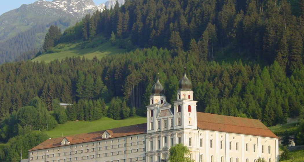
Benediktiner Kloster
02.02 Rhein-Route Etappe 2 Disentis - Chur (oua_8580502_6403454_profile)
The Surselva is the largest Romansch-speaking area in the Grisons region. Up and down we go, following the burbling Rhine through pretty little hamlets. The amazing wild gorge of the Anterior Rhine is known as the Grand Canyon of Switzerland. The day ends in Chur, the oldest Swiss town north of the Alps.
Technique /6
Fitness 6/6
Highest Point   m
Lowest Point   m
Best Season
Jan
Feb
Mär
Apr
Mai
Jun
Jul
Aug
Sep
Okt
Nov
Dez
Start
Disentis
Destination
Chur
Coordinates
46.705270682288, 8.8554213182519

Details

Description

Surselva - «above the forest» - Graubunden’s largest Romansch-speaking region. The wild gorge of the Vorderrhein is awe-inspiring - Switzerland’s Grand Canyon. Chur, the oldest town north of the Alps boasts the highest density of restaurants.

Directions

Disentis - Trun - Ilanz - Rheinschlucht - Tamins - Chur

Responsible for this content SwitzerlandMobility.
This content has been translated automatically.

E-bike Kunkelspass (tour around the Calanda mountain range)

Medium
58.2 km
4:45 h
995 mhd
995 mhd
Churer Rheintal mit Calanda und Kunkelspass
Das eindrückliche Calanda-Massiv, von Brambrüesch aus gesehen (links der Ringelspitz)

Show all 10 images

Schlussaufstieg zum Kunkelspass
The circular tour of the Calanda massif over the Kunkelspass is a real classic. The historic pass route also offers an impressive scenic experience.
Technique 2/6
Fitness 3/6
Highest Point  1358 m
Lowest Point  515 m
Best Season
Jan
Feb
Mär
Apr
Mai
Jun
Jul
Aug
Sep
Okt
Nov
Dez
Start
Station Chur
Destination
Station Chur
Coordinates
46.853294, 9.529913

Details

Description

You have to do this tour once. For many cyclists it is one of the annual highlights. You experience the mighty Calanda massif from all sides. And who would have thought that it looks so rugged and jagged from the back. The route is extremely varied with the enjoyable start along the Rhine route. Via a side road with little traffic, you reach Pfäfers, where you cross the impressive Tamina bridge that spans the gorge. A long path through the Tamina valley follows via Valens, past the Mapragg reservoir and via Vättis finally to the Kunkelspass. The Überruf mountain inn stands at the top of the pass and offers the ideal opportunity for refreshments before the descent via the Forstrasse, at the beginning through tunnels hewn into the rock, leads down towards Tamins. The way back from there again follows the Rhine back to the Alpine City of Chur.

The Kunkelspass connects the Tamina valley (SG) with the municipality of Tamins (GR). It lies between the steep walls of the Calanda in the east and the mountain group around the Ringelspitz in the west. The narrow road and the tunnel on the Tamins side with the panoramic openings in the tunnel wall were built during the First World War. The Kunkelspass also forms the eastern entrance to the geological wonderland of the Tectonic Arena Sardona. At the pass near the Überruf mountain restaurant there is a seminar room with information about the UNESCO World Heritage Site. A telescope offers the opportunity to have a close look at the Ringelspitz and the Glarus thrust or the demolition niche of the Tamins mountain fall.

The Calanda massif consists of the four peaks Haldensteiner Calanda (at 2,805m the highest), Felsberger Calanda, Taminser Calanda and Berger Calanda (above Untervaz).

Directions

From Chur you follow the Rhine route 2 to Landquart. There you cross the Rhine and follow a little-used mountain road to Pfäfers, cross the Tamina gorge on the impressive Tamina bridge and then follow the mountain bike route 482 to the Mapragg dam. There you leave the route and ride on the road along the lake. After the lake, you follow route 482 again via Vättis to the Kunkelspass and down to Tamins, from where you finally return to the city of Chur on Rhine route 2.

Directions

Public Transport

Chur train station is easily accessible by SBB (Swiss Federal Railways), Rhaetian Railways, Postbus or Chur Bus.

Anreise Information

Motorway exit Chur Nord or Chur Süd and then drive to the city centre.

Parking

At Chur railway station two multi-storey car parks are available (Otto & Alex / SBB Park & Rail).

Responsible for this content Graubünden Ferien.

Geological E-Bike tour: over the Kunkelspass around Calanda

Medium
60.5 km
4:30 h
1063 mhd
1064 mhd
Gemeinsam um den Calanda
Auf dem Weg zum Kunkelspass

Show all 5 images

Gemeinsam über den Kunkelspass
This round trip is a classic for E-Bikers. Especially those interested in geology will enjoy the Calanda Circuit.
Technique 3/6
Fitness 4/6
Highest Point  1358 m
Lowest Point  500 m
Best Season
Jan
Feb
Mär
Apr
Mai
Jun
Jul
Aug
Sep
Okt
Nov
Dez
Start
Bad Ragaz train station
Destination
Bad Ragaz train station
Coordinates
47.010059, 9.504616

Details

Description

The start of this geologically highly interesting round trip is in Bad Ragaz. After the village centre, you turn onto the old, picturesque road towards Valens, where you have to climb 300 metres in altitude for the first 4.5 kilometres. A panoramic stop on the Tamina Bridge, which opened in 2017, is a must. With a span of 260 metres, it is the largest arch bridge in Switzerland. From Pfäfers, follow the gently ascending main road into the Tamina Valley. The next stop is worth a stop at the Windegg viewpoint in front of Vadura. Here you can enjoy a wonderful view of the Glarus main thrust and the Wildseehörner. World Heritage information boards, viewing judges and cool loungers invite you to linger... but you probably want to go further.

At kilometre 16 you reach Vättis, where the exhibition 'BergeQuake!' shows the connection between earthquakes and mountain building in the Sardona tectonic arena... very impressive thanks to the live transmission of seismic recordings! Over the next few kilometres at the bottom of the bubbling Görbsbach, you can enjoy the view of the rugged limestone formations of the Haldensteiner (2,805 m) and Felsberger Calanda (2,697 m). The Eggwald mountain restaurant in Ober Kunkels (1148 m a.s.l.) invites you to stop for a bite to eat. A last short ascent, you have reached Graubünden soil and soon also the Kunkelspasshöhe (1,357 m a.s.l.). The garden terrace of the mountain inn Überuf is irresistible. The lovely pass plateau presents itself like an arena, surrounded by the Calanda (2805 m above sea level), the Crap Mats (2947 m above sea level) and the Ringelspitz (3247 m above sea level), the highest mountain in St.Gallen, located in the Tectonic Arena. Inside the inn, an educational information room is  dedicated to the UNESCO World Heritage Site of the Sardona Tectonic Arena.
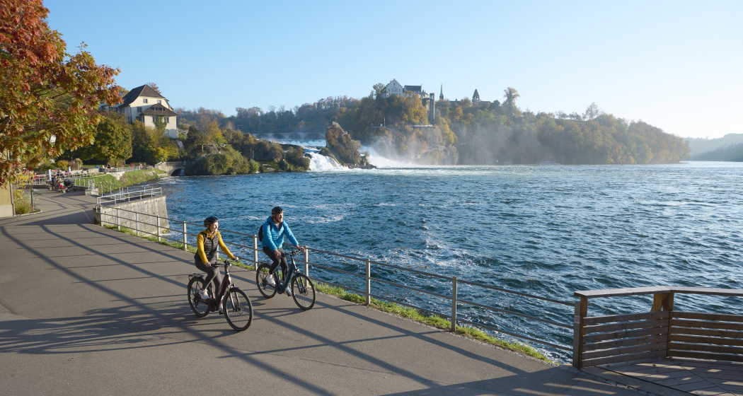
The descent to Tamins (660 m a.s.l.) leads over a steep and bumpy natural road built during the First World War. The view from the tunnel blasted into the rock is spectacular. You can overlook the Domleschg and even see the Bernina massif in the distance. From Tamins, follow the national Veloland route no. 2 to Felsberg, where you continue along the right bank of the Rhine to Chur. Once again, you can educate yourself in geology: In the Chur Natural History Museum, a comprehensive geology exhibition focuses on the topic of Alpine formation. Then you can easily roll down the Rhine to Landquart and Bad Ragaz... or you can swing to the train station, look up again to the Calanda... and end the round on the railway.

Geheimtipp

Rent an e-bike at the e-bike station Bad Ragaz. This is located right next to the Tamina Therme, where you can treat yourself to a soothing bath after the tour.

Sicherheitshinweis

Take appropriate equipment with you to the tour and stay on the marked trails.

Ausrüstung

Normal bike equipment. Functional clothing is an advantage, as ascents and descents alternate.

Directions

Bad Ragaz – Pfäfers – Vättis – Kunkelspass – Tamins – Chur – Landquart – Bad Ragaz

Directions

Public Transport

By train to Bad Ragaz station

Anreise Information

Via motorway A13 exit Bad Ragaz

Parking

Parking directly at Bad Ragaz train station (chargeable)

Responsible for this content Graubünden Ferien.
This content has been translated automatically.

RheinWelten on the Rhine Route

Medium
438.5 km
30:00 h
1838 mhd
2913 mhd
RheinWelten
RheinWelten

Show all 8 images

RheinWelten führt dich zum Rheinfall
The "RheinWelten" e-bike route now connects Switzerland's existing cycling destination "Rhine Route 2" with regional, cultural and culinary highlights in 15 worlds of experience.
Technique 1/6
Fitness 3/6
Highest Point  2044 m
Lowest Point  258 m
Best Season
Jan
Feb
Mär
Apr
Mai
Jun
Jul
Aug
Sep
Okt
Nov
Dez
Start
Andermatt
Destination
Basel
Coordinates
46.634663, 8.596397

Details

Description

"RheinWelten" is a unique two-wheeler offer from the source of the Rhine to Basel for enjoyable explorers. 45 local tours in 15 adventure worlds can be discovered in Switzerland and Liechtenstein on an e-bike.  The tours combine visits to producers and farm shops, visits to museums or wineries, as well as local restaurants and overnight accommodations with the most beautiful cycling routes or hikes in the regions. The adventure worlds can be visited individually as a day trip or as a multi-day bike tour. 

Selected information on the new digital platform www.rheinwelten.com encourage people to discover new things. RheinWelten takes you through 12 tourist destinations in six cantons as well as the Principality of Liechtenstein. Experience unique cultural landscapes and the culinary diversity along the Rhine by e-bike.

Geheimtipp

Not the way is the goal, but the worlds of experience of the RheinWelten.

Ausrüstung

Roadworthy (e-)trekking bike, bicycle helmet, saddlebags or trekking backpack (approx. 35 litres) with rain cover, comfortable sports shoes, possibly cycling shoes, weather-adapted and durable clothing in the multi-layer principle, if necessary cycling jersey, change of clothes, cycling gloves, air pump, bicycle tools, sun and rain protection, provisions and drinking water, drinking bottle and suitable holder, first aid kit, pocket knife, mobile phone, if necessary mobile phone holder for the handlebar, headlamp and Reflectors, maps, travel documents, toiletry bags and towels, hand detergent and clothesline.

Directions

Rhine Route 2: Andermatt - Oberalppass - Disentis - Trun - Ilanz - Versam - Reichenau - Chur - Landquart - Jenins - Maienfeld - Sargans - Buchs - Oberriet - Altstätten - St.Margrethen - Fussach (D) - Gaissau (D) - Rohrschach - Arbon - Romanshorn - Kreuzlingen - Steckborn - Stein am Rhein - Gailingen (D) - Schaffhausen - Dachsen - Ellikon - Eglisau - Zurzach - Felsenau - Laufenburg - Stein - Rheinfelden - Pratteln - Muttenz - Basel

Directions

Public Transport

Arrival by train to Andermatt possible

Anreise Information

Motorway exit Göschnen direction Andermatt

Parking

Paid parking available

Responsible for this content Graubünden Ferien.
This content has been translated automatically.