Heidiland Bike Tour

168.5 km
18:35 h
5370 mhd
5264 mhd
Heidiland Bike Tour (oua_24515991_0c70eab_profile)
Heidiland Bike Tour
Technique 0/6
Fitness 0/6
Highest Point  1428 m
Lowest Point  421 m
Best Season
Jan
Feb
Mär
Apr
Mai
Jun
Jul
Aug
Sep
Okt
Nov
Dez
Coordinates
47.13502, 9.09802

Details

Responsible for this content Graubünden Ferien.

Rhine-Route No. 2: Section 3 Chur - Buchs (SG)

Medium
47.5 km
3:15 h
107 mhd
248 mhd
Heidihaus Grand Tour
Maienfeld

Show all 4 images

Rheindamm
The Rhine route accompanies the Alpine river from its source in the mountains to the large Rhine ports of Basel. On varied paths, the journey leads through many landscapes that this powerful river has created over the course of time.
Technique 2/6
Fitness 4/6
Highest Point  630 m
Lowest Point  445 m
Best Season
Jan
Feb
Mär
Apr
Mai
Jun
Jul
Aug
Sep
Okt
Nov
Dez
Start
Chur, railway station
Destination
European box
Coordinates
46.854078, 9.528082

Details

Description

The Bündner Herrschaft, Graubunden's fertile garden and winery lies on a mound of slate detritus. Also the home of Heidi, Peter and Alpöhi (Heidi's grandfather).

Note(s)
Beware: in good weather, a strong wind blows up the Rhine Valley in the afternoon however down valley if the Föhn wind is blowing.

See also
Ostschweiz Tourismus
Fürstenlandstrasse 53
9000 St.Gallen
Tel:+41 (0)71 274 99 00
Fax: +41 (0)71 274 99 01
Email: info@ostschweiz.ch
Internet: www.ostschweiz.ch

Ausrüstung

Normal cycling equipment. Functional clothing is an advantage, as ascents and descents alternate

Directions

Chur - Igis Landquart - Jenins - Sargans - Buchs

Directions

Public Transport

By train to Chur.

Anreise Information

Take the motorway exit Chur Nord and follow the signs to the train station.

Parking

Public parking available at the train station in Chur (for a fee).

Responsible for this content Graubünden Ferien.
This content has been translated automatically.

E-Bike & Hike Fulhorn

Medium
55.6 km
6:40 h
2000 mhd
2000 mhd
Fulhorn
Alp dil Plaun

Show all 3 images

E-Bike & Hike Fulhorn (oua_66797816_bdc3664_profile)
This summit tour offers an all-round experience: beautiful ascent route to the mountain village Feldis and further to Alp dil Plaun, from where the hike to the Fulhorn summit with 360° panorama.
Technique 2/6
Fitness 4/6
Highest Point  2529 m
Lowest Point  564 m
Best Season
Jan
Feb
Mär
Apr
Mai
Jun
Jul
Aug
Sep
Okt
Nov
Dez
Start
Station Chur
Destination
Station Chur
Coordinates
46.853448, 9.529775

Details

Description

From Chur, this tour begins with a leisurely roll-in to Domat/Ems. Directly in front of the golf course, the ascent then follows on the alpine road to the beautifully situated Graubünden mountain village of Feldis, which is known for its exceptionally rich alpine flora. By the way, there is also a gondola lift from Rhäzüns to Feldis - so if you want to save some battery and energy, you can alternatively ride to Rhäzüns and then take the gondola lift with your bike to Feldis. Through the picturesque village and past the chairlift, the beautiful climb over the Feldis Alps towards Alp dil Plaun follows shortly afterwards. Up to the settlement of Culm Ault you can continue without any problems, there is a good point to park the e-bike and continue on foot. At Windegga you can see the top station of the ski lift from Pradaschier. After Tgom'Aulta the path becomes steeper towards Fulbergegg (2'448m). From there it is not far to the summit, still up the ridge and you are already standing on top of the Fulhorn (2'528m), where a magnificent all-round panorama opens up.

The descent follows the same route. For technically experienced mountain bikers who still have reserves, there are also various trail options back to Chur.

Directions

From Chur on bike route 6 (Graubünden Route) to Domat/Ems. Via the alpine road to the mountain village Feldis and through it. On the alpine road via Plaun digls Mats in the direction of Alp dil Plaun and further to the settlement Culm Ault. From there on foot towards Windegga and via Tgom'Aulta and Fulbergegg to the Fulhorn. Return on the same way.

Directions

Public Transport

Chur train station is easily accessible by SBB (Swiss Federal Railways), Rhaetian Railways, Postbus or Chur Bus.

Anreise Information

Motorway exit Chur Nord or Chur Süd and then drive to the city centre.

Parking

At Chur railway station two multi-storey car parks are available (Otto & Alex / SBB Park & Rail).

Responsible for this content Graubünden Ferien.

E-Bike Short tour from Chur

Simple
19.3 km
1:25 h
128 mhd
126 mhd
Unterwegs auf der Churer Rheinroute 501
Überquerung des Rheins zwischen Haldenstein und Chur (Pardislabrücke)

Show all 6 images

Fürstenwald oberhalb Chur
This loop leads on continuously signposted cycle paths in a short time out of the city of Chur through the beautiful Fuerstenwald forest and back along the Rhine. Ideal if you only have a little time available, but still want to experience a beautiful tour.
Technique /6
Fitness 1/6
Highest Point  655 m
Lowest Point  540 m
Best Season
Jan
Feb
Mär
Apr
Mai
Jun
Jul
Aug
Sep
Okt
Nov
Dez
Start
Chur rail station
Destination
Chur rail station
Coordinates
46.853267, 9.529947

Details

Description

A worthwhile short tour out of the city of Chur. It leads through the beautiful Fuerstenwald forest recreation area to the rural village of Trimmis and along the Rhine back to the Alpine City. On the way back, you cross the Rhine on the Pardislabrücke bridge, which is well worth seeing, the Plessur on the Italian bridge and finally you return through the picturesque old town to the starting point at Chur railway station.  

Directions

From Chur station, simply follow the signposted route 501 (Churer Rheinroute) through the Fürstenwald, to Trimmis and to the Rhine. Turn left there and follow the route again to Haldenstein and through the old town back to the starting point at Chur station.

Directions

Public Transport

Chur train station is easily accessible by SBB (Swiss Federal Railways), Rhaetian Railways, Postbus or Chur Bus.

Anreise Information

Motorway exit Chur Nord or Chur Süd and then drive to the city centre.

Parking

At Chur railway station two multi-storey car parks are available (Otto & Alex / SBB Park & Rail).

Responsible for this content Graubünden Ferien.

Churer millstreams

Medium
10.7 km
2:40 h
60 mhd
53 mhd
Churer Mühlbäche
Ententeich

Show all 3 images

Churer Mühlbäche (oua_802246422_9729e63_profile)
The Chur mill streams are witnesses of days long past. Today, they still rush through Chur and offer a special kind of local recreation area in the Obere Au.
Technique 2/6
Fitness 3/6
Highest Point  609 m
Lowest Point  552 m
Best Season
Jan
Feb
Mär
Apr
Mai
Jun
Jul
Aug
Sep
Okt
Nov
Dez
Start
bus station Obere Au, Chur
Destination
bus station Obere Au, Chur
Coordinates
46.85809, 9.506397

Details

Description

Anyone walking through Chur often hears the water gurgling beneath them or sees small streams rushing past. No, it is not a sewer, it is the Chur mill streams. Since Chur itself has no water of its own and still obtains its drinking water from sources of value, the mill streams were the lifelines of the city for centuries. The Plessur as the dominant river in the landscape flows through Chur, but it has much of a wild mountain stream on which neither goods could be transported nor mills could be driven. Therefore, the construction of the mill streams was the prerequisite for a regulated water supply of Chur. They provided the city with service water and hydroelectric power and enabled industry and the population to survive in Chur. Did you know, for example, that the Chur Quadereis was produced annually with the water of the Mühlbach or that the repair workshop of the SBB was powered by the same water? 

Geheimtipp

  • The tour is suitable for strollers
  • The tour is wheelchair accessible
  • Book the tour as a culinary tour and enjoy a delicious 3-course menu during your tour

Ausrüstung

Comfortable footwear

Directions

You start your tour directly at the bus stop of the Obere Au. Follow the mill streams past the concrete garden and the Kneipp bath to coffee Merz. Cross the road and go under the highway along Pulvermühle street. Immediately after the roundabout on the right side of the road is the former Pulvermühle. Follow the road a little further and you will also see the mill streams open again. At the end of the Pulvermühle, directly at the roundabout, turn right and after a few meters you will see the mill streams again. Cross the road at the signalized crossing and follow Küblereiweg and later Vogelsangweg onto Sägenstrasse; turn right at the road junction near the climbing center. Follow Sägenstrasse until you have passed Merkle Metallbau and are in front of the CADA small power station. Continue along Sägenstrasse until you reach the roundabout, turn right there and continue to the end of the road. Turn left at the next roundabout and follow Kasernenstrasse to the entrance "Welschdörfli". Diagonally opposite the hotel Schweizerhaus, turn right into Seilerbahnweg and then directly left into St. Margrethenstrasse. Follow this street, cross Malixerstrasse and turn into Höhenbühlweg. Follow this, turn right a little up the slope and then take the first staircase on the left down to Lindenquai (with strollers / wheelchairs follow Malixerstrasse, turn right at the traffic circle and into Lindenquai). Follow the Lindenquai and the Bodmerstrasse; at the retirement home cross the Plessur and follow the Plessurquai and the Sandstrasse to the right until you reach the aqueduct. Immediately afterwards - at the train depot - take the left fork Sandstrasse and follow the path around the sports field. At the end of the path cross St. Luzistrasse and go opposite into Münzweg. Follow the Münzweg until you reach Willy Sand mill; after the mill follow Jochstrasse. After the sculptor's workshop Bianchi turn right and follow the Jochstrasse until the end and the Arcas square. At Arcas go through the "Brotlaube" to Martinsplatz and follow Poststrasse to the crossroads by the UBS building. Cross the big main street (Grabenstrasse) and follow Bahnhofsstrasse to Alexanderplatz and further Alexanderstrasse (past Mc Donald's) to the intersection at Gürtelstrasse. Cross under the tracks and then turn directly left. Between the allotment gardens you will see the millstreams open again. Immediately after, turn right twice until you are in front of the old chocolate factory, now Activ Fitness. Walk across the parking lot (opposite the Activ Fitness entrance) and follow Calandastrasse. At the intersection with Calandastrasse turn right and follow the street until the end and the intersection with Ringstrasse. Turn left here until you reach the roundabout and there turn right into Tittwiesenstrasse. Follow this road until you reach the two high-rise buildings and you will see the millstreams open again in the field opposite these buildings. Follow the mill streams until you reach the "Ententeich" near Mehli Landmaschinen. From here on you can no longer walk along the mill streams, but follow the Rheinmühleweg until you reach the field path. Turn right there and follow the path for a few meters until just before the allotment gardens. Turn left there and follow the path to the banks of the Rhine and the Rhine promenade. At the Rhine turn left and follow the shore to Camp Au; during this walk you will see the mouth of the mill streams on the Rhine. From Camp Au, use the Tennisplatzweg back to Obere Au, the starting and also the end point of your tour.

Directions

Public Transport

Travel by train to Chur and continue with the Chur Bus Line 2 to the Obere Au sports facilities.

Anreise Information

Take the Chur Süd freeway exit and at the traffic circle take the "Obere Au" exit. Follow the signs to the Obere Au, where there are sufficient parking facilities.

Parking

There are enough parking spaces available, but they are used for the sports facilities both in summer and winter. Thus, there is a possibility that the capacity will be exhausted at some point.

Price:

  • first hour free of charge (parking must be started from the first hour onwards
  • after that CHF 1.00 per hour

Further information here.

Responsible for this content Chur Tourism.

Ice Rink Chur

Quader outdoor ice rink

Eisfeld Quader
Eisfeld Quader

Show all 10 images

Eisfeld Quader
The romantic ice rink in the city center.

Description

The season on the Quader ice rink is over - we look forward to welcoming you again from 15 November 2025.

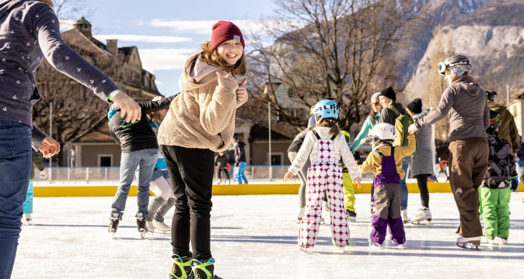
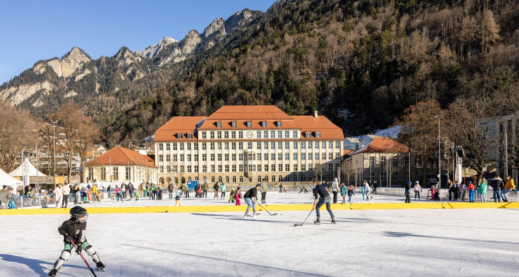
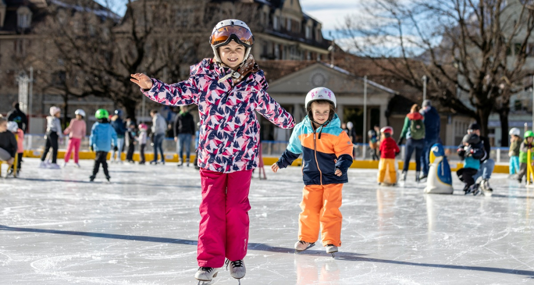
The Quader outdoor ice rink, with its romantic lighting and atmospheric music, is the winter meeting place in the heart of the city, just a two-minute walk from Chur railway station. Allow yourself to be enchanted by the fairy-tale ambience on the ice rink in front of the imposing Quader school building. A separate section is reserved for hockey enthusiasts, while the remaining area is open to people of all ages wishing to practise their ice-skating skills.

Khurer Gnusswaga
The "Khurer Gnusswaga" - Chur food stall - stands next to the Quader outdoor ice rink. The food stall offers homemade dishes for every appetite. A small heated tent next to the ice rink provides cosy warmth where you can enjoy your drink or meal. More information about the Khurer Gnusswaga 

Skating for wheelchair users
The Cerebral foundation has provided the city of Chur with a so-called "ice glider", a platform with its own blades that allows wheelchair users to access the ice. The gliders are designed to adapt to most common wheelchair models. The glider can be used free of charge. See flyer for images.

Prices

Please find ice sports prices here.

Ticket Shop
Buy your tickets online at the ticket shop www.sportanlagenchur.ch/ticketshop

  • buy your ticket online with or without ChurCard, adult or child
  • pay by credit/debit card or Twint
  • receive your ticket with QR code by e-mail
  • validate your QR code at the entry to the ice rink
  • let the ice fun begin!

The tickets are valid on the date of purchase. Purchased tickets cannot be cancelled.

Children unter 6 years are free when accompanied by a paying adult.

Equipment rental

  • Ice skates CHF 6.-
  • Beginners ice skates (2 blades) CHF 3.-
  • Sharpen ice skates CHF 14.- (within 1 to 3 days)
  • Skating aids per hour CHF 4.- 
  • Ice hockey stick CHF 3.-
  • Ice hockey helmet CHF 4.-
  • Soft puck CHF 4.- (sale only)

An ID-card has to be deposited for all rental items.

Please kindly place your group reservation via this format least 48 hrs in advance (reservations for Monday have to be done by Friday 12pm), thank you. You'll find the booking plan with the time slots already booked by groups here: Booking plan.

Opening hours

16.11.2024-02.03.2025* | Season start winter 2025/2026: 15.11.2025

  • Monday-Friday 11am-9pm
  • Saturday 10am-9pm
  • Sunday 10am-8pm, except 2. March 2025 open until 6pm
  • School classes possible from 10am on Tuesdays and Thursdays. Mandatory registration at least 48 hrs in advance (reservations for Monday have to be done by Friday 12pm). Please use this form. You'll find the booking plan with the time slots already booked by groups here: Booking plan.

*Season depending on weather

The Quader outdoor ice rink is generally always open, except in heavy rain or with lots of fresh snowfall. If the weather is uncertain, we will be happy to inform you on: +41 81 254 42 99

Holidays

  • Christmas Eve, 10am-4pm
  • Christmas Day closed
  • Boxing Day, 10am-8pm
  • New Years Eve, 10am-4pm
  • New Year, 10am-4pm
  • 2nd January, 10am-8pm

Special opening hours

  • Christmas holidays 23.12.2024-03.01.2025 opening at 10am on weekdays (food truck open daily from 11am)
  • Sports holidays 24.-28.02.2025 opening at 10am on weekdays (food truck opening daily from 11am)

Directions

Directions

Contact

Responsible for this content Chur Sports and Event Facilities.

Cross country ski track Varsera

2 km
0:25 h
21 mhd
21 mhd
Langlaufloipe Varsera

Show all 4 images

Langlaufloipe Varsera
Cross country ski track Varsera
Technique 0/6
Fitness 0/6
Highest Point  607 m
Lowest Point  586 m
Best Season
Jan
Feb
Mär
Apr
Mai
Jun
Jul
Aug
Sep
Okt
Nov
Dez
Start
At the end of Via da Munt, Domat/Ems
Destination
At the end of Via da Munt, Domat/Ems
Coordinates
46.824393, 9.449326

Details

Description

If there is enough snow, a skating trail is groomed on the Domat/Ems golf course by the snow groomer, which maintains the Feldis-Domat/Ems toboggan run. The easiest way to get started is at the lumber yard at the end of Via da Munt.

Information on whether the trail is open and groomed can be found under www.snowsport-ems.ch

Responsible for this content Chur Tourism.
This content has been translated automatically.

Dreibündenstein - Fulhorn

Medium
7.7 km
3:00 h
1013 mhd
81 mhd
Dreibündenstein Hochebene mit Fulhorn
Schluss-Aufstieg zum Fulhorn

Show all 9 images

Blick von Spundis Richtung Dreibündenstein
Nice tour from Brambrüesch to the Dreibündenstein high plateau and further up to the peak of the Fulhorn with panoramic views.
Technique 3/6
Fitness 3/6
Highest Point  2529 m
Lowest Point  1593 m
Best Season
Jan
Feb
Mär
Apr
Mai
Jun
Jul
Aug
Sep
Okt
Nov
Dez
Start
Brambrüesch
Destination
Brambrüesch
Coordinates
46.829112, 9.516041

Details

Description

Rewarding ski tour, beginning at the top gondola station in Brambrüesch. Ascent through the forest at first, later on close to the ski slopes up to Furggabüel and the Dreibündenstein high plateau, which is being crossed on the tour (possible to ski down without skins). At appr. 2100m the ascent to the Fulhorn begins. Take care along the ascent since there are steep parts and snow drifts.

Descents are possible to Alp dil Plaun, the ski hut Term Bel and (if enough snow) as far as Domat/Ems in the valley (otherwise at Alp dil Plaun left/southwards to Scheid). The descent through the steep north side in direction of Pradaschier / Churwalden is only for experienced ski tourers and with safe snow conditions. If you would like to descent to Churwalden, you can alternatively use the slopes in the ski area, as well. All ascents and descents are at your own risk.

Directions

Public Transport

Take the train to Chur station. From there, the city bus (line 1) takes 3 minutes to the valley station of the mountain railways (Stadthalle/Brambrüeschbahn stop).

Anreise Information

  • Motorway exit Chur Süd

  • Drive into the city (Kasernenstrasse)

  • The valley station and car park are on the right-hand side in front of the town centre

Parking

More about parking for guests of the Chur mountain railways.

Responsible for this content Brambrüesch.
This content has been translated automatically.

Walking tour through the Alpine City

Simple
4.5 km
1:45 h
20 mhd
20 mhd
City E-Guide Chur
Blick auf die Churer Altstadt

Show all 14 images

Arcas Platz in der Altstadt
Discover Switzerland's oldest town on a tour through the city center and the historic Old town. In addition with the Audio Guide from Chur Tourism, you will enjoy an interesting and individual city tour.
Technique 1/6
Fitness 1/6
Highest Point  623 m
Lowest Point  574 m
Best Season
Jan
Feb
Mär
Apr
Mai
Jun
Jul
Aug
Sep
Okt
Nov
Dez
Start
Chur, train station
Destination
Chur, train station
Coordinates
46.853748, 9.529188

Details

Description

The City E-Guide by Chur Tourism is the individual city tour for your mobile phone or tablet. With the free app, you can explore the city on your own. All kinds of interesting facts about history, culture, sights and much more are available in the app at any time. You can choose from various tours of different lengths, which can be adapted to your starting point thanks to GPS positioning.

In 43 chapters you will learn many interesting facts about the history and culture of the Alpine City of Chur and the holiday canton of Graubünden. A further 32 chapters deal with the Cathedral Treasure Museum of the Diocese of Chur - you will learn many interesting facts about the history of the diocese, about the cathedral treasure of Chur and the Death Pictures from the Episcopal Castle.

At the Tourist Info at Chur mainstation, you have also the possibility to rent a tablet with the City E-Guide on it. Thanks to the larger screen, tablets are ideal for experiencing the tours together with one device.  

Directions

Public Transport

The tour begins directly at the Chur railway station.

Responsible for this content Chur Tourism.

Chur - Trimmis - Zizers - Haldenstein - Chur

Simple
26.4 km
2:15 h
139 mhd
139 mhd
Trimmiser Mittelweg
Trimmiser Mittelweg

Show all 7 images

Churer Rheinroute 501, Pardislabrücke Haldenstein-Chur
Beautiful round tour from Chur, connecting the two new cycle paths Chur-Trimmis and Haldenstein-Chur with the Rhine route.
Technique 1/6
Fitness 2/6
Highest Point  655 m
Lowest Point  539 m
Best Season
Jan
Feb
Mär
Apr
Mai
Jun
Jul
Aug
Sep
Okt
Nov
Dez
Start
Chur railway station
Destination
Chur railway station
Coordinates
46.85354, 9.529757

Details

Description

The Chur-Trimmis cycle path over the Trimmiser Mittelweg was opened on 27 November 2019. It leads from the end of the Cadonaustrasse in Chur to the Blutmarchweg in the Fürstenwald and over a new bridge at the Maschänserrüfe and the Trimmiser Mittelweg to Trimmis. The Haldenstein-Chur cycle path was opened on 14 December 2018. It leads from Haldenstein along the Rhine to the Pardisla bridge, which was newly built and crosses the Rhine in the direction of Chur.

The two new cycle paths can be combined in a round tour from Chur via Zizers to a beautiful round tour. Provided there is no snow all the way down to the valley, this route can be used practically all year round and is also suitable in winter as a round route for cyclists, cross-country bikers, e-bikers or gravel bikers. Between Trimmis and Zizers, the tour leads through the vineyard landscape and on to Molinära Hof over a piece of unpaved ground (hiking trail). If you prefer to do the whole round on a paved surface, you can go in Trimmis directly down to the Deutsche Strasse and along it to Zizers - so the round is even suitable for racing cyclists (a short section through the Fürstenwald on the new cycle path Chur-Trimmis runs on a not asphalted but paved forest path).

Responsible for this content Chur Tourism.