rhiienergie Trail Bonaduz

Medium
10 km
2:10 h
130 mhd
125 mhd
rhiienergie Trail Bonaduz
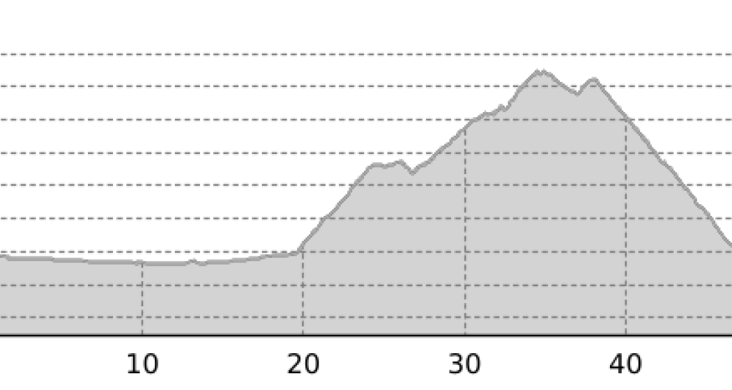
rhiienergie Trail Bonaduz (oua_25240356_715877c_profile)
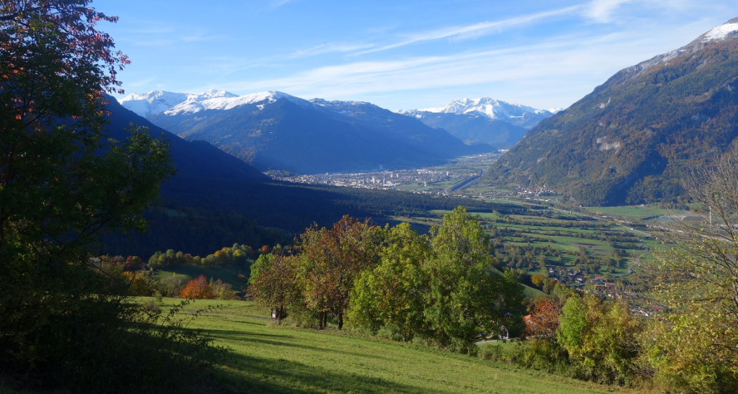
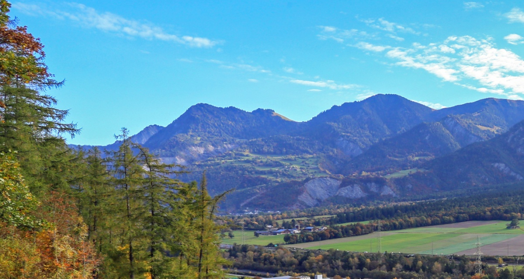
The Bonaduz Trail (yellow signage) is about 10 km long with a height difference of 130 meters.
Technique 2/6
Fitness 3/6
Highest Point  738 m
Lowest Point  651 m
Best Season
Jan
Feb
Mär
Apr
Mai
Jun
Jul
Aug
Sep
Okt
Nov
Dez
Start
Bonaduz
Destination
Bonaduz
Coordinates
46.818725, 9.385551

Details

Description

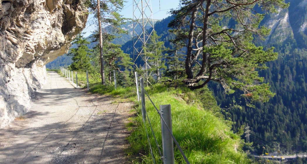
In the communes of Bonaduz, Domat / Ems, Felsberg, Rhäzüns and Tamins, rhiienergie created five interconnected Nordic Walking routes (also suitable for jogging / running). Each route runs for about 10 kilometers on existing paths and roads across meadows and through forests. A corresponding signage shows on the one hand the way direction and on the other the respective distance covered.

Responsible for this content Chur Tourism.
This content has been translated automatically.

E-bike Rhine Gorge circuit

Medium
65.2 km
5:20 h
1154 mhd
1133 mhd
Einzigartige Naturkulisse: Die Rheinschlucht
Aussichtspunkt Zault zwischen Bonaduz und Versam

Show all 9 images

Rheinschlucht
The circuit tour of the Rhine Gorge is an extended but rewarding day trip with numerous viewpoints along the Rhine Gorge, the beautiful Cresta Lake and the confluence of the Rhine.
Technique 2/6
Fitness 4/6
Highest Point  1169 m
Lowest Point  564 m
Best Season
Jan
Feb
Mär
Apr
Mai
Jun
Jul
Aug
Sep
Okt
Nov
Dez
Start
Station Chur
Destination
Station Chur
Coordinates
46.853213, 9.530019

Details

Description

The circular tour around the Rhine Gorge from Chur includes numerous highlights and is extremely varied. At the beginning of the route, you cross the Rhine twice at Reichenau, where the Vorderrhein and Hinterrhein rivers meet. After Bonaduz, the spectacular road follows above the Rhine Gorge via Versam and Valendas. The Zault and Spitg viewing platforms reveal magnificent views of the natural wonder of the Rhine Gorge. On the way back, after the climb to Laax, there is a beautiful section through the Flimserwald forest and to the Conn lookout tower, from where a sensational panorama of the Rhine Gorge opens up from high above. The next highlight is Lake Cresta, before the return trip via Trin, Tamins and Felsberg back to the Alpine City of Chur.  

Directions

From Chur on the Graubünden Route 6 to Domat/Ems. Along the edge of the golf course in the direction of Reichenau train station. There follow the Rhine Route 2 via Bonaduz along the Rhine Gorge to Valendas. In the village, turn right and descend to Valendas train station, where the Rhine is crossed on the bridge. From there follows an ascent through the forest to Laax. However, the route branches off again immediately and leads along bikeroute 90 past Lake Cauma in the direction of Trin. Before Conn turn off and ride to the viewpoint and restaurant Conn. Then back on the bike route Graubünden 90 and via Crestasee to Trin Mulin. There cross the road to Trin village and go through it. Before entering the main road to Tamins, cross under it and shortly afterwards continue on the Graubünden 90 bike route to the village of Tamins. In the village center change to the Rhine Route 2 and follow it back to Chur.

Directions

Public Transport

Chur train station is easily accessible by SBB (Swiss Federal Railways), Rhaetian Railways, Postbus or Chur Bus.

Anreise Information

Motorway exit Chur Nord or Chur Süd and then drive to the city centre.

Parking

At Chur railway station two multi-storey car parks are available (Otto & Alex / SBB Park & Rail).

Responsible for this content Graubünden Ferien.

E-bike round tour Walser settlement Stams

Medium
53.5 km
5:15 h
1358 mhd
1358 mhd
Blick von Says ins Churer Rheintal
Blick auf Says und oben Stams

Show all 3 images

E-Bike Rundtour Walsersiedlung Stams (oua_66798104_865041c_profile)
A very varied circular tour with ascent via Valzeina and the wild valley behind it to the Walser settlement of Stams, where a magnificent view and a rustic mountain inn beckon.
Technique 2/6
Fitness 3/6
Highest Point  1692 m
Lowest Point  523 m
Best Season
Jan
Feb
Mär
Apr
Mai
Jun
Jul
Aug
Sep
Okt
Nov
Dez
Start
Station Chur
Destination
Station Chur
Coordinates
46.853247, 9.529973

Details

Description

After a leisurely roll through the Graubünden Rhine Valley into the Prättigau region, the climb on the mountain road towards Valzeina begins shortly before Grüsch. The small mountain village is a typical Walser scattered settlement with numerous farms, which are far apart. After leaving the asphalt road, the climb continues through the long, wild and magnificent Valzeina valley up to Stams, the highest point of the tour. The beautifully situated Walser settlement is today only used as a maiensäss. In addition to the great view far into the Chur Rhine Valley, there is also a rustic mountain restaurant where you can fortify yourself with drinks and Graubünden specialties.

Now follows a long descent via Says - also a Walser settlement - down to the village of Trimmis. Finally, it's back to the Alpine City of Chur on a beautiful bike path through the Fürstenwald forest.

Directions

From Chur on the Rhine Route 2 to Landquart, there along the Prättigau Route 21 to the fork in the mountain road to Valzeina. Follow this to the village of Valzeina and from there on bikeroute 330 (Panorama Ride) to the "Laubenzug" junction. Here continue on the bikeroute Graubünden 90 to Stams. The descent is also along the Graubünden 90 bikeroute to Trimmis on the mountain road. From Trimmis on the Churer Rheinroute 501 back to Chur.

The ride is also possible in the opposite direction.

Directions

Public Transport

Chur train station is easily accessible by SBB (Swiss Federal Railways), Rhaetian Railways, Postbus or Chur Bus.

Anreise Information

Motorway exit Chur Nord or Chur Süd and then drive to the city centre.

Parking

At Chur railway station two multi-storey car parks are available (Otto & Alex / SBB Park & Rail).

Responsible for this content Graubünden Ferien.

Pleasure tour Chur Rhine valley

Simple
38.4 km
0:00 h
223 mhd
223 mhd
Churer Rheintal aus der Vogelperspektive
Kultur & Genussroute Churer Rheintal

Show all 11 images

Kultur & Genussroute Churer Rheintal
Pleasant tour through the Chur Rhine valley, ideal for a half day cycling or e-bike tour.
Technique 2/6
Fitness 2/6
Highest Point  674 m
Lowest Point  562 m
Best Season
Jan
Feb
Mär
Apr
Mai
Jun
Jul
Aug
Sep
Okt
Nov
Dez
Start
Chur, railway station
Destination
Chur, railway station
Coordinates
46.83469502, 9.45786212

Details

Description

From Chur, follow the course of the Rhine and cross the villages of Felsberg and Tamins to the confluence of the Rhine at Reichenau. You then reach the high plateau of the municipalities of Bonaduz and Rhäzüns. The route takes you past the historic Sogn Gieri church. Optionally, you can plan a detour to Rhäzüns to visit the church of Sogn Paul. The new Hinterrheinsteg, which connects national cycle routes no. 2 (Rhine route) and no. 6 (Graubünden route), finally takes you back to Chur via the Domat/Ems golf course. 

The new Hinterrheinsteg opens up many possibilities and is also suitable for families. 

Directions

Public Transport

The tour starts at the Chur railway station.

Responsible for this content Chur Tourism.

Outdooractive Logo

This website uses technology and content from the Outdooractive platform.

E-bike round trip Lenzerheide - Alter Schin - Domleschg

Geschlossen
Medium
59.9 km
5:45 h
1238 mhd
1250 mhd
Einstieg "Alter Schyn"
Strasse "Alter Schyn"

Show all 9 images

Alter Schyn Weg in der Felsflanke
Magnificent round tour via the Polenweg to Lenzerheide and via Domleschg valley back to Chur. Spectacular is the path road "Alter Schin" cut into the rock high above the Albula gorge.
Technique 2/6
Fitness 4/6
Highest Point  1555 m
Lowest Point  564 m
Best Season
Jan
Feb
Mär
Apr
Mai
Jun
Jul
Aug
Sep
Okt
Nov
Dez
Start
Station Chur
Destination
Station Chur
Coordinates
46.7277, 9.557867

Details

Description

From Chur you can follow the signalized bikeroute 255 "Brambrüesch" via Passugg and the Polenweg to Churwalden. The route continues via Mittelberg to Parpan and shortly afterwards you pass the lake "Heidsee" on the right shore and ride through the center of Lenzerheide. Now follows the descent via Lain and Muldain and finally to the entrance of the legendary Alter Schin, a road cut into the steep mountain flank high above the Albula gorge. The former trade route from the Middle Ages leads at airy heights and through rock tunnels spectacularly down into Domleschg. The southern-looking valley is characterized by rolling hills, orchards and numerous castles, a landscape that invites you to explore it by e-bike. Lake Canova invites you to take a refreshing dip in the water (bathing season from May to mid-October). The trail continues along the Polenweg with a view of the Rhäzünser Rheinauen, which are among the most intact floodplain landscapes in Switzerland and are of national importance. Behind the golf course of Domat/Ems with a view of the "Tumas" (the striking hills that originate from landslides and are under nature protection) then follows the last stretch back to the Alpine City of Chur. 

Directions

From Chur ascent on the bikeroute 255 (Brambrüesch) to Churwalden. From there via Salez and Mittelberg to Parpan and Lenzerheide. From Gravas the continuation takes place first on the bikeroute 603 (Alpine Tour) to Trantermoira above Lain and from there on the bikeroute 90 (Graubünden Bike) via the "Alter Schin" to the valley floor to Scharans. The further return journey through Domleschg is through the hilly landscape along the castles and via Canova Lake to Rothenbrunnen. From there on the Graubünden Route 6 back to Chur.

Directions

Public Transport

Chur train station is easily accessible by SBB (Swiss Federal Railways), Rhaetian Railways, Postbus or Chur Bus.

Anreise Information

Motorway exit Chur Nord or Chur Süd and then drive to the city centre.

Parking

At Chur railway station two multi-storey car parks are available (Otto & Alex / SBB Park & Rail).

Responsible for this content Graubünden Ferien.

E-bike & Hike Calanda summit

Medium
41 km
6:40 h
2291 mhd
2284 mhd
Aussicht vom Calanda auf Chur
E-Bike & Hike Calanda Gipfel

Show all 6 images

Outside Chur - Key Visual
A real challenge: After the ascent on the mountain road from Haldenstein to the Calanda mountain hut, the hike to the summit of the Haldenstein Calanda at 2,805m follows.
Technique 2/6
Fitness 4/6
Highest Point  2804 m
Lowest Point  553 m
Best Season
Jan
Feb
Mär
Apr
Mai
Jun
Jul
Aug
Sep
Okt
Nov
Dez
Start
Station Chur
Destination
Station Chur
Coordinates
46.853183, 9.530058

Details

Description

After a short roll-in from Chur over the Rhine to Haldenstein, the long climb to the Calanda mountain hut begins at the striking Haldenstein Castle. Past the ruins of Haldenstein and Alp Arella, the route climbs steadily. In between, the view back to the city of Chur appears every now and then. On the alp Funtanolja you can fill your water bottle again at the fountain. Now the vegetation changes noticeably and becomes more and more alpine. Shortly after the Neusäss Alp, the tree line is also overcome and the view of the surrounding mountain world becomes clear. The Calanda hut offers not only a magnificent view but also refreshment with a small but fine range of drinks and dishes. From the Calanda hut we continue on foot. Up the steep mountain flank and finally you cross on the back side to the summit of the Haldenstein Calanda (2'805m). The panorama from the summit is simply breathtaking, because now you can see the whole mountain world and also how steep and rugged this mountain massif is on the back side.

The descent follows the same route back as the ascent. For technically experienced mountain bikers who still have reserves, however, there are also various trail options off the mountain road.

Directions

From Chur train station on the Rhine route 2 to the turnoff to Haldenstein. There past the castle, through the village and follow the mountain road to the Calanda hut SAC. There you continue on foot on the signposted hiking trail to the Haldenstein Calanda at 2,805m. The way back follows the same path.

Directions

Public Transport

Chur train station is easily accessible by SBB (Swiss Federal Railways), Rhaetian Railways, Postbus or Chur Bus.

Anreise Information

Motorway exit Chur Nord or Chur Süd and then drive to the city centre.

Parking

At Chur railway station two multi-storey car parks are available (Otto & Alex / SBB Park & Rail).

Responsible for this content Graubünden Ferien.