Geschlossen
Medium
18 km
1:15 h
300 mhd
300 mhd
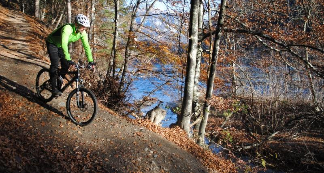
Rheinauen Ufer
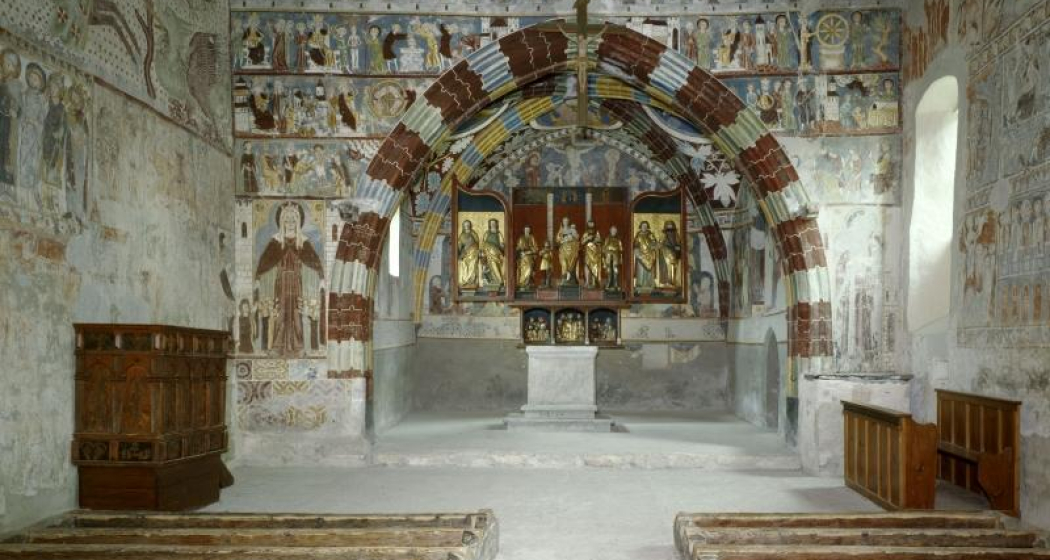
Kirche Sogn Gieri Chor

Show all 4 images

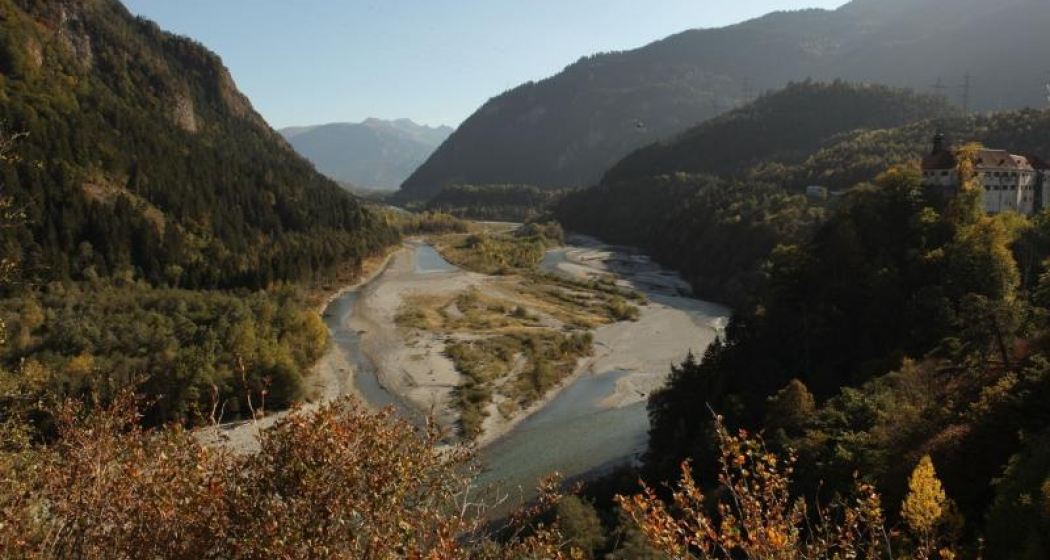
Panorama Rheinauen
This pleasant mountain bike tour takes you along the Rhäzünser Rheinauen and features unique views of these wetlands of national importance. It also takes in a visit of the church at Sogn Gieri, famous for its murals, considered unrivalled by art historians.
Technique /6
Fitness 2/6
Highest Point   m
Lowest Point   m
Best Season
Jan
Feb
Mär
Apr
Mai
Jun
Jul
Aug
Sep
Okt
Nov
Dez
Start
Rhäzüns
Destination
Rhäzüns
Coordinates
46.799042540309, 9.3991089621148

Details

Description

From the railway station at Rhäzüns we soon reach the water's edge, our nostrils filling with the fresh air from the wetlands. The Rhäzünser Rheinauen are among the most best preserved wetland areas in Switzerland and are considered of national importance. We continue along the single trail as it rises and falls until we reach the flatter section along the Rhine dam after Rothenbrunnen. Along the Polenweg to Reichenau the sparse forest lets us glimpse wonderful views of these unique Rheinauen wetlands. Along this section of the route the Hinterrhein meanders from one side of the valley to the other. In Reichenau, the confluence of the Hinterrhein and Vorderrhein, we once again switch to the other side of the river and roll on towards Bonaduz. After a short, steep ascent up to the high plateau of Rhäzüns and Bonaduz the route continues past Sogn Gieri (St. Georg), which is well worth a stop. The Romanesque church, more than 1,000 years old, is famous beyond Switzerland's borders for its astonishing and beautifully preserved murals. After the rewarding visit of Sogn Gieri we happily cycle back to Rhäzüns.

Directions

Rhäzüns - Saulzas - Undrau - Rothenbrunnen - Polenweg - Schafweide - Stn. Reichenau-Tamins - Nulez - Plazzas - Sogn Gieri - Rhäzüns

Directions

Public Transport

By train to Rhäzüns.

Anreise Information

Take the A13/E432 in the direction of and to Rhäzüns.

Responsible for this content SwitzerlandMobility.
This content has been translated automatically.

Geschlossen
Simple
31 km
4:20 h
1200 mhd
1200 mhd
Churer Altstadt mit Hausberg Brambrüesch im Hintergrund
Willkommen in der Bike-Stadt Chur

Show all 7 images

Aufstieg auf dem Polenweg
From the heart of Chur's Old Town and into the nearby mountain scenery - this Alpine town is the gateway to Graubünden.
Technique /6
Fitness 6/6
Highest Point   m
Lowest Point   m
Best Season
Jan
Feb
Mär
Apr
Mai
Jun
Jul
Aug
Sep
Okt
Nov
Dez
Start
Chur
Destination
Chur
Coordinates
46.854472231092, 9.5285856715227

Details

Description

This biking tour starts in Chur, a city surrounded by 937 Grisons mountain peaks. There are plenty of things to do and see here in Switzerland's oldest town. Wanting mountain magic or vibrant city life? Chur in the Alps has both. This is a round trip amid magnificent scenery and with gentle climbs and beautiful descents. Leave the pulsating city behind you as you continue along the Plessur towards Meiersboden. This pleasant route goes up to Passugg, where the famous Passugg mineral water has been bubbling out of the Theophil Spring for over 400 years. From Passugg follow the street upwards for a moment. Then turn right and follow the Polenweg to Churwalden. Turn left at the monastery and ride through the Chlosterwald to the Oberhus and then on to Spina. High above the municipality of Malix, the route continues steadily upwards until you get to the Brambrüesch plateau, the location of the mountain station for the Chur mountain railway. Here, several guesthouses offer you the opportunity to recharge your batteries while enjoying outstanding views of the many mountain peaks. The descent takes you through meadows and pastures to the Känzeli, Rosenhügel, Obertor and finally ends in the traffic free Oldtown (or if you prefer a proper trail descent, just follow one of the official freeride trails in the Alpenbikepark Chur). Perfect to finish the tour in one of the many terraces. In early summer this tour is magnificent due to its Alpine flora and fauna.

Directions

Public Transport

The tour begins directly at the train station of Chur.

Responsible for this content SwitzerlandMobility.

Geschlossen
Difficult
375 km
69:20 h
15300 mhd
15300 mhd
90 Graubünden Bike - Gesamttour
Weissfluh by Andrea Badrutt

Show all 4 images

Vals@Stefan Schlumpf
Breathtaking Alpine bike tour with a vast total height difference, sensational passes and incredible long- distance views. Lovely trails, little asphalt. Mountain bikers will really be in their element on this route, which demands fitness and technique
Technique /6
Fitness 6/6
Highest Point   m
Lowest Point   m
Best Season
Jan
Feb
Mär
Apr
Mai
Jun
Jul
Aug
Sep
Okt
Nov
Dez
Start
Trun
Destination
Trun
Coordinates
46.743138415152, 8.9909979408772

Details

Description

The imposing castle ruins of Zignau and Schlans face each other on opposite sides of the gentle Surselva slopes, as if resembling a gateway to mark the beginning or end of this breathtaking bike tour. This tour quite simply has everything a biker could wish for.

An Alpine to high-Alpine route with numerous height metres, testing passes, breathtaking views, remote valleys and sensational trails. A gentle, simple meadow trail winds over the Durannapass, the ascent to the Strelapass is steep, rough and challenging and the Kunkelspass is romantic biking bliss. The top highlight is the seemingly unspectacular section between Filisur and Lenzerheide. This cave, meadow, forest, tunnel and reed-bed trail is great fun and will also give less experienced bikers a true biking tingle.

The technically and physically demanding route is recommended for experienced bikers and best travelled in high summer and early autumn.

Sicherheitshinweis

In Davos Klosters there are many alps with livestock farming. Therefore, you can expect to encounter animals everywhere. Please be considerate and drive the terrain at an appropriate speed.

Directions

Responsible for this content SwitzerlandMobility.

Simple
13 km
2:10 h
360 mhd
360 mhd
Rundtour Bonaduzer Wald 256
256 Bonaduzer Wald

Show all 17 images

256 Bonaduzer Wald
This tour opens up to magnificent views of the imposing Rhine Gorge. From Bonaduz the route passes through beautiful forest paths into the Rhine Gorge and back again.
Technique /6
Fitness 2/6
Highest Point   m
Lowest Point   m
Best Season
Jan
Feb
Mär
Apr
Mai
Jun
Jul
Aug
Sep
Okt
Nov
Dez
Start
Bonaduz
Destination
Bonaduz
Coordinates
46.810512104199, 9.3977179167695

Details

Description

The starting point of this mountain bike tour is the village of Bonaduz, which together with Rhäzüns forms an actual high plateau. Bonaduz is also the gateway to the Rhine Gorge Natural Monument.

After crossing the idyllic forest landscape near Bonaduz on well-maintained forest paths, an ascent follows on a road with little traffic, which leads to Sigl'Ault with great views. This is soon followed by a single trail that leads smoothly down to the panoramic road above the Rhine Gorge. The "Ruinaulta", as the gorge is called in Romansh, is one of the most magnificent and diverse landscapes in the Alps, which was formed by a landslide 10,000 years ago. You follow this road with a magnificent view down below, past the "Zault" viewing platform (photo stop recommended), before finally diving back into the forests and driving back to Bonaduz on extensive forest paths.

Geheimtipp

This route is usually drivable early in the year until late in autumn.

Sicherheitshinweis

Watch out for hikers. In the canton of Graubünden we share the paths.

Ausrüstung

Repair and first aid kit belong in the rucksack

Directions

This route is only signposted in one direction: Bonaduz – Sigl Ault – Zault.

Directions

Public Transport

Stop: Flims Dorf, mountain railways
By post bus from Chur or the public Flims Laax Falera Shuttle.

Timetable
www.sbb.ch

Anreise Information

By car on the A13 motorway from Zurich to Chur, exit 18 Reichenau

Parking

You will find parking spaces in Bonaduz at the railway station.

Responsible for this content Flims Laax Falera Management Ltd..
This content has been translated automatically.

Outdooractive Logo

This website uses technology and content from the Outdooractive platform.

Medium
46 km
5:00 h
620 mhd
3700 mhd
pinkbike Trail Shooting

Show all 4 images

pinkbike Trail Shooting
This is a tour made for single trail fans: about 400 altitude meters up, six lift rides and more than 3,300 altitude meters down. In addition to all the single trails, the views of Heidsee Lake, the Albula Valley and the Domleschg region are breathtaking. Never a dull moment.
Technique /6
Fitness 4/6
Highest Point   m
Lowest Point   m
Best Season
Jan
Feb
Mär
Apr
Mai
Jun
Jul
Aug
Sep
Okt
Nov
Dez
Start
Lenzerheide
Destination
Lenzerheide
Coordinates
46.72715139073, 9.5578329519424

Details

Description

Attention:

- The chairlift Tgantieni, Scalottas and Weisshorn 2nd does not transport downhill bikes (double crown fork)!

- Transport of bikes with a maximum weight of 25 kg: Gondola lifts Chur-Brambrüesch 2nd section.

No less than five cable cars make the ascents on this round tour easier for you. You start with the two chairlifts from Lenzerheide via Tgantieni to Piz Scalottas. Once there, a good 4 km long, partly steep descent to Churwalden awaits you. On the beautiful single trail along the elevation curve you pass the Junehütte - take a moment and enjoy the wide view over the whole valley. After Parpan you pass lush alpine meadows to the Maiensäss settlement Mittelberg - Büel.

The final ride leads to Runcalier, over a short stretch on the Tschiertschen main road and a flowing trail in the Steinbach forest to Chur. Here the mountain railroad takes you via Känzeli up to Brambrüesch. From Brambrüesch you continue to Churwalden. From Churwalden the panoramic cable car Heidbüel brings you back up to 1930 m.a.s.l. After a short transfer on the gravel road a last trail highlight awaits you from the mountain restaurant Spoina to the Heidsee between Lenzerheide and Valbella.

Whole tour: 42 km (5 km chair and gondola ride)

Sicherheitshinweis

Attention:

- The chairlifts Tgantieni, Scalottas and Weisshorn 2 do not transport downhill bikes (double crown fork)!

- Transport of bikes with maximum weight 25 Kg: Gondola lifts Chur-Brambrüesch 2nd section.

Please note the respective operating times as well as the transport criteria before you start the tour. You can find more info on www.bikekingdom.ch

Directions

Lenzerheide – Piz Scalottas – Parpan – Mittelberg – Fanülla – Chur – Brambrüesch – Churwalden – Alp Stätz – Spoina – Lenzerheide

Directions

Public Transport

By train to Chur and continue by post bus to Lenzerheide/Lai.

Anreise Information

On the A13 and B3 to Lenzerheide.

Responsible for this content SwitzerlandMobility.

Geschlossen
Simple
45 km
4:30 h
460 mhd
2900 mhd
615 Biketicket to ride blau

Show all 7 images

615 Biketicket to ride blau
For a leisurely ride and for families this round tour through idyllic countryside offers a lot of fun! With pleasant and gentle declines and slight ascents, this route is suitable even for bikes without extra suspension.
Technique /6
Fitness 4/6
Highest Point   m
Lowest Point   m
Best Season
Jan
Feb
Mär
Apr
Mai
Jun
Jul
Aug
Sep
Okt
Nov
Dez
Start
Lenzerheide
Destination
Lenzerheide
Coordinates
46.72715139073, 9.5578329519424

Details

Description

Taking the Tgantieni chairlift, the first step of the tour is comfortably begun. Above lies the alpine path, going to the Tgantieni Mountain Hotel and then further onto the Bergbeizli (small mountain pub) Spoina. The first part runs over well-prepared forest roads with occasional glimpses of Lenzerheide and Heid lake. The gentle descent passes the Valbella hostel and goes through Parpan village back to Churwalden.

A further nature trail brings you to Passugg, which is the source of a famous mineral water. The roaring creek Rabiosa, in Romansch «The Raging», cuts its way through the Passugg gorge. In 1863 this spring was rediscovered, which is known today throughout Switzerland as the mineral springs of Passugg. Next you drop down to Chur and take the gondola back up to Brambrüesch. From here descend again on a tarmac surface to Churwalden, where you take the chairlift Heidbüel.

Sicherheitshinweis

Attention:

- The Tgantieni and Scalottas chairlifts do not transport downhill bikes (double bridge fork)!

- Please note the respective operating times as well as the transport criteria before you start the tour. You can find more information here.

Ausrüstung

Protector jackets and full-face helmets are also prohibited. Normal helmets, knee and elbow protectors are permitted.

Directions

This route is only signposted in one direction: Lenzerheide-Tgantieni-Churwalden-Brambrüesch-Chruwalden-Alp Stätz-Lenzerheide

Directions

Public Transport

Travel by train to Chur, then transfer directly to the Postauto Graubünden buses to reach Lenzerheide within 30 minutes.

Anreise Information

Von Basel und Zürich - Chur-Süd (Ausfahrt Nr. 17) - Lenzerheide.

Von Milano - Lugano - San-Bernadino-Tunnel - Thusis - Chur (Ausfahrt Lenzerheide) - Lenzerheide.

Parking

Parking: Julier Parkplatz, Parkplatz Rothorn oder Parkplatz Tgantieni

Responsible for this content Graubünden Ferien.

Kunkelspass round trip

Difficult
56 km
4:30 h
963 mhd
963 mhd
Aufstieg zum Kunkelspass
Kunkelspass - hier fährt kaum ein Biker vorbei

Show all 9 images

Kunkelspass
The Kunkels Pass bike tour is a real classic and well known among mountain bikers, cyclists and e-bikers. You completely ride around the impressive Calanda mountain on this tour.
Technique 1/6
Fitness 5/6
Highest Point  1357 m
Lowest Point  514 m
Best Season
Jan
Feb
Mär
Apr
Mai
Jun
Jul
Aug
Sep
Okt
Nov
Dez
Start
Chur, train station
Destination
Chur, train station
Coordinates
46.85416, 9.528797

Details

Description

From the Chur railway station, follow the national cycling route no. 2 (Rhine route) and cycle at the riverbank to Landquart. In Landquart, cross the Rhine river and later at Sarelli go left and follow the road up to Pfäfers and carry on to Vättis through a rugged basin with almost vertical mountain slopes.

The final ascent to the pass takes you away from the traffic through unspoilt, splendid countryside. Shortly past the Eggwald mountain restaurant, you leave the Canton of St. Gallen and enter Grisons again before reaching the pass summit.

When crossing from the Tamina Valley into the Rhine Valley, the great differences at either side of the water divide are amazing. The final descent to Tamins is a special treat, offering views of the confluence of the Vorder and Hinter Rhine. From Tamins take the national cycle route No. 2 (Rhine route) back to Chur (or return by rail from Reichenau station).

Responsible for this content Chur Tourism.

Trans Grischun: Scuol–Sta. Maria (Stage 4)

Difficult
39.4 km
3:30 h
1089 mhd
1001 mhd
Spektakuläre Brücke über den Inn bei Scuol
Das wilde Val S-charl mit dem Fluss Clemgia

Show all 12 images

Trinkflasche füllen im Bergdorf S-charl
On the last stage of the Trans Grischun it gets wild, rough and technical. The highlight is the route through Val S-charl and up to the Pass da Costainas, the transition from the Lower Engadine to Val Müstair.
Technique 1/6
Fitness 6/6
Highest Point  2250 m
Lowest Point  1206 m
Best Season
Jan
Feb
Mär
Apr
Mai
Jun
Jul
Aug
Sep
Okt
Nov
Dez
Start
Scuol
Destination
Sta. Maria Val Müstair
Coordinates
46.8539, 9.53159

Details

Description

After the start in Scuol, follow mountain bike route no. 1. The ascent to the mountain village of S-charl starts in the forest with a few steep ramps. Here the surface is still asphalted and the metres in altitude quickly melt away. Shortly afterwards, the forest thins out at Sasstaglia, tarmac is replaced by gravel and the view opens up into the valley. The Clemgia river flows down the bumpy gorge on the right. Nature becomes wilder. Not surprising, as you are close to the Swiss National Park. Nestled between high mountain peaks, the route climbs leisurely, with short, steep ramps in between, up to S-charl at 1808 metres above sea level. Here we recommend you take a short breather: fill your water bottle and recharge your batteries in the restaurant if necessary. Then the final ascent to the roof of the Trans Grischun begins - to the Pass da Costainas at 2250 metres above sea level. Shortly after S-charl, you will see the God da Tamangur on the left side of the valley. This is the highest contiguous Swiss stone pine forest in Europe. Nature and gravel bike experience at its best.

Geheimtipp

The Trans Grischun leads through inhabited areas at regular intervals, so that you can always find places to stay overnight and adapt the stages to your needs.

Sicherheitshinweis

On high sections, snow fields are possible well into the summer months.

The tour was assessed in favourable weather conditions, the current weather conditions and weather forecasts must be taken into account before starting the tour. This tour does not require any special riding safety or technical skills.

Emergency call:

144 Emergency call, first aid

1414 Mountain rescue REGA

112 International emergency call

Be considerate when crossing and overtaking hikers. Most of the mountain bike routes in Graubünden are on single trails that are also signposted as hiking trails. Hikers always have right of way.

Ausrüstung

Helmet, gloves, good shoes, goggles, rain and sun protection, water bottle, repair kit, first aid kit

Directions

Scuol – S-charl – Alp Astras – Costainas – Alp da Munt – Lü – Tschierv – Fuldera – Valchava – Sta. Maria Val Müstair

Directions

Public Transport

  • With the Rhaetian Railway (from Chur, Landquart/Prättigau or from the Upper Engadine) hourly to Scuol-Tarasp
  • By PostBus (from Martina, Sent, Ftan or Tarasp) hourly to Scuol-Tarasp railway station

Anreise Information

  • From the north: via Landquart - Klosters by car transport through the Vereina Tunnel (Selfranga - Sagliains) or via the Flüela Pass to the Lower Engadine on H27
  • From the east: via Landeck / Austria in the direction of St. Moritz on H27
  • From the south: via Reschenpass (Nauders-Martina) or Ofenpass (Val Müstair-Zernez) on H27

Scuol is located directly on the Engadine road H27 (20 minutes journey time from Vereina south portal)

Parking

  • Paid parking at the railway station and at the Bergnahnen in Scuol.
  • Free car parks in Porta and Punt (Scuol Sot).

Responsible for this content Tourism Engadin Scuol Samnaun Val Müstair AG.
This content has been translated automatically.

Outdooractive Logo

This website uses technology and content from the Outdooractive platform.

Stage 1 Gravel Bike Route Hinterrhein: Chur - Thusis

Geschlossen
Medium
29.8 km
2:35 h
404 mhd
257 mhd
Kunstwerke des bekannten Künstlers Robert Indermaur
Etappe 1 Gravelbike-Route Hinterrhein: Chur – Thusis

Show all 5 images

Sonnenuntergang
Deep ravines, impressive panoramic views and witnesses to the history of Graubünden’s transport routes await discovery at the Posterior Rhine.
Technique 3/6
Fitness 3/6
Highest Point  805 m
Lowest Point  559 m
Best Season
Jan
Feb
Mär
Apr
Mai
Jun
Jul
Aug
Sep
Okt
Nov
Dez
Start
Chur
Destination
Thusis
Coordinates
46.861438, 9.506374

Details

Description

 You start the journey in Chur (593 m above sea level) and get on bike path no. 6 on the Polenweg to the imposing fortification Porta Rhaetica. From Rothenbrunnen the route makes its way over the gentle hills of the Domleschg fruit and castle country. In Paspels (757 m above sea level), you can marvel at the art works by the well-known artist Robert Indermaur. Lake Canova invites you to take a break, especially to cool down during summer. From here, it’s not far to Thusis, the historical trading place (680 m above sea level).

Stages

Overall route: Chur  – Chur

Stage 1: Chur – Thusis

Stage 2: Thusis – Glaspass – Thusis

Stage 3: Thusis – Andeer

Stage 4 Andeer – Lai da Vons – Splügen

Stage 5. Splügen – Splügen

Stage 6. Splügen – Chur

Geheimtipp

Tip: Gravel bikers with lots of leg power will manage stages 1 and 2 in one day.

Responsible for this content Graubünden Ferien.
This content has been translated automatically.

Trans Grischun: Castrisch–Scuol (Stage 3)

Difficult
134.7 km
0:00 h
6402 mhd
5820 mhd
Abfahrt ins Safiental
Aufstieg nach Guarda im Unterengadin

Show all 13 images

Biketransport mit dem Zug oder Postauto ist in Graubünden ein Kinderspiel
Today is a long day ahead – including a transfer with the Rhaetian Railway. So it's always worth getting up early. The highlights? A small Maiensässbeizli with a great view, a spectacular road through the Rhine Gorge and typical Lower Engadine villages.
Technique 5/6
Fitness 4/6
Highest Point  2946 m
Lowest Point  517 m
Best Season
Jan
Feb
Mär
Apr
Mai
Jun
Jul
Aug
Sep
Okt
Nov
Dez
Start
Castrisch or Ilanz
Destination
Chur / Scuol
Coordinates
46.84462199, 9.72071553

Details

Description

The stage starts in the tranquil village of Castrisch. You first follow the official Rhine Veloroute No. 3, which is only slightly uphill - perfect for taking it easy on your legs. In Valendas, you can fill your water bottle with fresh mountain spring water from the largest wooden fountain in Europe. Shortly after Carrera, turn off onto the road to Brün and continue up to Imschlacht. The road and views are fantastic. Tip: you can fortify yourself with a portion of mountain cheese, salsiz or a nut tart at the Maiensässbeizli. Continue down into the Safiental valley. Then comes another highlight: the spectacular panoramic road along the Rhine Gorge. The rock faces of the “Swiss Grand Canyon” tower 300 meters high. From Bonaduz, you cycle along side roads to Chur. The section between the capital of Graubünden and Lavin in the Lower Engadine is covered comfortably on the Rhaetian Railway.

From the Lower Engadin village of Lavin, your muscle power is needed once again. The route to the stage finish takes you along a fine gravel path via Guarda to Scuol. Below you, the bright turquoise Inn River flows. The landscape in the Lower Engadin presents a completely different picture. The sunburnt stables of the Surselva have given way to houses adorned with colorful paintings. The art of Sgraffito, the traditional stucco technique of the region, is now mastered by only a few in the valley. And in Scuol, not only does mountain spring water flow from the fountains, but even mineral water. Simply gschpunna.

Total distance and elevation gain (excluding public transport sections): 66 km, 1,400 meters of ascent, 1,900 meters of descent.

Geheimtipp

The Trans Grischun passes through inhabited areas at regular intervals, so that you can always find places to stay overnight and adapt the stages to your needs.

Sicherheitshinweis

The tour should not be undertaken in uncertain weather conditions. Weather changes are frequent in the mountains. If a rain front or similar is approaching during the hike, you should turn back in good time.

144 Emergency call, first aid

1414 Mountain rescue REGA

112 International emergency call

Ausrüstung

Helmet, gloves, cycling shoes, glasses, rain and sun protection, drinks, repair kit, first aid kit

Directions

Castrisch - Valendas - Brün - Imschlacht - Arezen - Versam - Versamer Tobel - Bonaduz - Reichenau - Tamins - Felsberg - Chur - public transport - Lavin - Guarda - Ftan - Ardez - Scuol

Directions

Public Transport

Stage tour

Anreise Information

Stage tour

Parking

Stage tour

Responsible for this content Surselva Tourism.
This content has been translated automatically.

Outdooractive Logo

This website uses technology and content from the Outdooractive platform.