Experience the Cabins high above the Chur Rhine Valley
Medium
29.2 km
12:25 h
2285 mhd
2179 mhd
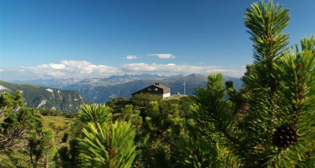
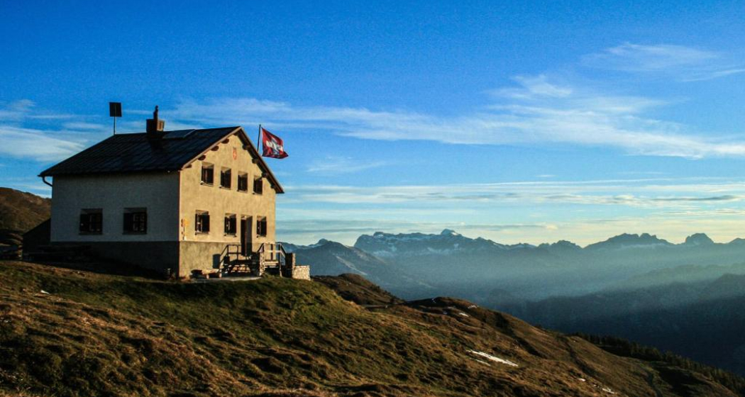
Ringelspitzhütte
Calandahütte SAC

Show all 9 images

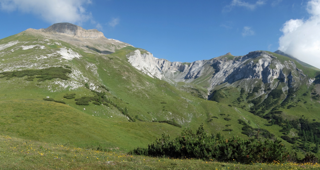
Blick vom Rossboden auf den Felsberger Calanda
Three-day hike along the fascinating mountain ranges of Calanda and the Ringelspitz massif, which is part of the UNESCO World Heritage Site Sardona.
Technique /6
Fitness 4/6
Highest Point  2084 m
Lowest Point  552 m
Best Season
Jan
Feb
Mär
Apr
Mai
Jun
Jul
Aug
Sep
Okt
Nov
Dez
Start
Haldenstein, station
Destination
Tamins, village
Coordinates
46.876883, 9.530665

Details

Description

The impressive alpine hut hike, rich in experiences and views, begins in the Chur Rhine Valley, in the village of Haldenstein opposite Chur. The mighty Calanda massif towers imposingly in front of the Alpine City. You can enjoy a gentle ascent into the beautiful nature and the view becomes more and more impressive the higher you climb. The ascebt to the Calanda hut is about 1,500 metres. Those who still have energy left at the top can also master the ascent to the summit of Haldensteiner Calanda. This is another 800 metres of altitude difference, but the panoramic view is more than worth it.

The next day, one crosses from the hut over the Felsberger and Taminser Älpli to the historic Kunkelspass. An ideal place to strengthen yourself in the Überruf mountain restaurant. One is now officially in the perimeter of the UNESCO World Heritage Sardona and can inform in detail about it in the information room next to the restaurant. The ascent to the Ringelspitzhütte follows, from where you have a great view of the UNESCO World Heritage Site and the clearly visible Glarus main thrust at the Ringelspitz summit. After the second overnight hut stay the descent follows through the picturesque Lavoitobel, which is characterised by alpine rocky landscapes and the idyllic Lavoi stream. Further down follows a leisurely descent through secluded forests until you finally reach the Rhine Valley again and the village of Tamins. From there you can easily reach the city of Chur and the main railway station for the return journey by bus.

Responsible for this content Chur Tourism.

Trailrun LANGA

Difficult
28 km
5:55 h
2140 mhd
1066 mhd
Trailrun LANGA
Trailrun LANGA

Show all 18 images

Trailrun LANGA
The Long Trail LANGA connects the two trails UFFA and OBA and is aimed at 28.2 km and 2,140 vertical meters to complete and well-trained, persevering runners.
Technique 4/6
Fitness 6/6
Highest Point  2158 m
Lowest Point  589 m
Best Season
Jan
Feb
Mär
Apr
Mai
Jun
Jul
Aug
Sep
Okt
Nov
Dez
Start
Alexanderplatz, City of Chur
Destination
VIVA berg.baiz, Brambrüesch
Coordinates
46.852216, 9.53128

Details

Description

Further information on the two individual trails can be found on the separate tours:

Directions

Public Transport

Take the train to Chur station. From there, the city bus (line 1) takes 3 minutes to the valley station of the mountain railways (Stadthalle/Brambrüeschbahn stop).

Anreise Information

  • Motorway exit Chur Süd
  • Drive into the city (Kasernenstrasse)
  • The valley station and car park are on the right-hand side in front of the town centre

Parking

More about parking for guests of the Chur mountain railways.

Responsible for this content Brambrüesch.
This content has been translated automatically.

Walking tour through the Alpine City

Simple
4.5 km
1:45 h
20 mhd
20 mhd
City E-Guide Chur
Blick auf die Churer Altstadt

Show all 14 images

Arcas Platz in der Altstadt
Discover Switzerland's oldest town on a tour through the city center and the historic Old town. In addition with the Audio Guide from Chur Tourism, you will enjoy an interesting and individual city tour.
Technique 1/6
Fitness 1/6
Highest Point  623 m
Lowest Point  574 m
Best Season
Jan
Feb
Mär
Apr
Mai
Jun
Jul
Aug
Sep
Okt
Nov
Dez
Start
Chur, train station
Destination
Chur, train station
Coordinates
46.853748, 9.529188

Details

Description

The City E-Guide by Chur Tourism is the individual city tour for your mobile phone or tablet. With the free app, you can explore the city on your own. All kinds of interesting facts about history, culture, sights and much more are available in the app at any time. You can choose from various tours of different lengths, which can be adapted to your starting point thanks to GPS positioning.

In 43 chapters you will learn many interesting facts about the history and culture of the Alpine City of Chur and the holiday canton of Graubünden. A further 32 chapters deal with the Cathedral Treasure Museum of the Diocese of Chur - you will learn many interesting facts about the history of the diocese, about the cathedral treasure of Chur and the Death Pictures from the Episcopal Castle.

At the Tourist Info at Chur mainstation, you have also the possibility to rent a tablet with the City E-Guide on it. Thanks to the larger screen, tablets are ideal for experiencing the tours together with one device.  

Directions

Public Transport

The tour begins directly at the Chur railway station.

Responsible for this content Chur Tourism.

Cross country ski track Bonaduz

8.9 km
1:45 h
30 mhd
28 mhd
Loipe Bonaduz in Richtung Rhäzüns
Langlaufloipe Bonaduz (oua_56297823_f9117be_profile)
Cross country ski track Bonaduz
Technique 0/6
Fitness 0/6
Highest Point  683 m
Lowest Point  655 m
Best Season
Jan
Feb
Mär
Apr
Mai
Jun
Jul
Aug
Sep
Okt
Nov
Dez
Start
Entrance at the parking lot Eisfeld Tuleu
Destination
Entrance at the parking lot Eisfeld Tuleu
Coordinates
46.809668, 9.387092

Details

Description

If there is enough snow, the trail in Bonaduz is prepared for both the classic style and the skating technique. It is a circular route that leads mostly flat across meadows and along the edge of the forest to the neighbouring village of Rhäzüns and back. 

Ausrüstung

A valid cross-country skiing ticket is required for use.  The Bonaduz / Rhäzüns cross-country ski pass can be paid for by twint when entering the trail, at the Tuleu ice rink. Ebeso you can buy a season ticket at Bieler Sport in Bonaduz. The Swiss cross-country ski pass (valid throughout Switzerland) can also be obtained from Bieler Sport in Bonaduz for CHF 140.-.

Directions

Public Transport

Bus or train to Bonaduz, then walk to Tuleu Ice Field

Anreise Information

  • Bonaduz motorway exit
  • In the village turn off at the junction Ilanz / Safien / sports facilities and follow the road to the junction sports facilities
  • Turn there and follow the road to the parking lot at the Tuleu ice field

Parking

  • Parking at the Ice Field Tuleu

Responsible for this content Chur Tourism.
This content has been translated automatically.

rhiienergie Trail Tamins

Medium
7.2 km
1:50 h
270 mhd
270 mhd
rhiienergie Trail Tamins
rhiienergie Trail Tamins (oua_25240696_e2c8fcd_profile)
The Tamins Trail (orange signage) is just under 7.5 km long with a height difference of 270 meters.
Technique 2/6
Fitness 3/6
Highest Point  823 m
Lowest Point  607 m
Best Season
Jan
Feb
Mär
Apr
Mai
Jun
Jul
Aug
Sep
Okt
Nov
Dez
Start
Tamins
Destination
Tamins
Coordinates
46.833095, 9.406022

Details

Description

In the communes of Bonaduz, Domat / Ems, Felsberg, Rhäzüns and Tamins, rhiienergie created five interconnected Nordic Walking routes (also suitable for jogging / running). Each route runs for about 10 kilometers on existing paths and roads across meadows and through forests. A corresponding signage shows on the one hand the way direction and on the other the respective distance covered.

Responsible for this content Chur Tourism.
This content has been translated automatically.

rhiienergie Trail Felsberg

Medium
8.9 km
2:25 h
550 mhd
550 mhd
rhiienergie Trail Felsberg
rhiienergie Trail Felsberg (oua_25240669_e6d0ed3_profile)
The Felsberg Trail (red signage) is almost 9 km long with a height difference of 440 meters.
Technique 2/6
Fitness 4/6
Highest Point  1008 m
Lowest Point  588 m
Best Season
Jan
Feb
Mär
Apr
Mai
Jun
Jul
Aug
Sep
Okt
Nov
Dez
Start
Felsberg
Destination
Felsberg
Coordinates
46.843184, 9.46418

Details

Description

In the communes of Bonaduz, Domat / Ems, Felsberg, Rhäzüns and Tamins, rhiienergie created five interconnected Nordic Walking routes (also suitable for jogging / running). Each route runs for about 10 kilometers on existing paths and roads across meadows and through forests. A corresponding signage shows on the one hand the way direction and on the other the respective distance covered.

Responsible for this content Chur Tourism.
This content has been translated automatically.

Helsana Trail Chur: Grosser Trail

Medium
13 km
2:20 h
438 mhd
438 mhd
Helsana Trail Chur: Grosser Trail
Helsana Trail Chur: Grosser Trail (oua_25240934_63e754c_profile)
The long trail is signposted yellow and with a length of 13 km the longest round and rather challenging.
Technique 2/6
Fitness 4/6
Highest Point  922 m
Lowest Point  643 m
Best Season
Jan
Feb
Mär
Apr
Mai
Jun
Jul
Aug
Sep
Okt
Nov
Dez
Start
Waldhausstall Fürstenwald, Chur
Destination
Waldhausstall Fürstenwald, Chur
Coordinates
46.870252, 9.544071

Details

Description

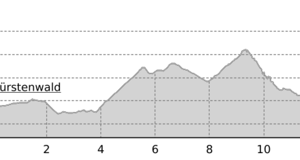
In the Fürstenwald near Chur there are three signposted jogging / nordic walking trails available:

  • Short Trail (blue route)
  • Medium Trail (green route)
  • Long Trail (yellow route)

The Fürstenwald is a recreational area near Chur. It offers a diverse and popular route network for joggers and nordic walkers.

Responsible for this content Chur Tourism.
This content has been translated automatically.

Helsana Trail Chur: Medium Trail

Medium
10.2 km
1:40 h
267 mhd
267 mhd
Helsana Trail Chur: Mittlerer Trail
Helsana Trail Chur: Mittlerer Trail (oua_25240915_c62d24a_profile)
The middle trail is signposted green and with a length of 10 km a varied and mediocre demanding round.
Technique 2/6
Fitness 4/6
Highest Point  864 m
Lowest Point  641 m
Best Season
Jan
Feb
Mär
Apr
Mai
Jun
Jul
Aug
Sep
Okt
Nov
Dez
Start
Waldhausstall Fürstenwald, Chur
Destination
Waldhausstall Fürstenwald, Chur
Coordinates
46.870216, 9.544077

Details

Description

In the Fürstenwald near Chur there are three signposted jogging / nordic walking trails available:

  • Short Trail (Route blue)
  • Medium Trail (route green)
  • Long Trail (Route yellow) 

The Fürstenwald is a recreational area near Chur. It offers a diverse and popular route network for joggers and nordic walkers.

Responsible for this content Chur Tourism.
This content has been translated automatically.

rhiienergie Trail Rhäzüns

Medium
9.9 km
2:10 h
90 mhd
90 mhd
rhiienergie Trail Rhäzüns
rhiienergie Trail Rhäzüns (oua_25240854_fd4a489_profile)
The Rhäzüns Trail (green signage) is 10 km long with a height difference of almost 100 meters.
Technique 2/6
Fitness 3/6
Highest Point  670 m
Lowest Point  587 m
Best Season
Jan
Feb
Mär
Apr
Mai
Jun
Jul
Aug
Sep
Okt
Nov
Dez
Start
Rhaezüns
Destination
Rhaezüns
Coordinates
46.800072, 9.400274

Details

Description

In the communes of Bonaduz, Domat / Ems, Felsberg, Rhäzüns and Tamins, rhiienergie created five interconnected Nordic Walking routes (also suitable for jogging / running). Each route runs for about 10 kilometers on existing paths and roads across meadows and through forests. A corresponding signage shows on the one hand the way direction and on the other the respective distance covered.

Responsible for this content Chur Tourism.
This content has been translated automatically.

20 Miles Chur - Lenzerheide

Geschlossen
Difficult
31.4 km
6:00 h
1324 mhd
440 mhd
20 Miles Chur - Lenzerheide
Heidsee.

Show all 6 images

Plessur
From 2003 - 2014 the Graubünden Marathon took place annually. This was considered one of the toughest mountain marathons in Europe and also had a 20 miles route.
Technique 4/6
Fitness 5/6
Highest Point  1758 m
Lowest Point  587 m
Best Season
Jan
Feb
Mär
Apr
Mai
Jun
Jul
Aug
Sep
Okt
Nov
Dez
Start
Chur
Destination
Lenzerheide
Coordinates
46.853814, 9.535538

Details

Description

The start is in Chur on the Quaderwiese, from there it leads through the old town on the road Chur-Arosa to sand. Over a gravel road it continues to Passugg. In Passugg the route leads around the building of the beverage manufacturer Passugger and leaves the road again on a dirt road. From Passugg the route follows the Polenweg to Churwalden. In Churwalden the route first goes through the village and then towards Büel, Foppa. From Foppa it goes down via Mittelberg to Parpan. From there the route leads over the Parpanerhöhe to Valbella. From Canols it continues once around the Heidsee to Lenzerheide.

Geheimtipp

To finish off, a jump into the Heidsee offers the perfect cooling off and an optimal start to the recovery phase.

Sicherheitshinweis

The course is considered good training and can be tackled independently with appropriate preparation.

Ausrüstung

Sturdy and well broken-in shoes, clothes adapted to the weather, sufficient refreshments.

Directions

The start is in Chur on the Quader meadow. From there you take the route through the old town and then turn to the road Chur-Arosa. At the junction “Arosa” continue straight towards Sand. At Sand, the route leaves the asphalt road on a gravel road towards Passugg. In Passugg, the route leads around the building of the drink manufacturer Passugger and leaves the road again on a dirt road. After a climb, you turn onto a wide gravel road. Follow the “Polish” path to Churwalden. You run through the village Churwalden (1’240m asl) past the post office, Coop and after the hotel Hemmi you turn left. Afterwards a longer section starts up to Büel, Foppa. In Foppa (1’753 m asl) turn into the asphalt road direction Parpan. After about 1 km down the road, turn left onto a narrow path towards Mittelberg. At Mittelberg, turn left onto the asphalt road that leads to Parpan. At the first junction in Parpan (1’493m asl), turn right into the main road just before the main road, turn left and then go up the parallel to the Hotel Alpina. After the post office, turn left. After about 15m turn right and after another 10m turn right again. You then turn directly into a narrow path that leads over roots to the Valbellnerhöhe. There you walk past a very small lake and then you run parallel to the road until you reach Canols. On your right, you can see the big lake Heidsee. Cross the main street and walk past the Canols kiosk. After a round around the right side of lake Heidsee you cross the main road at the Rothorn valley station. After the underpass turn right and then walk up the sidewalk and after about 100m cross the side of road and run straight into the forest. After about 1.5 km on a gravel road in the forest you cross a side road and cross the main road at the underpass. Then you turn into the finishing line at the school Lenzerheide.

Directions

Public Transport

With the train or bus to Chur.

Anreise Information

Take A13 to Chur.

Parking

Parking available by Quader.

Responsible for this content Graubünden Ferien.