Mittenberg Run

Medium
4.9 km
1:00 h
450 mhd
0 mhd
Mittenberg Run
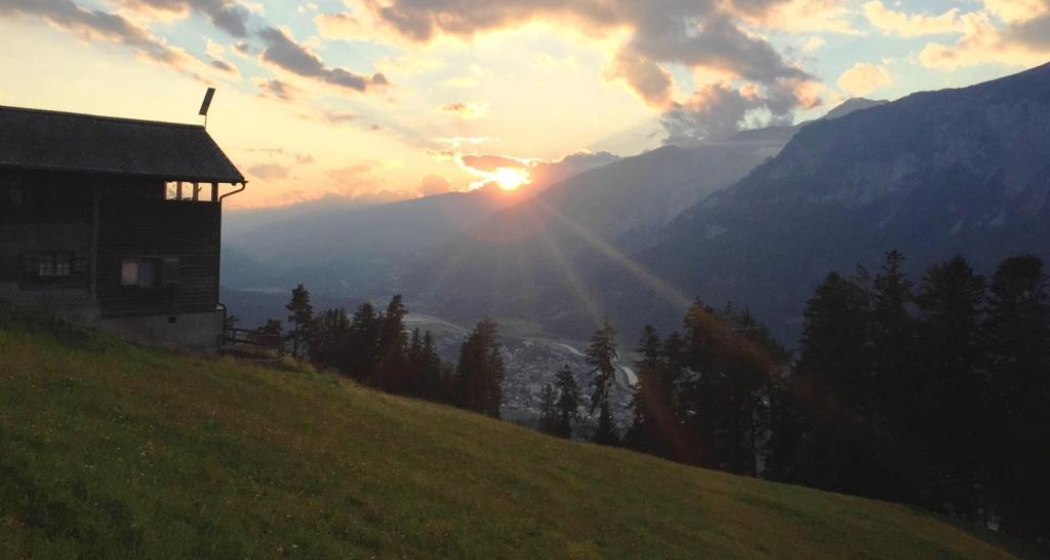
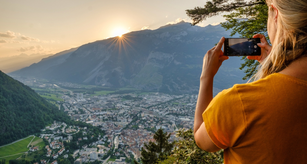
Mittenberg mit Blick ins Churer Rheintal

Show all 3 images

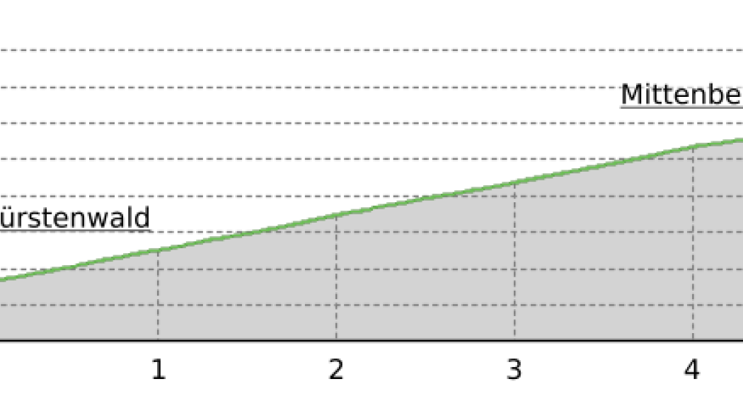
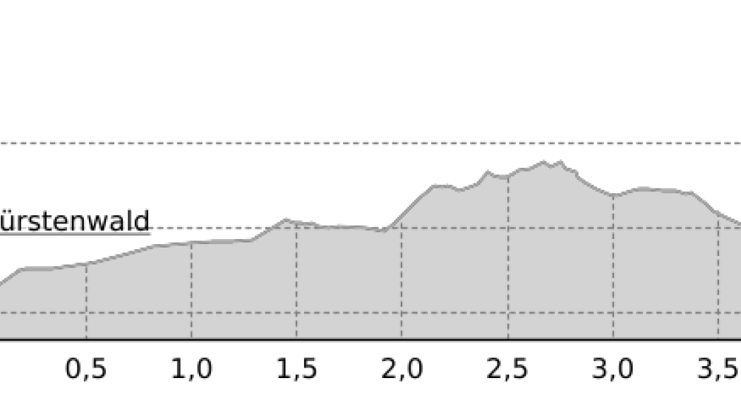
Mittenberg Run (oua_25240967_7b2e07f_profile)
The route from Waldhausstall to Mittenberg is a classic. 5 kilometers and 450 meters of altitude are to be mastered.
Technique /6
Fitness 4/6
Highest Point  1102 m
Lowest Point  663 m
Best Season
Jan
Feb
Mär
Apr
Mai
Jun
Jul
Aug
Sep
Okt
Nov
Dez
Start
Waldhausstall Fürstenwald, Chur
Destination
Mittenberg
Coordinates
46.870288, 9.544138

Details

Description

From Waldhausstall at Fürstenwald follow the forest road to Mittenberg at 1'100 meters. The track is signposted and the venue of the twice-yearly Mittenberg race. For the descent back there are different variants. Either follow the forest road back to Waldhausstall or one of the various trails back to the valley.

Responsible for this content Chur Tourism.
This content has been translated automatically.

rhiienergie Trail Domat/Ems

Medium
12.9 km
3:05 h
300 mhd
300 mhd
rhiienergie Trail Domat/Ems
rhiienergie Trail Domat/Ems (oua_25240395_97c88eb_profile)
The Domat / Ems Trail (blue signage) is about 12 km long with a height difference of almost 300 meters.
Technique 2/6
Fitness 4/6
Highest Point  743 m
Lowest Point  585 m
Best Season
Jan
Feb
Mär
Apr
Mai
Jun
Jul
Aug
Sep
Okt
Nov
Dez
Start
Domat/Ems
Destination
Domat/Ems
Coordinates
46.819269, 9.424038

Details

Description

In the communes of Bonaduz, Domat / Ems, Felsberg, Rhäzüns and Tamins, rhiienergie created five interconnected Nordic Walking routes (also suitable for jogging / running). Each route runs for about 10 kilometers on existing paths and roads across meadows and through forests. A corresponding signage shows on the one hand the way direction and on the other the respective distance covered.

Responsible for this content Chur Tourism.
This content has been translated automatically.

rhiienergie Trail Bonaduz

Medium
10 km
2:10 h
130 mhd
125 mhd
rhiienergie Trail Bonaduz
rhiienergie Trail Bonaduz (oua_25240356_715877c_profile)
The Bonaduz Trail (yellow signage) is about 10 km long with a height difference of 130 meters.
Technique 2/6
Fitness 3/6
Highest Point  738 m
Lowest Point  651 m
Best Season
Jan
Feb
Mär
Apr
Mai
Jun
Jul
Aug
Sep
Okt
Nov
Dez
Start
Bonaduz
Destination
Bonaduz
Coordinates
46.818725, 9.385551

Details

Description

In the communes of Bonaduz, Domat / Ems, Felsberg, Rhäzüns and Tamins, rhiienergie created five interconnected Nordic Walking routes (also suitable for jogging / running). Each route runs for about 10 kilometers on existing paths and roads across meadows and through forests. A corresponding signage shows on the one hand the way direction and on the other the respective distance covered.

Responsible for this content Chur Tourism.
This content has been translated automatically.

Alpine City Trail

Difficult
19.5 km
3:15 h
400 mhd
400 mhd
Am Rheinufer
Am Rheinufer

Show all 9 images

Blick auf die Churer Altstadt
Extensive jogging tour around the Alpine City of Chur along beautiful forest paths and the banks of the Rhine, with a detour through the old town.
Technique 2/6
Fitness 5/6
Highest Point  739 m
Lowest Point  554 m
Best Season
Jan
Feb
Mär
Apr
Mai
Jun
Jul
Aug
Sep
Okt
Nov
Dez
Start
Obertor, Chur
Destination
Obertor, Chur
Coordinates
46.848027, 9.529569

Details

Description

The start takes place at the Obertor and through the historic old town of Chur, past the bishop's court and the cathedral and shortly afterwards on natural paths and through the residential quarter to the Fürstenwald recreation area. After a nice round through the forest we descend again towards the Mühleturm and the banks of the Rhine. After a longer flat stretch along the Rhine, the way back follows a magnificent section of forest until you finally immerse yourself in city life again from the Rosenhügel back to the old town.

Responsible for this content Chur Tourism.

Grisons Marathon

Geschlossen
Difficult
42.1 km
9:00 h
2648 mhd
401 mhd
Graubünden Marathon
Graubünden Marathon (oua_2810084_050c892_profile)

Marathon run over the classic distance from Chur via Lenzerheide to the Parpaner Rothorn.

Technique 6/6
Fitness 6/6
Highest Point  2840 m
Lowest Point  591 m
Best Season
Jan
Feb
Mär
Apr
Mai
Jun
Jul
Aug
Sep
Okt
Nov
Dez
Start
Chur
Destination
Rothorn
Coordinates
46.851745, 9.5335

Details

Description

Geheimtipp

The route from Chur to Lenzerheide is signposted and can be walked all year round. The route from Lenzerheide to the Rothorn can be walked from June.

Directions

The start is in Chur on the Quader meadow. From there you take the route through the old town and then turn to the road Chur-Arosa. At the junction “Arosa” continue straight towards Sand. At Sand, the route leaves the asphalt road on a gravel road towards Passugg. In Passugg, the route leads around the building of the drink manufacturer Passugger and leaves the road again on a dirt road. After a climb, you turn onto a wide gravel road. Follow the “Polish” path to Churwalden. You run through the village Churwalden (1’240m asl) past the post office, Coop and after the hotel Hemmi you turn left. Afterwards a longer section starts up to Büel, Foppa. In Foppa (1’753 m asl) turn into the asphalt road direction Parpan. After about 1 km down the road, turn left onto a narrow path towards Mittelberg. At Mittelberg, turn left onto the asphalt road that leads to Parpan. At the first junction in Parpan (1’493m asl), turn right into the main road just before the main road, turn left and then go up the parallel to the Hotel Alpina. After the post office, turn left. After about 15m turn right and after another 10m turn right again. You then turn directly into a narrow path that leads over roots to the Valbellnerhöhe. There you walk past a very small lake and then you run parallel to the road until you reach Canols. On your right, you can see the big lake Heidsee. Cross the main street and walk past the Canols kiosk. After a round around the right side of lake Heidsee you cross the main road at the Rothorn valley station. After the underpass turn right and then walk up the sidewalk and after about 100m cross the side of road and run straight into the forest. After about 1.5 km on a gravel road in the forest you cross a side road and cross the main road at the underpass. After going around the school you leave Lenzerheide (1’478m asl) again at the underpass and after the underpass you turn right towards village centre. After the UBS building turn left and walk up a steep asphalt road. After approximately 100m turn left onto a 1m wide gravel road. After the steep gravel road turn left onto an asphalt road after about 25m turn right. After another 100m turn left and then climb steeply again towards the waterfall. The path up to the waterfall is narrow and is very energy-sapping. When you reach the waterfall, a beautiful trail leads up to the Alp Scharmoin (1’904 m asl) to the Rothorn centre station. From the centre station, about 1km has many steep sections on the gravel road. Then there is a small flat section of about 500m. However, the final ascent starts at 2’266m asl on a route of approx. 2.5 km up to the Rothorn summit 2’861 m asl. Once you are on the summit, you can be proud of what you have done, because you have made the toughest marathon in the world!

Responsible for this content Graubünden Ferien.
This content has been translated automatically.

Chur - Brambrüesch - Scalottas

Difficult
22.6 km
5:45 h
2668 mhd
943 mhd
Aussicht von Schönegg bei Sonnenuntergang
Dreibündenstein

Show all 10 images

Fulhorn
From the Alpine town up to the Piz Scalottas.
Technique 5/6
Fitness 5/6
Highest Point  2574 m
Lowest Point  587 m
Best Season
Jan
Feb
Mär
Apr
Mai
Jun
Jul
Aug
Sep
Okt
Nov
Dez
Start
Chur, Maltese
Destination
Piz Scalottas
Coordinates
46.848204, 9.529024

Details

Description

This beautiful route leads from Chur to the Piz Scalottas. Not directly, of course. So it goes from Chur ers to Brambrüesch, over the Fuulhorn and Stätzerhorn and finally over the Piz Danis until the finish on the Piz Scalottas is reached. From Piz Scalottas you can comfortably take the chairlift back down to the valley.  

Geheimtipp

If you still haven't had enough on the Piz Scalottas, you can also walk via June Hut - Spoina to Lenzerheide.

Sicherheitshinweis

Observe the operating hours of the Scalottas chairlift.

Ausrüstung

Trailrun backpack, sturdy and well-worn shoes, functional clothing, maps / GPS, enough food for on the go.

Directions

Public Transport

By train or PostBus to Chur, where the start is.

Anreise Information

By car to the Brambrüeschbahn in Chur. However, since the destination is located in Lenzerheide, it is advisable to travel by public transport.

Parking

Parking lot of the Brambrüesch Railway.

Responsible for this content Graubünden Ferien.
This content has been translated automatically.

Helsana Trail Chur: Short Trail

Simple
4.1 km
0:40 h
77 mhd
77 mhd
Helsana Trail Chur: Kleiner Trail
Helsana Trail Chur: Kleiner Trail (oua_25240865_c249a90_profile)
The short trail is signposted blue and with a length of 4 km a shorter and easier run.
Technique /6
Fitness 2/6
Highest Point  739 m
Lowest Point  663 m
Best Season
Jan
Feb
Mär
Apr
Mai
Jun
Jul
Aug
Sep
Okt
Nov
Dez
Start
Waldhausstall Fürstenwald, Chur
Destination
Waldhausstall Fürstenwald, Chur
Coordinates
46.870241, 9.544089

Details

Description

In the Fürstenwald near Chur there are three signposted jogging / nordic walking trails available:

  • Short Trail (blue route)
  • Medium Trail (green route)
  • Long Trail (yellow route)

The Fürstenwald is a recreational area near Chur. It offers a diverse and popular route network for joggers and nordic walkers.

Responsible for this content Chur Tourism.
This content has been translated automatically.

Schanfigger Höhenweg, 6th route, Hochwang - Chur

Difficult
18.2 km
6:00 h
210 mhd
1595 mhd
Maladers-Chur_Schanfigger Dörferweg
Hochwang_BlackterFuerggli_Blickrichtung_Fondei

Show all 8 images

St. Peter - Pagig unterhalb vom Hochwang
Unique alpine flora, wild ravines and mountain forests: The last stage of the Schanfigger Höhenweg is mainly characterised by the descent to Chur, which is a tough one with 1,500 metres of descent and a length of 15 km.
Technique 4/6
Fitness 5/6
Highest Point  1960 m
Lowest Point  580 m
Best Season
Jan
Feb
Mär
Apr
Mai
Jun
Jul
Aug
Sep
Okt
Nov
Dez
Start
Hochwang
Destination
Chur
Coordinates
46.85446, 9.665454

Details

Description

This section is the "wildest" of the long-distance hike. Although with Lafet and Balnettis you pass beautiful, traditional alpine pastures and mountain meadows, you often find yourself in wild gorges. The path here is little used and is not part of alpine access roads as on other parts of the route. It is all the more astonishing when you suddenly come across farmers making hay again. The meadows are very high and steep, and the access from the valley also leads over extremely steep roads, which are now being replaced by the - naturally sensible - melioration roads.

Geheimtipp

Very motivated and sporty hikers take the diversions over the Montalin (Chur's local mountain).

Sicherheitshinweis

In case of rain and especially thunderstorms, the ravines must be passed with increased caution.

Basically, in bad weather you should think twice about walking the trail, as it is not without danger.

Ausrüstung

Good shoes, rain jacket, walking sticks if necessary, enough to drink, snack to eat.

Directions

Hochwang -Triemel - Bargun - Lafet - Hütten - Balnettis - Stroggwald - Maiensäss - Maladers - Chur

Directions

Public Transport

By train to St. Peter via Chur and from there by nostalgic post bus to the Hochwanghütte. 

Anreise Information

By car to Chur and then by public transport to Hochwang.

Parking

Responsible for this content Graubünden Ferien.

Museum Chur

Graubünden Art Museum

Bündner Kunstmuseum, Erweiterungsbau
Bündner Kunstumseum, Villa Planta

Show all 7 images

Bündner Kunstmuseum, Ausstellung Erweiterungsbau
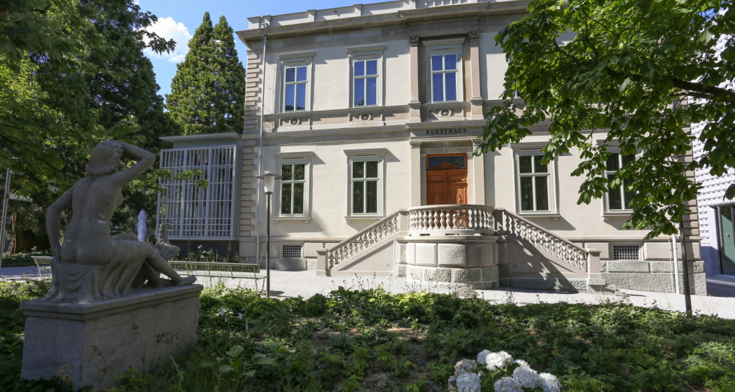
With the expansion (2014-2016), the Graubünden Art Museum has become one of the most attractive museums in Switzerland for the public. It sees itself as a centre for art in and from Graubünden with international appeal.

Description

The extension of 2014-2016 has made the Art Museum Graubünden one of Switzerland's most attractive museums. It is a centre for art in and from Graubünden with international renown. The magnificent historical Villa Planta and the modern extension by Barozzi Veiga come together as a unique architectural unit which by itself is worth a visit.

A home for art in Graubünden

The unique collection comprises some 8,000 works from all strands of art ranging from the 18th century to the present and is exhibited on an area of 1,200 square metres. Among the highlights are works by Chur-born Angelika Kauffmann (1741 - 1807), one of the first female artists to win recognition by the Royal Academy in London. The heart of the collection is the artist family Giacometti, with pieces by the world-famous sculptor Alberto and the two accomplished Swiss painters Giovanni and Augusto. Ernst Ludwig Kirchner (1180 - 1938) and Swiss Expressionism are represented in the collection with some striking works. More recent and contemporary streams are represented by Matias Spescha (1925 - 2008), Not Vital (*1948) or Hans Danuser (*1953), to give an example.

Special exhibitions

In addition to the permanent exhibition, five to six exhibitions of historical and contemporary art, thematic or monographic in nature, are shown throughout the year. Information on current and future exhibitions can be found at www.buendner-kunstmuseum.ch

A public space where art comes alive

The museum is a space of encounter, where art becomes tangible for everyone thanks to a diverse and varied programme of tours, talks and other events. It is a house with open doors where everyone can feel at home and spend an enjoyable few hours. The art museum Graubünden offers a wide range of art mediation events and services complemented its exhibitions. Public tours, family and kids' events, art mediation for schools and adolescents, exhibition guides, academic publications, catalogues, symposia, artist talks and performances make for an interesting programme. The museum staff engages personally with its visitors to give them the best possible access to art in all its facets.

Museum cafe and bookshop

There is a stylish cafe in the museum, located in the stately conservatory of Villa Planta. During summer, visitors sit outside under a group of old, shady sequoias just off the pedestrian area. The cafe offers fresh, regional cuisine. In the Foyer you will find a well-stocked art book store with a wide selection of exhibition catalogues and art postcards depicting the most famous works from the museum's collection.

Prices

Admission adults Fr.
15.-
Children and young people (up to 16 years) free Groups of 10
persons or more Fr. 10.- Members of the

Bündner Kunstverein and holders of the Swiss Museum Pass do not pay admission.
Members of the Bündner Kunstverein and holders of the Swiss Museum Pass do not pay admission.

Opening hours

  • Monday: closed
  • Tuesday - Sunday: 10am - 5pm
  • Thursday: 10am - 8pm

Contact

Responsible for this content Prättigau Marketing.

Guidle Logo

This website uses content from Guidle.

Museum Chur

Raetian Museum

Rätisches Museum, Dauerausstellung
Rätisches Museum

Show all 9 images

Rätisches Museum
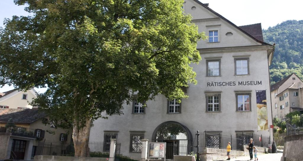
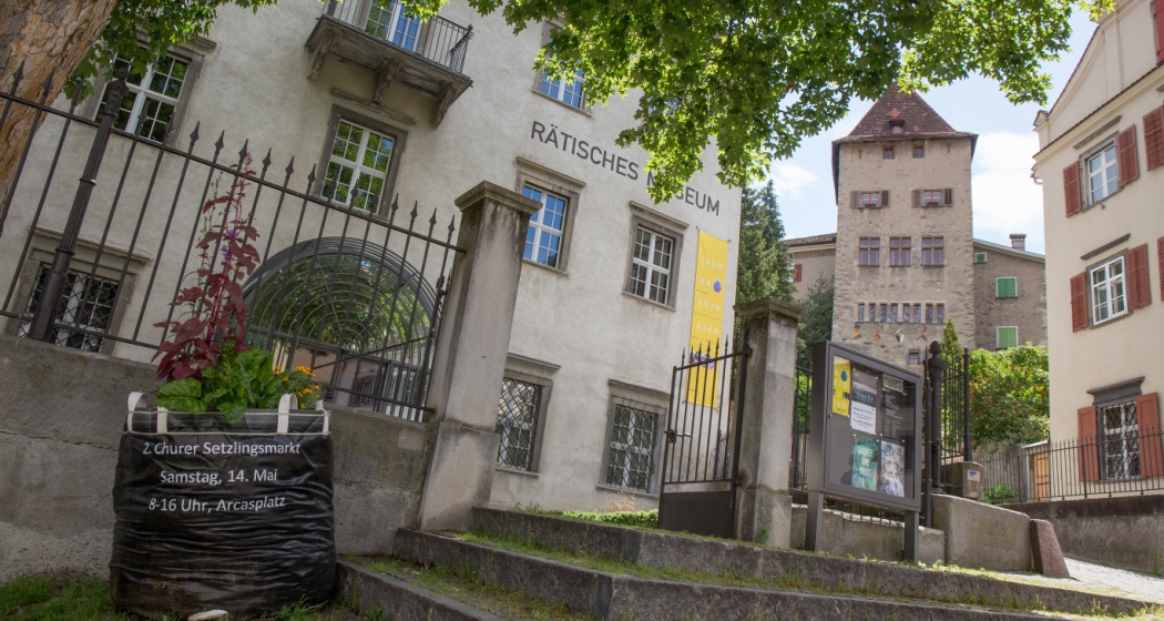
In the middle of the picturesque Old Town of Chur, the Rhaetian Museum presents Bündner history and stories from its beginnings to the present day. A permanent exhibition on four floors and changing special exhibitions invite visitors to take a journey through the centuries.

Description

The Raetian Museum is housed in a baroque patrician house built in 1675 and illustrates and imparts the history of Graubünden. In addition to the permanent exhibition, which includes archaeological, historico-cultural, and ethnographic objects from all over Graubünden Canton from pre- and early history to the present, a diverse programme of exhibitions deals with contemporary Grison culture and history. The public can explore these topics at a wide range of events.

A visit is worthwile also for young guests: Children can get a big key from the ticket desk which opens a box in every room. Inside the box is child-friendly information about the theme of the room to complement the guides which are geared toward adults.

Museum shop

The small but exquisite shop offers little bits of Graubünden's history for you to take home with you. Literature, gifts and souvenirs - there is a diverse range of high-quality products. 

Accessibility of the museum for people with disabilities

The Rhaetian Museum is partially barrier-free accessible. All floors of the museum are wheelchair accessible (elevator/wheelchair lift). The floor in the basement consists of natural stones and is relatively uneven. A disabled parking space is located right next to the museum.

Opening hours

  • Monday: closed
  • Tuesday - Sunday: 10am - 5pm

Contact

Responsible for this content Chur Tourism.