discover.swiss ID
osm_1684184
discover.swiss Additional Type
City

Trek Runcatrail - Caumasee - Tamins

Medium
21.7 km
1:55 h
290 mhd
1470 mhd
Trek Runcatrail - Caumasee - Tamins

Show all 8 images

Trek Runcatrail - Caumasee - Tamins
The Runca Trail is the classic single trail starting in Flims. The route becomes particularly interesting when you extend it from Flims to Tamins and incorporate highlights such as Lake Cauma or the Conn viewing platform into the route.
Technique /6
Fitness 3/6
Highest Point  1845 m
Lowest Point  660 m
Best Season
Jan
Feb
Mär
Apr
Mai
Jun
Jul
Aug
Sep
Okt
Nov
Dez
Start
Flims
Destination
Tamins
Coordinates
46.860235, 9.269049

Details

Description

The tour starts with the chairlift ride to Naraus. The start of the descent leads for a little way along a gravel road until the actual Runca Trail begins at the Flembach stream. This varied route meanders fluidly to the Runca Höhe and along numerous good, wooden trails to the Waldhaus area of Flims. This is usually where the Runca Trail descent ends, but not in this version. Cycle on small gravel roads down to the idyllic Lake Cauma and then climb up to the Conn viewing platform with its wonderful view of the Rhine Gorge. Both places are ideal as a lunchtime stop-off before starting on the trip to Tamins. From Conn, you ride mainly on single trails to Pintrun, and then ascend a little way to Digg - from where you travel on the signposted mountain bike route to Tamins along a mix of trails and little gravel roads.Tip: Instead of taking the post bus in Tamins back to Flims, extend the tour to Chur. A wonderful singletrail hugs the left bank of the Rhine to the outskirts of Chur.

HOME OF TRAILS

Incidentally: Danny MacAskill and Claudio Caluori took a relaxing break at Lake Cauma in the "Home of Trails" video.

Discover the Lake Cauma

Geheimtipp

Instead of getting back to Flims in Tamins in Postbus, you continue the tour to Chur. A wonderful single trail nestles along the left bank of the Rhine to the outskirts of Chur.

Responsible for this content Graubünden Ferien.
This content has been translated automatically.
Ringelspitz hut round trip

Difficult
15.6 km
6:15 h
1300 mhd
1300 mhd
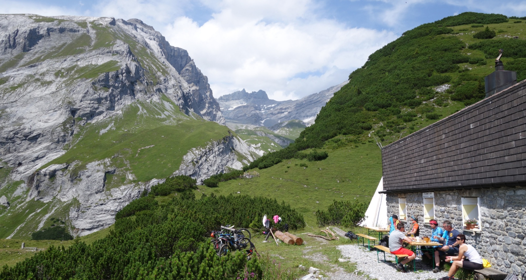
Ringelspitzhütte mit Blick zum Ringelspitz Gipfel
Ringelspitzhütte Rundtour

Show all 5 images

Tektonikarena Sardona
Impressive hiking tour through the gorgeous Lavoitobel to the Ringelspitz hut and along the Kunkelspass back to Tamins.
Technique 3/6
Fitness 5/6
Highest Point  1998 m
Lowest Point  662 m
Best Season
Jan
Feb
Mär
Apr
Mai
Jun
Jul
Aug
Sep
Okt
Nov
Dez
Start
Tamins, village
Destination
Tamins, village
Coordinates
46.829182, 9.405976

Details

Description

The village of Tamins is the starting point of this exciting round trip. In the northern rim of the village you walk northwards into the Lavoitobel. The wild and secluded valley is home of deer, chamois and many local birds. In the end of the valley there is a rather steep ascent to the Ringelspitz hut, which is open during the whole summertime and on sunny weekends in spring and fall. Ideal for a lunch break or why not spending a night in the beautiful surrounding of the Alps. The descent follows the hiking route to Grossalp - Kunkelspass - Foppaloch - Tamins.

Responsible for this content Chur Tourism.

CampAu Family tour

Simple
22.6 km
1:30 h
135 mhd
135 mhd
CampAu am Rhein-Ufer
Blick auf Reichenau-Tamins und das Churer Rheintal

Show all 4 images

Restaurant beim CampAu
Pleasant family cycling tour at the border of the Rhine river through the villages of the Chur Rhine valley.
Technique 1/6
Fitness 1/6
Highest Point  662 m
Lowest Point  557 m
Best Season
Jan
Feb
Mär
Apr
Mai
Jun
Jul
Aug
Sep
Okt
Nov
Dez
Start
Chur, Campsite Au
Destination
Chur, Campsite Au
Coordinates
46.861849, 9.507594

Details

Description

Start your tour at the campsite Obere Au. Cycle along the Rhine river to the village of Felsberg (in case the path is closed due to military exercises in this area, you can follow the official cycling route no. 2 and 6). The tour takes you then through the villages of Felsberg, Tamins, Reichenau, Domat/Ems and back to Felsberg and Chur. The campsite Obere Au has a playground for children and a restaurant, where you can have a meal and drinks.

Responsible for this content Chur Tourism.

Domleschger Loop

Simple
56.2 km
3:00 h
386 mhd
386 mhd
Schloss Ortenstein
Churer Rheintal

Show all 5 images

Schloss Rhäzüns
Domleschger Loop
Technique /6
Fitness 2/6
Highest Point  777 m
Lowest Point  561 m
Best Season
Jan
Feb
Mär
Apr
Mai
Jun
Jul
Aug
Sep
Okt
Nov
Dez
Start
Chur, Obere Au
Destination
Chur, Obere Au
Coordinates
46.854236, 9.50527

Details

Description

The perfect after-work tour: This mostly flat round trip leads from Chur via the Chur Rhine Valley through the picturesque Domleschg.  Most of the journey leads through gentle hilly landscapes, past wonderful orchards and imposing castles and palaces.

Responsible for this content Chur Tourism.
This content has been translated automatically.
Rhine and Tuma heights around Domat/Ems

Medium
17.6 km
5:00 h
302 mhd
302 mhd
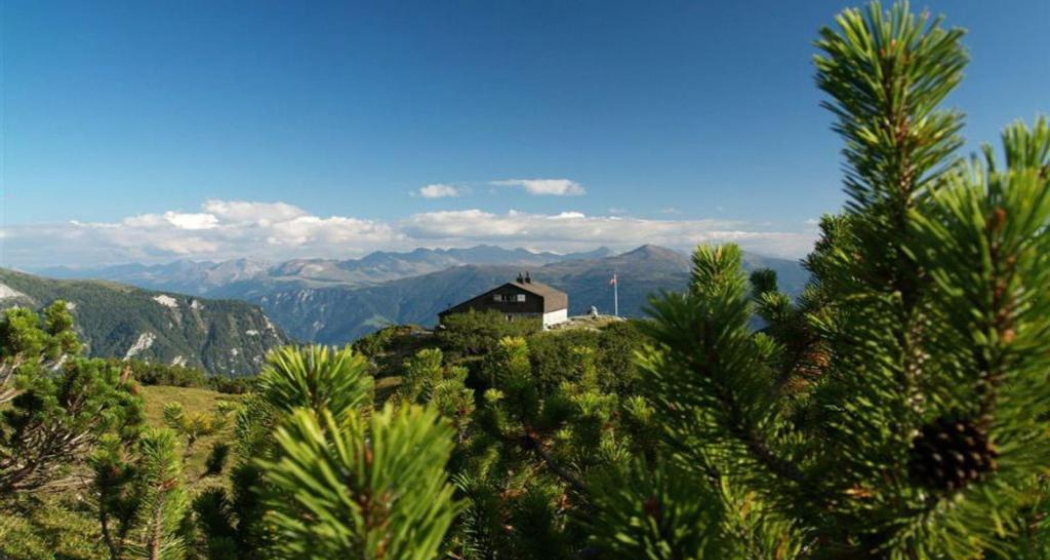
Domat/Ems und die markanten Tumas
Tumas und Kirchtürme von Domat/Ems

Show all 4 images

Domat/Ems mit Tumas und Blick ins Rheintal bis Chur
Interesting hiking tour around the so called «Tumas» (rubble cones) in Domat/Ems and the surrounding Rhine valley.
Technique 1/6
Fitness 3/6
Highest Point  790 m
Lowest Point  582 m
Best Season
Jan
Feb
Mär
Apr
Mai
Jun
Jul
Aug
Sep
Okt
Nov
Dez
Start
Domat/Ems, bus stop in the village
Destination
Domat/Ems, bus stop in the village
Coordinates
46.83376, 9.44758

Details

Description

The plain around Domat/Ems consists of different landslides: The Flimser Bergsturz, Kunkels and Calanda. The erosion has left over only the hard debris. This hills are called «Tumas» and build a protected nature reserve today.

The Chur city bus no.1 takes you from the main station to Domat/Ems (bus-stop «Domat/Ems Post»), the starting point. During this hiking tour you will explore different «Tumas», cross the Rhine river and visit the village of Tamins. On the way back to Domat/Ems, you cross the Rhine river another time, across a weir this time. At the same bus-station (Domat/Ems Post) you take the bus back to Chur.

Responsible for this content Chur Tourism.

Felsberger Älpli - Kunkelspass

Difficult
26 km
7:30 h
1580 mhd
1580 mhd
Blick von der gegenüberliegenden Seite auf das Calanda Massiv
Berggasthaus Überruf am Kunkelspass

Show all 5 images

Blick zurück auf den legendären Kunkelspass
Impressive tour into the mountain world of Chur, at the mountainside of the mighty Calanda massif.
Technique 3/6
Fitness 5/6
Highest Point  2080 m
Lowest Point  565 m
Best Season
Jan
Feb
Mär
Apr
Mai
Jun
Jul
Aug
Sep
Okt
Nov
Dez
Start
Felsberg
Destination
Felsberg
Coordinates
46.84458, 9.47677

Details

Description

To Felsberg you can get easily from Chur with the city bus (line 1) or the Rhaetian Railway. After a steep ascnet you will be rewarded by a gorgeous scenery and unique views on the mountain and into the valley. If you are lucky, you can even spot some wild animals (chamois, alpine ibex) in the surroundings of this tour. At the Kunkelspass is the ideal point for a break at the restaurant Überruf. The way back into the valley along Foppaloch, Benis Boden and along the Senda Sursilvana is worthwile, as well.

Responsible for this content Chur Tourism.

rhiienergie Trail Tamins

Medium
7.2 km
1:50 h
270 mhd
270 mhd
rhiienergie Trail Tamins
rhiienergie Trail Tamins (oua_25240696_e2c8fcd_profile)
The Tamins Trail (orange signage) is just under 7.5 km long with a height difference of 270 meters.
Technique 2/6
Fitness 3/6
Highest Point  823 m
Lowest Point  607 m
Best Season
Jan
Feb
Mär
Apr
Mai
Jun
Jul
Aug
Sep
Okt
Nov
Dez
Start
Tamins
Destination
Tamins
Coordinates
46.833095, 9.406022

Details

Description

In the communes of Bonaduz, Domat / Ems, Felsberg, Rhäzüns and Tamins, rhiienergie created five interconnected Nordic Walking routes (also suitable for jogging / running). Each route runs for about 10 kilometers on existing paths and roads across meadows and through forests. A corresponding signage shows on the one hand the way direction and on the other the respective distance covered.

Responsible for this content Chur Tourism.
This content has been translated automatically.

rhiienergie Trail Felsberg

Medium
8.9 km
2:25 h
550 mhd
550 mhd
rhiienergie Trail Felsberg
rhiienergie Trail Felsberg (oua_25240669_e6d0ed3_profile)
The Felsberg Trail (red signage) is almost 9 km long with a height difference of 440 meters.
Technique 2/6
Fitness 4/6
Highest Point  1008 m
Lowest Point  588 m
Best Season
Jan
Feb
Mär
Apr
Mai
Jun
Jul
Aug
Sep
Okt
Nov
Dez
Start
Felsberg
Destination
Felsberg
Coordinates
46.843184, 9.46418

Details

Description

In the communes of Bonaduz, Domat / Ems, Felsberg, Rhäzüns and Tamins, rhiienergie created five interconnected Nordic Walking routes (also suitable for jogging / running). Each route runs for about 10 kilometers on existing paths and roads across meadows and through forests. A corresponding signage shows on the one hand the way direction and on the other the respective distance covered.

Responsible for this content Chur Tourism.
This content has been translated automatically.

Nature trail Eichwald Tamins

Simple
4.1 km
1:20 h
186 mhd
186 mhd
Naturlehrpfad Eichwald Tamins
Naturlehrpfad Eichwald Tamins (oua_25241030_107b079_profile)
Nature trail through a beautiful and very diverse forest landscape with information boards on various forest topics.
Technique 1/6
Fitness 2/6
Highest Point  792 m
Lowest Point  606 m
Best Season
Jan
Feb
Mär
Apr
Mai
Jun
Jul
Aug
Sep
Okt
Nov
Dez
Start
Tamins
Destination
Tamins
Coordinates
46.834524, 9.411363

Details

Description

The nature trail informs you on 19 thematic panels about the origin and the diverse habitats around Eichwald. The path is walkable all year round, especially interesting, of course, during the growing season, when countless plants and microorganisms can be observed. The panels are arranged along the way, the tour takes about 2 hours. The path is easily accessible even for smaller children. In the area Benis Boden there is a picnic area with a fire pit.

Responsible for this content Chur Tourism.
This content has been translated automatically.

Chur – Ilanz

Medium
49.9 km
4:50 h
1249 mhd
1006 mhd
Rheinschlucht
Gravel&Road Graubünden

Show all 6 images

Gravel&Road Graubünden
Between the Alpine town of Chur and Ilanz there are 35 kilometres and 500 metres of altitude difference – if you choose the direct route. On this gravel bike tour you will diligently collect additional kilos and altitude meters thanks to a worthwhile additional loop into the Safiental.
Technique 3/6
Fitness 3/6
Highest Point  1581 m
Lowest Point  559 m
Best Season
Jan
Feb
Mär
Apr
Mai
Jun
Jul
Aug
Sep
Okt
Nov
Dez
Start
Chur
Destination
Anonymous
Coordinates
46.861349, 9.50708

Details

Description

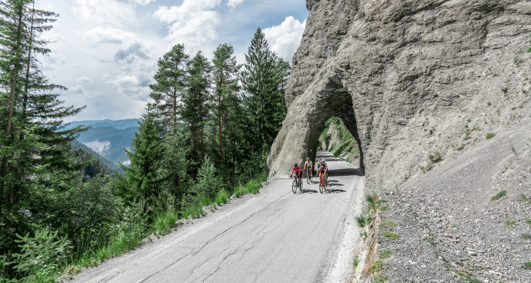
You start in Chur (593 m above sea level) and ride along the Rhine on the cycle path to Reichenau, where the Anterior and Rear Rhines meet. On side roads, follow cycle path number 3 to Bonaduz (662 m above sea level). Here you can access the spectacular road through the Ruinaulta. The Rhine Gorge, with its 300-metre-high rock faces and rock formations, is also called the "Swiss Grand Canyon". Take a short break to enjoy one of the most diverse landscapes in the Alps. Over the bridge at the end of the first short descent, you will enter a short climb with magnificent hairpin bends that leads to Versam (909 m above sea level). Right at the entrance to the village, turn off in the direction of Safiental and follow the mountain bike route no. 157 "Calörtsch". Via Arezen you reach the mountain pastures near Calörtsch (1401 m above sea level) on dirt roads through forests and meadows. Here you can enjoy a particularly impressive panoramic view of the Flimserstein. Following the MTB route, a short forest path through the Calörtscher Forest (1580 m above sea level) will take you back to a road that will take you to the idyllic village of Brno (1287 m above sea level). The fast descent from Brno will take you back to cycle route 3, which you will follow in the direction of Valendas (809 m above sea level). Valendas delights not only with countless well-preserved manor houses, but also with the largest wooden fountain in Europe. From here, follow the cycle route to Ilanz (699 m above sea level), the first town on the Rhine. From Ilanz you can take the Rhaetian Railway back to the starting point in Chur.

Responsible for this content Graubünden Ferien.
This content has been translated automatically.