E-bike Rhine Gorge circuit

Medium
65.2 km
5:20 h
1154 mhd
1133 mhd
Einzigartige Naturkulisse: Die Rheinschlucht
Aussichtspunkt Zault zwischen Bonaduz und Versam

Show all 9 images

Rheinschlucht
The circuit tour of the Rhine Gorge is an extended but rewarding day trip with numerous viewpoints along the Rhine Gorge, the beautiful Cresta Lake and the confluence of the Rhine.
Technique 2/6
Fitness 4/6
Highest Point  1169 m
Lowest Point  564 m
Best Season
Jan
Feb
Mär
Apr
Mai
Jun
Jul
Aug
Sep
Okt
Nov
Dez
Start
Station Chur
Destination
Station Chur
Coordinates
46.853213, 9.530019

Details

Description

The circular tour around the Rhine Gorge from Chur includes numerous highlights and is extremely varied. At the beginning of the route, you cross the Rhine twice at Reichenau, where the Vorderrhein and Hinterrhein rivers meet. After Bonaduz, the spectacular road follows above the Rhine Gorge via Versam and Valendas. The Zault and Spitg viewing platforms reveal magnificent views of the natural wonder of the Rhine Gorge. On the way back, after the climb to Laax, there is a beautiful section through the Flimserwald forest and to the Conn lookout tower, from where a sensational panorama of the Rhine Gorge opens up from high above. The next highlight is Lake Cresta, before the return trip via Trin, Tamins and Felsberg back to the Alpine City of Chur.  

Directions

From Chur on the Graubünden Route 6 to Domat/Ems. Along the edge of the golf course in the direction of Reichenau train station. There follow the Rhine Route 2 via Bonaduz along the Rhine Gorge to Valendas. In the village, turn right and descend to Valendas train station, where the Rhine is crossed on the bridge. From there follows an ascent through the forest to Laax. However, the route branches off again immediately and leads along bikeroute 90 past Lake Cauma in the direction of Trin. Before Conn turn off and ride to the viewpoint and restaurant Conn. Then back on the bike route Graubünden 90 and via Crestasee to Trin Mulin. There cross the road to Trin village and go through it. Before entering the main road to Tamins, cross under it and shortly afterwards continue on the Graubünden 90 bike route to the village of Tamins. In the village center change to the Rhine Route 2 and follow it back to Chur.

Directions

Public Transport

Chur train station is easily accessible by SBB (Swiss Federal Railways), Rhaetian Railways, Postbus or Chur Bus.

Anreise Information

Motorway exit Chur Nord or Chur Süd and then drive to the city centre.

Parking

At Chur railway station two multi-storey car parks are available (Otto & Alex / SBB Park & Rail).

Responsible for this content Graubünden Ferien.

E-bike round tour Walser settlement Stams

Medium
53.5 km
5:15 h
1358 mhd
1358 mhd
Blick von Says ins Churer Rheintal
Blick auf Says und oben Stams

Show all 3 images

E-Bike Rundtour Walsersiedlung Stams (oua_66798104_865041c_profile)
A very varied circular tour with ascent via Valzeina and the wild valley behind it to the Walser settlement of Stams, where a magnificent view and a rustic mountain inn beckon.
Technique 2/6
Fitness 3/6
Highest Point  1692 m
Lowest Point  523 m
Best Season
Jan
Feb
Mär
Apr
Mai
Jun
Jul
Aug
Sep
Okt
Nov
Dez
Start
Station Chur
Destination
Station Chur
Coordinates
46.853247, 9.529973

Details

Description

After a leisurely roll through the Graubünden Rhine Valley into the Prättigau region, the climb on the mountain road towards Valzeina begins shortly before Grüsch. The small mountain village is a typical Walser scattered settlement with numerous farms, which are far apart. After leaving the asphalt road, the climb continues through the long, wild and magnificent Valzeina valley up to Stams, the highest point of the tour. The beautifully situated Walser settlement is today only used as a maiensäss. In addition to the great view far into the Chur Rhine Valley, there is also a rustic mountain restaurant where you can fortify yourself with drinks and Graubünden specialties.

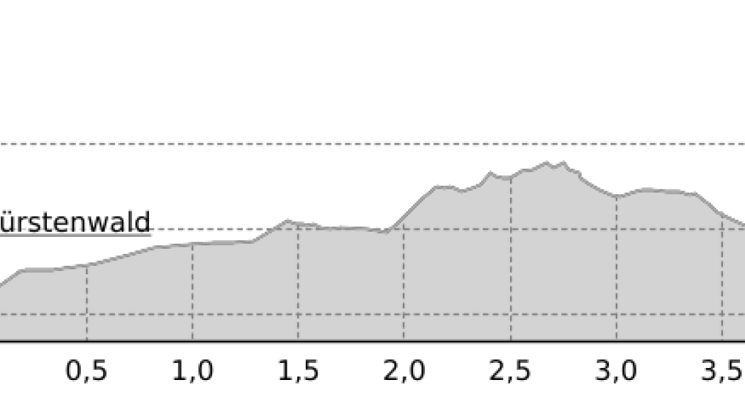
Now follows a long descent via Says - also a Walser settlement - down to the village of Trimmis. Finally, it's back to the Alpine City of Chur on a beautiful bike path through the Fürstenwald forest.

Directions

From Chur on the Rhine Route 2 to Landquart, there along the Prättigau Route 21 to the fork in the mountain road to Valzeina. Follow this to the village of Valzeina and from there on bikeroute 330 (Panorama Ride) to the "Laubenzug" junction. Here continue on the bikeroute Graubünden 90 to Stams. The descent is also along the Graubünden 90 bikeroute to Trimmis on the mountain road. From Trimmis on the Churer Rheinroute 501 back to Chur.

The ride is also possible in the opposite direction.

Directions

Public Transport

Chur train station is easily accessible by SBB (Swiss Federal Railways), Rhaetian Railways, Postbus or Chur Bus.

Anreise Information

Motorway exit Chur Nord or Chur Süd and then drive to the city centre.

Parking

At Chur railway station two multi-storey car parks are available (Otto & Alex / SBB Park & Rail).

Responsible for this content Graubünden Ferien.
Grisons Marathon

Geschlossen
Difficult
42.1 km
9:00 h
2648 mhd
401 mhd
Graubünden Marathon
Graubünden Marathon (oua_2810084_050c892_profile)

Marathon run over the classic distance from Chur via Lenzerheide to the Parpaner Rothorn.

Technique 6/6
Fitness 6/6
Highest Point  2840 m
Lowest Point  591 m
Best Season
Jan
Feb
Mär
Apr
Mai
Jun
Jul
Aug
Sep
Okt
Nov
Dez
Start
Chur
Destination
Rothorn
Coordinates
46.851745, 9.5335

Details

Description

Geheimtipp

The route from Chur to Lenzerheide is signposted and can be walked all year round. The route from Lenzerheide to the Rothorn can be walked from June.

Directions

The start is in Chur on the Quader meadow. From there you take the route through the old town and then turn to the road Chur-Arosa. At the junction “Arosa” continue straight towards Sand. At Sand, the route leaves the asphalt road on a gravel road towards Passugg. In Passugg, the route leads around the building of the drink manufacturer Passugger and leaves the road again on a dirt road. After a climb, you turn onto a wide gravel road. Follow the “Polish” path to Churwalden. You run through the village Churwalden (1’240m asl) past the post office, Coop and after the hotel Hemmi you turn left. Afterwards a longer section starts up to Büel, Foppa. In Foppa (1’753 m asl) turn into the asphalt road direction Parpan. After about 1 km down the road, turn left onto a narrow path towards Mittelberg. At Mittelberg, turn left onto the asphalt road that leads to Parpan. At the first junction in Parpan (1’493m asl), turn right into the main road just before the main road, turn left and then go up the parallel to the Hotel Alpina. After the post office, turn left. After about 15m turn right and after another 10m turn right again. You then turn directly into a narrow path that leads over roots to the Valbellnerhöhe. There you walk past a very small lake and then you run parallel to the road until you reach Canols. On your right, you can see the big lake Heidsee. Cross the main street and walk past the Canols kiosk. After a round around the right side of lake Heidsee you cross the main road at the Rothorn valley station. After the underpass turn right and then walk up the sidewalk and after about 100m cross the side of road and run straight into the forest. After about 1.5 km on a gravel road in the forest you cross a side road and cross the main road at the underpass. After going around the school you leave Lenzerheide (1’478m asl) again at the underpass and after the underpass you turn right towards village centre. After the UBS building turn left and walk up a steep asphalt road. After approximately 100m turn left onto a 1m wide gravel road. After the steep gravel road turn left onto an asphalt road after about 25m turn right. After another 100m turn left and then climb steeply again towards the waterfall. The path up to the waterfall is narrow and is very energy-sapping. When you reach the waterfall, a beautiful trail leads up to the Alp Scharmoin (1’904 m asl) to the Rothorn centre station. From the centre station, about 1km has many steep sections on the gravel road. Then there is a small flat section of about 500m. However, the final ascent starts at 2’266m asl on a route of approx. 2.5 km up to the Rothorn summit 2’861 m asl. Once you are on the summit, you can be proud of what you have done, because you have made the toughest marathon in the world!

Responsible for this content Graubünden Ferien.
This content has been translated automatically.

Chur - Brambrüesch - Scalottas

Difficult
22.6 km
5:45 h
2668 mhd
943 mhd
Aussicht von Schönegg bei Sonnenuntergang
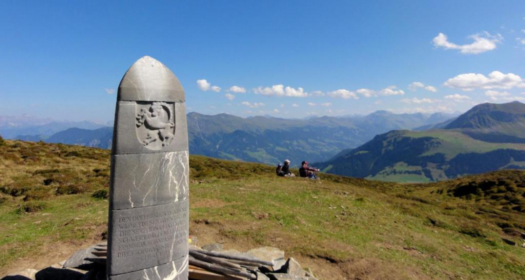
Dreibündenstein

Show all 10 images

Fulhorn
From the Alpine town up to the Piz Scalottas.
Technique 5/6
Fitness 5/6
Highest Point  2574 m
Lowest Point  587 m
Best Season
Jan
Feb
Mär
Apr
Mai
Jun
Jul
Aug
Sep
Okt
Nov
Dez
Start
Chur, Maltese
Destination
Piz Scalottas
Coordinates
46.848204, 9.529024

Details

Description

This beautiful route leads from Chur to the Piz Scalottas. Not directly, of course. So it goes from Chur ers to Brambrüesch, over the Fuulhorn and Stätzerhorn and finally over the Piz Danis until the finish on the Piz Scalottas is reached. From Piz Scalottas you can comfortably take the chairlift back down to the valley.  

Geheimtipp

If you still haven't had enough on the Piz Scalottas, you can also walk via June Hut - Spoina to Lenzerheide.

Sicherheitshinweis

Observe the operating hours of the Scalottas chairlift.

Ausrüstung

Trailrun backpack, sturdy and well-worn shoes, functional clothing, maps / GPS, enough food for on the go.

Directions

Public Transport

By train or PostBus to Chur, where the start is.

Anreise Information

By car to the Brambrüeschbahn in Chur. However, since the destination is located in Lenzerheide, it is advisable to travel by public transport.

Parking

Parking lot of the Brambrüesch Railway.

Responsible for this content Graubünden Ferien.
This content has been translated automatically.

Pleasure tour Chur Rhine valley

Simple
38.4 km
0:00 h
223 mhd
223 mhd
Churer Rheintal aus der Vogelperspektive
Kultur & Genussroute Churer Rheintal

Show all 11 images

Kultur & Genussroute Churer Rheintal
Pleasant tour through the Chur Rhine valley, ideal for a half day cycling or e-bike tour.
Technique 2/6
Fitness 2/6
Highest Point  674 m
Lowest Point  562 m
Best Season
Jan
Feb
Mär
Apr
Mai
Jun
Jul
Aug
Sep
Okt
Nov
Dez
Start
Chur, railway station
Destination
Chur, railway station
Coordinates
46.83469502, 9.45786212

Details

Description

From Chur, follow the course of the Rhine and cross the villages of Felsberg and Tamins to the confluence of the Rhine at Reichenau. You then reach the high plateau of the municipalities of Bonaduz and Rhäzüns. The route takes you past the historic Sogn Gieri church. Optionally, you can plan a detour to Rhäzüns to visit the church of Sogn Paul. The new Hinterrheinsteg, which connects national cycle routes no. 2 (Rhine route) and no. 6 (Graubünden route), finally takes you back to Chur via the Domat/Ems golf course. 

The new Hinterrheinsteg opens up many possibilities and is also suitable for families. 

Directions

Public Transport

The tour starts at the Chur railway station.

Responsible for this content Chur Tourism.

Outdooractive Logo

This website uses technology and content from the Outdooractive platform.

Helsana Trail Chur: Short Trail

Simple
4.1 km
0:40 h
77 mhd
77 mhd
Helsana Trail Chur: Kleiner Trail
Helsana Trail Chur: Kleiner Trail (oua_25240865_c249a90_profile)
The short trail is signposted blue and with a length of 4 km a shorter and easier run.
Technique /6
Fitness 2/6
Highest Point  739 m
Lowest Point  663 m
Best Season
Jan
Feb
Mär
Apr
Mai
Jun
Jul
Aug
Sep
Okt
Nov
Dez
Start
Waldhausstall Fürstenwald, Chur
Destination
Waldhausstall Fürstenwald, Chur
Coordinates
46.870241, 9.544089

Details

Description

In the Fürstenwald near Chur there are three signposted jogging / nordic walking trails available:

  • Short Trail (blue route)
  • Medium Trail (green route)
  • Long Trail (yellow route)

The Fürstenwald is a recreational area near Chur. It offers a diverse and popular route network for joggers and nordic walkers.

Responsible for this content Chur Tourism.
This content has been translated automatically.

Stage 5 Road cycling Route Source Region Rhine: Ilanz – Chur

Medium
47.3 km
3:20 h
1143 mhd
1289 mhd
Strasse nach Bonaduz
Ilanz die erste Stadt am Rhein

Show all 5 images

Gasthaus am Brunnen
270 kilometers, two magnificent alpine passes, deep gorges,

spectacular landscapes and a ride through all three language regions of Graubünden await you.

Technique 3/6
Fitness 3/6
Highest Point  1590 m
Lowest Point  559 m
Best Season
Jan
Feb
Mär
Apr
Mai
Jun
Jul
Aug
Sep
Okt
Nov
Dez
Start
Anonymous
Destination
Chur
Coordinates
46.77372, 9.204208

Details

Description

 Shortly after Ilanz (699m above sea level), you’ll turn onto a small road to Sevgein and finally reach Riein (1,270m above sea level). The low-traffic and perfectly paved road ascends steeply at the beginning and soon you’ll leave the village of Sevgein behind you. From here, the street lights up its true magic. The road steadily ascends and the view of Valsertal is unique. Since Riein is a dead end for motorised vehicles, only a few cars can be found here.

After Riein, you’ll pass the ban on motorised vehicles and a narrow asphalt road leads you to Cuolm (1,550m above sea level) and Ober Dutjen. The idyllic landscape makes you forget all the hardships and the fast descent to Valendas (810m above sea level) with excellent views of the Rhine Valley is a pure reward. From Versam, a spectacular road leads through the Ruinaulta. The Rheinschucht (Rhine gorge), with its 300-meter high rock walls and rock formations also called "Little Swiss Canyon" ascends to Versam, before you are treated to a fast descent with fantastic hairpin bends. Over the bridge at the end of the descent, you’ll reach a short incline. You can anticipate rocky tunnels and a fantastic panoramic road. Take a little rest to enjoy the view of the gorge. The route will lead you to Bonaduz (662m above sea level) and Reichenau, where the Anterior and Posterior Rhine flow together and further back to Chur (593m above sea level).

Stages

Ouverall route: Chur – Chur

Stage 1: Chur – Splügen

Stage 2: Splügen – Biasca

Stage 3: Biasca – Disentis

Stage 4: Disentis – Ilanz

Stage 5: Ilanz – Chur

Geheimtipp

Tip for tired legs: If you prefer to keep the cycling day short, but just as spectacular, skip the descent over Riein and Dutjen. Instead, follow the road from Ilanz directly through the Rheinschlucht (Rhine gorge). That will shorten the daily route to 34.3 kilometers and 249 altitude.

Responsible for this content Graubünden Ferien.
This content has been translated automatically.

Stage 1 Road cycling Route Source Region Rhine: Chur – Splügen

Medium
56.2 km
3:40 h
1216 mhd
300 mhd
Chur
Schloss Schauenstein

Show all 6 images

Rofflaschlucht
270 kilometers, two magnificent alpine passes, deep gorges, spectacular landscapes and a ride through all three language regions of Graubünden await you.
Technique 3/6
Fitness 3/6
Highest Point  1485 m
Lowest Point  559 m
Best Season
Jan
Feb
Mär
Apr
Mai
Jun
Jul
Aug
Sep
Okt
Nov
Dez
Start
Chur
Destination
Splügen
Coordinates
46.861551, 9.507159

Details

Description

Your journey starts in Chur (593m above sea level) and following the Rhine along the bike path, you’ll get to Reichenau. This is where the Posterior and Anterior Rhine come together, the two rivers that that we’re most interested in on this tour. On side roads, you’ll follow the road through the rolling hills of the Domleschg fruit and castle country. At Rothenbrunnen you’ll see the imposing Porta Raetica fortification whilst still on your bike. In Paspels, you’ll be able to admire the works of art by the well-known artist Robert Indermaur and the Schauenstein castle in Fürstenau will tempt you to take a first break. After passing through the historic trading town of Thusis (680m above sea level), the road ascends steadily. The Viamala-Schlucht (gorge) natural monument will have you in awe and you’ll soon forget all about the tough journey. The road runs spectacularly through the Viamala and a look into the gorge is certainly worthwhile. The route continues through the valley of the Posterior Rhine, passing the villages of Schamserberg until the valley narrows towards the Rofflaschlucht (gorge). The Roffla promises great insights into a wild ravine. The path ascends steadily but not steeply. Through the valley floor of the Rheinwald, you’ll reach Splügen (1,475m above sea level), the oldest pass village of Graubünden.

Stages

Overall route: Chur – Chur

Stage 1: Chur – Splügen

Stage 2: Splügen – Biasca

Stage 3: Biasca – Disentis

Stage 4: Disentis – Ilanz

Stage 5: Ilanz – Chur

Responsible for this content Graubünden Ferien.
This content has been translated automatically.

Road cycling Route Source Region Rhine

Medium
304.5 km
17:25 h
4827 mhd
4935 mhd
Gravel&Road Graubünden

Show all 8 images

Gravel&Road Graubünden
270 kilometers, two magnificent alpine passes, deep gorges, spectacular landscapes and a ride through all three language regions of Graubünden await you.
Technique 3/6
Fitness 3/6
Highest Point  2066 m
Lowest Point  237 m
Best Season
Jan
Feb
Mär
Apr
Mai
Jun
Jul
Aug
Sep
Okt
Nov
Dez
Start
Chur
Destination
Chur
Coordinates
46.797537, 9.398778

Details

Description

Your journey starts in Chur, passing side streets you’ll discover the rolling hills of the Domleschg fruit and castle country. The route leads through the Viamala-Schlucht (gorge) natural monument and from here, the route climbs steadily through the valley of the Posterior Rhine. At the Roffla-Schlucht (gorge), the valley narrows, before finally reaching Splügen, the oldest pass village in Graubünden. Shortly after, the San Bernardino Pass, an Alp transit history classic attracts your attention. The pass’ numerous hairpin turns accelerate every racing bike enthusiast’s heart. Once at the top, a little rest is more than deserved. Soon after, the fast descent to the south is waiting for you to get down into the Misox. During the 44-kilometer descent, the landscape will surprise and astound you - high Alpine one minute, Mediterranean the next. Shortly after Roveredo, you’ll cross the Cantonal border from Graubünden to Ticino. Until Biasca, the terrain continues to rise gently. The Lukmanier Pass is a real treat which deserves to be at the top of the racing bike Olympus. The ascent leads through the Valle di Blenio to Olivone, where you’ll turn off into the Valle Santa Maria. At the Ospizio del Lucomagno you’ll not only find the passport sign, but it’ll also take you back to the canton of Graubünden. The descent will take you through Val Medel to Disentis. The journey continues along the Anterior Rhine through the Bündner Oberland, the Surselva. A detour over the Obersaxen plateau, which stuns with its countless hidden streets, will take you to Ilanz, the first city on the Rhine. From here, a spectacular road leads through the Ruinaulta: the Rheinschlucht (Rhine gorge), with its 300-meter high rock walls and rock formations also called "Little Swiss Canyon". Following the road will bring you back to Chur.

Stages

Stage 1: Chur – Splügen

Stage  2: Splügen – Biasca

Stage  3: Biasca – Disentis

Stage  4: Disentis – Ilanz

Stage  5: Ilanz – Chur

Geheimtipp

Tip for tired legs: If you prefer to keep the cycling day short, but just as spectacular, skip the descent over Riein and Dutjen. Instead, follow the road from Ilanz directly through the Rheinschlucht (Rhine gorge). That will shorten the daily route to 34.3 kilometers and 249 altitude.

Tip: Don’t worry about carrying your luggage on this trip multi-day trip. Book the luggage transfer from hotel to hotel - convenient and easy.

Directions

Chur - Splügen: 56.2 kilometers - 1216 altitude

Your journey starts in Chur (593m above sea level) and following the Rhine along the bike path, you’ll get to Reichenau. This is where the Posterior and Anterior Rhine come together, the two rivers that that we’re most interested in on this tour. On side roads, you’ll follow the road through the rolling hills of the Domleschg fruit and castle country. At Rothenbrunnen you’ll see the imposing Porta Raetica fortification whilst still on your bike. In Paspels, you’ll be able to admire the works of art by the well-known artist Robert Indermaur and the Schauenstein castle in Fürstenau will tempt you to take a first break. After passing through the historic trading town of Thusis (680m above sea level), the road ascends steadily. The Viamala-Schlucht (gorge) natural monument will have you in awe and you’ll soon forget all about the tough journey. The road runs spectacularly through the Viamala and a look into the gorge is certainly worthwhile. The route continues through the valley of the Posterior Rhine, passing the villages of Schamserberg until the valley narrows towards the Rofflaschlucht (gorge). The Roffla promises great insights into a wild ravine. The path ascends steadily but not steeply. Through the valley floor of the Rheinwald, you’ll reach Splügen (1,475m above sea level), the oldest pass village of

Graubünden.

Splügen - Biasca: 94.1 kilometers - 894 altitude

The Walser settlement Posterior Rhine (1,624m above sea level) at the foot of the Rheinwaldhorn is the starting point of the San Bernardino Pass, an Alp transit history classic. The pass’ numerous hairpin turns at 2066 altitude will accelerate every racing bike enthusiast’s heart. The ascent is steady, but doesn’t have any extremely steep ramps, so you can still enjoy the scenery. Once you arrive at the pass, taking a short break is well deserved. The Ospizio and the small lake invite you to relax. Soon, however, the anticipation of the rapid descent south to the Misox will have you jumping back into the saddle.

Let yourself be staggered by the diverse scenery during the 44-kilometer descent. The numerous hairpin turns will put a smile on your face. Surrounded by chestnut trees and grapevines, chill grotti along the roadside will startle you with their southern flair. Shortly after Roveredo, you’ll cross the canton border into Ticino and the last 20 kilometers will lead you to Biasca (301m above sea level) without having to put too much effort. The perfect starting point to tackle the Lukmanier Pass on the following day.

Biasca - Disentis: 60 kilometers - 1787 altitude

The beginning of the crowning stage takes off leisurely. Although the route ascends steadily from Biasca (301m above sea level), it’s enjoyable despite tired legs. The Lukmanier Pass is a real treat that deserves to be at the top of the racing bike Olympus. A 42-kilometer-long ascent with 1680 altitude can be hard on tired legs. The ascent continues through the Valle di Blenio to Olivone (902m above sea level) where you’ll turn into Valle Santa Maria. The ascent is constant but has quite a few crisp ramps. The actual pass is next to the Lai da Santa Maria mountain lake at 1972 altitude, the passport sign is located at the Ospizio del Lucomagno at 1914 altitude, where you’ll also get back to Graubünden. The descent leads through the Val Medel to Disentis (1,130m above sea level). A last short, crisp climb will bring you back into the village. From a distance, you’ll be able to see the imposing Benedictine monastery, which has had an impact on the town since the 13th century.

Disentis - Ilanz: 61.4 kilometers - 1570 altitude

From Disentis (1,130m above sea level) the journey continues along the Anterior Rhine through the Surselva, the largest Romansh-speaking area of Graubünden. In Trun (852m above sea level) you’ll turn off the main road and explore picturesque villages on the northern side of the valley at six kilometers and 300 meters above sea level. After swapping valley sides, you’ll be on the ascent in the direction of the Obersaxen plateau. The area was settled by the Walsers and acts a Swiss German language island in the middle of the Surselva. With its countless hidden streets, Obersaxen enthuses the most adventurous racing cyclists. Until you reach Meierhof (1,259m above sea level) you stay on the main road and then turn right in the center of the village. You’ll climb up a little higher and with turn of the paedals and the view into the Surselva gets more and more impressive. You’ll pass the villages of Miraniga, Misanenga and Surcuolm before tackling the last ascent of the day. At 1535 altitude, a magical view over the Val Lumnezia and the Rheinschlucht (Rhine gorge) will thrill you. Enjoy the winding descent in direction of Luven (998m above sea level), before you end the racing bike day in Ilanz (699m above sea level), the first city on the Rhine.

Ilanz - Chur: 47.5 kilometers - 1143 altitude

Shortly after Ilanz (699m above sea level), you’ll turn onto a small road to Sevgein and finally reach Riein (1,270m above sea level). The low-traffic and perfectly paved road ascends steeply at the beginning and soon you’ll leave the village of Sevgein behind you. From here, the street lights up its true magic. The road steadily ascends and the view of Valsertal is unique. Since Riein is a dead end for motorised vehicles, only a few cars can be found here.

After Riein, you’ll pass the ban on motorised vehicles and a narrow asphalt road leads you to Cuolm (1,550m above sea level) and Ober Dutjen. The idyllic landscape makes you forget all the hardships and the fast descent to Valendas (810m above sea level) with excellent views of the Rhine Valley is a pure reward. From Versam, a spectacular road leads through the Ruinaulta. The Rheinschucht (Rhine gorge), with its 300-meter high rock walls and rock formations also called "Little Swiss Canyon" ascends to Versam, before you are treated to a fast descent with fantastic hairpin bends. Over the bridge at the end of the descent, you’ll reach a short incline. You can anticipate rocky tunnels and a fantastic panoramic road. Take a little rest to enjoy the view of the gorge. The route will lead you to Bonaduz (662m above sea level) and Reichenau, where the Anterior and Posterior Rhine flow together and further back to Chur (593m above sea level).

Responsible for this content Graubünden Ferien.
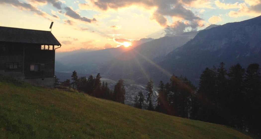
This content has been translated automatically.

E-bike round trip Lenzerheide - Alter Schin - Domleschg

Geschlossen
Medium
59.9 km
5:45 h
1238 mhd
1250 mhd
Einstieg "Alter Schyn"
Strasse "Alter Schyn"

Show all 9 images

Alter Schyn Weg in der Felsflanke
Magnificent round tour via the Polenweg to Lenzerheide and via Domleschg valley back to Chur. Spectacular is the path road "Alter Schin" cut into the rock high above the Albula gorge.
Technique 2/6
Fitness 4/6
Highest Point  1555 m
Lowest Point  564 m
Best Season
Jan
Feb
Mär
Apr
Mai
Jun
Jul
Aug
Sep
Okt
Nov
Dez
Start
Station Chur
Destination
Station Chur
Coordinates
46.7277, 9.557867

Details

Description

From Chur you can follow the signalized bikeroute 255 "Brambrüesch" via Passugg and the Polenweg to Churwalden. The route continues via Mittelberg to Parpan and shortly afterwards you pass the lake "Heidsee" on the right shore and ride through the center of Lenzerheide. Now follows the descent via Lain and Muldain and finally to the entrance of the legendary Alter Schin, a road cut into the steep mountain flank high above the Albula gorge. The former trade route from the Middle Ages leads at airy heights and through rock tunnels spectacularly down into Domleschg. The southern-looking valley is characterized by rolling hills, orchards and numerous castles, a landscape that invites you to explore it by e-bike. Lake Canova invites you to take a refreshing dip in the water (bathing season from May to mid-October). The trail continues along the Polenweg with a view of the Rhäzünser Rheinauen, which are among the most intact floodplain landscapes in Switzerland and are of national importance. Behind the golf course of Domat/Ems with a view of the "Tumas" (the striking hills that originate from landslides and are under nature protection) then follows the last stretch back to the Alpine City of Chur. 
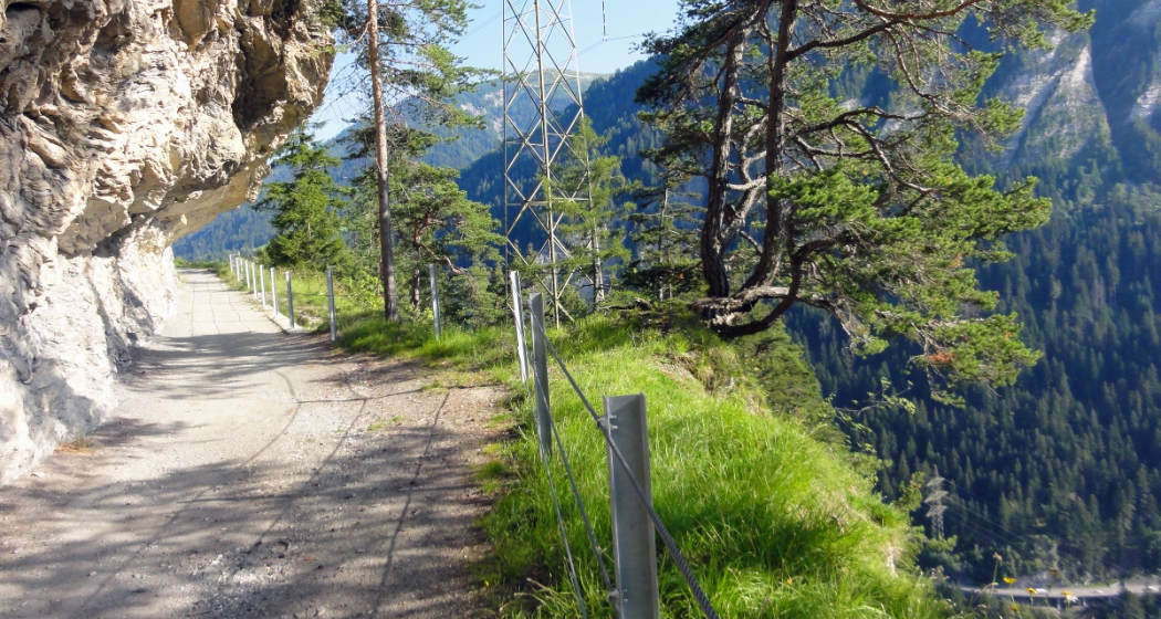
Directions

From Chur ascent on the bikeroute 255 (Brambrüesch) to Churwalden. From there via Salez and Mittelberg to Parpan and Lenzerheide. From Gravas the continuation takes place first on the bikeroute 603 (Alpine Tour) to Trantermoira above Lain and from there on the bikeroute 90 (Graubünden Bike) via the "Alter Schin" to the valley floor to Scharans. The further return journey through Domleschg is through the hilly landscape along the castles and via Canova Lake to Rothenbrunnen. From there on the Graubünden Route 6 back to Chur.

Directions

Public Transport

Chur train station is easily accessible by SBB (Swiss Federal Railways), Rhaetian Railways, Postbus or Chur Bus.

Anreise Information

Motorway exit Chur Nord or Chur Süd and then drive to the city centre.

Parking

At Chur railway station two multi-storey car parks are available (Otto & Alex / SBB Park & Rail).

Responsible for this content Graubünden Ferien.