discover.swiss ID
osm_1684071
discover.swiss Additional Type
City

Event Domat/Ems

Graubünden-Glarus Cantonal Wrestling Festival

- Graubünden-Glarus Cantonal Wrestling Festival
- Anniversary 105 years of the Domat/Ems wrestling club

Description

Date
15.06.2025 from 08:00 to 17:00 o'clock
Ort
Vial Leisure Centre

This year, the traditional Graubünder-Glarus Cantonal Wrestling Festival will be organised and carried out by the Domat/Ems wrestling club. As a spectator, you can watch exciting duels between the entire Graubünden wrestlers and the top wrestlers of northeastern Switzerland. A convivial occasion where cozy get-togethers, food and drink are not neglected.

Veranstaltungsort

Responsible for this content Guidle.
This content has been translated automatically.
Guidle Logo

This website uses content from Guidle.

Natural Monument Domat/Ems

Rheinauen

Rheinauen Rhäzüns
Fantastic river landscape, also known as the Grand Canyon of Switzerland

Description

The Rheinauen in Rhäzüns are one of the last large natural riparian landscapes along the Rhine upstream of Lake Constance; they are among the most intact wetlands in Switzerland. The Hinterrhein rages unfettered between Rothenbrunnen and Reichenau. Each flood changed the course of the river; debris is deposited and transferred, new river islands and meanders are created. In the transition zone between water and land are the wetlands. This is where you'll find sandy beaches, clear groundwater ponds, barren gravel banks, and dense deciduous forests. You can discover an enormous variety of plants and animals in a very small area.

Contact

Rheinauen

7403 Rhäzüns

Responsible for this content Chur Tourism.

Natural Monument Domat/Ems

Tumas

Tumas, Domat/ems
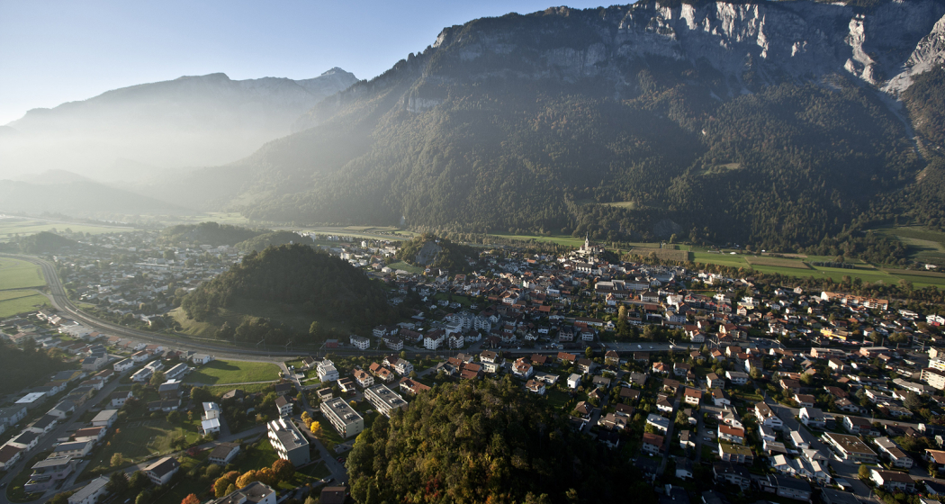
The small hills in Domat/Ems are called Tumas in romanish language

Description

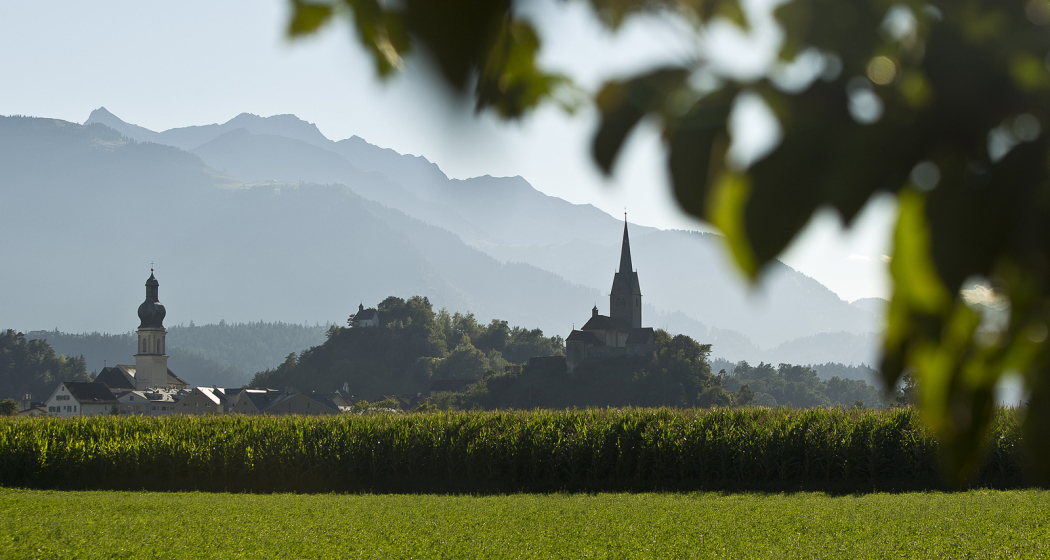
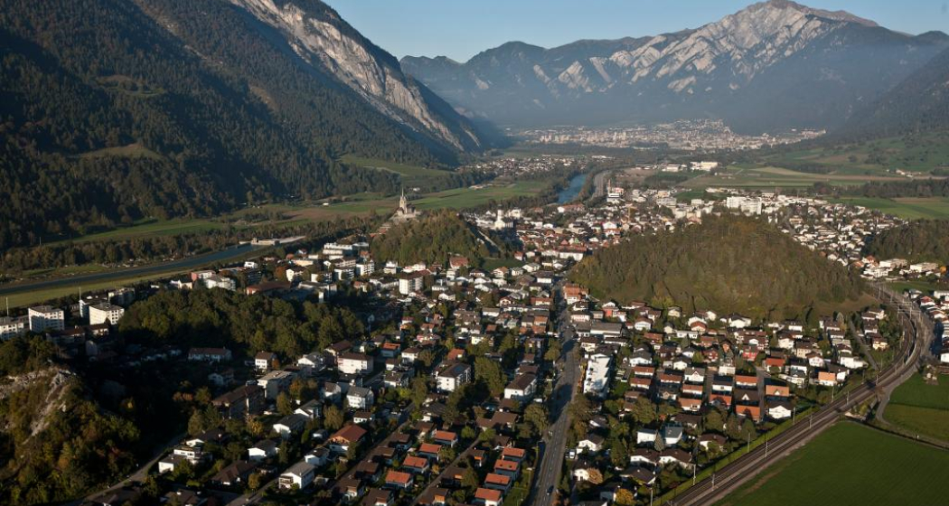
Domat/Ems lies at the beginning of the wide Chur Rhine valley, surrounded by wooded hills and high mountain ranges - a landscape in grand style. The location of Domat/Ems between small round hills, known as the «Tumas», is also distinctive. The «Tumas» are relics of past landslides that have shaped the lowlands around Domat/Ems. They were originally formed from harder debris that was not washed away by erosion. The distinctive talus slopes lean against the southern foot of the mountain; they jut out in the shape of a fan and roll in gentle slopes down to the plain. The «Tumas» are under conservation.

Contact

Tumas

7013 Domat/Ems

Responsible for this content Chur Tourism.

Benis Ground Round

Medium
5.1 km
0:55 h
209 mhd
209 mhd
Benis Boden Runde (oua_57507259_1aa175f_profile)
Benis Ground Round
Technique /6
Fitness 3/6
Highest Point  795 m
Lowest Point  586 m
Best Season
Jan
Feb
Mär
Apr
Mai
Jun
Jul
Aug
Sep
Okt
Nov
Dez
Start
Parking Stauwehr Domat/Ems
Destination
Parking Stauwehr Domat/Ems
Coordinates
46.835052, 9.433794

Details

Directions

Public Transport

By train or bus to the stop Ems Chemie/ Domat-Ems from there on foot to the parking lot Stauwehr (about 15 minutes).

Parking

Free parking is available at axpo's run-of-river hydropower plant (weir).

Responsible for this content Chur Tourism.
This content has been translated automatically.
Cross country ski track Varsera

2 km
0:25 h
21 mhd
21 mhd
Langlaufloipe Varsera

Show all 4 images

Langlaufloipe Varsera
Cross country ski track Varsera
Technique 0/6
Fitness 0/6
Highest Point  607 m
Lowest Point  586 m
Best Season
Jan
Feb
Mär
Apr
Mai
Jun
Jul
Aug
Sep
Okt
Nov
Dez
Start
At the end of Via da Munt, Domat/Ems
Destination
At the end of Via da Munt, Domat/Ems
Coordinates
46.824393, 9.449326

Details

Description

If there is enough snow, a skating trail is groomed on the Domat/Ems golf course by the snow groomer, which maintains the Feldis-Domat/Ems toboggan run. The easiest way to get started is at the lumber yard at the end of Via da Munt.

Information on whether the trail is open and groomed can be found under www.snowsport-ems.ch

Responsible for this content Chur Tourism.
This content has been translated automatically.
Brambrüesch-Pradaschier (via Dreibündenstein – big route)

Simple
12.3 km
4:25 h
601 mhd
988 mhd
Brambrüesch-Pradaschier (via Dreibündenstein - grosse Route)

Show all 6 images

Brambrüesch-Pradaschier (via Dreibündenstein - grosse Route)

Beautiful and scenic tour with picturesque wooded sections and panoramic views.
From the train station Chur you can reach the valley station of Chur-Dreibündenstein mountain railways either by city bus (line 1, stop Stadthalle) or on foot in about 15 minutes. The hike begins at the summit station of the Brambrüesch cable car. Through picturesque woodland sections the Malix Alp is soon reached. Relatively flat and with wonderful panoramic views you first pass the Galtialp, later the Bärenalp and finally the Pradaschieralp. Several fireplaces for a rest and a magnificent mountain flora accompany the hiker - a real pleasure hike! Soon the mountain station of the Pradaschier-Bahn is reached, where a cozy mountain restaurant with a large sun terrace invites you to a visit. You will reach the village Churwalden by the longest toboggan run in the world, a truly memorable experience! Alternatively, you can reach Churwalden by chair lift or on foot on the hiking trail. From Churwalden the, Postauto will return to Chur within 30 minutes.

Technique 2/6
Fitness 1/6
Highest Point  2172 m
Lowest Point  1209 m
Best Season
Jan
Feb
Mär
Apr
Mai
Jun
Jul
Aug
Sep
Okt
Nov
Dez
Start
Valley station of the Chur-Dreibündenstein cable cars
Destination
Churwalden
Coordinates
46.828876, 9.515455

Details

Description

For the hike, an attractive round trip ticket is available at the Chur-Dreibündenstein mountain railways, which includes the ascend from Chur to Brambrüesch, two runs with the toboggan run Pradaschier - Churwalden and the return trip by Postauto from Churwalden to Chur.
 
Option A: From the mountain restaurant Brambrüesch follow the hiking trail to the Malixer Alp and further to the Dreibündenstein. Descent over Grüenenbüel to Pradaschier (hiking time approx. 3 h 15 min.)


Option B: Hiking trail to Churwalden.

Geheimtipp

Catering in the mountain restaurant Pradaschier

Directions

Public Transport

From the train station Chur you can reach the valley station of the Chur-Dreibündenstein mountain railways either by city bus (line 1, stop Stadthalle) or on foot in about 15 minutes.

Anreise Information

From Basel and Zurich - Chur-Sued (exit no. 17)

From Milano - Lugano - San Bernadino Tunnel - Thusis - Chur.

Parking

Guests of the Chur mountain railways park on the Stadthallen parking free of charge. For this purpose, mentioning   the plate number at the cash desk is mandatory!

Responsible for this content Brambrüesch.
This content has been translated automatically.

Alter Schyn-Runde

Geschlossen
Medium
59.9 km
3:50 h
1353 mhd
1353 mhd
Alter Schyn-Runde
SKODA Velowelt

Show all 3 images

Alter Schyn-Runde (oua_3617435_a80a4de_profile)
Technically less demanding, but altogether long tour for enduring biker.
Technique 2/6
Fitness 4/6
Highest Point  1558 m
Lowest Point  562 m
Best Season
Jan
Feb
Mär
Apr
Mai
Jun
Jul
Aug
Sep
Okt
Nov
Dez
Start
Tourist Office, Lenzerheide
Destination
Tourist Office, Lenzerheide
Coordinates
46.7277, 9.557867

Details

Description

This tour includes the descent on the "Alter Schin", a road high above the Albula Gorge into the steep mountain flank, connecting the rear Rhine Valley with the Lenzerheide holiday region. Via Lain and Muldain you reach this partly vertiginous trade route from the Middle Ages. The tour then leads through spectacular rock tunnels and tranquil villages such as Scharans and Tomils down to Domleschg with its southern charm. On the way, many different inns invite you to take a breather. The long round to Chur continues on agricultural side roads and cycle paths before an ascent via the "Polenweg" to Churwalden and then via Salez and the Mittelberg back to Parpan and Lenzerheide. A bit of endurance is required on the day trip, but the technical difficulties are limited.

Directions

Public Transport

Arriving by train to Chur, then change directly to the buses from PostbusGraubünden and get to Lenzerheide within 30 minutes.

In the village the free sports bus is available.

Anreise Information

From Basel and Zurich - Chur-Süd (exit no. 17) - Lenzerheide.

From Milano - Lugano - San Bernadino Tunnel - Thusis - Chur (exit Lenzerheide) - Lenzerheide.

Parking

Parking spaces entrance Lenzerheide or valley station Rothornbahn.

Responsible for this content Graubünden Ferien.
This content has been translated automatically.

Dreibündenstein - Fulhorn

Medium
7.7 km
3:00 h
1013 mhd
81 mhd
Dreibündenstein Hochebene mit Fulhorn
Schluss-Aufstieg zum Fulhorn

Show all 9 images

Blick von Spundis Richtung Dreibündenstein
Nice tour from Brambrüesch to the Dreibündenstein high plateau and further up to the peak of the Fulhorn with panoramic views.
Technique 3/6
Fitness 3/6
Highest Point  2529 m
Lowest Point  1593 m
Best Season
Jan
Feb
Mär
Apr
Mai
Jun
Jul
Aug
Sep
Okt
Nov
Dez
Start
Brambrüesch
Destination
Brambrüesch
Coordinates
46.829112, 9.516041

Details

Description

Rewarding ski tour, beginning at the top gondola station in Brambrüesch. Ascent through the forest at first, later on close to the ski slopes up to Furggabüel and the Dreibündenstein high plateau, which is being crossed on the tour (possible to ski down without skins). At appr. 2100m the ascent to the Fulhorn begins. Take care along the ascent since there are steep parts and snow drifts.

Descents are possible to Alp dil Plaun, the ski hut Term Bel and (if enough snow) as far as Domat/Ems in the valley (otherwise at Alp dil Plaun left/southwards to Scheid). The descent through the steep north side in direction of Pradaschier / Churwalden is only for experienced ski tourers and with safe snow conditions. If you would like to descent to Churwalden, you can alternatively use the slopes in the ski area, as well. All ascents and descents are at your own risk.

Directions

Public Transport

Take the train to Chur station. From there, the city bus (line 1) takes 3 minutes to the valley station of the mountain railways (Stadthalle/Brambrüeschbahn stop).

Anreise Information

  • Motorway exit Chur Süd

  • Drive into the city (Kasernenstrasse)

  • The valley station and car park are on the right-hand side in front of the town centre

Parking

More about parking for guests of the Chur mountain railways.

Responsible for this content Brambrüesch.
This content has been translated automatically.

Cross Country Trail Chur Rhine valley

Medium
30.1 km
2:45 h
611 mhd
611 mhd
Trail-Spass in den Wäldern
Abzweigung auf den Trail Richtung Reichenau

Show all 7 images

Trail mit Blick auf den Rhein
This tour offers superb single tracks and is well suited as a veritable cross country training tour.
Technique 3/6
Fitness 3/6
Highest Point  857 m
Lowest Point  559 m
Best Season
Jan
Feb
Mär
Apr
Mai
Jun
Jul
Aug
Sep
Okt
Nov
Dez
Start
Chur, train station
Destination
Chur, train station
Coordinates
46.847544, 9.531373

Details

Description

Due to the low elevation, the Chur Rhine valley offers good mountain biking conditions already at the end of winter time until late in the autumn time. The tour combines attractive single tracks with some ascents and descents, as well as panoramic trails.

Along the tour you will get a good view into the diverse scenery of the  Rhine valley and the Alpine City of Chur. At Rei-chenau/Tamins you will cross the Rhine river just where the Vorder and Hinter Rhine confluence.

Directions

Public Transport

The tour starts at the Chur train station.

Responsible for this content Chur Tourism.

Uphill Trail UFFA

Difficult
12.5 km
2:50 h
1295 mhd
254 mhd
Uphill Trail UFFA
Uphill Trail UFFA

Show all 12 images

Uphill Trail UFFA
With 12.5 km and 1'295 vertical meters, this route also offers serious mountain runners a real sporting challenge.
Technique 4/6
Fitness 5/6
Highest Point  1841 m
Lowest Point  589 m
Best Season
Jan
Feb
Mär
Apr
Mai
Jun
Jul
Aug
Sep
Okt
Nov
Dez
Start
Alexanderplatz, City of Chur
Destination
VIVA berg.baiz, Brambrüesch
Coordinates
46.852219, 9.531286

Details

Description

After starting on the Alexanderplatz in the heart of Chur, the Uphill Trail UFFA leads through the picturesque old town of the canton's main town, through the Obergasse and the Obertor up to the Rosenhügel. There, the track changes from asphalt to forest roads and varied (single) trails, which lead up to the first lookout point on Juchs. Over a steep and challenging climb, it goes up to the highest point at Spundisköpf lake, from there on a varied trail over the Spundisköpfe to the mountain station and the finish at the mountain restaurant.

Directions

Public Transport

Take the train to Chur station. From there, the city bus (line 1) takes 3 minutes to the valley station of the mountain railways (Stadthalle/Brambrüeschbahn stop).

Anreise Information

  • Motorway exit Chur Süd
  • Drive into the city (Kasernenstrasse)
  • The valley station and car park are on the right-hand side in front of the town centre

Parking

More about parking for guests of the Chur mountain railways.

Responsible for this content Brambrüesch.
This content has been translated automatically.